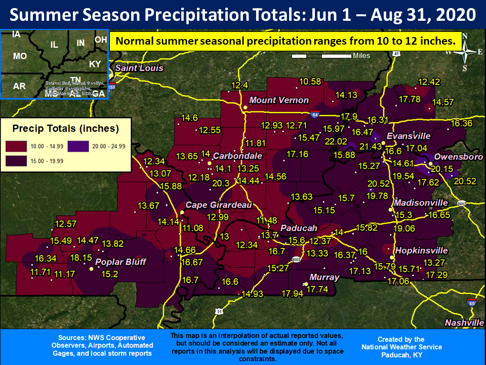
The year 2020 featured several severe weather events across our region. The first significant event occurred during the early morning hours of January 11th with 12 tornadoes, including an EF-2 in Cape Girardeau County MO. An event on March 28th featured two EF-2 tornadoes hitting the Henderson, KY and Newburgh, IN areas. Large hail occurred with several events, with up to baseball sized hail being observed near Poplar Bluff, MO on March 12th. The year will also be remembered for a lack of snow and abnormal warmth during the winter season. Evansville and Paducah both finished with a trace of snow for the winter, which tied for the least snowy winter on record. The Evansville tri-state region also observed an excessively wet summer, with Evansville finishing as their 2nd wettest summer on record.
|
Top 10 Event Summaries for the Year 2020 (in chronological order). CLICK ON IMAGES TO ENLARGE |
|||||
|
1. January 11 Severe Thunderstorms and Tornadoes - 12 tornadoes including an EF-2 near Jackson, MO
Image: Map of all 12 tornadoes from this event |
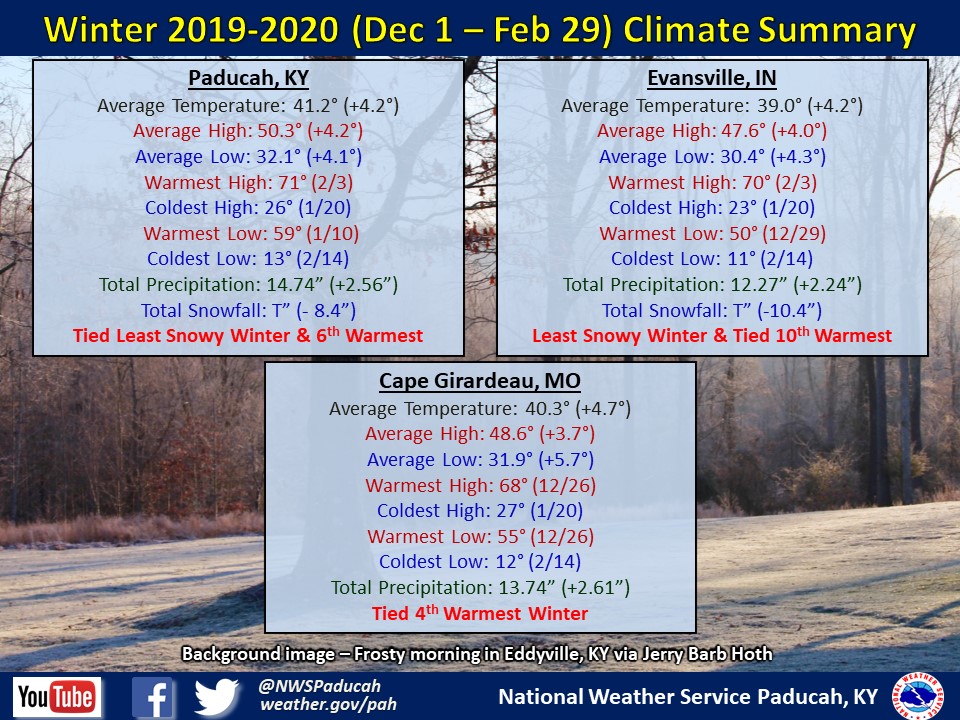
2. Winter 2019-2020 - Lack of snow and abnormally warm Image: Climate Summary for the season |
||||
|
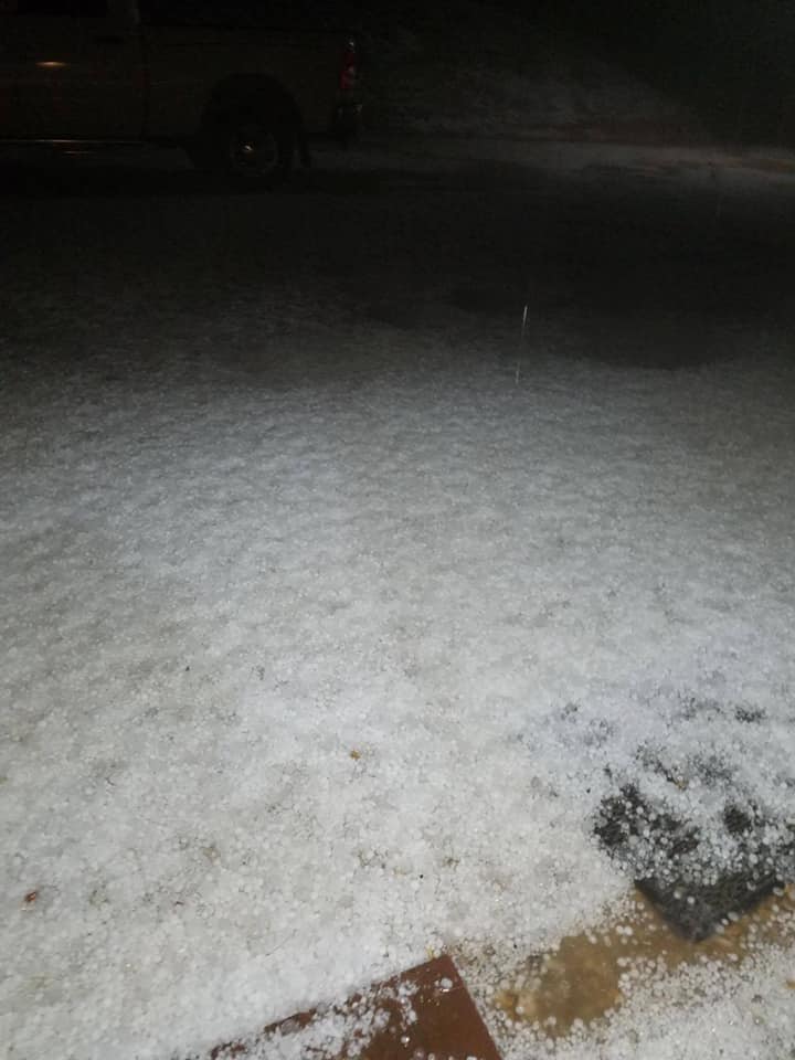
3. March 2 Severe Thunderstorms include golf ball sized hail near Paducah and an EF-1 tornado near Crofton, KY
Image: Hail covering ground in Ellington, MO courtesy of Holden Anderson |
4. March 12 Severe Thunderstorms include large hail greater than baseball size near Poplar Bluff, MO.
Image: Aerial view of tornado-warned storm near Poplar Bluff, MO courtesy of Dan Skoff |
||||
|
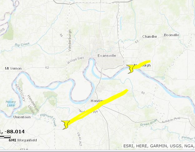
5. March 28 Severe Thunderstorms include two EF-2 tornadoes in Henderson, KY and Newburgh, IN areas.
Image: Tornado tracks for the two EF-2 tornadoes |
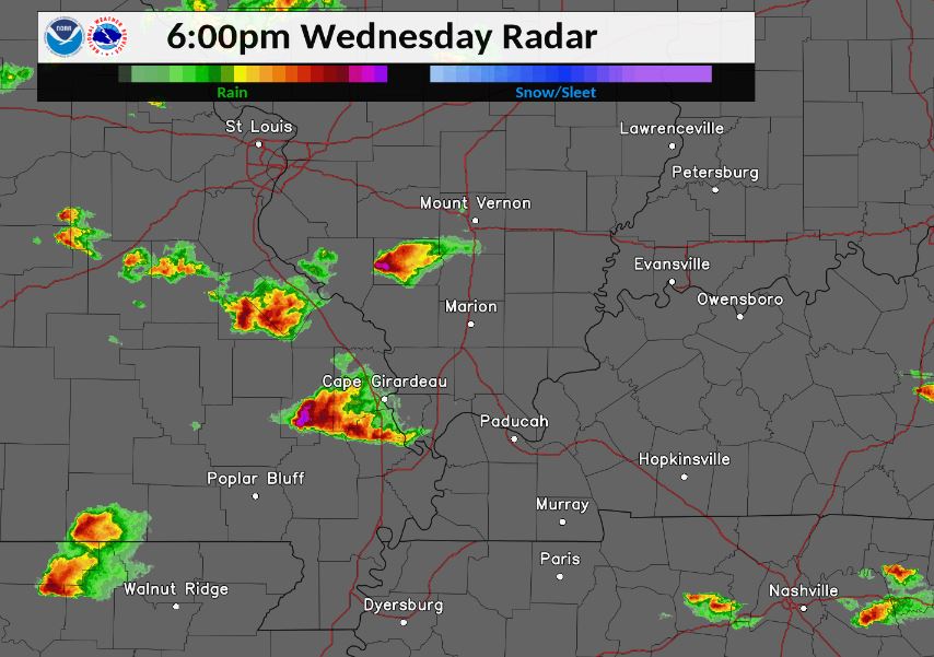
6. April 8 Severe Thunderstorms produce large hail up to 2.25" in diameter.
Image: Radar at 6 PM on April 8th |
||||
|
7. May 3 Severe Thunderstorms produce widespread wind damage across southeast MO and far west KY
Image: Marston, MO tornado track map |
8. May 4 Severe Thunderstorms produce widespread wind damage across southeast Missouri
Image: Wind damage in Gideon, MO courtesy of Highway Patrol |
||||
|
9. June 28 Flash Flooding in northwest KY and southwest IN with numerous water rescues
Image: Flash Flooding in Owensboro, KY |
10. Summer 2020 excessively wet across the Evansville Tri-state region
|
||||


.jpg)
.jpg)
.jpg)
.jpg)