Summer 2023 Climate Summary:
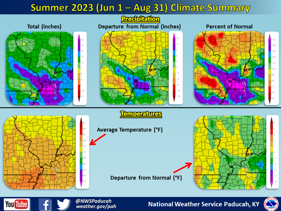
Temperatures averaged slightly below normal by around 0.5 degree. June and August both finished a bit below normal, while July was slightly above normal. The worst heat wave of the season occurred between August 20-26, when very high humidity caused heat index readings to reach values of 105 to 120 degrees on a daily basis.
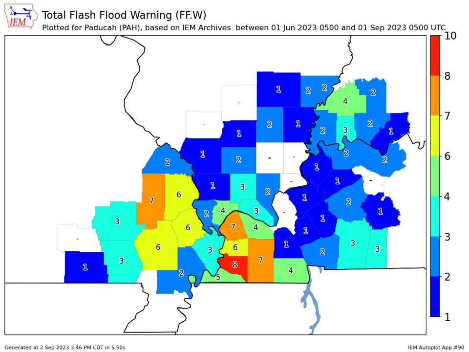
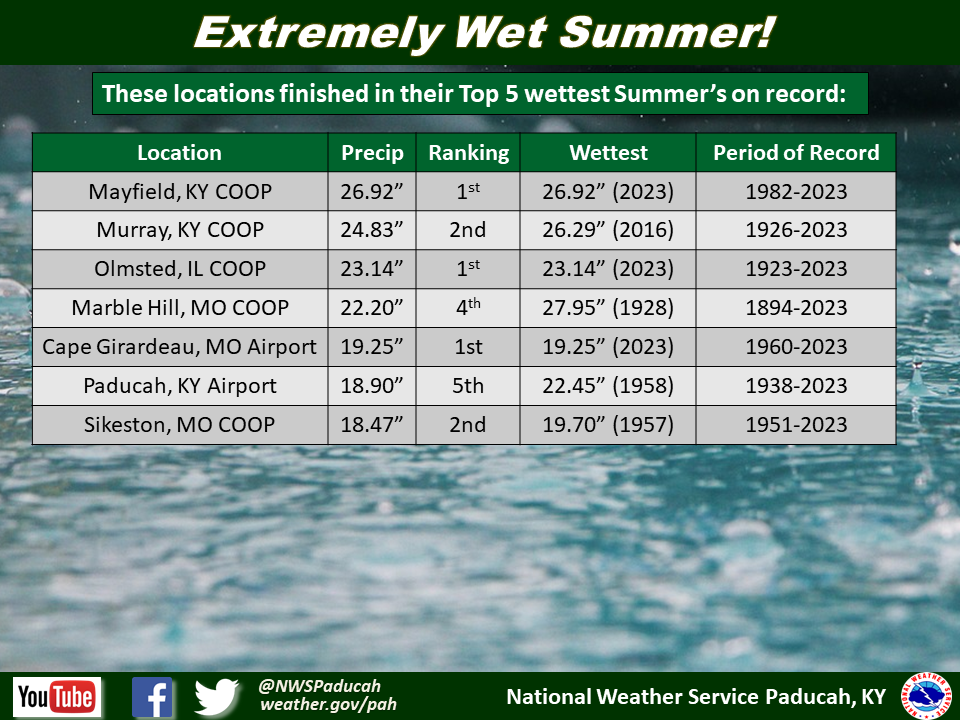
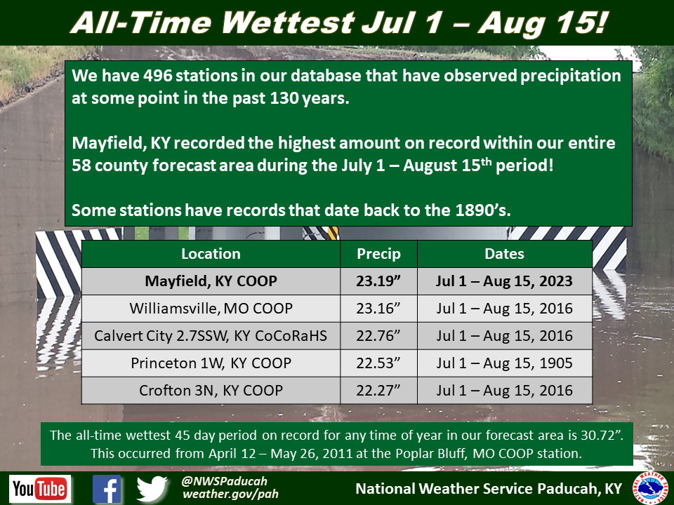
Precipitation was highly variable, but the main takeaway was the extremely wet summer that a portion of the region experienced. Areas of southeast Missouri, far southern Illinois, and the Jackson Purchase area of west Kentucky received rainfall amounts ranging from 15 to 25 inches. Localized higher amounts were observed, with the highest official total being 28.36” at the KY Mesonet station 6 miles southwest of Mayfield. These amounts were 4 to 12+ inches more than this region observes in an average summer. What was even more impressive is that most of this rain fell in a 6 week period from July 1st through August 15th. June was a dry month, with moderate to severe drought occurring across a large part of the area. Cape Girardeau recorded their wettest summer on record, while Paducah checked in as their 5th wettest.
As is common during the warm season, some portions of our area kept missing out on the heavier rain events. Drier than normal conditions were observed across western portions of southeast Missouri (Van Buren, Doniphan, and Poplar Bluff areas) and also in a small portion of southeast Illinois centered around White and Hamilton counties. Rainfall totals in these areas were generally 7 to 10 inches, or 1 to 4 inches below normal.
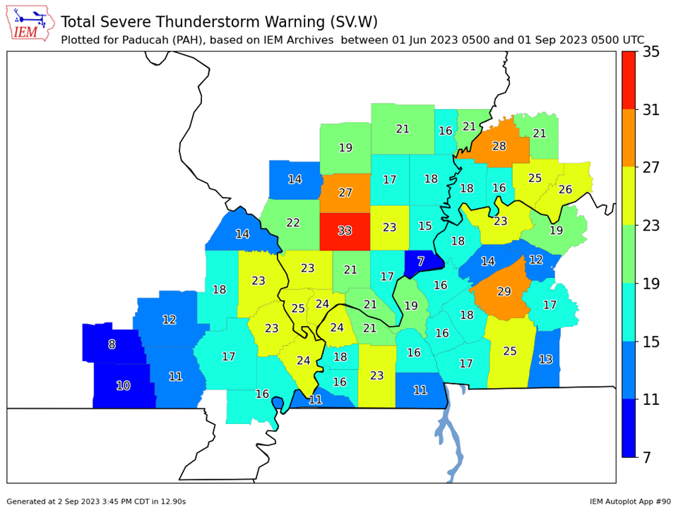
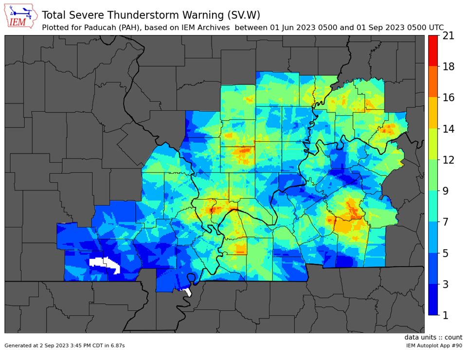
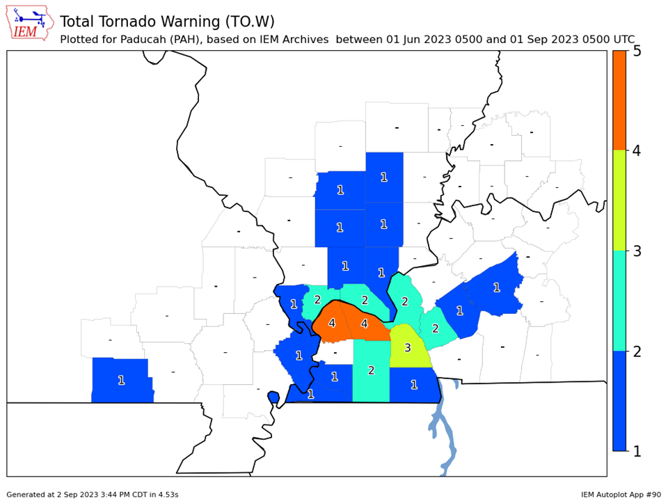
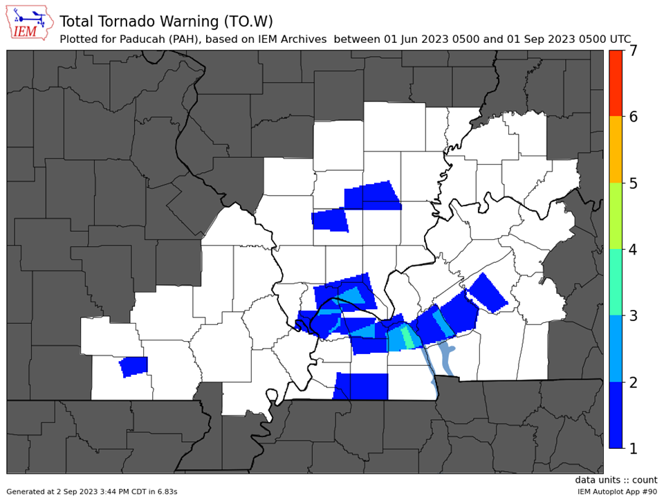
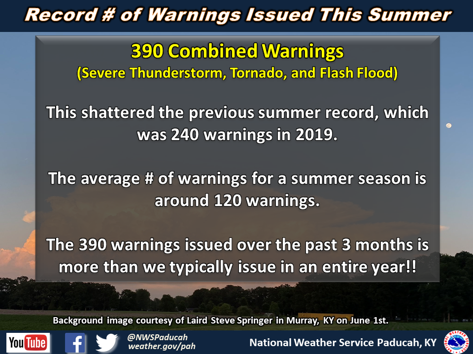
It was an extremely active summer for severe thunderstorms and flash flooding. We issued 390 combined warnings (Severe Thunderstorm, Tornado, and Flash Flood) across our 58 county forecast area during the summer season. This shattered the previous record for a summer which was 240 warnings issued back in 2019. An average summer will typically consist of around 120 warnings issued. Williamson County Illinois led the way with 36 combined warnings throughout the summer season. Our most active stretches were focused from June 29-July 2, July 17-20, and August 2-7.
The graphic below is an interpolated rainfall map using actual observations. Please note that there are likely discrepancies in between observations, since the values are estimated based on nearest reports.
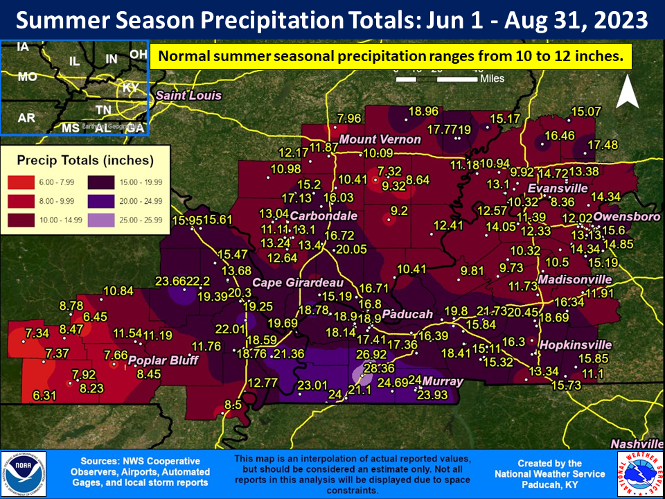
| Summer 2023 Review: Precipitation and Temperature Maps (Click on image to enlarge) |
 |
| Climate Maps are from the Northeast Regional Climate Center |


| Severe Thunderstorm Warnings - County Based | Severe Thunderstorm Warnings - Polygon Based |
 |
 |
| Tornado Warnings - County Based | Tornado Warnings - Polygon Based |
 |
 |
 |
 |
 |
 |

