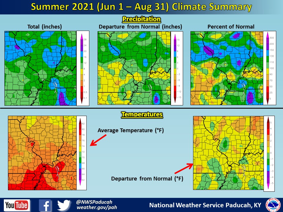
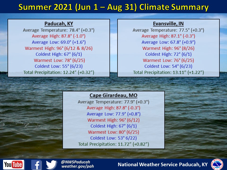
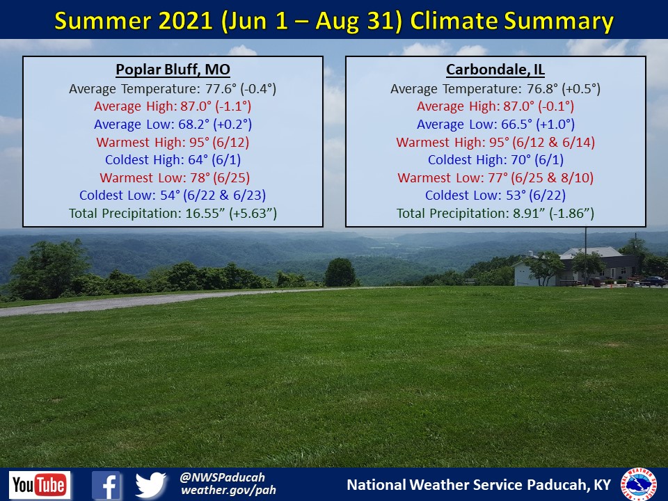
Summer 2021 Climate Summary: Temperatures averaged a little above normal, by less than 1 degree across the area. High temperatures were very slightly below normal, but our overnight lows were around 1-2 degrees above normal for the season. Paducah observed 55 days with low temperatures in the 70s. A typical summer averages around 38 such days. Meanwhile, our 90 degree tally was around 2 to 7 days below normal for the 3 month period. June and August both observed above normal temperatures while July was cooler than normal.
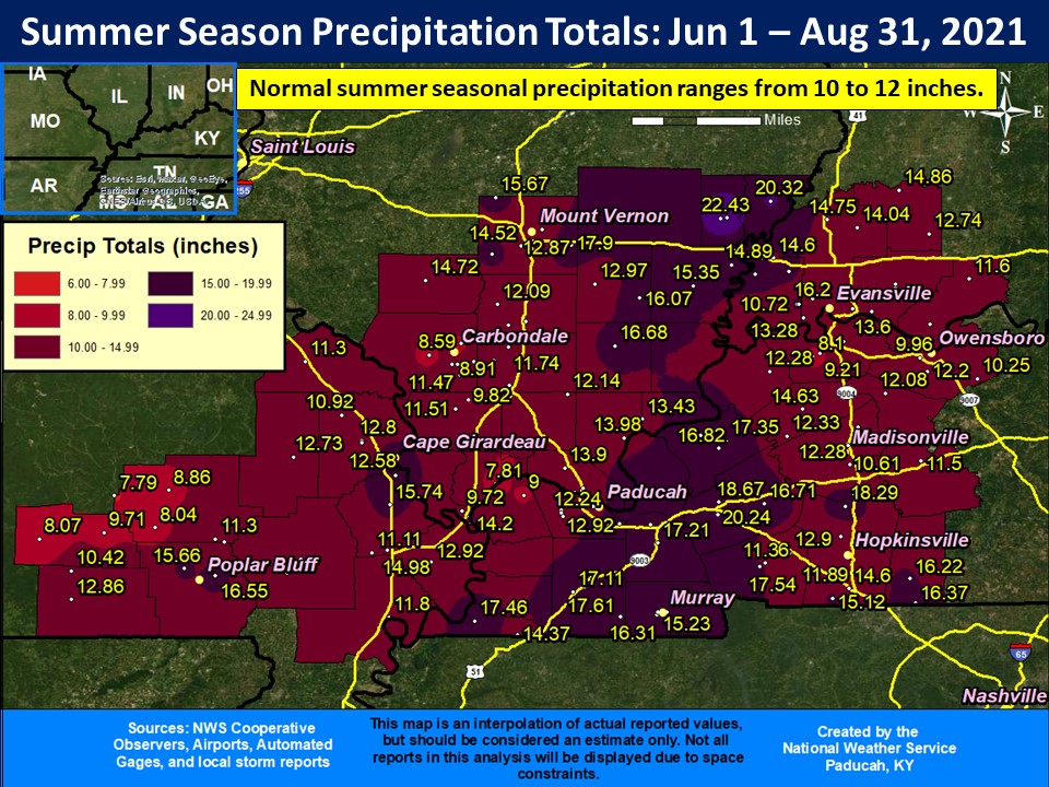
It was a wetter than normal summer for much of the Quad State region. Rainfall totals of 12 to 20 inches were observed in many locations, which was roughly 2 to 8+ inches wetter than normal. The highest observed total was 22.96” at a CoCoRaHS station in Albion, IL. Lower amounts were in the Ozark foothills and a corridor of lower amounts occurred from the Carbondale area southeastward to the NWS Paducah office, which finished near to a bit drier than normal. Many counties observed a lot of variability and McCracken was no exception. The official station at Paducah’s Barkley Airport only recorded 12.24”, but employees that live in the Reidland and Lone Oak areas received 17.85” and 16.36” respectively. Breaking it down by month, June was the driest month and July was the wettest compared to normal.
The graphic below is an interpolated rainfall map using actual observations. Please note that there are likely discrepancies in between observations, since the values are estimated based on nearest reports.
| Summer 2021 Review: Precipitation and Temperature Maps (Click on image to enlarge) |
 |
| Climate Maps are from the Northeast Regional Climate Center |
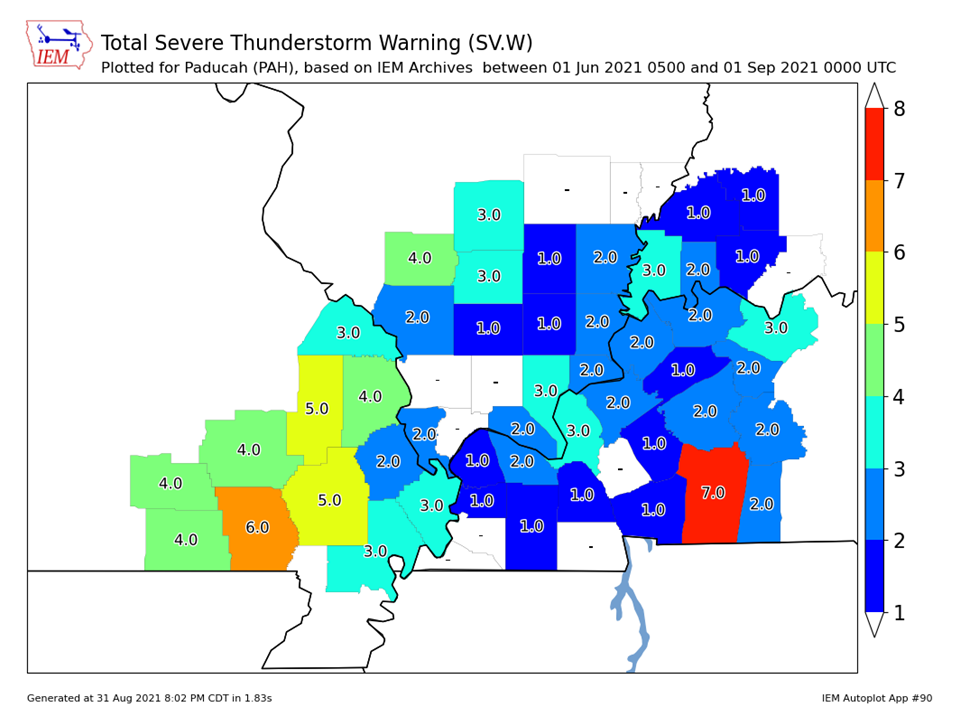
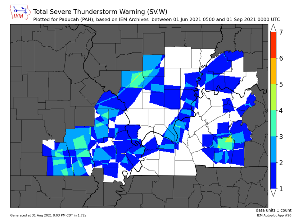
| Severe Thunderstorm Warnings - County Based | Severe Thunderstorm Warnings - Polygon Based |
 |
 |
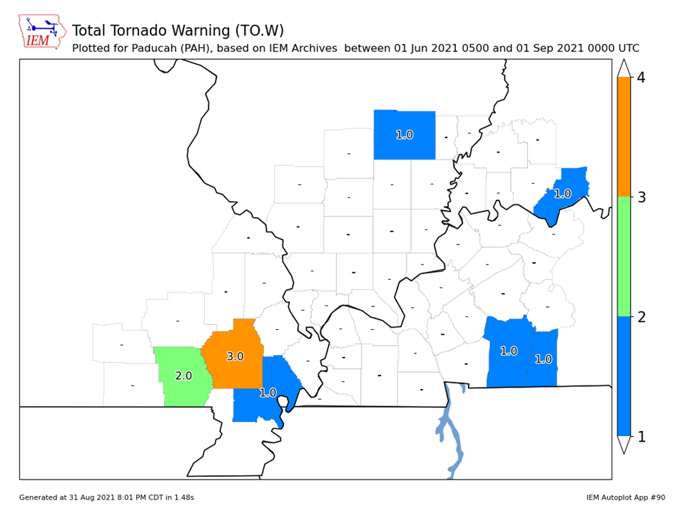
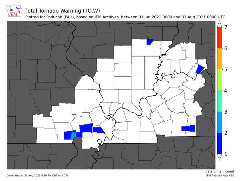
| Tornado Warnings - County Based | Tornado Warnings - Polygon Based |
 |
 |

