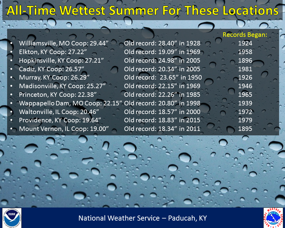
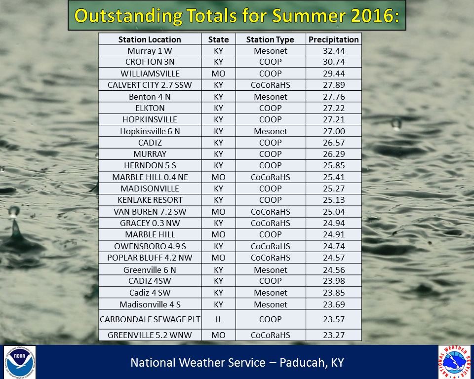
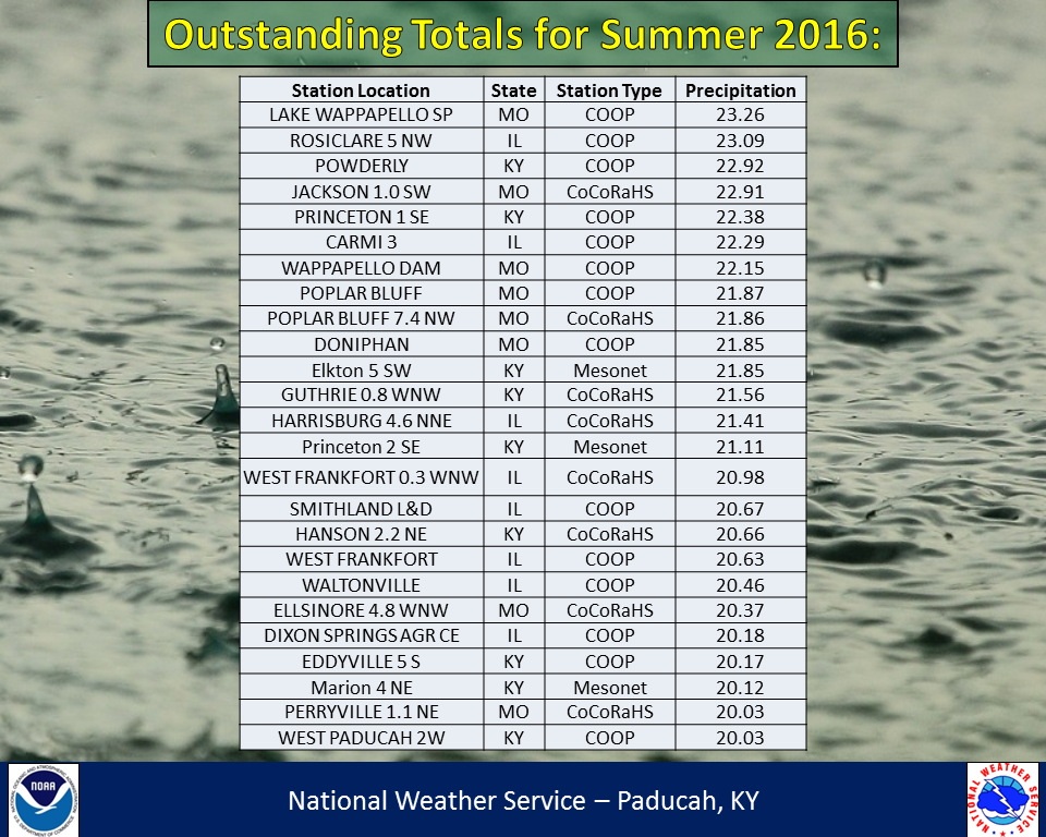
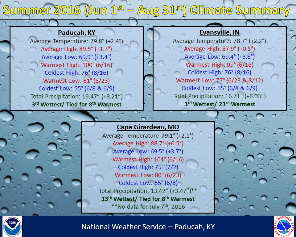
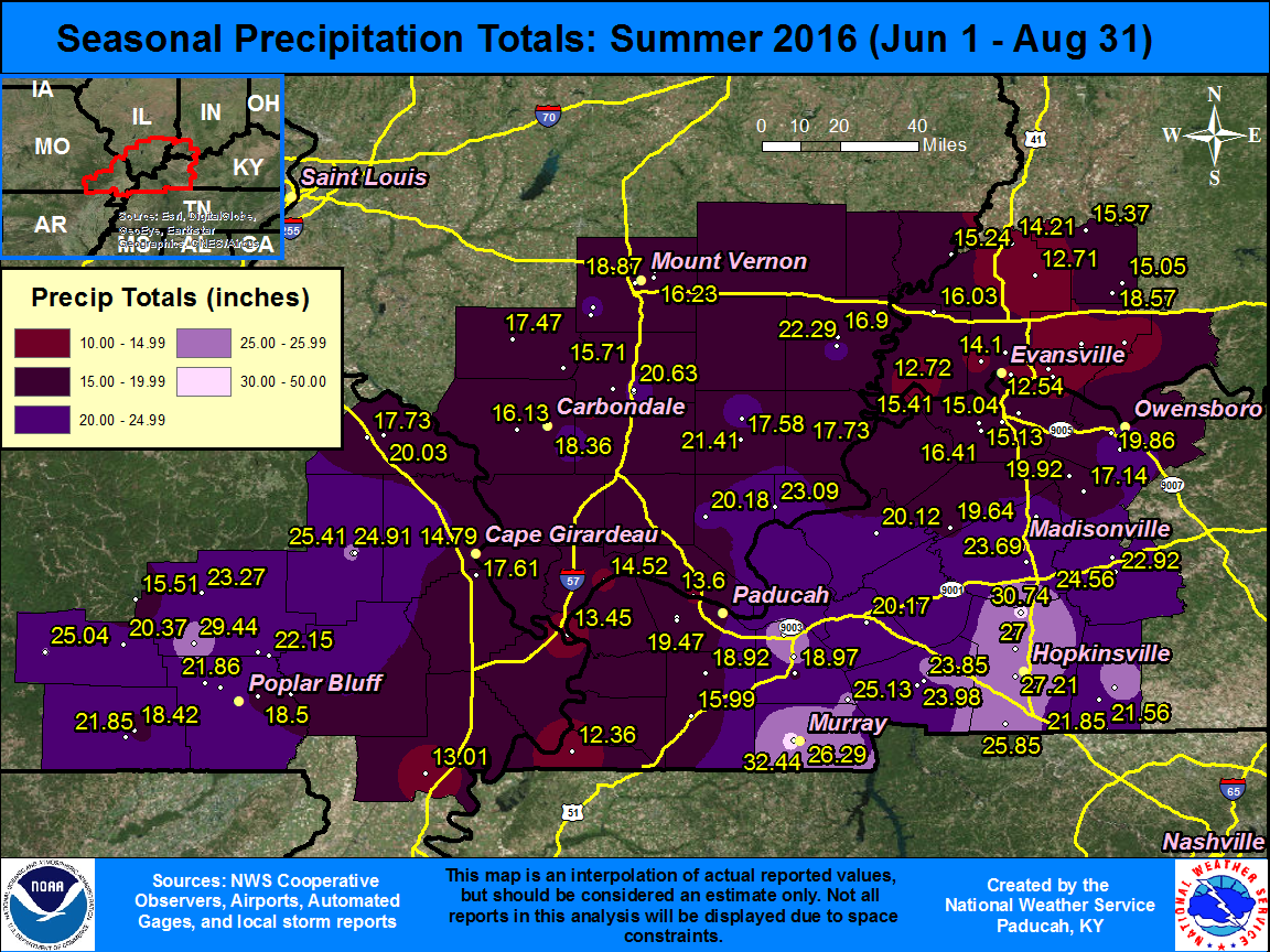
Summer 2016 (June-August) will be remembered for being extremely wet over the region, along with above normal temperatures. Many locations experienced their wettest summer on record, with 50 observing sites in our area picking up at least 20” of rain. A couple locations even saw over 30”! To put this in perspective, normal precipitation for a whole summer is around 10 to 12”. So many locations received anywhere from 1.5 to almost 3 times the normal summer rainfall! Paducah, KY and Evansville, IN both recorded their 3rd wettest summer on record, with 19.47” and 16.71” respectively. June was actually a fairly dry month around the area, with below normal rainfall common, along with some concerns that a drought would develop if we didn’t receive much rain soon. Those thoughts quickly vanished as the flood gates opened up as the calendar turned to July. The wet pattern would then continue right through much of August. In fact, somewhere in our forecast area saw measurable rain on 52 out of 53 days from June 30th through August 21st! As for temperatures, they were generally around 2 degrees above normal which was good enough to rank in the Top 10 Warmest in Paducah and Cape Girardeau. High temperatures were actually near normal to slightly above normal, but low temperatures were a solid 3 to 4 degrees above normal. If you thought there were more warm, humid nights compared to a typical summer, you were correct! There were 63 days with low temperatures at or above 70 degrees in Paducah, which is a record for the summer season. This breaks the old record of 59 days set back in 2010. In Evansville, IN there were 59 days with lows in the 70s, which is the most in a summer season since 1934!
The image below is an interpolated precipitation map based on actual observations, so for locations in between these values it may over-estimate or under-estimate amounts (click on the image to enlarge):
| Summer 2016 Review: Precipitation and Temperature Maps (click to enlarge) |
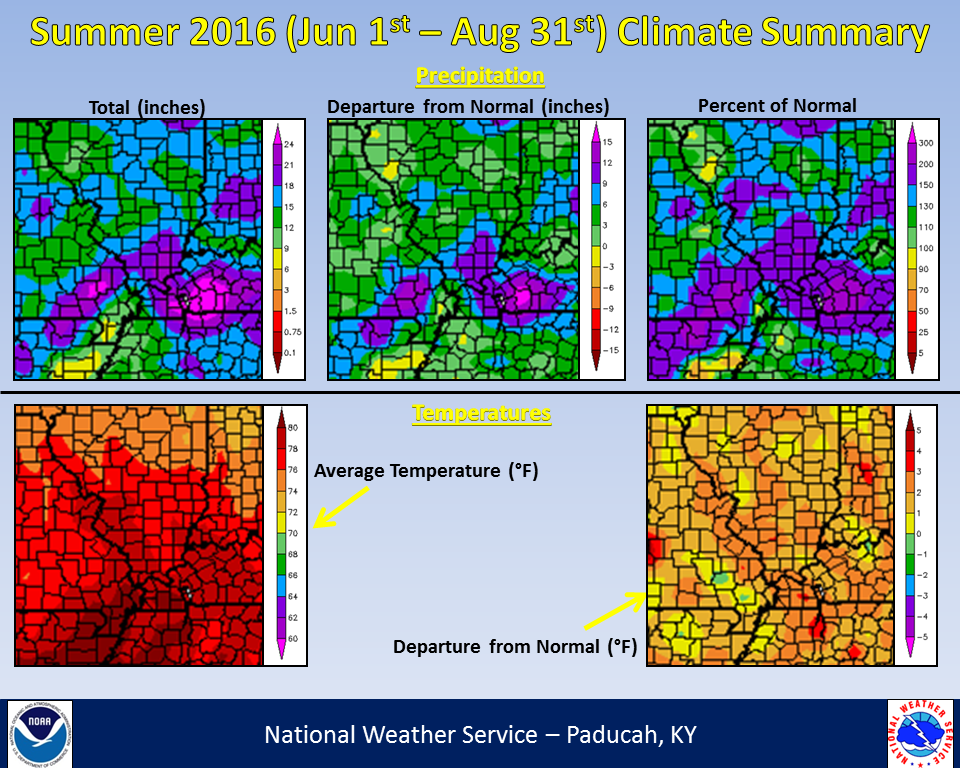 |
| Climate Maps are from the Northeast Regional Climate Center |