Isolated severe thunderstorms with strong wind gusts and hail will be possible Tuesday from parts of central Plains northeastward into the Midwest. Additional storms capable of damaging winds will be possible across the eastern Florida peninsula. Elevated to critical fire weather including gusty winds and low relative humidity is forecast again Tuesday over much of the northern Great Plains. Read More >
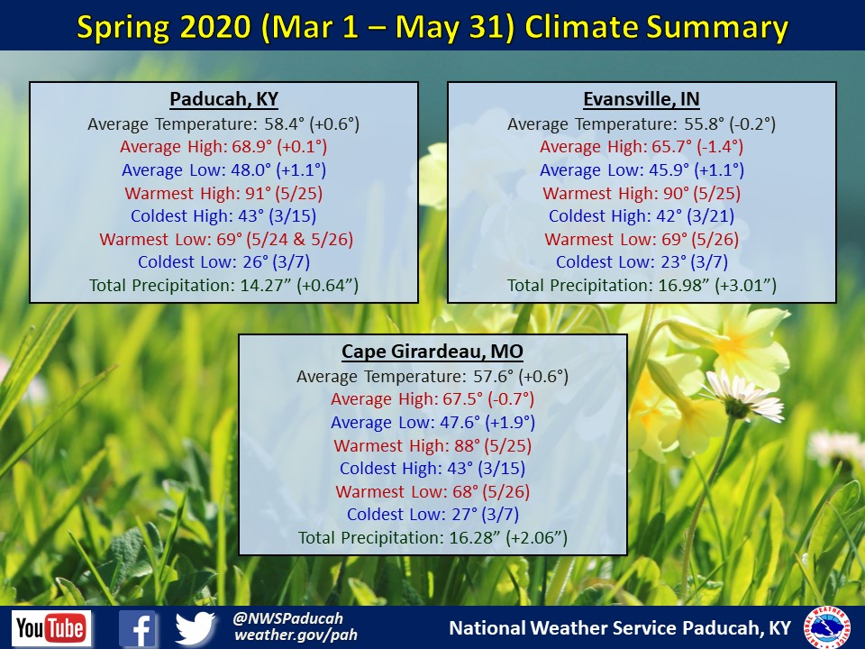
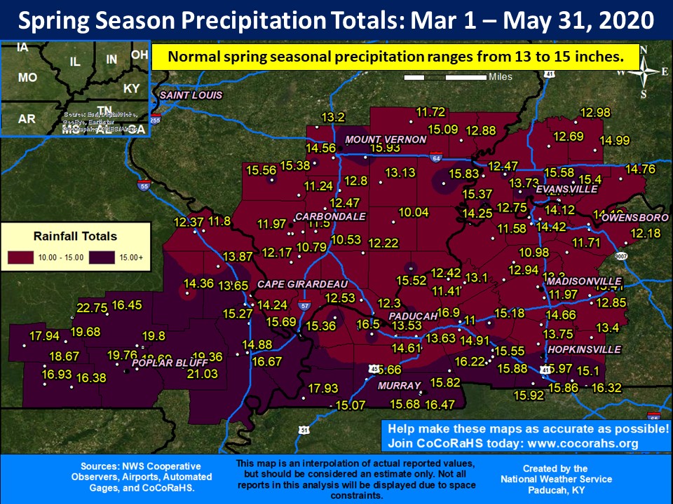
Precipitation varied across the region. The spring season finished wetter than normal across much of southeast Missouri, portions of southern Illinois primarily north of Route 13, a few areas of western Kentucky mainly closer to the Tennessee border, and portions of southwest Indiana including Vanderburgh County. A few locations in southeast Missouri observed over 20 inches for the season, including 24.01" at the Wappapello Dam COOP station. Near normal to drier than normal precipitation occurred across much of southern Illinois along and south of Route 13 and into a good part of western Kentucky, especially Crittenden, Webster, and Hopkins Counties. Breaking it down by month, March finished wetter than normal across much of the area, while April flipped the switch and turned drier. The drier than normal conditions persisted into May for many areas east of the Mississippi River. Meanwhile southeast Missouri observed rainfall amounts of 1 to 3+ inches above normal for May.
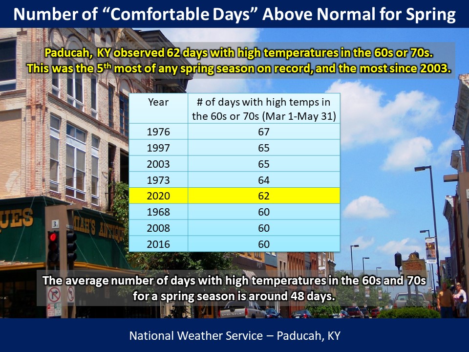
Temperatures finished near normal for the season. We started off with well above normal temperatures in March, followed by below normal temperatures in April and May. An unusually high number of days experienced high temperatures in the 60s and 70s in Paducah. This is considered the “comfortable” range for many people. We observed 62 of these days, which was the 5th most on record for a spring season, and the most since 2003.
 |
| Spring 2020 Review: Precipitation and Temperature Maps |
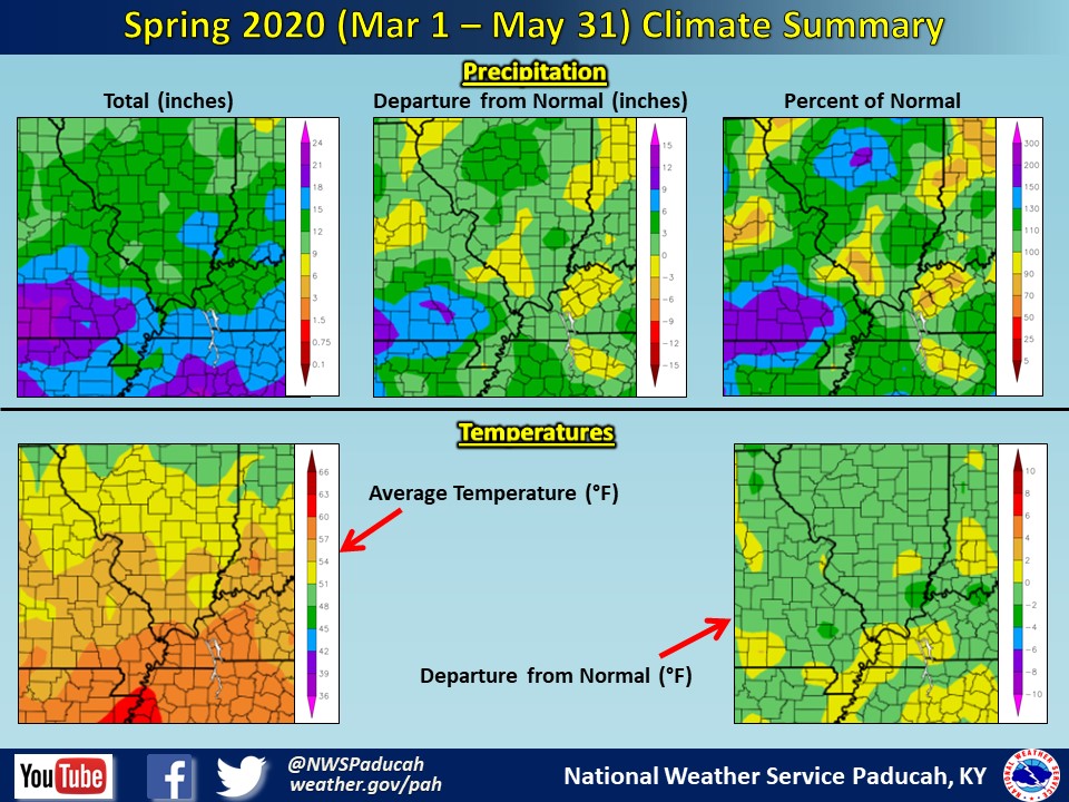 |
| Climate Maps are from the Northeast Regional Climate Center |