Paducah, KY
Weather Forecast Office
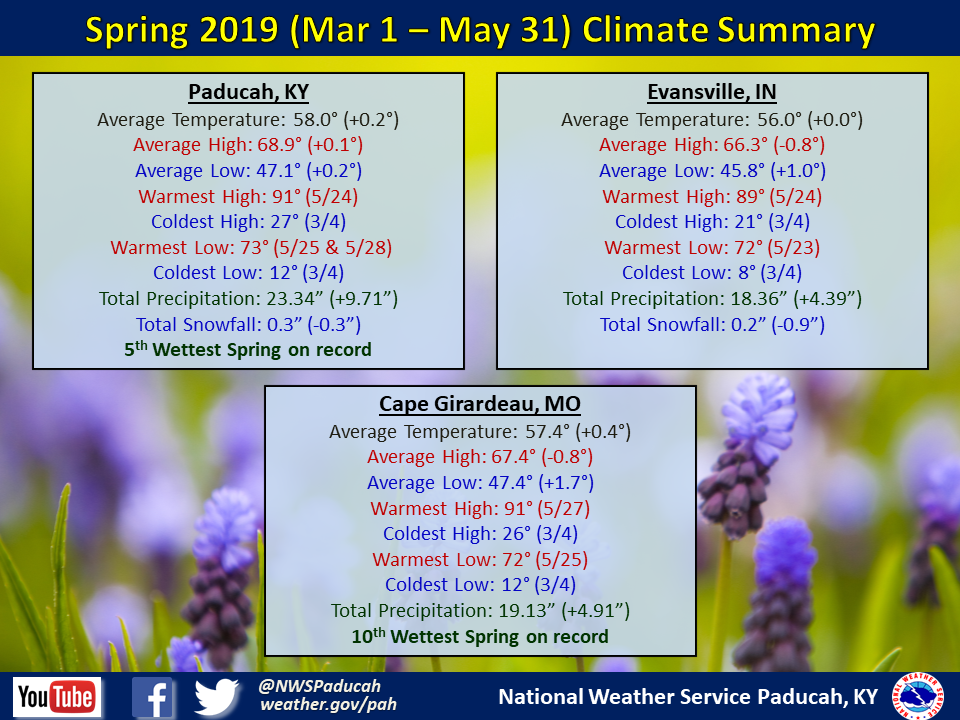
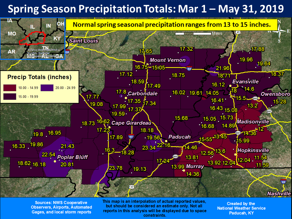
Spring Seasonal Summary (March 1st through May 31st): Meteorological spring finished wetter than normal across much of the area. Rainfall totals of 15 to 20 inches were common for the season, with some locally higher amounts close to 2 feet! The highest observed total was at a CoCoRaHS station in New Madrid, MO where 23.78” was observed. Meanwhile, Paducah wasn’t far behind with 23.34”, making it the 5th wettest spring on record for the city. The exception to the wet conditions was across the southern Pennyrile region of west Kentucky. Locations in Trigg, Christian, and Todd counties only received around 11 to 13 inches on average, which was slightly drier than normal.
Temperatures for the season finished right around normal. May and April both finished with above normal temperatures, while March observed below normal temperatures.
One takeaway from this spring was the low frequency of severe thunderstorms across our area. The lack of severe weather in April helped skew the scale toward the low side. The combined number of severe thunderstorm, tornado, and flash flood warnings issued in our forecast area was the lowest for a spring season since 2015. We issued 120 of these warnings this spring compared to an average of around 177 for our 58 county forecast area.
 |
| Spring 2019 Review: Precipitation and Temperature Maps |
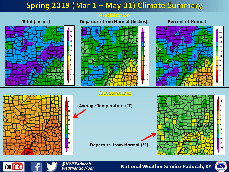 |
| Climate Maps are from the Northeast Regional Climate Center |
FORECASTS
Forecast Discussion
User Defined Area Forecast
Hourly Forecasts
Fire Weather
Activity Planner
LOCAL INFORMATION
Aviation Weather
Our Office
SKYWARN
Items of Interest
Hazardous Weather Support
Local Observations
Weather History
NWS Paducah KY Weekly Partner Briefing
US Dept of Commerce
National Oceanic and Atmospheric Administration
National Weather Service
Paducah, KY
8250 Kentucky Highway 3520
West Paducah, KY 42086-9762
270-744-6440
Comments? Questions? Please Contact Us.