Spring 2023 Climate Summary:
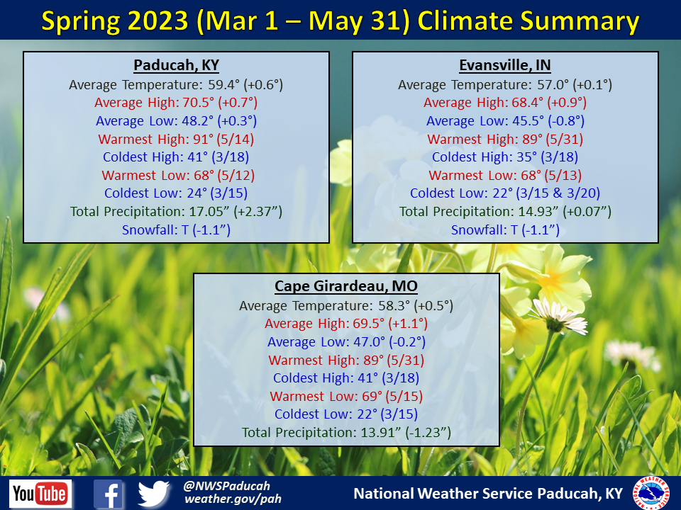
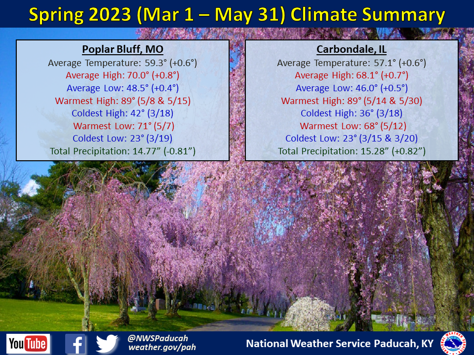
Temperatures averaged slightly above normal by around 0.5 degree. March and May both finished slightly above normal while April finished right near normal.
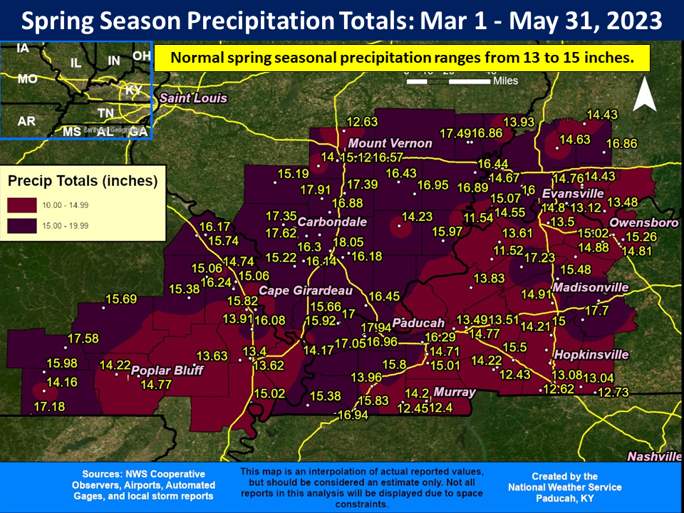
Precipitation was wetter than normal across a large portion of our region. Amounts ranged from 12 to 18 inches, which was 1 to 4 inches wetter than normal. March was a very wet month across the region and most locations picked up 50-60% of their spring rainfall that month. We dried out in April and even more so in May, when most locations finished drier than normal. The latter half of May was particularly dry, and much of the region failed to receive any measurable rain during the final 11 days of the month. This was rather unusual to go that long without rain during this time of year. The highest observed rainfall total for the season was 18.89” at a CoCoRaHS station located 0.7 miles west of Carbondale, IL.
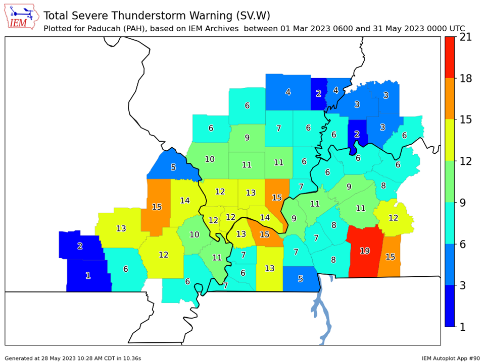
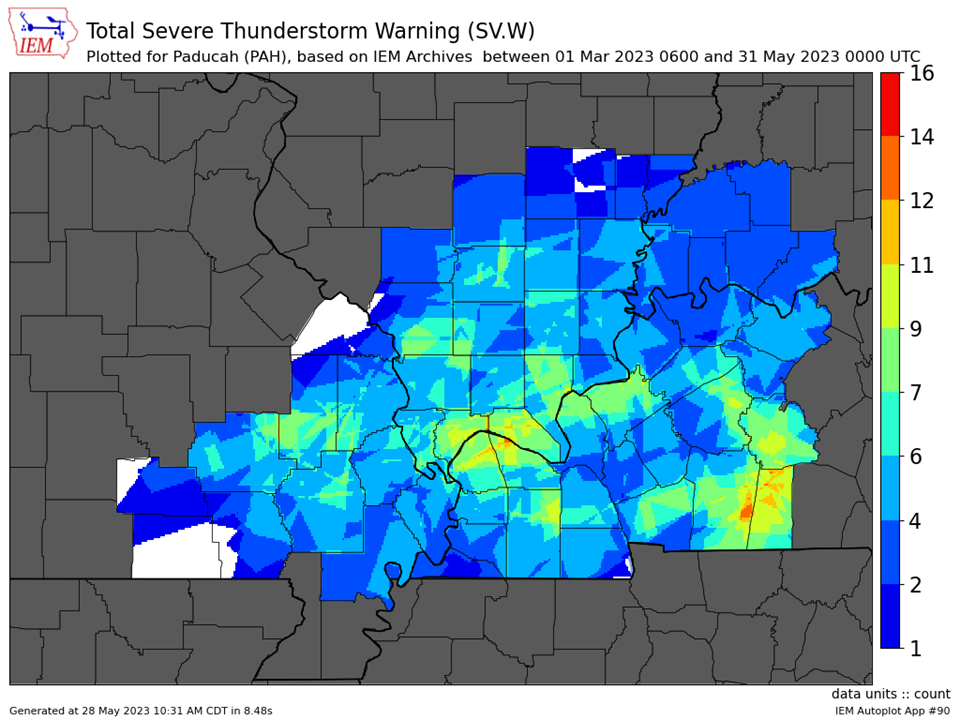
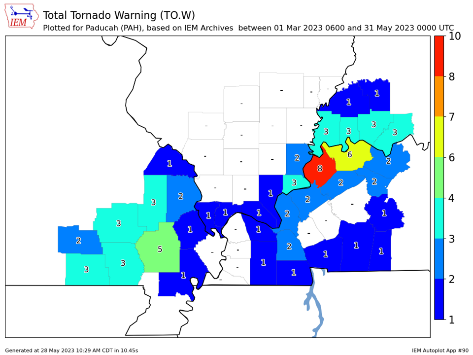
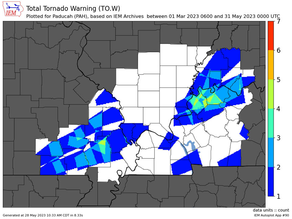
We issued 124 Severe Thunderstorm Warnings and 30 Tornado Warnings across our 58 county forecast area during the spring season (March 1 – May 31, 2023). This was right near normal for a typical spring. The majority of these warnings occurred over 6 separate days: March 3 & 31, April 5 & 15, and May 7 & 8.
The graphic below is an interpolated rainfall map using actual observations. Please note that there are likely discrepancies in between observations, since the values are estimated based on nearest reports.
| Spring 2023 Review: Precipitation and Temperature Maps (Click on image to enlarge) |
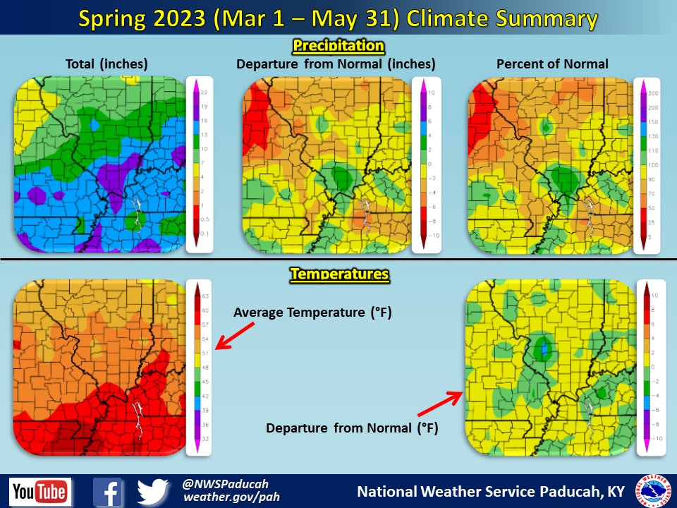 |
| Climate Maps are from the Northeast Regional Climate Center |
| Severe Thunderstorm Warnings - County Based | Severe Thunderstorm Warnings - Polygon Based |
 |
 |
| Tornado Warnings - County Based | Tornado Warnings - Polygon Based |
 |
 |

