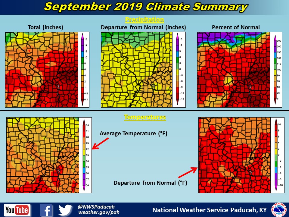
September 2019 Climate Review: Temperatures finished well above normal (by around 6 to 8 degrees) and numerous locations achieved their warmest September on record, including Cape Girardeau, MO. Paducah, KY finished as the 2nd warmest September, while Evansville finished 5th warmest. An unusually high number of days in the 90s occurred, with Paducah having 21 days, Evansville 17 days, and Cape Girardeau 16 days. This was the 2nd most number of 90s during any September in Paducah (27 days in Sept 1939) and Evansville (18 days in Sept 1897). It was the most on record for Cape Girardeau. The average number of 90s in September is typically around 4 to 7 days. Evansville didn’t even observe a high temperature below 80 degrees the entire month, the first time on record this had happened in September. The previous record was 27 of 30 days hitting 80 degrees in 1939. The warmest temperature of the year occurred on September 16th in Paducah (97), Evansville (96), and Cape Girardeau (98). This was quite rare to achieve such a feat so late in the season!
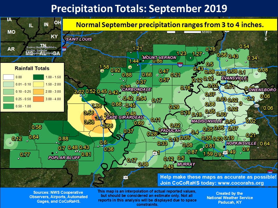
September was a very dry month across the region, particularly across western Kentucky, southeast Illinois, and southwest Indiana. Several locations observed their driest September on record, including Evansville, which received a whopping 0.08” the entire month! There were numerous locations that received a tenth of an inch or less, especially in the northern Pennyrile region of western Kentucky. The streak of 12 consecutive months with above normal precipitation came to an abrupt end in Paducah, as we only picked up 0.32”. This was the 4th driest September on record in Paducah, and the driest month since October 2005. The only area that received near normal or even slightly above normal rainfall was across portions of Scott and Cape Girardeau Counties in Missouri, due to training thunderstorms on the 20th. A few isolated locales in these counties picked up 4 to 6 inches within a few hours!
The graphic below is an interpolated rainfall map using actual observations. Please note that there are likely discrepancies in between observations, since the values are estimated based on nearest reports. (Ex: Estimates in Bollinger County Missouri appear too high, but we have no observations from that county.)

| September 2019 Review: Precipitation and Temperature Maps (Click on image to enlarge) |
 |
| Climate Maps are from the Northeast Regional Climate Center |