Paducah, KY
Weather Forecast Office
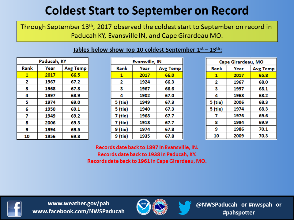
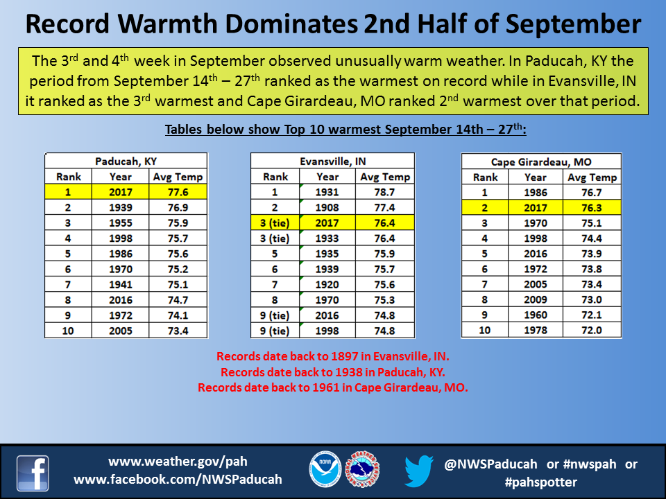
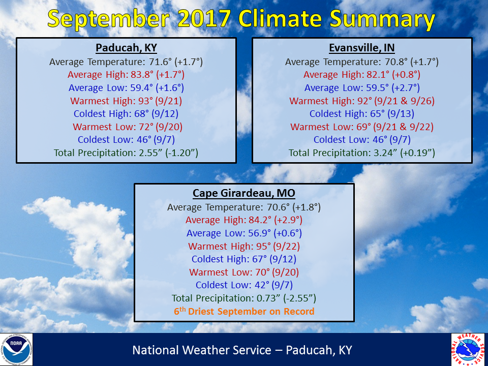
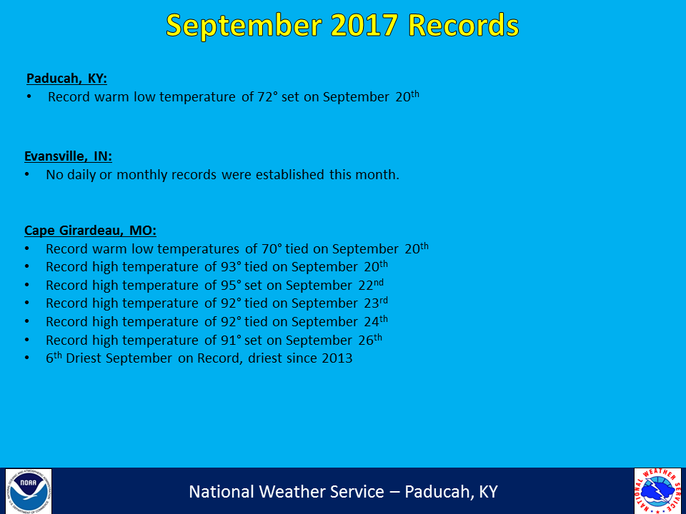
September 2017 Climate Summary: Temperatures were above normal with drier than normal conditions for many locations. It was hard to believe the month ended with above normal temperatures after what we endured during the first 2 weeks. Through September 13th, it was actually the coldest start to September on record in Paducah, Evansville, and Cape Girardeau. A major pattern change then followed with abnormally warm and even some record high temperatures set during the September 20th - 27th period. Highs routinely hit the 90s during this stretch. Paducah reached 90 degrees on 9 consecutive days (September 19-27), which is a record for this late in the season. The previous record for number of consecutive days reaching 90 after September 10th was 7 days from September 16-22, 1955. Overall temperatures finished around 1 to 2 degrees above normal for September.
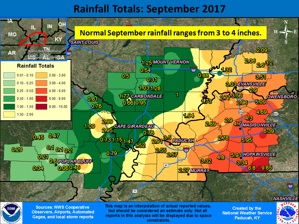
Rain was hard to come by for many locations, with drier than normal conditions (1-3 inch deficits) common across southeast Missouri, southern Illinois, and the Jackson Purchase area of west Kentucky. The Ozark foothills in Missouri observed the least rainfall with some locations picking up less than 0.25”. The Poplar Bluff, MO airport received only 0.06” for the entire month! The exception to the dryness was in part of the Pennyrile region of west Kentucky into a portion of southwest Indiana. This area experienced heavier rainfall associated with the remnants of Hurricane Harvey on the 1st of the month and the remnants of Hurricane Irma on the 12th – 13th, which resulted in wetter than normal conditions.
| September 2017 Review: Precipitation and Temperature Maps (Click on image to enlarge) |
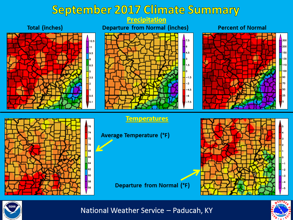 |
| Climate Maps are from the Northeast Regional Climate Center |
The graphic below is an interpolated rainfall map using actual observations. Please note that there are likely discrepancies in between observations, since the values are estimated based on nearest reports. Due to the convective nature of rainfall in the warmer months, amounts are more likely to vary over shorter distances, compared to the cooler months.
 |
FORECASTS
Forecast Discussion
User Defined Area Forecast
Hourly Forecasts
Fire Weather
Activity Planner
LOCAL INFORMATION
NWS Paducah KY Weekly Partner Briefing
Aviation Weather
Our Office
SKYWARN
Items of Interest
Hazardous Weather Support
WFO Paducah Navigator
Local Observations
Weather History
US Dept of Commerce
National Oceanic and Atmospheric Administration
National Weather Service
Paducah, KY
8250 Kentucky Highway 3520
West Paducah, KY 42086-9762
270-744-6440
Comments? Questions? Please Contact Us.


