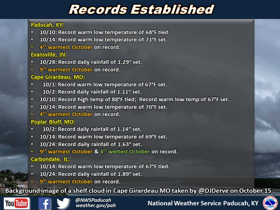
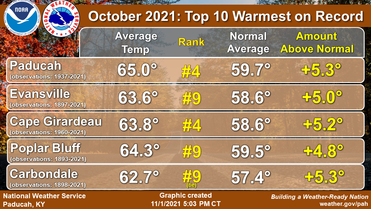
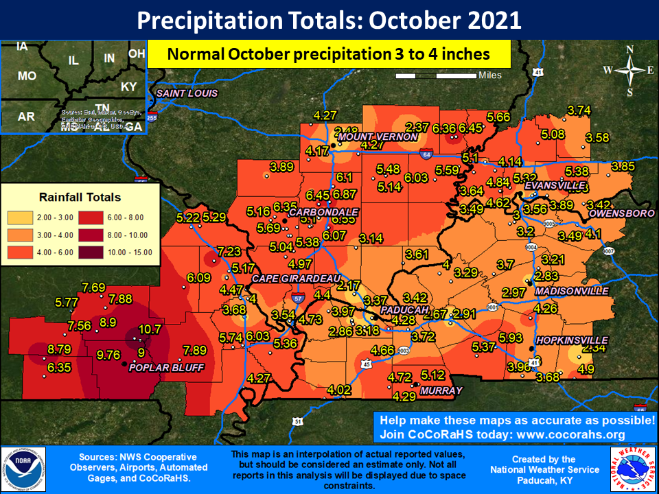
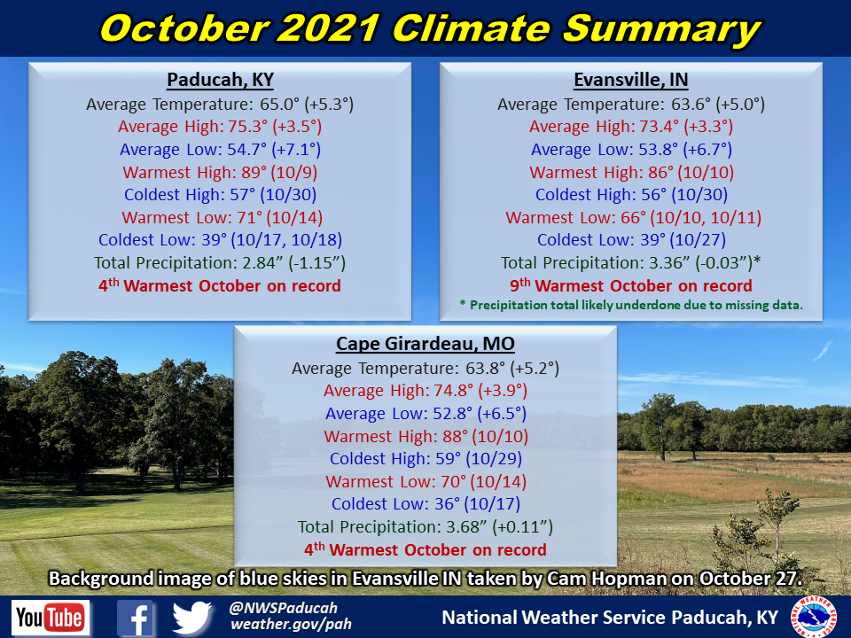
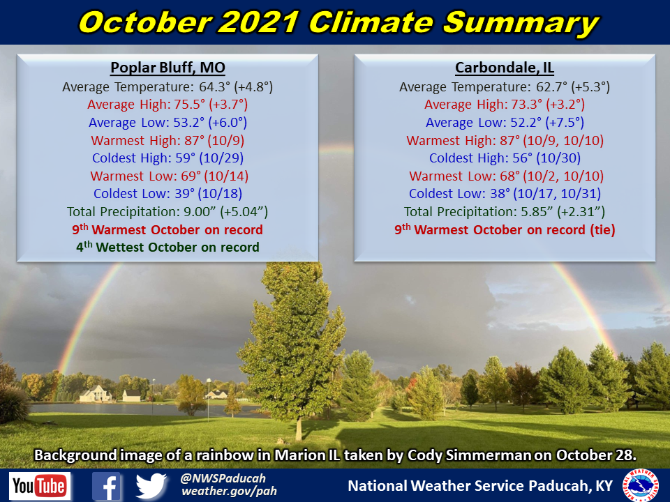
October 2021 Climate Review: The month of October started off warm and wet as the approach of a cold front brought showers and thunderstorms to much of the area. During the first five days of the month, Poplar Bluff picked up nearly 5 inches of rainfall, which was over half of the 9 inches they received for the entire month! That 9 inch total goes down as the 4th wettest October on record at Poplar Bluff. Things dried out and warmed up during the second weekend of October, as high temperatures surged into upper 80s across most of the area. In fact, Cape Girardeau tied a daily record high on the 10th, the same day that Cape Girardeau set and Paducah tied record daily warm lows. The unseasonably warm weather persisted into the middle of October as Paducah, Cape Girardeau, Poplar Bluff, and Carbondale all either set or tied their record daily warm lows on the 14th. Temperatures during this spell were 10 to as much as 20 degrees above normal. The passage of a cold front on the 15th not only brought showers and thunderstorms to the region, but also led to much cooler temperatures more akin to autumn. But up to that point, all five climate stations had logged their warmest first half of October on record.
Heading into the latter half of the month, a large dome of high pressure brought a prolonged period of dry and seasonably cool weather from October 15-22. In fact, all five climate stations measured absolutely no precipitation over that week long period. But that dry spell would soon come to an end as a dynamic low pressure system tracked from the Central Plains into the Ohio Valley on the 24th, dragging a strong cold front into the region late that weekend. The combination of strong instability and shear with the front’s approach resulted in the development of severe thunderstorms and tornadoes across portions of Missouri and southwest Illinois. The strongest tornado, an EF-3, tore through Fredericktown, MO, and continued to produce EF-1 and EF-2 damage into western Perry County MO before lifting. Two more EF-1 tornadoes touched down that evening within our area, affecting portions of Perry, Wayne, and Bollinger Counties in southeast Missouri. The rest of the region saw a period or two of heavy rainfall, and both Poplar Bluff and Carbondale set a record daily rainfall on the 24th. A slow moving low pressure system brought an abundance of clouds and damp weather to the region during the last week of the month, while seasonably cool conditions continued into Halloween. In its entirety, October 2021 would end up landing in the top 10 warmest Octobers at all climate stations.
| October 2021 Review: Precipitation and Temperature Maps (Click on image to enlarge) |
 |
| Climate Maps are from the Northeast Regional Climate Center |
Monthly Climate Report: Paducah | Evansville | Cape Girardeau | Poplar Bluff | Carbondale