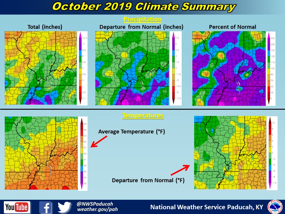
October 2019 Climate Review: Temperatures averaged near normal this month with Paducah, Evansville, and Cape Girardeau less than a degree above normal. The month was bookended by extremes with highs in the mid 90s to start the month and lows below freezing on Halloween. Record highs were set or tied at all 3 cities the first two days of the month. For Evansville, the 96 on October 2nd tied for the warmest temperature of the year, the first time that an October day was the warmest for any of these cities.
October was much wetter than average across most the region. Each of Paducah, Evansville, and Cape Girardeau had a top 10 wettest October, with Cape Girardeau’s 7.84’’ its 3rd wettest. Daily precipitation records were set at all three locations on October 21st and October 26th, which has gone a long way towards ending the drought brought on by the very dry September and start of October. The 3.87’’ on October 26th at Cape Girardeau also set a record for wettest October day. Precipitation was closer to normal in western counties of Southeast Missouri and in portions of the Pennyrile region of Western Kentucky.
The graphic below is an interpolated rainfall map using actual observations. Please note that there are likely discrepancies in between observations, since the values are estimated based on nearest reports.

| October 2019 Review: Precipitation and Temperature Maps (Click on image to enlarge) |
 |
| Climate Maps are from the Northeast Regional Climate Center |


