Overview
Severe thunderstorms moved across the region during the evening of May 6, 2003. A total of 21 tornadoes touched down across our forecast area, including a deadly F4 tornado that struck Pulaski, Massac, and Pope Counties in Illinois. There was also an F3 tornado that struck Jackson, MO.Tornadoes:
|
Tornado #1 - Massac County Illinois F4
Track Map 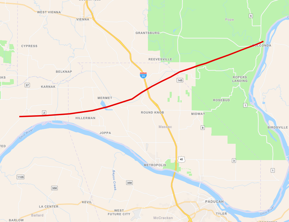 
This tornado was rated using the old F scale. The new EF scale was introduced in 2007. |
||||||||||||||||
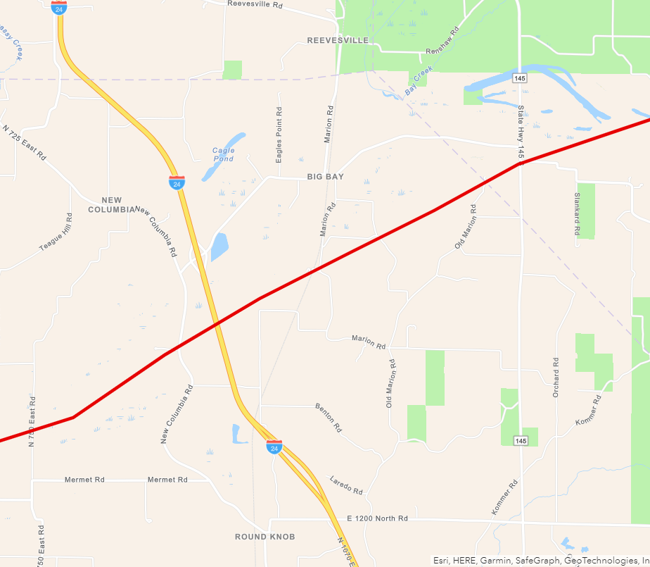
The 4 graphics below show zoomed in track maps for the F4 tornado across Pulaski, Massac, and Pope Counties. Click on the images to enlarge them.
.PNG) |
.PNG) |
 |
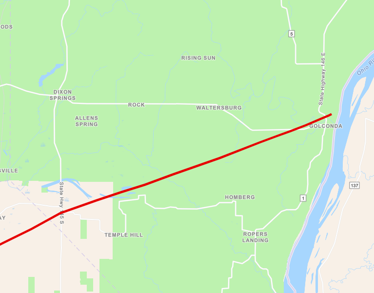 |
| Pulaski County | Western Massac County | Eastern Massac County | Pope County |
Here is map showing the locations of all 21 tornadoes that occurred throughout our forecast area on May 6, 2003:
(1).png) |
The table below shows a chronological order of the tornadoes that occurred with this event.
| Time (CDT) | State | County | Rating (F scale) | Length (miles) | Width (yards) |
| 8:04 PM | MO | Bollinger | 2 | 0.8 | 100 |
| 8:18 PM | MO | Bollinger | 0 | 0.3 | 50 |
| 8:31 PM | MO | Cape Girardeau | 1 | 1 | 50 |
| 8:45 PM | MO | Cape Girardeau | 3 | 2 | 50 |
| 8:57 PM | IL | Alexander | 0 | 0.3 | 30 |
| 9:11 PM | MO | Cape Girardeau | 1 | 3 | 50 |
| 9:32 PM | IL | Pulaski, Massac, Pope | 4 | 33 | 1,000 |
| 10:22 PM | MO | Scott | 1 | 5 | 200 |
| 10:27 PM | IL | Alexander, Mississippi, Ballard | 2 | 25 | 400 |
| 10:27 PM | IL | Johnson | 0 | 0.2 | 30 |
| 10:47 PM | IL | Johnson | 0 | 0.2 | 30 |
| 10:50 PM | IL | Massac | 0 | 0.2 | 30 |
| 11:12 PM | KY | McCracken | 0 | 2 | 75 |
| 11:17 PM | KY | McCracken | 1 | 3.5 | 80 |
| 11:22 PM | KY | Graves | 1 | 0.5 | 125 |
| 11:32 PM | KY | Hickman, Graves | 1 | 22 | 50 |
| 11:32 PM | KY | Graves | 1 | 1 | 100 |
| 11:38 PM | KY | Marshall | 1 | 2 | 100 |
| 11:50 PM | KY | Marshall | 0 | 0.5 | 80 |
| 11:52 PM | KY | Union, Henderson | 1 | 15 | 100 |
| 11:55 PM | KY | Marshall | 1 | 0.5 | 80 |
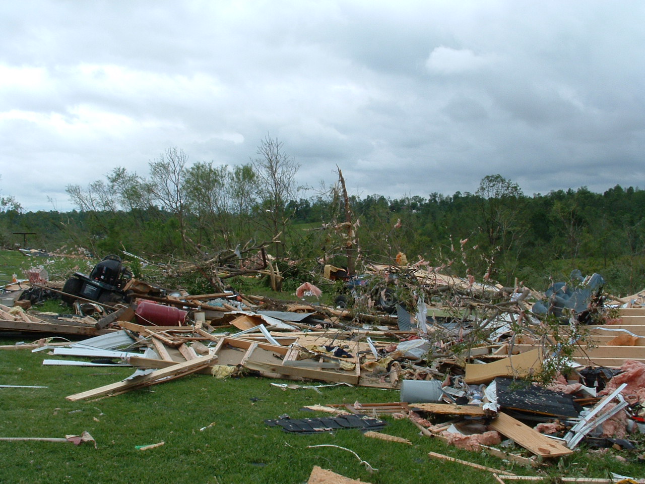
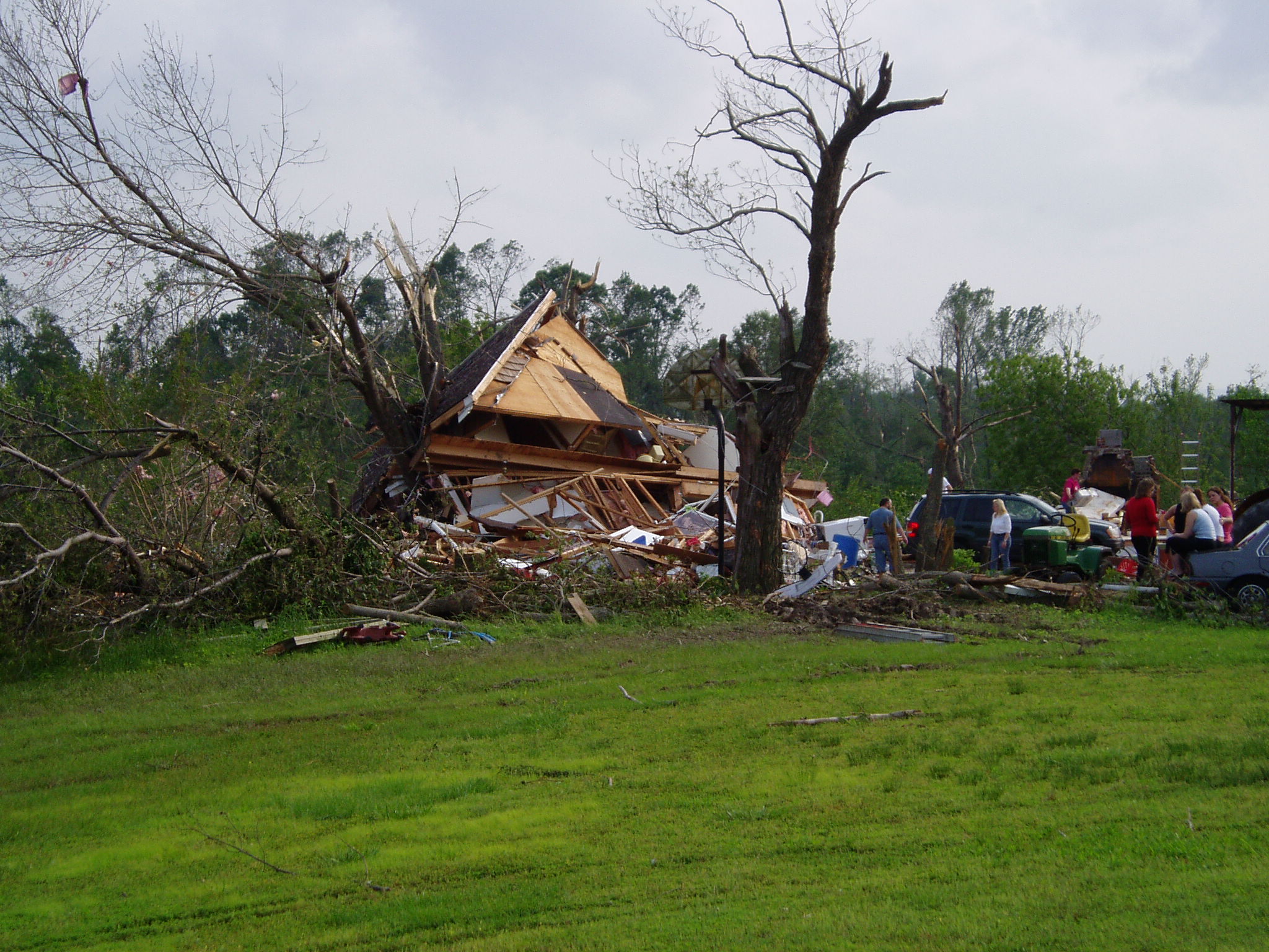
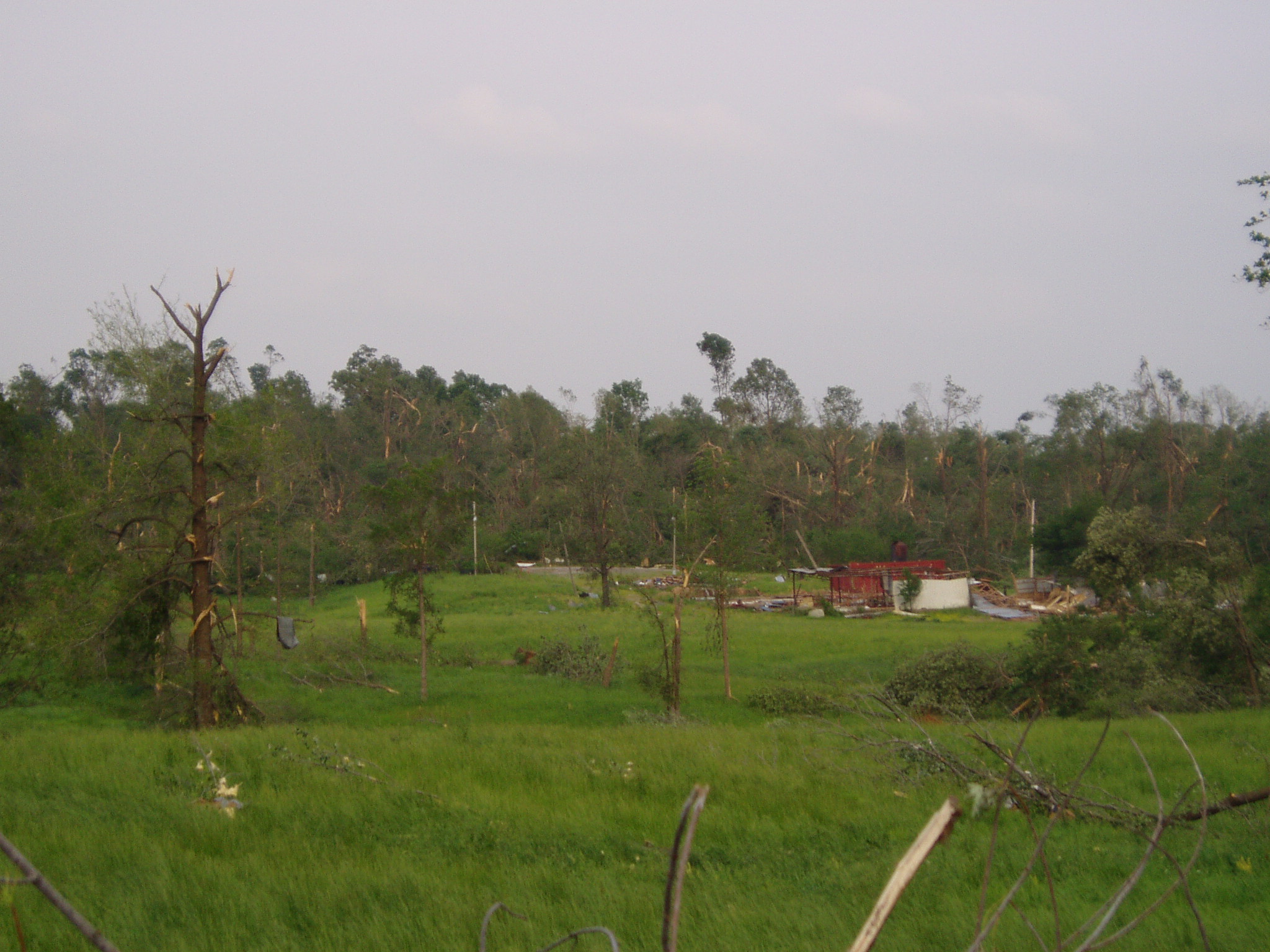
Photos
 |
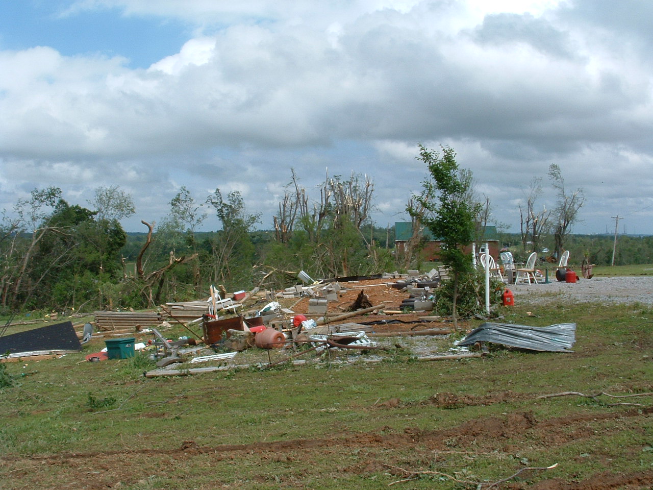 |
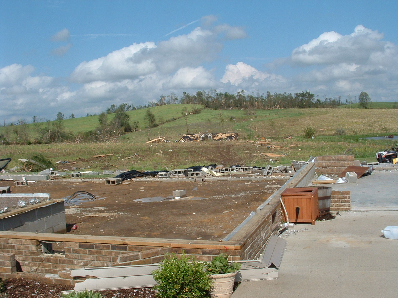 |
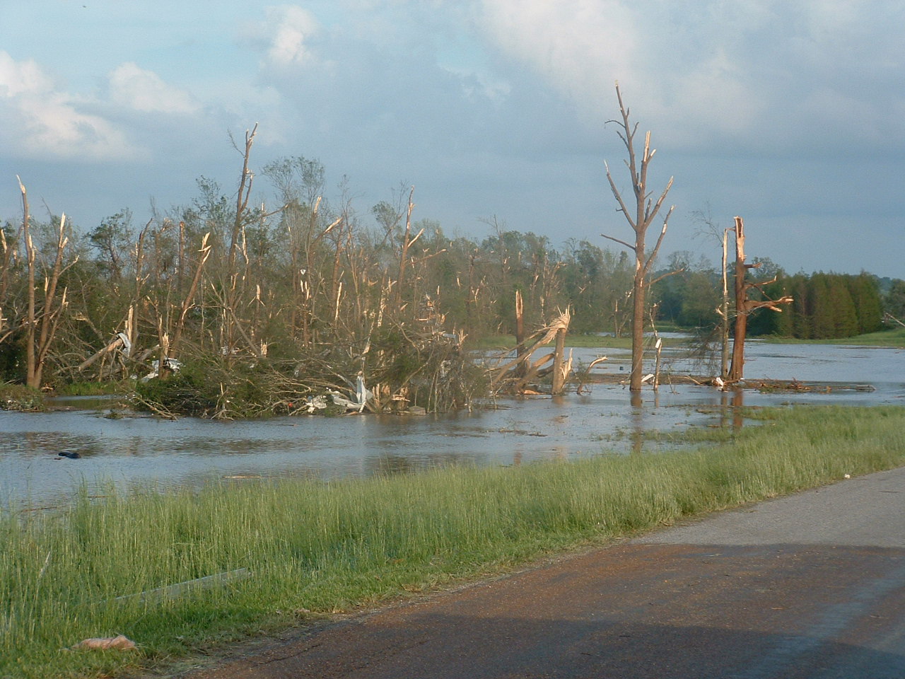 |
| NWS Damage Survey - F4 tornado (Massac County IL) | NWS Damage Survey - F4 tornado (Massac County IL) | NWS Damage Survey - F4 tornado (Massac County IL) | NWS Damage Survey - F4 tornado (Massac County IL) |
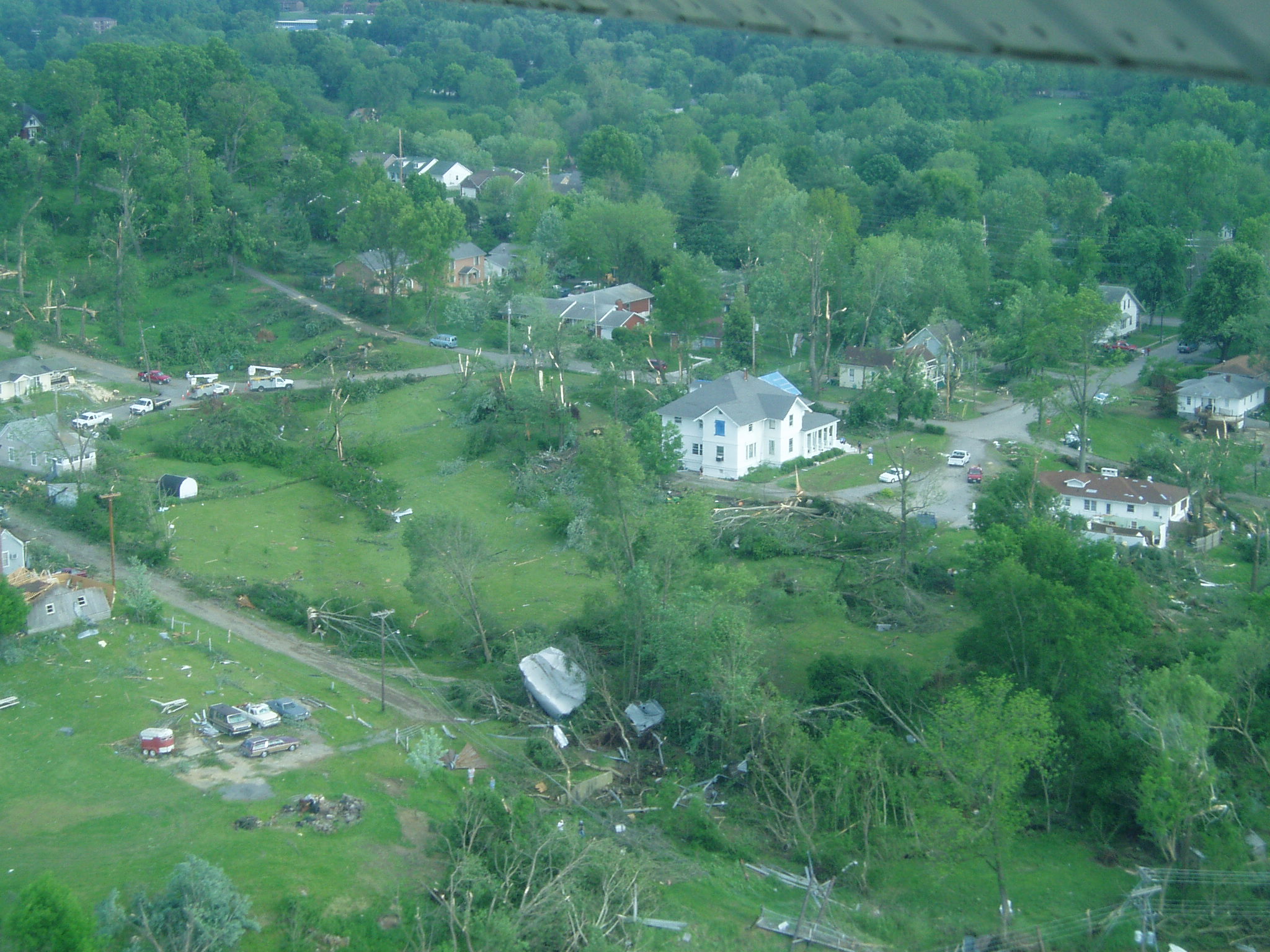 |
 |
 |
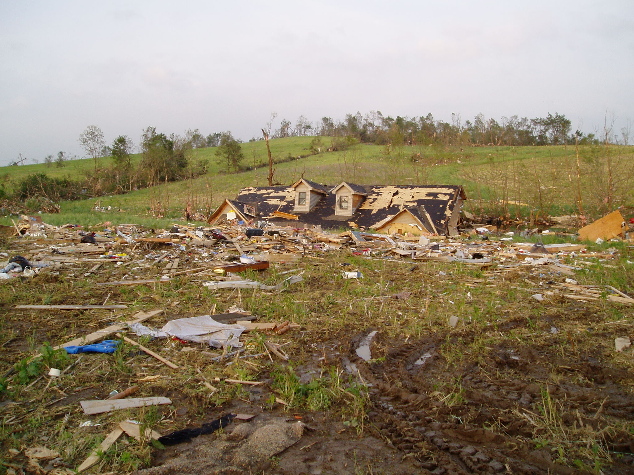 |
| NWS Damage Survey - F4 tornado (Massac County IL) | NWS Damage Survey - F4 tornado (Massac County IL) | NWS Damage Survey - F4 tornado (Massac County IL) | NWS Damage Survey - F4 tornado (Massac County IL) |
Radar
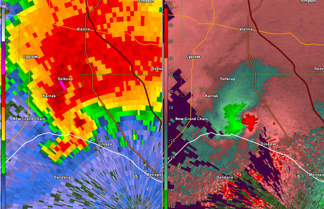
Click here for a radar loop of this event. Supercell thunderstorms formed after 7 PM across southeast Missouri and far southern Illinois. These storms would eventually merge with a larger complex of thunderstorms moving more quickly east-southeast from Missouri. The thunderstorms would then trek across western Kentucky before exiting our region by 2 AM. The images below depict the reflectivity and storm relative velocity (SRM) of the supercell thunderstorm that moved across Massac County Illinois and produced the deadly F4 tornado. (Click on the images to enlarge)
 |
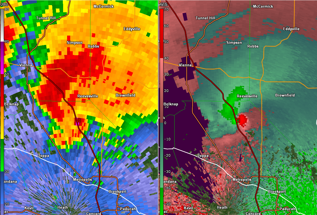 |
| Radar at 9:47 PM CDT (Massac County IL) | Radar at 10:07 PM CDT (Massac County IL) |
Storm Reports
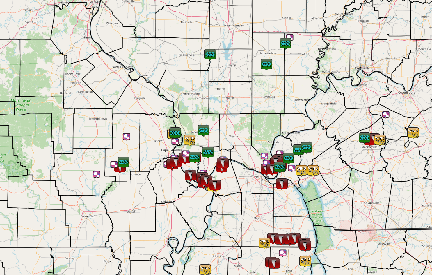
These images show the storm reports across our area and nationally during this severe weather event. (Click here for additional information from this event.)
 |
.PNG) |
| Local Storm Reports (NWS Paducah Zoomed In Map) | Local Storm Reports Nationally on May 6, 2003 |
Environment
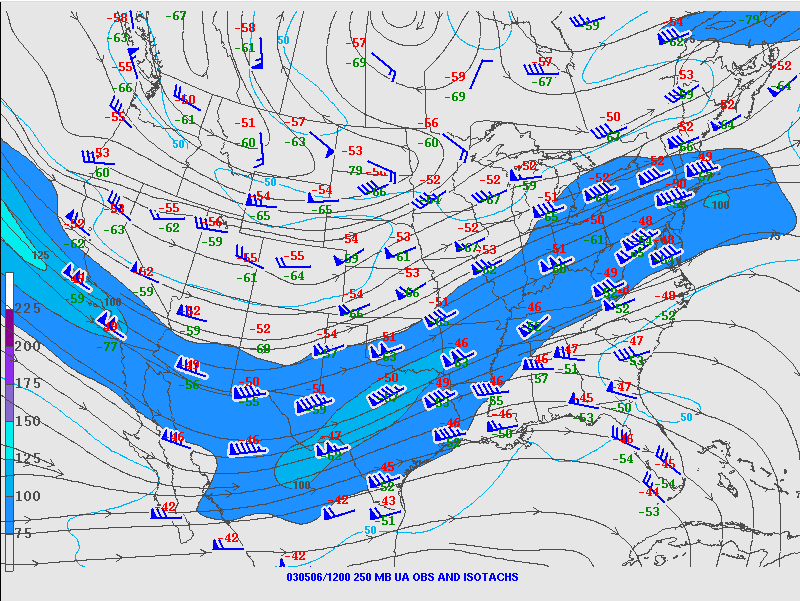
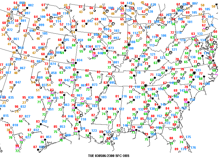
An upper level trough was located across the Rockies with strong mid-upper level jets positioned across the Southern Plains during the morning of May 6th. This provided strong forcing for thunderstorms to develop across the mid Mississippi Valley region late in the day. There was also abundant deep layer wind shear for storms to organize and maintain their intensity.
 |
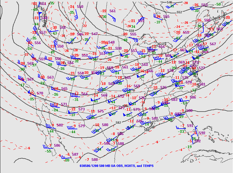 |
| 250 mb Chart - 7 AM May 6, 2003 | 500 mb Chart - 7 AM May 6, 2003 |
 |
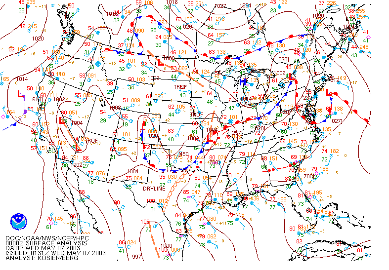 |
| Surface Analysis at 6 PM May 6, 2003 | National Surface Analysis at 6 PM May 6, 2003 |
The Day 1 outlook issued by the Storm Prediction Center had southeast Missouri and southern Illinois in a moderate risk for severe thunderstorms on May 6th.
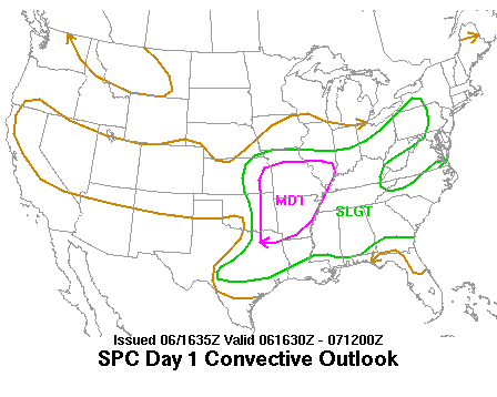 |
| SPC Day 1 Convective Outlook - Late AM (1130) Update |
 |
Media use of NWS Web News Stories is encouraged! Please acknowledge the NWS as the source of any news information accessed from this site. |
 |