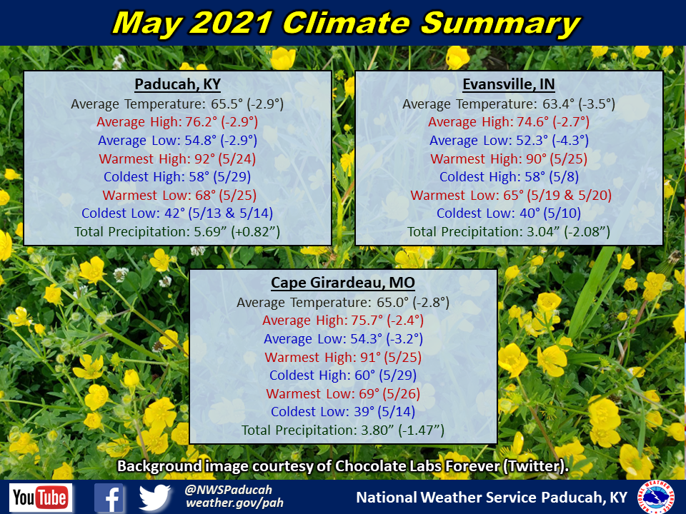
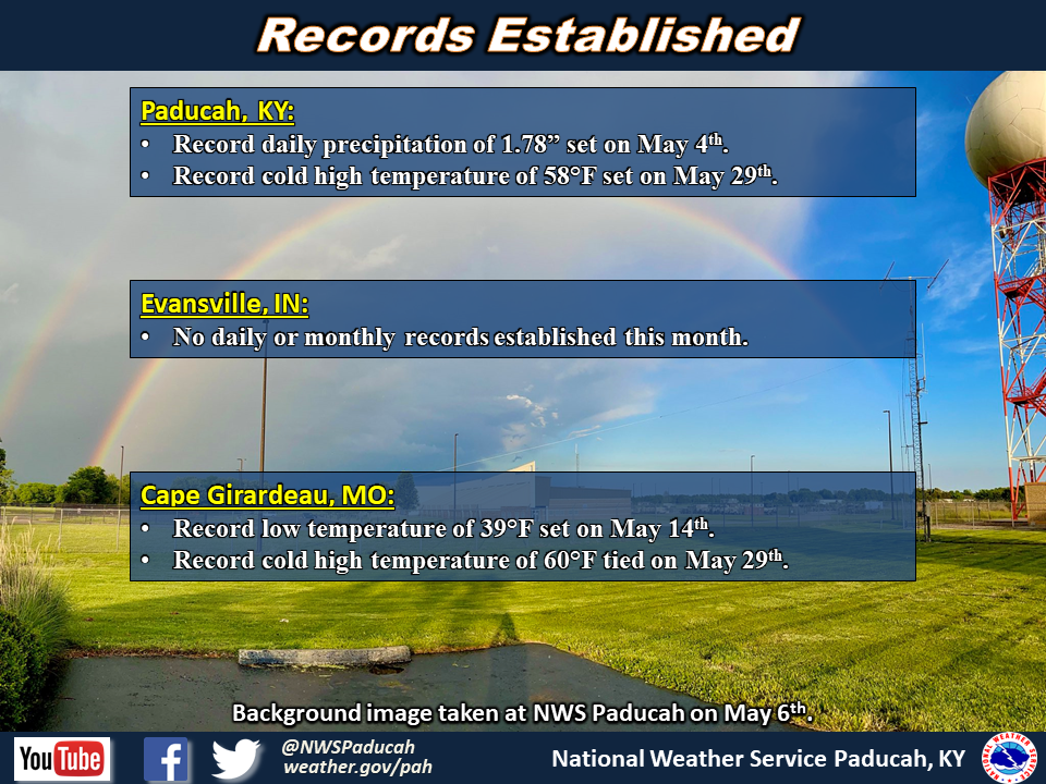
May 2021 Climate Review: Temperatures finished below normal by around 3 to 3.5 degrees. The week of May 10-15 featured temperatures of 10 to 12 degrees below normal, with many nights in the lower 40s and even a few upper 30s. The warmest period occurred from May 20-27, with high temperatures soaring to summer-like levels in the mid 80s to around 90. This was followed by abnormally chilly temperatures to end the month. Paducah only reached 58 degrees for a high temperature on May 29th, which was tied for the latest sub-60 degree high temperature on record. Overnight lows during Memorial Day weekend reached into the 40s, making it feeling more like early spring than the unofficial beginning of summer.
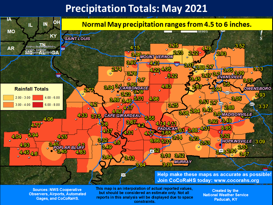
Much of the area observed drier than normal conditions for the month, with rainfall deficits ranging from 1 to 2.5 inches common. There were some exceptions, particularly across portions of southeast Missouri and western Kentucky, which finished slightly wetter than normal. Most locations picked up anywhere from 3 to 5 inches. The highest observed rainfall total was 6.85” at the COOP station near Crofton, KY (Christian County).
The graphic below is an interpolated rainfall map using actual observations. Please note that there are likely discrepancies in between observations, since the values are estimated based on nearest reports.
| May 2021 Review: Precipitation and Temperature Maps (Click on image to enlarge) |
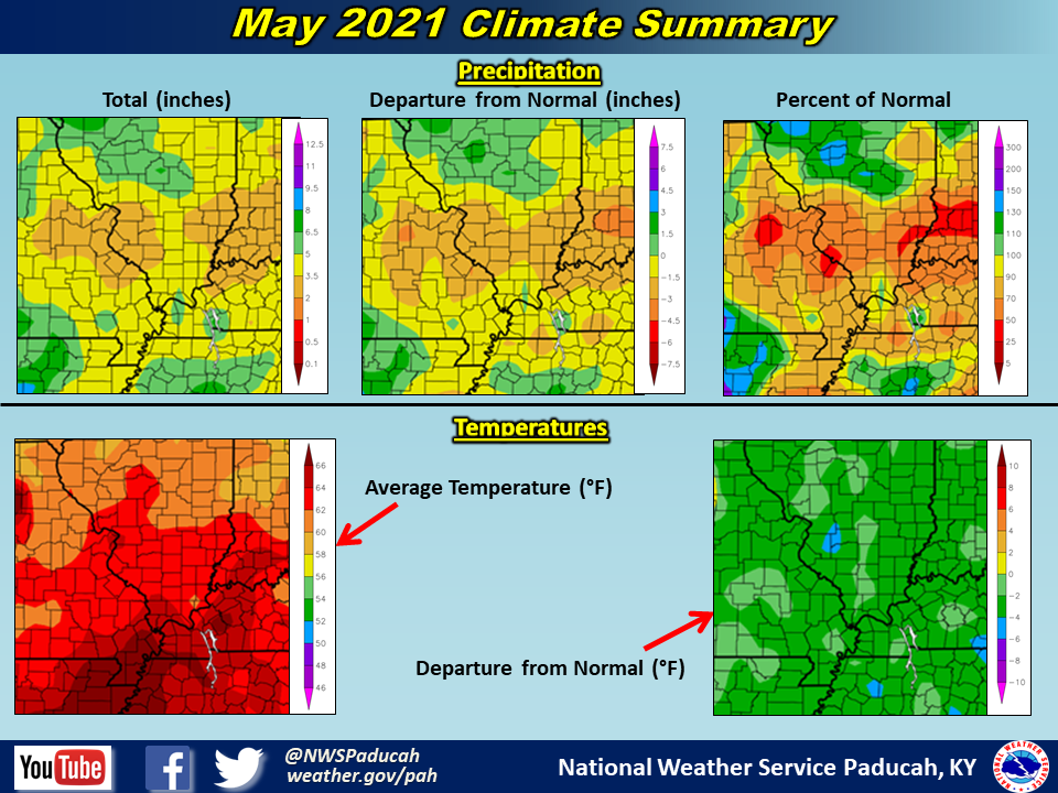 |
| Climate Maps are from the Northeast Regional Climate Center |