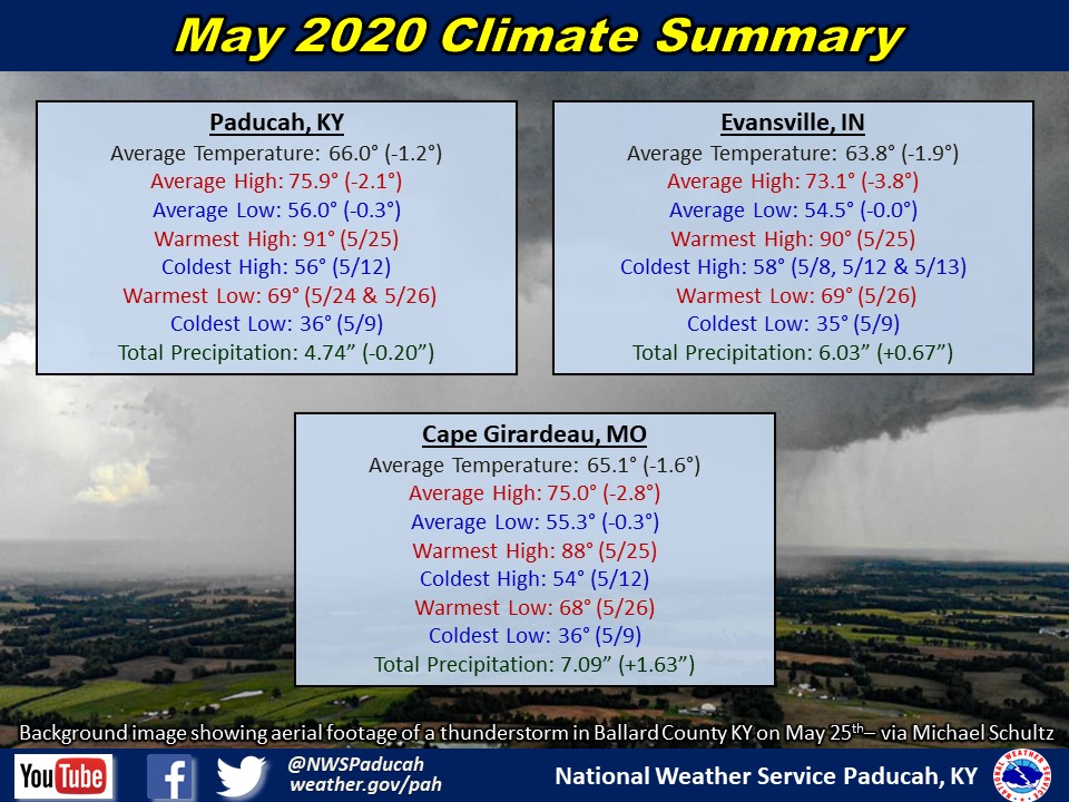
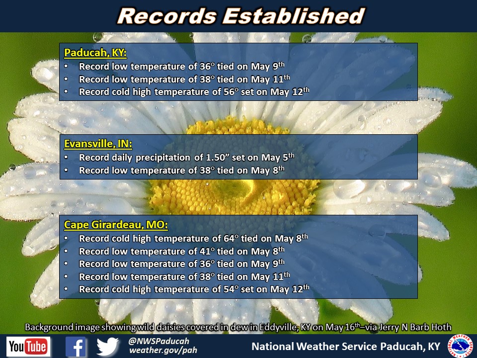
May 2020 Climate Review: Temperatures finished below normal by around 1 to 2.5 degrees. The month started out with 10 of the first 13 days registering below normal in Paducah. On May 12th, high temperatures remained in the 50s. This was a rare occurrence so late in the season and was actually the coldest high temperatures this late in the spring since 1981 in Paducah and Cape Girardeau. The warmest stretch of the month occurred over the Memorial Day holiday weekend with highs into the mid 80s to around 90.
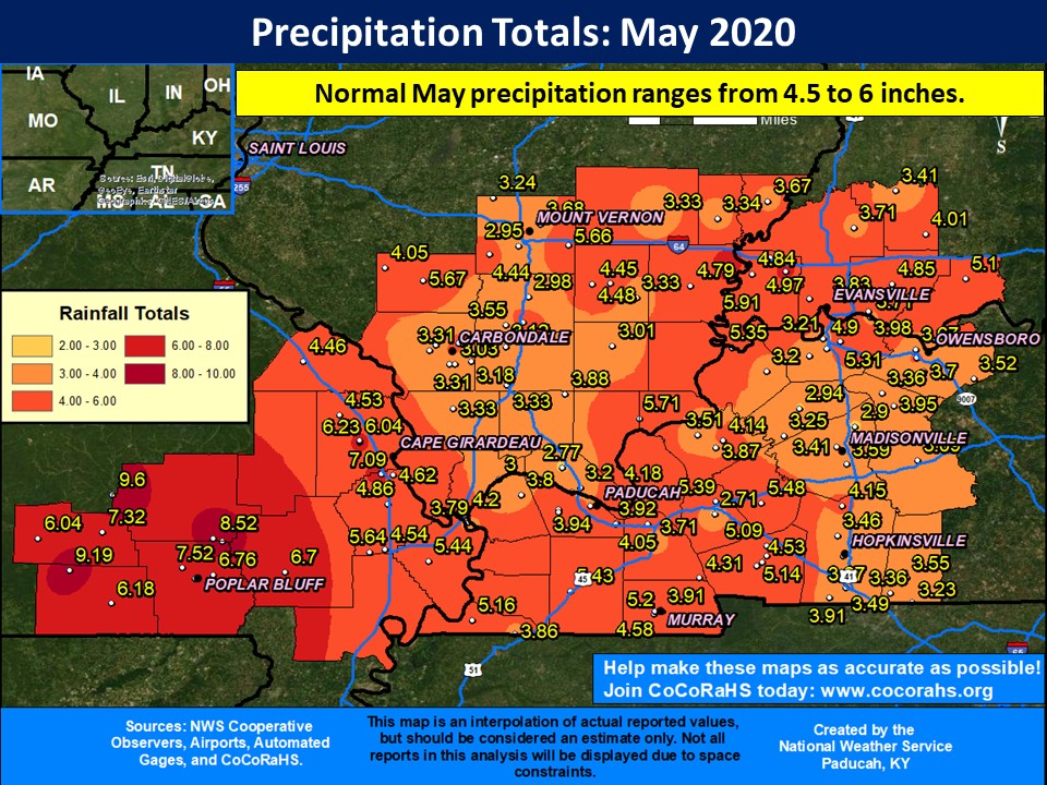
Rainfall varied, with a good part of the area finishing near or drier than normal east of the Mississippi River. Much of this area received 3 to 5 inches for the month. However, there were some exceptions with a few locations picking up greater than 5 inches in this area, including 7.57 inches at a CoCoRaHS station near Crossville, IL and 6.75 inches at a CoCoRaHS station near Poseyville, IN. On the flip side, much of southeast Missouri observed above normal rainfall, particularly across the Ozark Foothills region where amounts of 6 to 9 inches were common. The highest observed amount was 9.6 inches at the Clearwater Dam COOP in Wayne County Missouri.
May is typically the peak of our severe thunderstorm season, but it was quieter than normal this year. Only 33 combined warnings (Severe Thunderstorm, Tornado, and Flash Flood) were issued in our forecast area for the month, compared to a normal amount around 81. The most noteworthy events of the month impacted southeast Missouri and far southern portions of western Kentucky on May 3 and 4. These events did pack quite a punch with a good amount of wind damage, including a macroburst with winds up to 110 mph in Gideon, MO. Two tornadoes also occurred, one near Grandin, MO and the other in Marston, MO.
The graphic below is an interpolated rainfall map using actual observations. Please note that there are likely discrepancies in between observations, since the values are estimated based on nearest reports.
| May 2020 Review: Precipitation and Temperature Maps (Click on image to enlarge) |
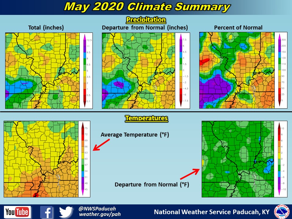 |
| Climate Maps are from the Northeast Regional Climate Center |