March 2023 Climate Review:
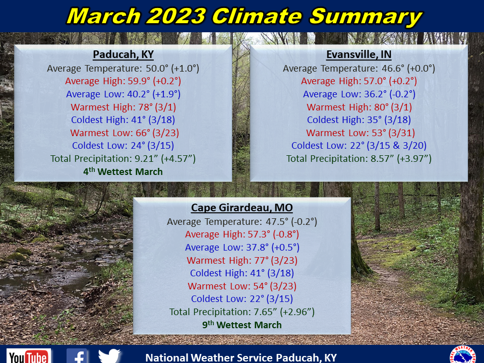
Temperatures averaged near to slightly above normal. The first 8 days of the month featured above normal temperatures with highs reaching the 60s and 70s. A few locations even reached 80 degrees on the 1st, including Evansville. This was the earliest 80 on record in Evansville, surpassing the previous earliest on March 4, 1983. This was followed by a cooler stretch from the 10th through the 21st. Low temperatures dropped into the 20s many nights during this period. Another warm period was observed from the 22nd through 26th with highs back into the 60s and 70s. A freeze occurred in many locations on the morning of the 29th. The month ended on a warm note with highs reaching back near 70 on the 31st.
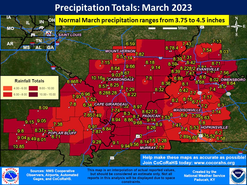
It was a very wet month across the region with rainfall on the order of 6 to 10 inches in most locations. This was 3 to 6 inches above normal. The highest observed amount was 10.85” at a CoCoRaHS station SSE of Gatewood in Ripley County, MO. The heaviest rainfall events occurred on March 2-3 and March 24. Both of these events produced widespread amounts of 2 to 3” and localized totals of nearly 5”.

| March 2023 Review: Precipitation and Temperature Maps (Click on image to enlarge) |
 |
| Climate Maps are from the Northeast Regional Climate Center |


Monthly Climate Report: Paducah | Evansville | Cape Girardeau | Poplar Bluff | Carbondale