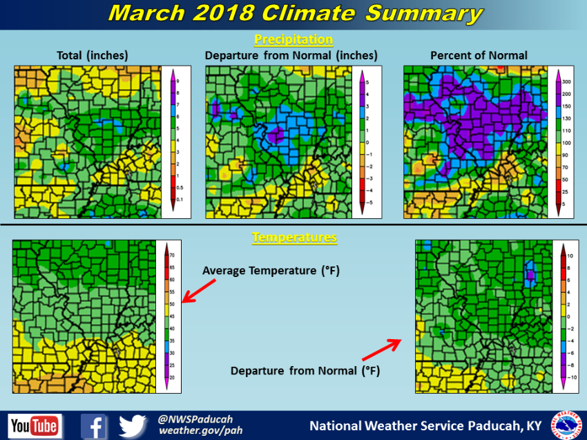
March 2018 Climate Review: Temperatures were cooler than normal and precipitation was generally near to slightly wetter than normal in our area. Temperature extremes were held in check with no records established at any of the 3 official climate stations. Temperatures generally finished 1 to 3 degrees below normal across the area. Precipitation varied, but thanks to heavy rain during the last week of the month, many areas observed near normal or even wetter than normal conditions. Snowfall was above normal for the month across much of southeast Illinois, northwest Kentucky, and southwest Indiana thanks to 2-6 inches of snow that occurred on March 11th. Aside from a few strong to severe thunderstorms late on the evening of March 16th and again on the 24th, the month was generally fairly lackluster in regards to severe thunderstorms across our region.
| March 2018 Review: Precipitation and Temperature Maps (Click on image to enlarge) |
 |
| Climate Maps are from the Northeast Regional Climate Center |
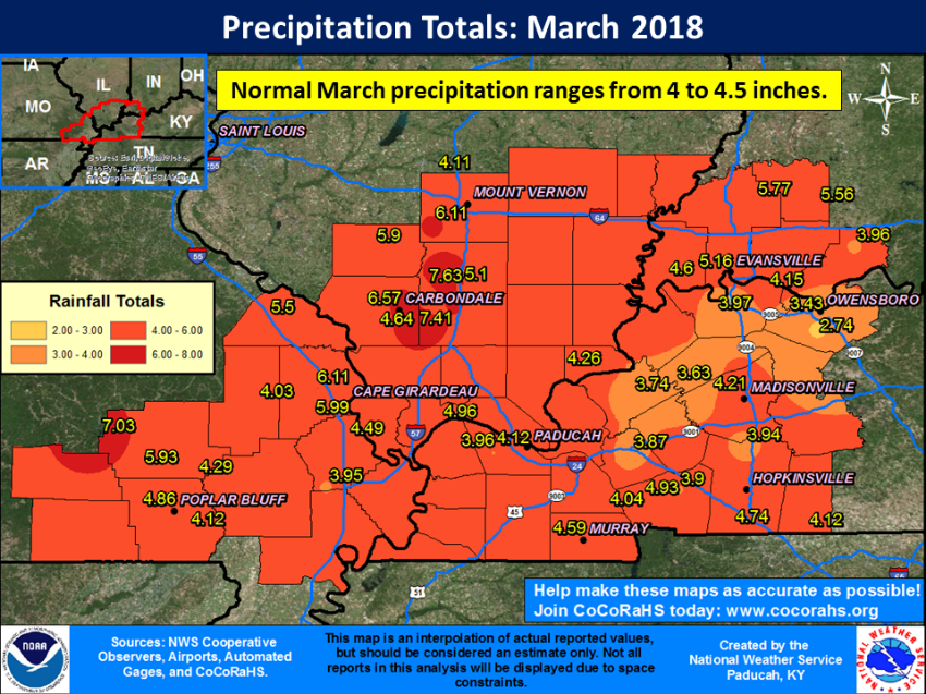
The graphic below is an interpolated rainfall map using actual observations. Please note that there are likely discrepancies in between observations, since the values are estimated based on nearest reports.
 |