
Moisture and nearby frontal boundary will focus more showers and thunderstorms for portions of the Mid-Atlantic and Northeast today. Rainfall could be locally heavy resulting instances of flash flooding. Meanwhile, the heat lingers for areas of the Southeast and expands across the Western U.S. the next several days. Between these areas, severe thunderstorms possible for the Plains and Midwest. Read More >
Overview
Intense heat and extremely high humidity levels lead to dangerously high heat indices on July 20, 2022. High temperatures in the mid to upper 90s combined with incredibly high dewpoints to produce heat index values ranging from 110 to 123. Cape Girardeau, MO tied their all-time highest heat index of 123 degrees, which was previously recorded on July 2, 1980. A weak frontal boundary moving into the region caused dewpoints to pool ahead of it. This resulted in a very tropical airmass with dewpoints rising into the upper 70s to lower 80s. A few sites even exceeded 82 degrees, which is very rare for our area.
Peak Heat Index Readings
Heat index values soared above 110 in most locations across the Quad State, with several sites above 115. In Cape Girardeau, the extreme heat and humidity produced a heat index reading of 123 degrees at 5 PM. This tied the all-time highest heat index on record in Cape Girardeau, which was previously set on July 2, 1980. Additional heat index climatology for Cape Girardeau can be found here.

| Location | State | Station Type | Peak Heat Index |
| Cape Girardeau | MO | ASOS | 123 |
| Elkton 5 SW | KY | KYMN | 122 |
| Morganfield 4 E | KY | KYMN | 118 |
| Perryville | MO | AWOS | 117 |
| Cairo | IL | AWOS | 117 |
| Marion | IL | AWOS | 117 |
| Mayfield 6 SW | KY | KYMN | 117 |
| Madisonville 4 S | KY | KYMN | 117 |
| Greenville 6 N | KY | KYMN | 117 |
| Carmi | IL | AWOS | 116 |
| Dixon 1 NW | KY | KYMN | 116 |
| Sikeston | MO | AWOS | 115 |
| Henderson | KY | AWOS | 115 |
| Hopkinsville 6 N | KY | KYMN | 115 |
| Marion 4 NE | KY | KYMN | 115 |
| Hickman 2 E | KY | KYMN | 115 |
| Carbondale | IL | ASOS | 114 |
| Poplar Bluff | MO | ASOS | 114 |
| Murray | KY | AWOS | 114 |
| Owensboro | KY | AWOS | 114 |
| La Center 5 NNE | KY | KYMN | 114 |
| Henderson 5 E | KY | KYMN | 114 |
| Benton 4 N | KY | KYMN | 114 |
| Calhoun 5 NW | KY | KYMN | 114 |
| Cadiz 4 SW | KY | KYMN | 114 |
| Paducah | KY | ASOS | 113 |
| Greenville | KY | AWOS | 113 |
| Mayfield | KY | AWOS | 113 |
| Murray 1 W | KY | KYMN | 113 |
| Madisonville | KY | AWOS | 112 |
| Princeton 2 SE | KY | KYMN | 112 |
| Evansville | IN | ASOS | 110 |
| Metropolis | IL | AWOS | 110 |
| Mt Vernon | IL | AWOS | 109 |
| Marion | KY | AWOS | 109 |
| Fairfield | IL | AWOS | 106 |
Oppressive Humidity
Dewpoints were extremely high with many locations exceeding 80 degrees. Numerous stations observed readings of 82+ degrees, which is very rare and nearly as high as they have ever been across our region. Marion, IL achieved the highest dewpoint in the area with a reading of 85 degrees! Additional dewpoint climatology for Paducah, KY can be accessed here.
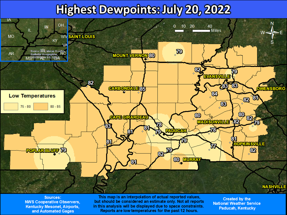
| Location | State | Station Type | Max Dewpoint |
| Marion | IL | AWOS | 85 |
| Morganfield 4 E | KY | KYMN | 84 |
| Cape Girardeau | MO | ASOS | 83 |
| Dixon 1 NW | KY | KYMN | 83 |
| Henderson | KY | AWOS | 83 |
| Marion 4 NE | KY | KYMN | 83 |
| Henderson 5 E | KY | KYMN | 83 |
| Elkton 5 SW | KY | KYMN | 82 |
| Perryville | MO | AWOS | 82 |
| Mayfield 6 SW | KY | KYMN | 82 |
| Madisonville 4 S | KY | KYMN | 82 |
| Greenville 6 N | KY | KYMN | 82 |
| Carmi | IL | AWOS | 82 |
| Calhoun 5 NW | KY | KYMN | 82 |
| Cairo | IL | AWOS | 81 |
| Sikeston | MO | AWOS | 81 |
| Hopkinsville 6 N | KY | KYMN | 81 |
| Hickman 2 E | KY | KYMN | 81 |
| Murray | KY | AWOS | 81 |
| Owensboro | KY | AWOS | 81 |
| La Center 5 NNE | KY | KYMN | 81 |
| Carbondale | IL | ASOS | 80 |
| Murray 1 W | KY | KYMN | 80 |
| Madisonville | KY | AWOS | 80 |
| Mt Vernon | IL | AWOS | 80 |
| Marion | KY | ASOS | 80 |
| Poplar Bluff | MO | ASOS | 79 |
| Benton 4 N | KY | KYMN | 79 |
| Paducah | KY | ASOS | 79 |
| Greenville | KY | AWOS | 79 |
| Mayfield | KY | AWOS | 79 |
| Evansville | IN | ASOS | 79 |
| Fairfield | IL | AWOS | 79 |
| Princeton 2 SE | KY | KYMN | 78 |
| Metropolis | IL | AWOS | 78 |
| Cadiz 4 SW | KY | KYMN | 77 |
Temperatures
Most locations observed temperatures peaking in the mid 90s, but there were some stations that reached the upper 90s including Cape Girardeau, MO. Low temperatures were also very warm, with readings only falling into the mid 70s to around 80 degrees. Paducah, Cape Girardeau, and Poplar Bluff all registered daily record warm lows of 80, 79, and 78 respectively. This marked the 4th time of the summer that Paducah observed low temperatures remaining above 80.
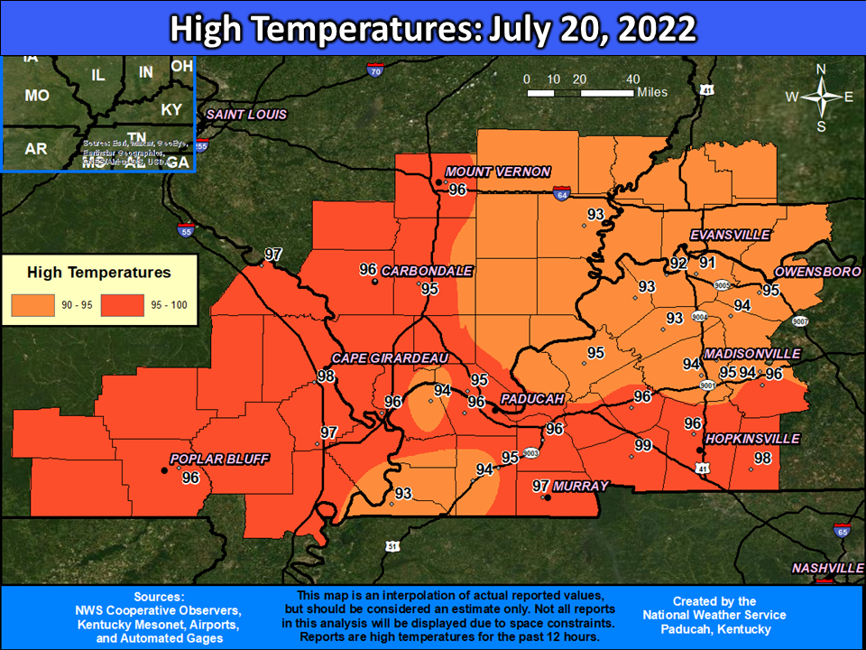
| Location | State | Station Type | High Temperature |
| Cadiz 4 SW | KY | KYMN | 99 |
| Cape Girardeau | MO | ASOS | 98 |
| Elkton 5 SW | KY | KYMN | 98 |
| Perryville | MO | AWOS | 97 |
| Sikeston | MO | AWOS | 97 |
| Murray 1 W | KY | KYMN | 97 |
| Cairo | IL | AWOS | 96 |
| Hopkinsville 6 N | KY | KYMN | 96 |
| Carbondale | IL | ASOS | 96 |
| Poplar Bluff | MO | ASOS | 96 |
| Benton 4 N | KY | KYMN | 96 |
| Paducah | KY | ASOS | 96 |
| Greenville | KY | AWOS | 96 |
| Princeton 2 SE | KY | KYMN | 96 |
| Mt Vernon | IL | AWOS | 96 |
| Marion | IL | AWOS | 95 |
| Murray | KY | AWOS | 95 |
| Owensboro | KY | AWOS | 95 |
| Mayfield | KY | AWOS | 95 |
| Madisonville | KY | AWOS | 95 |
| Evansville | IN | ASOS | 95 |
| Metropolis | IL | AWOS | 95 |
| Marion | KY | AWOS | 95 |
| Mayfield 6 SW | KY | KYMN | 94 |
| Madisonville 4 S | KY | KYMN | 94 |
| Greenville 6 N | KY | KYMN | 94 |
| La Center 5 NNE | KY | KYMN | 94 |
| Calhoun 5 NW | KY | KYMN | 94 |
| Morganfield 4 E | KY | KYMN | 93 |
| Carmi | IL | AWOS | 93 |
| Dixon 1 NW | KY | KYMN | 93 |
| Hickman 2 E | KY | KYMN | 93 |
| Fairfield | IL | AWOS | 93 |
| Marion 4 NE | KY | KYMN | 93 |
| Henderson | KY | AWOS | 92 |
| Henderson 5 E | KY | KYMN | 91 |
Forecast Analysis
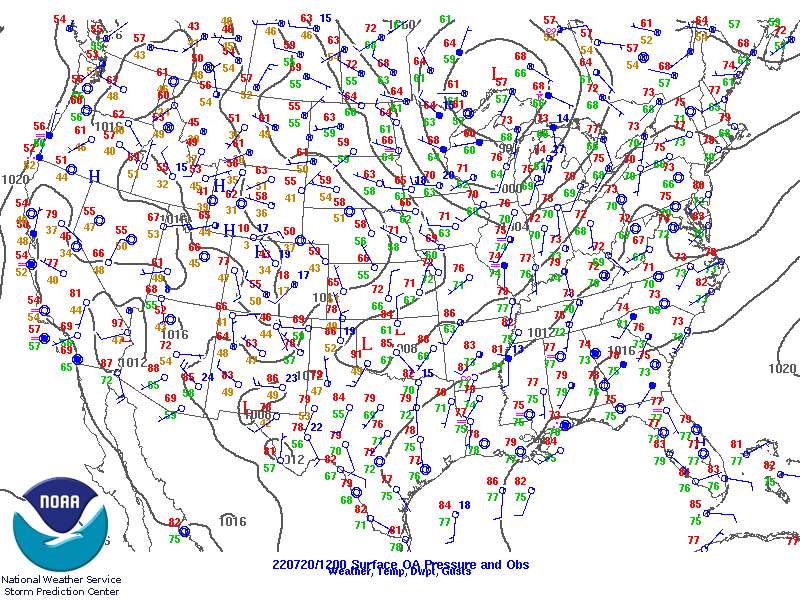
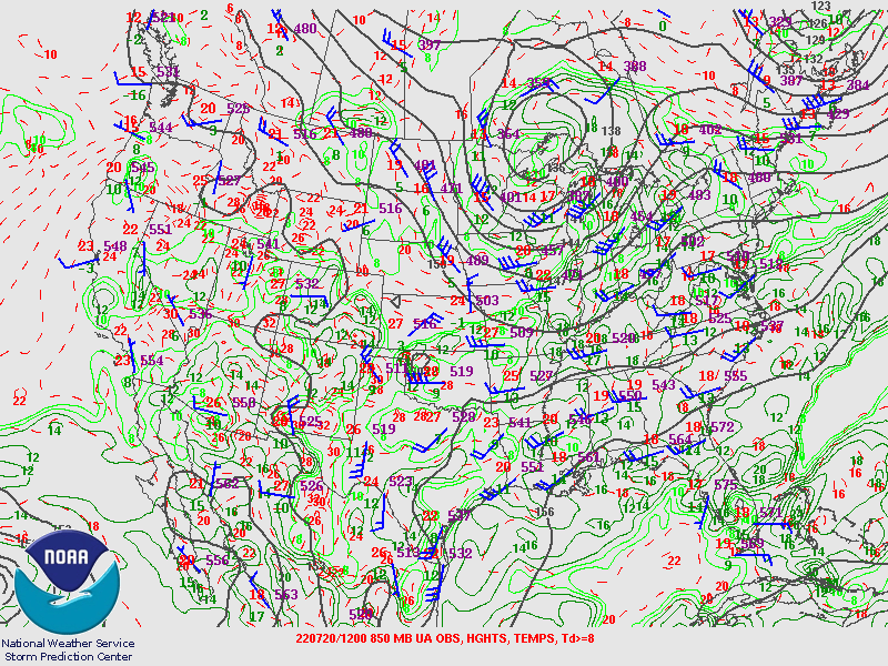
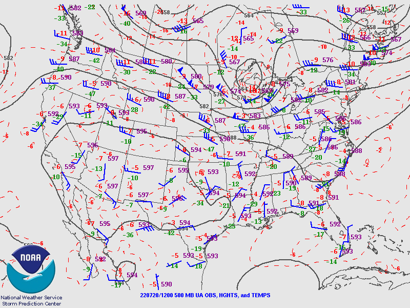
A mid level shortwave moved across the Great Lakes during the day which lead to a cold front moving into the Quad State during the late afternoon and evening. Abundant low level moisture pooled ahead of this boundary, resulting in ridiculously high humidity levels. Despite strong instability and plentiful moisture, only isolated thunderstorms formed ahead of the front. This was due to a strong cap (warm air aloft) in place along with weak wind shear. The thunderstorms that did develop struggled to maintain themselves and eventually fizzed out.
 |
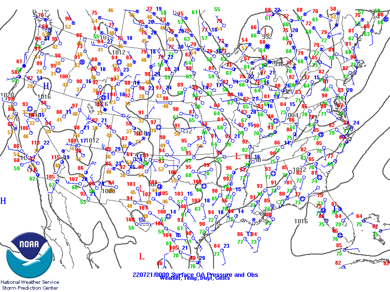 |
| Surface Map - 7 AM July 20, 2022 | Surface Map - 7 PM July 20, 2022 |
 |
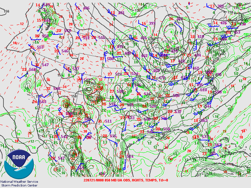 |
| 850mb Chart - 7 AM July 20, 2022 | 850mb Chart - 7 PM July 20, 2022 |
 |
|
| 500mb Chart - 7 AM July 20, 2022 |
 |
Media use of NWS Web News Stories is encouraged! Please acknowledge the NWS as the source of any news information accessed from this site. |
|

