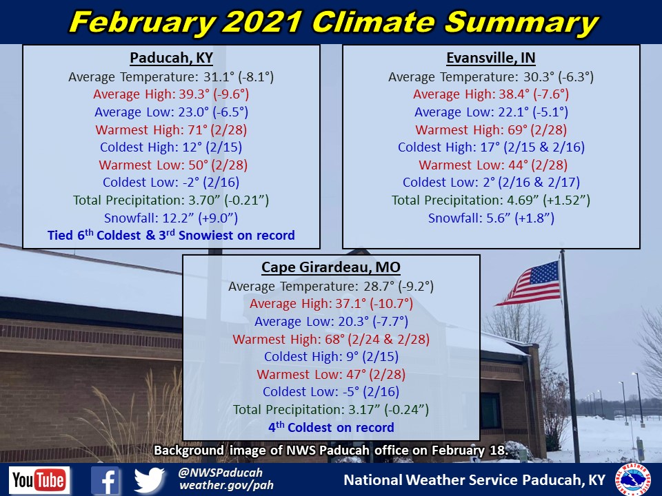
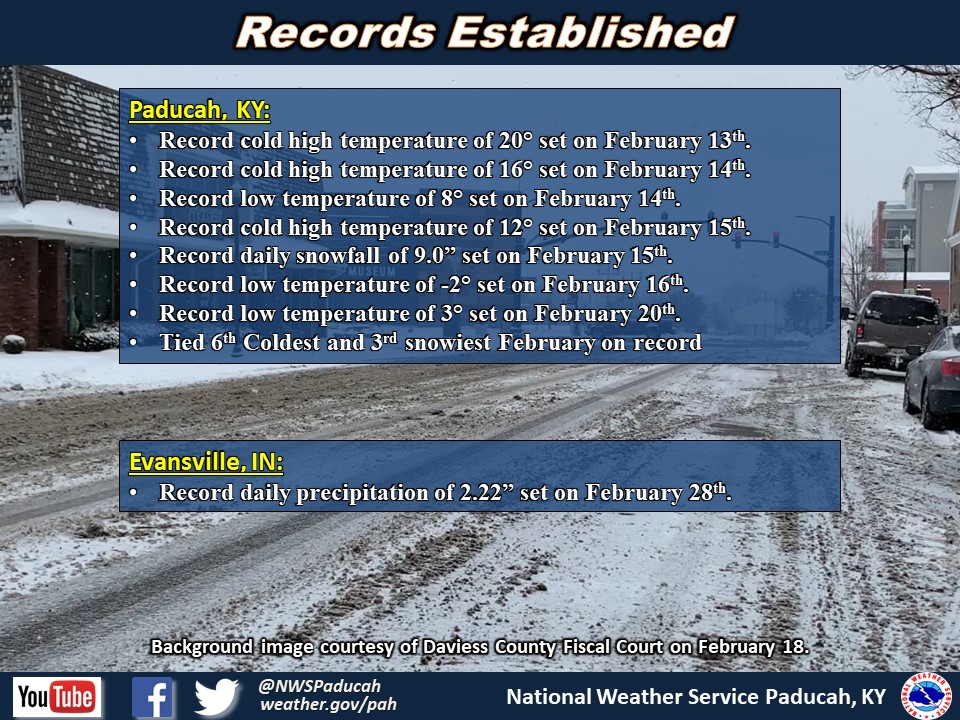
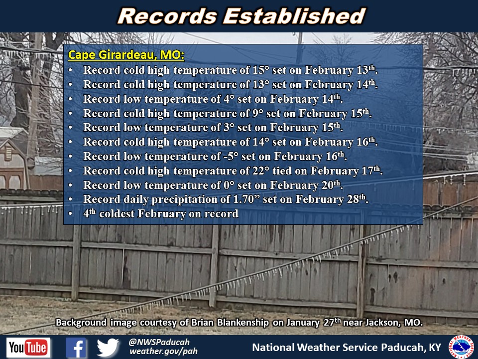
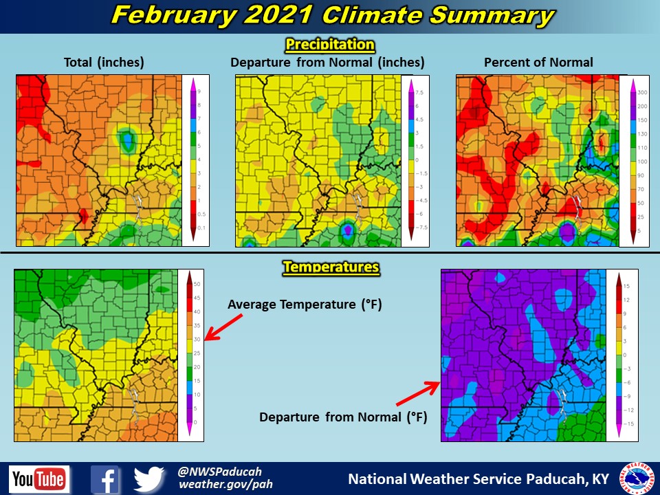
February 2021 Climate Review: Temperatures finished well below normal by around 6 to 10 degrees. We had a remarkably long period of frigid temperatures February 7th through 20th. Numerous record lows and record cold highs were broken during this period. Some of the records were broken by 10+ degrees including on Valentines Day! The period from February 13-17 was our coldest 5 day period since 1997 or 1996 in many locations including Paducah, Cape Girardeau, Poplar Bluff, and Carbondale. We warmed up during the final week of the month, but we still finished tied for the 6th coldest February on record in Paducah and the 4th coldest in Cape Girardeau. Paducah observed 10 days with highs remaining below freezing. This was the most in February since 1978 when we experienced 10 days with highs remaining below freezing (the record is 13 days set in 1958). Cape Girardeau set a February record with 13 days of highs below freezing, which broke the record of 12 days set in February 1978. The month ended with a taste of spring as temperatures reached the upper 60s to lower 70s on February 28 along with higher humidity levels as dewpoints soared through the 60s.
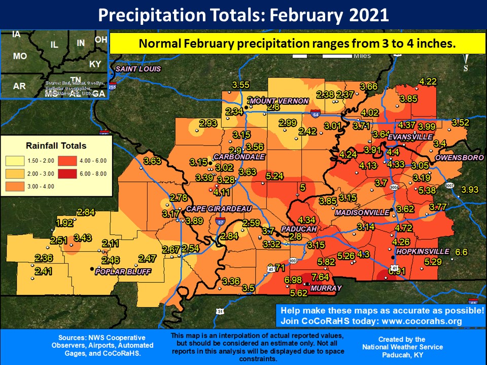
The majority of the region was on pace to be drier than normal until the final 2 days of the month. Widespread rain of 1.5 to 4 inches occurred, with a swath of 4 to 7 inches across our southern counties in western Kentucky February 27-28. Thus, some areas of western Kentucky along with a portion of southern Illinois and the Evansville Tri-state region ended up finishing the month wetter than normal. Much of southeast Missouri and northern portions of southern Illinois closer to I-64 still finished drier than normal since they didn’t receive as much rain during the final couple of days.
Snowfall was above normal for the month. Paducah picked up 12.2” for the month, which ranks as the 3rd snowiest February on record. We also observed 5 consecutive days with measurable snow, which tied the record set back on March 7-11, 1960. Most of the region picked up anywhere from 5 to 12” for the month, with some localized areas receiving more than a foot for the month. Most of our snow occurred during two events, one on February 15 and the other February 17-18.
The graphic below is an interpolated rainfall map using actual observations. Please note that there are likely discrepancies in between observations, since the values are estimated based on nearest reports.
|
February 2021 Review: Precipitation and Temperature Maps (Click on image to enlarge) Please note that much of the precipitation that occurred in the 24 hour period ending at 7 AM March 1 is not included in these precipitation maps, so totals are lower due to the heavy rain event over that time frame. |
 |
| Climate Maps are from the Northeast Regional Climate Center |