Fall 2024 Climate Summary:
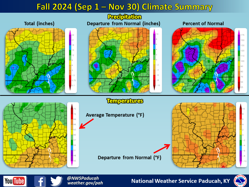
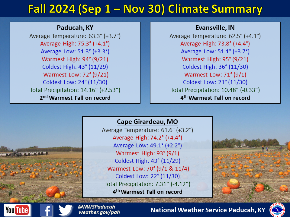
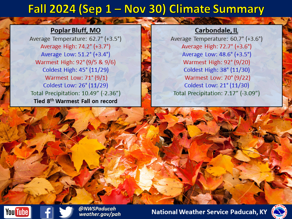
Temperatures finished the season well above normal by 3 to 4 degrees. Every month was above normal. November was the warmest compared to normal with most locations observing a top 5 warmest month. Paducah observed their 2nd warmest Fall season on record, while Evansville and Cape Girardeau clocked in as their 4th warmest Fall.
Precipitation finished wetter than normal across much of western Kentucky with amounts of 12 to 17 inches, which was roughly 2 to 6 inches above normal. Meanwhile, it finished fairly close to normal across much of southern Illinois and southwest Indiana, generally ranging from 9 to 12 inches. It was a drier than normal Fall across much of southeast Missouri where amounts largely finished between 7 and 11 inches, which was 1 to 4 inches below normal. The highest observed amount in our forecast area was 17.91” at a CoCoRaHS station 2 miles north of Golconda, IL.
We had several very long dry spells, one during the first half of September and another through the first 30 days of October. Moderate to severe drought in mid September was erased by the remnants of two tropical systems, Francine and Helene that produced heavy rainfall across the region from mid to late month. After that, we were on pace for one of our driest October’s on record before rain finally greeted the region on Halloween. The wet pattern then continued into the first part of November, which erased the abnormally dry conditions that had developed in October.
The graphic below is an interpolated rainfall map using actual observations. Please note that there are likely discrepancies in between observations, since the values are estimated based on nearest reports.
|
Fall 2024 Review: Precipitation and Temperature Maps (Click on image to enlarge) |
 |
| Climate Maps are from the Northeast Regional Climate Center |
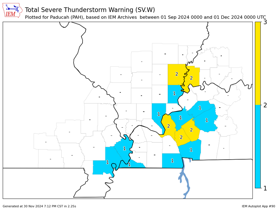
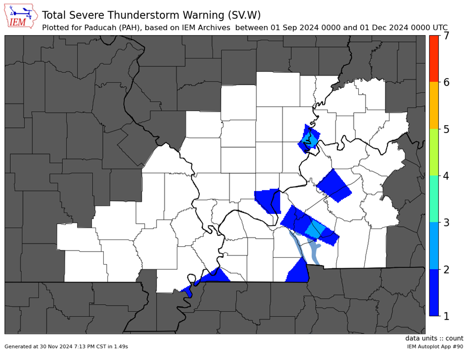
| Severe Thunderstorm Warnings - County Based | Severe Thunderstorm Warnings - Polygon Based |
 |
 |
| Tornado Warnings - County Based | Tornado Warnings - Polygon Based |
|
No Tornado Warnings were issued during the Fall season. |
No Tornado Warnings were issued during the Fall season. |