December 2022 Climate Review:
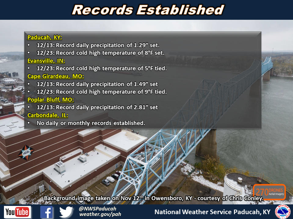
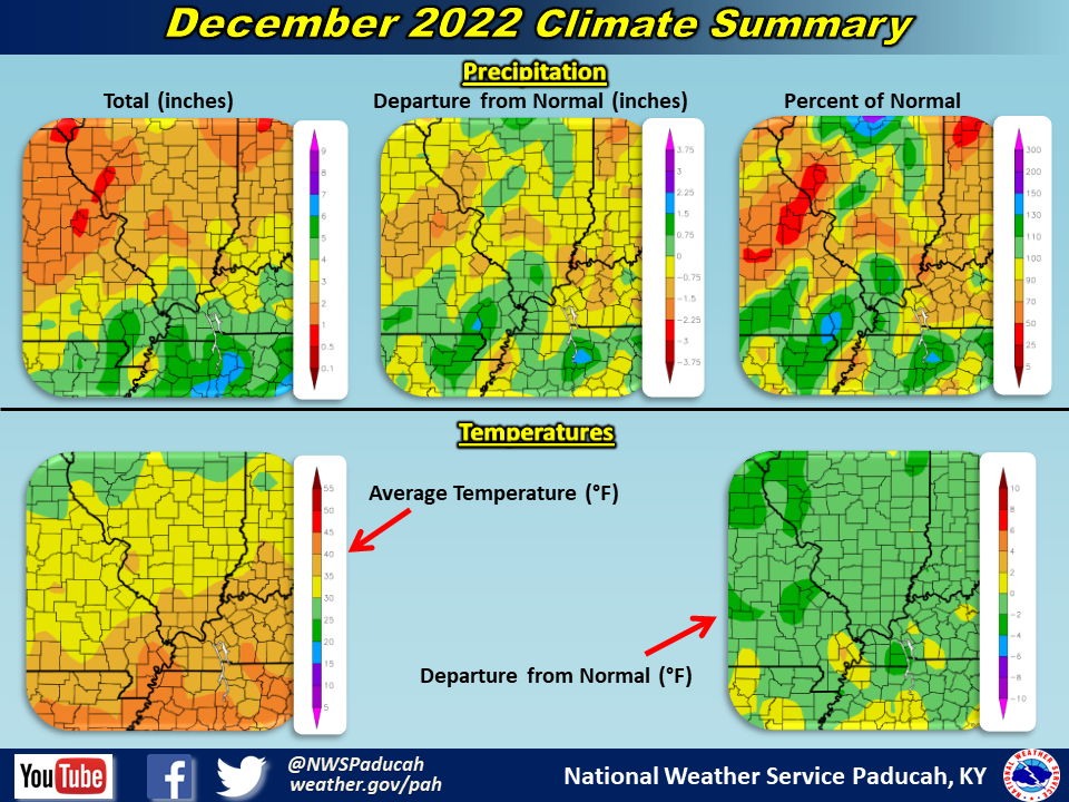
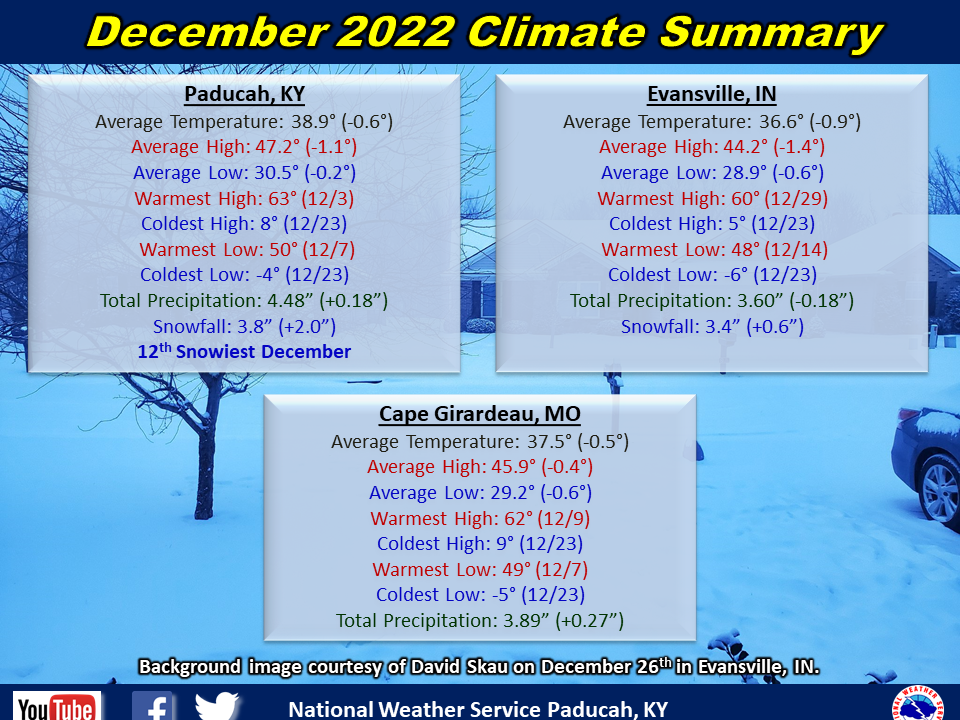
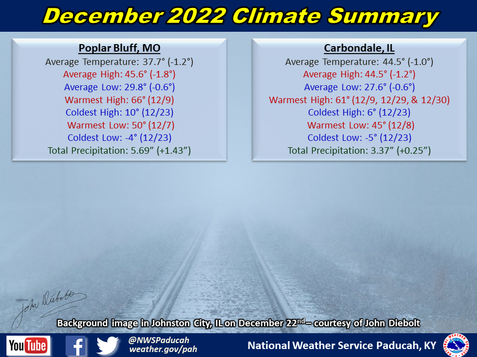
Temperatures averaged below normal by around 0.5 to 1 degree. This was largely driven by the arctic blast that occurred from December 22-27. If you removed those 6 days from the month, it would have actually finished around 4 degrees above normal! High temperatures during the first 2 weeks of the month were in the 50s quite often, with many areas even reaching the 60s on several days. Similar temperatures were experienced at the end of the month from the 28th through 31st. The big headline during the month was the brutal cold we were subjected to after an arctic front plowed through on the 22nd. Temperatures dropped below zero that night and only reached the single digits for highs on the 23rd. Strong winds led to dangerously cold wind chills of 20 to 30 below zero, which were the coldest in our area in over 25 years. Some moderation occurred Christmas Eve into Christmas Day, but highs were still only in the 20s. The entire region experienced one of our top 10 coldest high temperatures on Christmas Day. For Paducah, it was 3rd coldest (23) and Evansville was tied for 6th coldest (22).
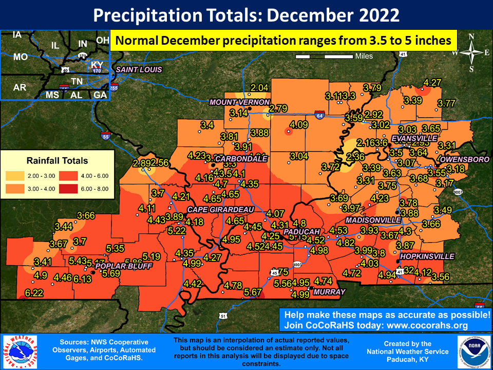
Precipitation finished near to wetter than normal across the region. Many areas observed amounts ranging from 4 to 6 inches. Localized higher amounts were primarily confined to parts of southeast Missouri into far western Kentucky. The highest observed amount was 6.78” at a CoCoRaHS station 3.3 miles northeast of Fulton, KY. There were two snow events that impacted the region on either side of the Christmas holiday. The first occurred on the afternoon and evening of December 22nd, and produced widespread amounts of 1 to 3 inches. The other event occurred Christmas Night into the 26th and produced amounts ranging from a dusting to around 2 inches. For some areas, this was the first measurable snow in the month of December in 8 years, including in Paducah. This was also the first White Christmas for most of the region since 2010.
| December 2022 Review: Precipitation and Temperature Maps (Click on image to enlarge) |
 |
| Climate Maps are from the Northeast Regional Climate Center |
Monthly Climate Report: Paducah | Evansville | Cape Girardeau | Poplar Bluff | Carbondale