Paducah, KY
Weather Forecast Office
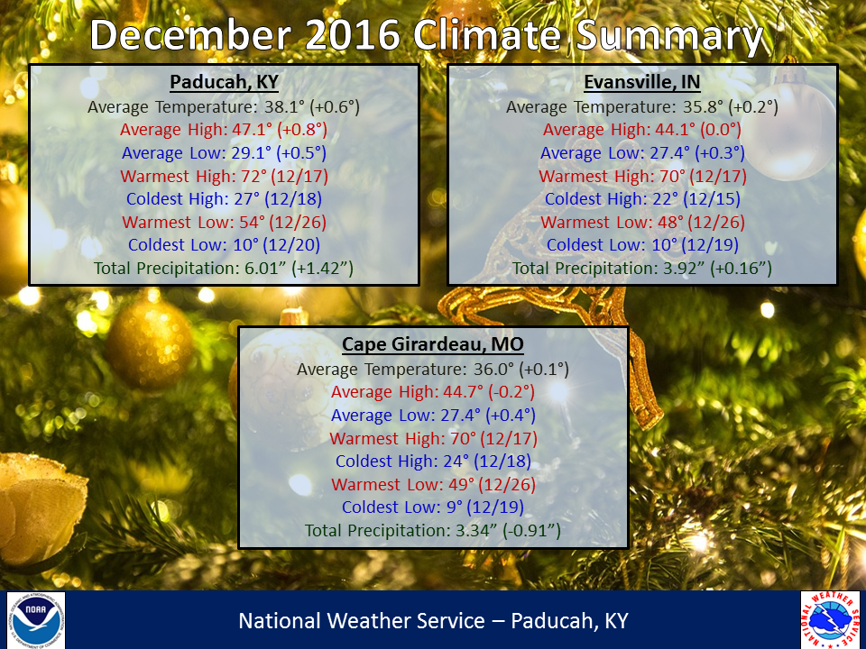
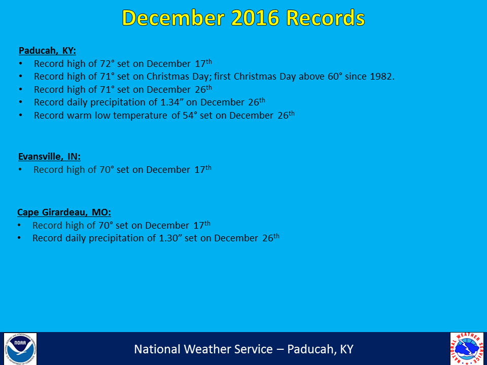
December 2016 saw temperatures range from near normal to slightly below normal across our area. Precipitation also varied from drier than normal across northwest counties to wetter than normal from the bootheel of Missouri through much of western KY. Generally locations from Doniphan, MO to Carbondale and Mount Vernon, IL saw precipitation amounts that were drier than normal on the order of 1-2+ inches. This was in contrast to locations from New Madrid, MO to Paducah and Owensboro, KY, along with other locations in west KY, that saw 1-3+ inches above typical December precipitation amounts. The warm spell around Christmas helped many areas finish close to normal for December, after a rather chilly couple of weeks in the middle of the month. You may recall the roller coaster ride we endured the week before Christmas, with high temperatures soaring into the lower 70s for many areas on the 17th before plummeting into the teens by the next morning. This was one of our areas most extreme temperature drops from one calendar day to the next on record with temperatures tumbling 55 to 65 degrees. After a lackluster fall severe weather season, our area did see a little active weather in December. The main event was on the 17th, with a secondary marginal event the day after Christmas. No measurable snow was noted during the month in our area, although many areas saw some sleet/snow flakes flying around on the evening of the 17th behind a strong cold front that pushed through.
| December 2016 Review: Precipitation and Temperature Maps |
 |
| Climate Maps are from the Northeast Regional Climate Center |
FORECASTS
Forecast Discussion
User Defined Area Forecast
Hourly Forecasts
Fire Weather
Activity Planner
LOCAL INFORMATION
NWS Paducah KY Weekly Partner Briefing
Aviation Weather
Our Office
SKYWARN
Items of Interest
Hazardous Weather Support
WFO Paducah Navigator
Local Observations
Weather History
US Dept of Commerce
National Oceanic and Atmospheric Administration
National Weather Service
Paducah, KY
8250 Kentucky Highway 3520
West Paducah, KY 42086-9762
270-744-6440
Comments? Questions? Please Contact Us.