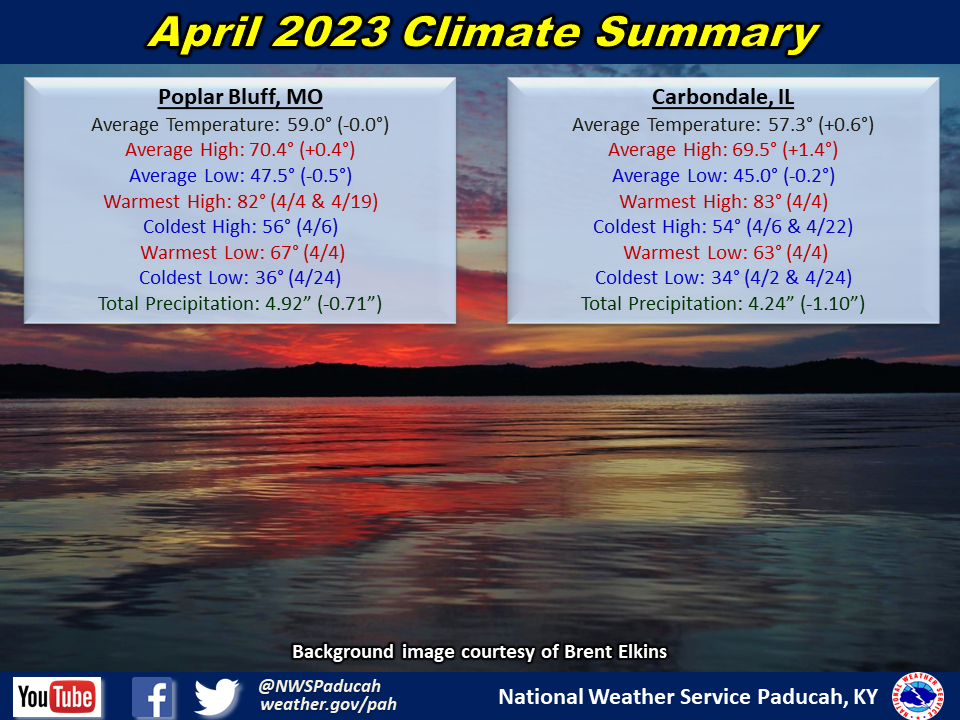
April 2023 Climate Review:
Temperatures averaged near normal. High temperatures were 1 to 2 degrees above normal, while lows averaged around 1 to 1.5 degrees below normal. We had 3 different periods where temperatures soared into the upper 70s and 80s. The first was from April 4th to 5th, then another from the 12th through 15th, and finally another from the 18th through 20th. The chilliest stretch occurred from the 21st through 24th, when highs were only in the 50s to lower 60s and lows dipped into the 30s several of these nights. The cooler than normal pattern continued through the end of the month with most days registering highs in the 60s.
Rainfall finished drier than normal across much of the region. This was most pronounced across western Kentucky, southwest Indiana, and the Missouri Bootheel. These areas generally received 2 to 3.5 inches, which was 1 to 3 inches below normal. Meanwhile, much of southern Illinois and southeast Missouri observed near to slightly above normal rainfall. These areas picked up 4 to 5.5 inches, but a few locations received over 6 inches, The highest observed rainfall amount was 6.63” at a CoCoRaHS station 0.8 miles ESE of Lambert, MO (Stoddard County).
| April 2023 Review: Precipitation and Temperature Maps (Click on image to enlarge) |
 |
| Climate Maps are from the Northeast Regional Climate Center |


Monthly Climate Report: Paducah | Evansville | Cape Girardeau | Poplar Bluff | Carbondale