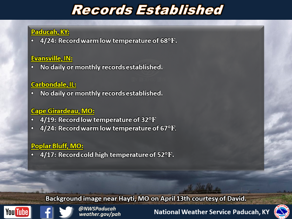
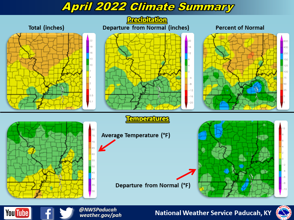
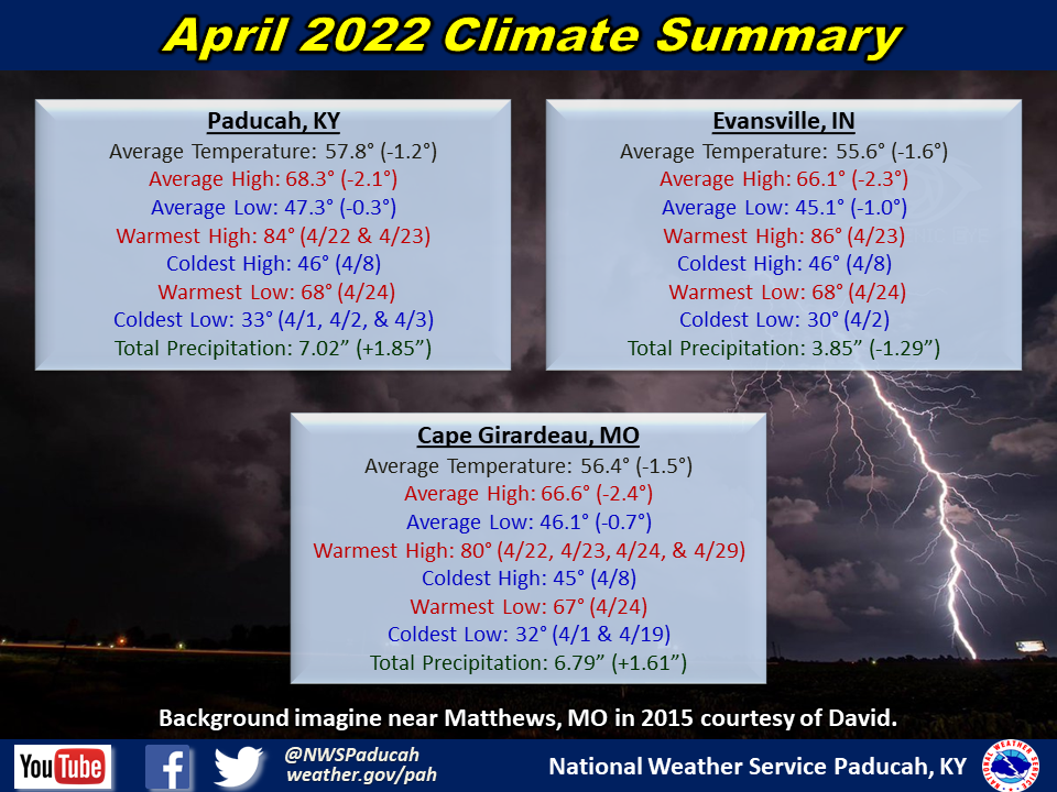
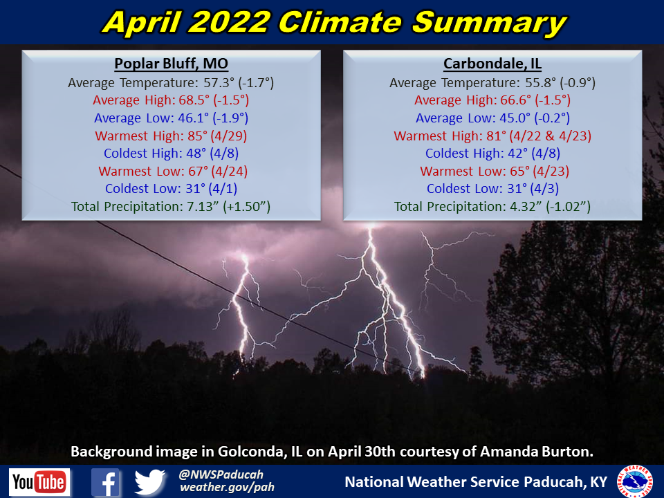
Temperatures: Monthly average temperatures were 1 to 2 degrees below normal. We started the month on a chilly note with high temperatures primarily in the 50s and 60s through the first 9 days of the month. After a brief warm up between April 10-13 with temperatures reaching 80 several days, readings once again dropped below normal from the 14th through 20th. Many areas observed temperatures near freezing temperatures on the 19th. A warm period into the 80s occurred from April 22-24 before yet another cool down from the 25-28. The month ended on a warm note though, with many areas reaching the 80s on the 29th and 30th.
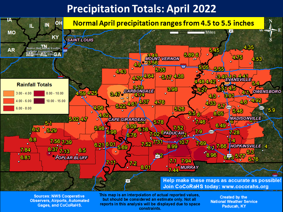
Precipitation: April finished wetter than normal across most of southeast Missouri and western Kentucky, particularly along and south of a Cape Girardeau, MO to Madisonville, KY line. These areas observed amounts ranging from 5 to 8+ inches, which was 1 to 4+ inches above normal. The most extreme corridor was from Carlisle County KY east into northern Graves, Marshall, Trigg and Christian Counties. Our highest observed amount was 10.70” at the Marshall County KY Mesonet station located 4 miles north of Benton. Meanwhile, much of southern Illinois and southwest Indiana experienced near to slightly drier than normal conditions with amounts ranging from 3.5 to 5”.
Our two primary severe weather events during the month occurred on the 13th and 30th. There were 6 tornadoes with the April 13th event and golf ball sized hail in Carter County Missouri with the April 30th event.
| April 2022 Review: Precipitation and Temperature Maps (Click on image to enlarge) |
 |
| Climate Maps are from the Northeast Regional Climate Center |
Monthly Climate Report: Paducah | Evansville | Cape Girardeau | Poplar Bluff | Carbondale