Overview
During the afternoon and evening hours of Tuesday, July 30, multiple clusters and lines of severe thunderstorms developed across parts of southern Illinois, southwest Indiana, and western Kentucky. Fueled by very high levels of instability, these storms became severe, producing wind damage and an EF-1 tornado that struck parts of southeast Vanderburgh and southwest Warrick County in southwest Indiana.Tornadoes:
|
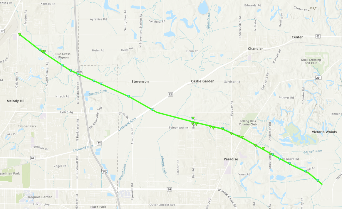
Tornado - Melody Hill to Newburgh
|
||||||||||||||||
The Enhanced Fujita (EF) Scale classifies tornadoes into the following categories:
| EF0 Weak 65-85 mph |
EF1 Moderate 86-110 mph |
EF2 Significant 111-135 mph |
EF3 Severe 136-165 mph |
EF4 Extreme 166-200 mph |
EF5 Catastrophic 200+ mph |
 |
|||||
Photos & Video
 |
 |
 |
 |
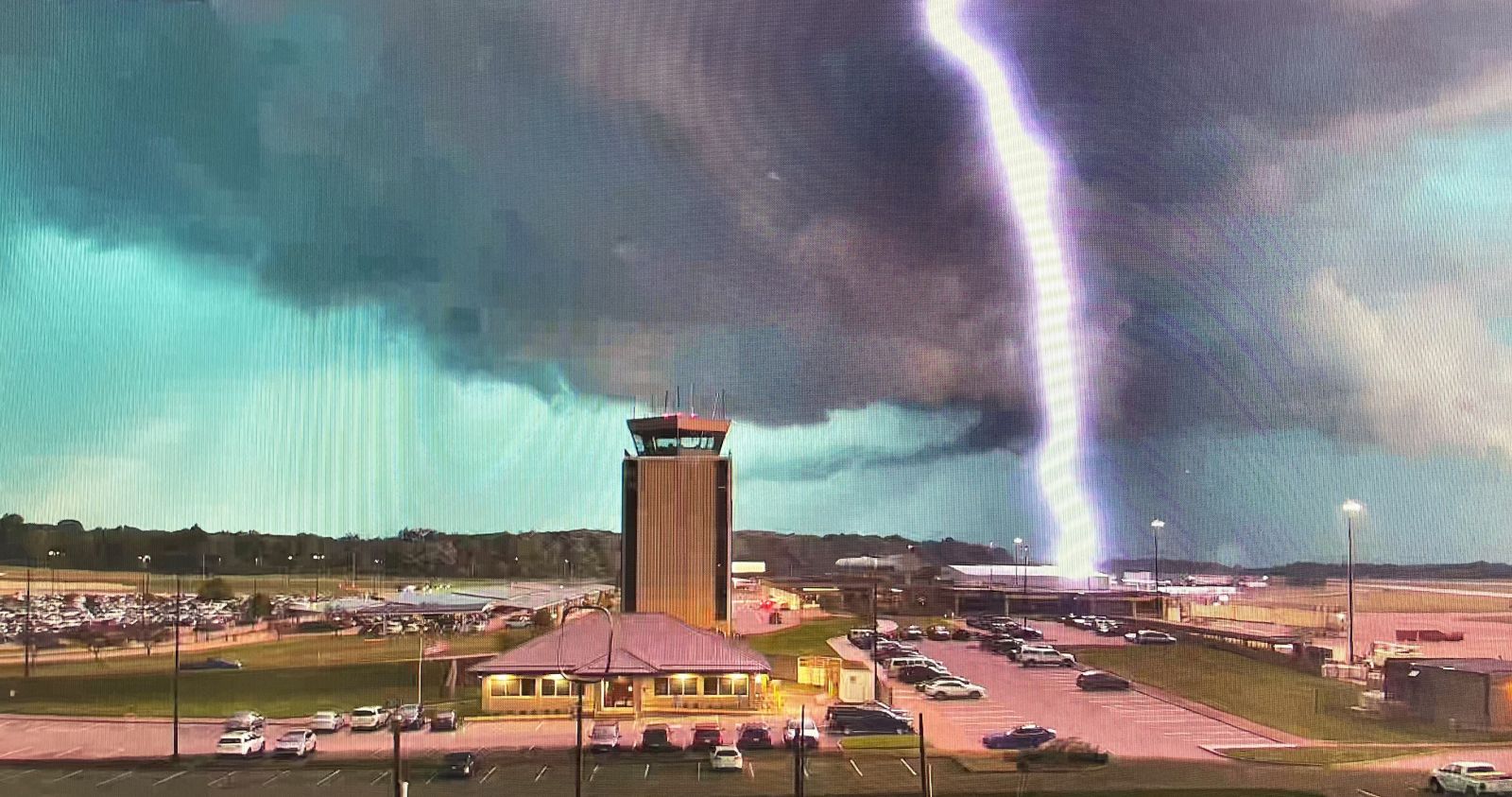
| Lightning Strike at the Evansville Airport. (Cliff Weaver/Vanderburgh County EMA) |
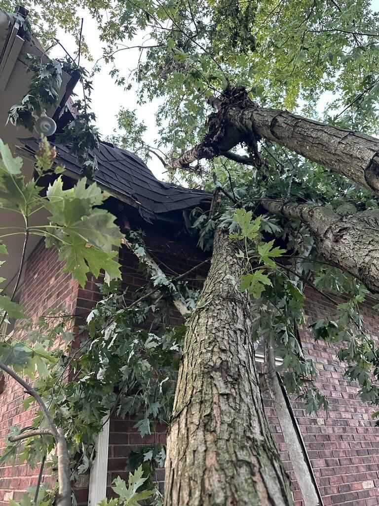
Tree down on structure in Booneville, IN. (Sharon Taylor/Vanderburgh County ARES) |
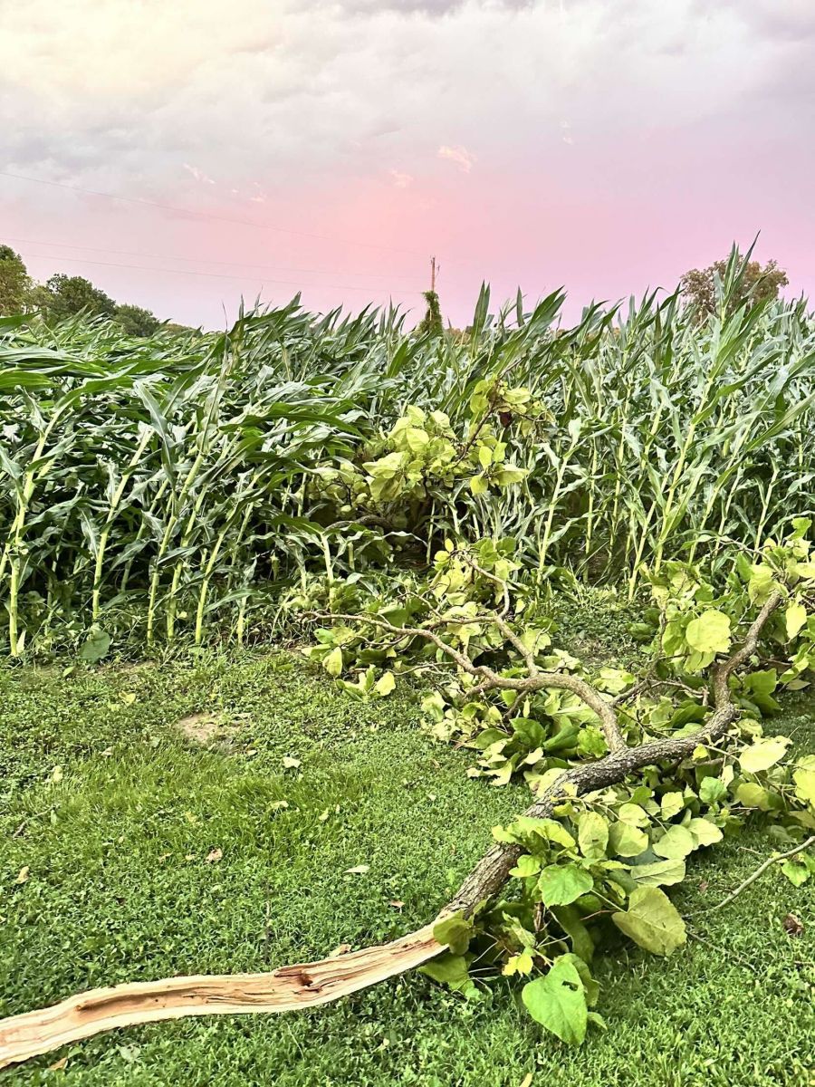
Crop damage near Chandler, IN. (Issac Dixon/Robards Fire Department) |
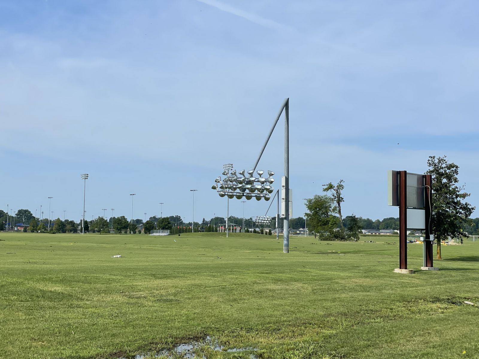
Goebel Soccer Complex in Evansville, IN. (Nick Adams/Vanderburgh County EMA) |
 |
 |
 |
 |
| Tree down at the Newburgh/Ohio Township Fire Department. (Shawn Weber/Ohio Township Fire Department) |
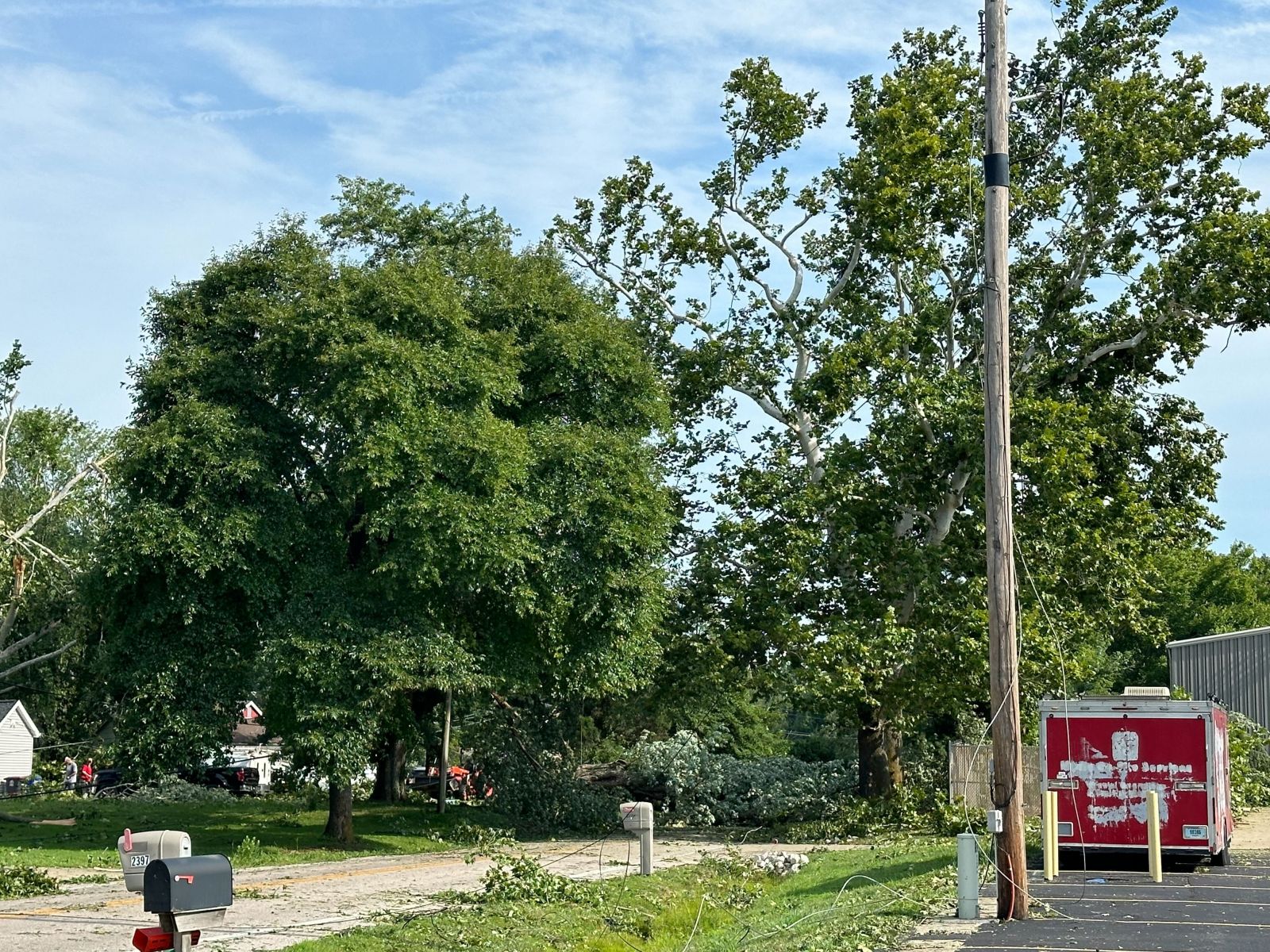
Tree down on Coal Mine Road near Sherra Lane in Newburgh, IN. (Shawn Weber/Ohio Township Fire Department) |
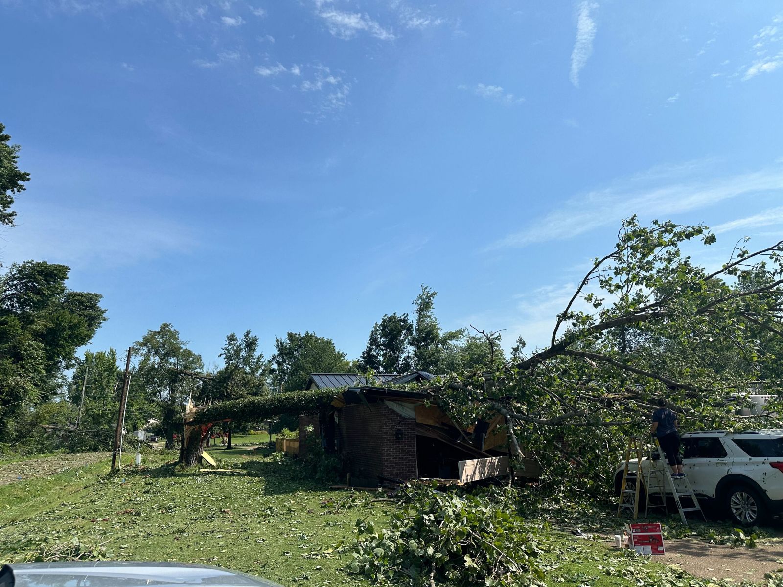
Tree on house on Millersburg Road in Evansville, IN. (Nick Adams/Vanderburgh County EMA) |
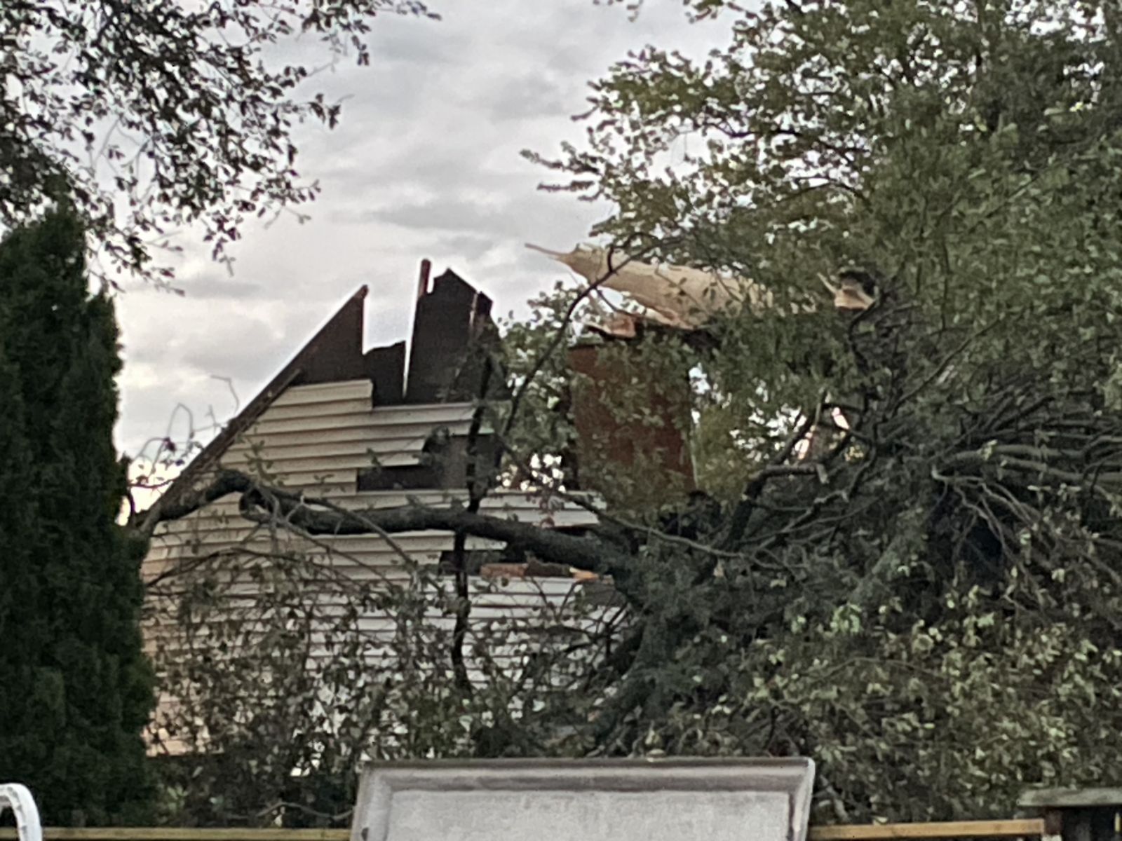
Tree down in Newburgh, IN. (Sharon Taylor/Vanderburgh County ARES) |
Radar
Click here for an animated radar loop for this event.
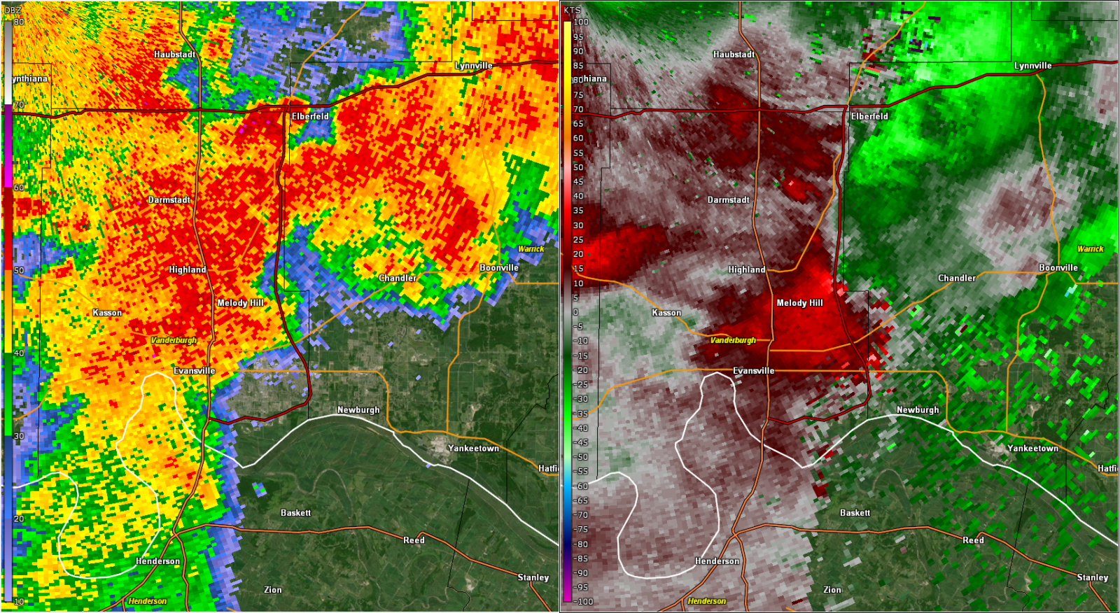 |
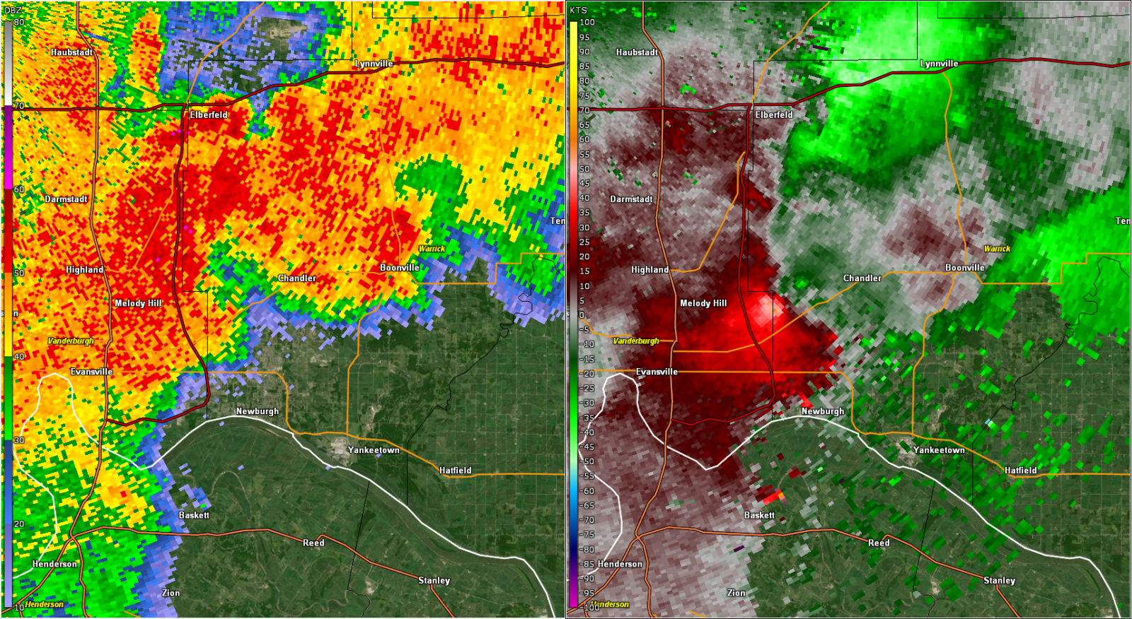 |
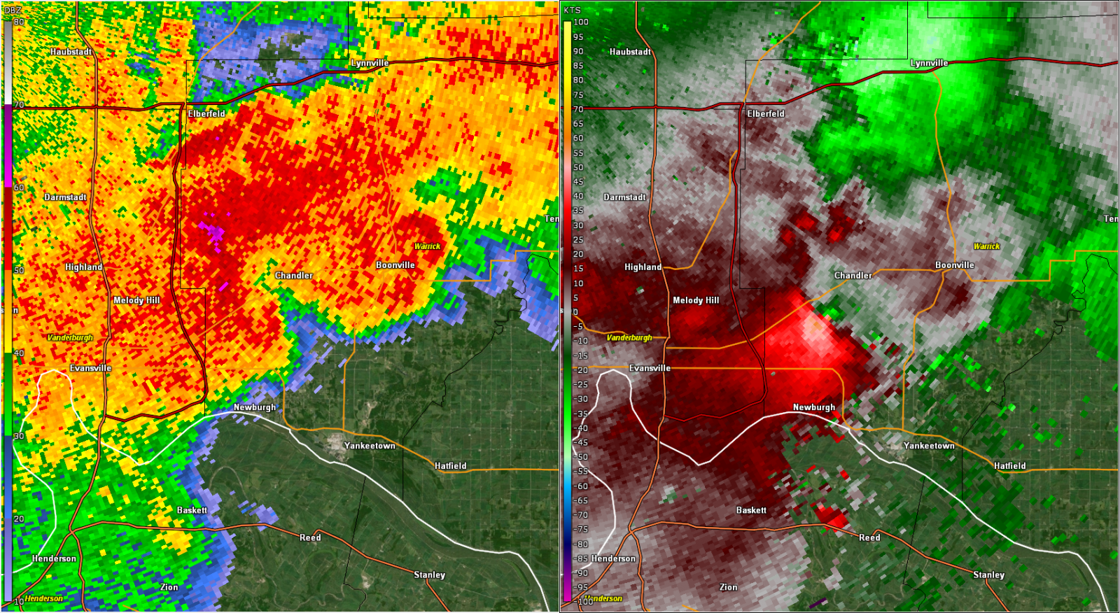 |
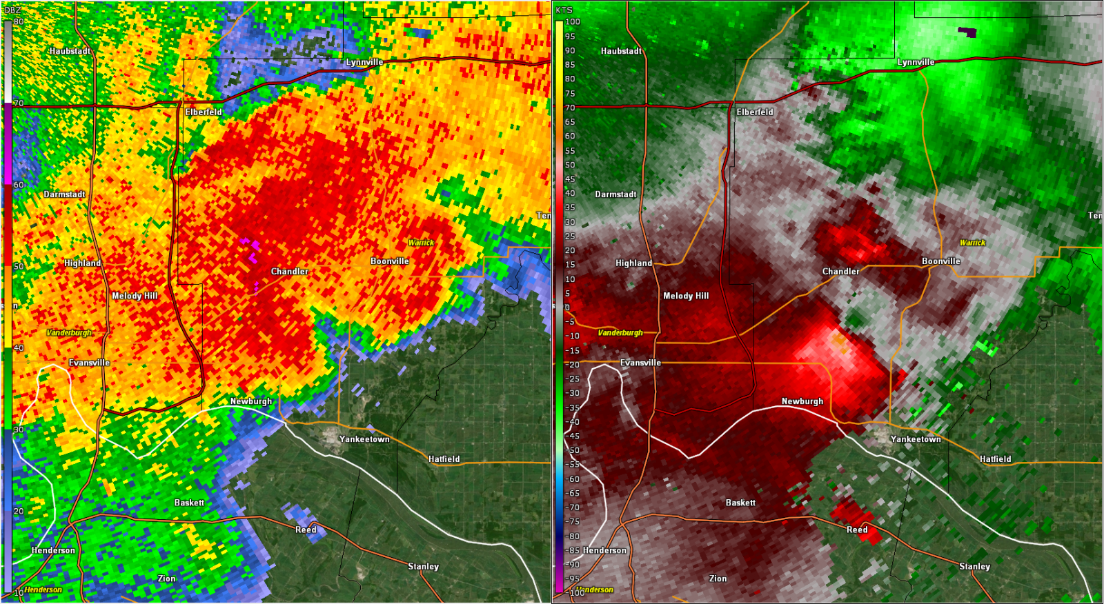 |
| KVWX base reflectivity and storm relative velocity at 6:32 PM CDT on July 30, 2024. | KVWX base reflectivity and storm relative velocity at 6:35 PM CDT on July 30, 2024 | KVWX base reflectivity and storm relative velocity at 6:38 PM CDT on July 30, 2024 | KVWX base reflectivity and storm relative velocity at 6:40 PM CDT on July 30, 2024 |
Storm Reports
Preliminary Local Storm Report...Summary
National Weather Service Paducah KY
427 PM CDT Wed Jul 31 2024
..TIME... ...EVENT... ...CITY LOCATION... ...LAT.LON...
..DATE... ....MAG.... ..COUNTY LOCATION..ST.. ...SOURCE....
..REMARKS..
0455 PM Tstm Wnd Gst Sesser 38.09N 89.05W
07/30/2024 E60 MPH Franklin IL Trained Spotter
0507 PM Tstm Wnd Gst Harrisburg 37.74N 88.54W
07/30/2024 M60 MPH Saline IL Trained Spotter
0515 PM Tstm Wnd Dmg 1 N Mcleansboro 38.10N 88.53W
07/30/2024 Hamilton IL Law Enforcement
Tree down on power lines. Multiple trees
down on state routes. Utility pole blown
down.
0539 PM Tstm Wnd Dmg 1 NE Mount Carmel 38.42N 87.76W
07/30/2024 Wabash IL Emergency Mngr
A tree fell through a garage heavily
damaging a car, on the northeast side of Mt
Carmel.
0550 PM Tstm Wnd Dmg 5 WNW Morganfield 37.71N 87.99W
07/30/2024 Union KY Law Enforcement
Multiple trees down along State Route 947
west of Morganfield. Also, multiple trees
down in the city of Morganfield.
0550 PM Tstm Wnd Dmg Morganfield 37.68N 87.91W
07/30/2024 Union KY Law Enforcement
Numerous trees down throughout the county.
0550 PM Tstm Wnd Dmg Patoka 38.41N 87.59W
07/30/2024 Gibson IN Law Enforcement
Late report. Trees and power lines down in
and around Patoka.
0555 PM Tstm Wnd Dmg Princeton 38.36N 87.57W
07/30/2024 Gibson IN Emergency Mngr
Small trees and limbs down in Princeton and
northern portions of the county. Corn fields
nearly flattened.
0557 PM Tstm Wnd Dmg 1 NW Princeton 38.37N 87.58W
07/30/2024 Gibson IN Public
Large tree limbs down.
0600 PM Tstm Wnd Dmg Princeton 38.36N 87.57W
07/30/2024 Gibson IN Law Enforcement
Late report. Trees and power lines down in
and around Princeton.
0610 PM Tstm Wnd Dmg Oakland City 38.34N 87.34W
07/30/2024 Gibson IN Public
Wind gusts at least between 50-55 mph has
caused a transformer to blow.
0625 PM Tstm Wnd Dmg 3 NNW Darmstadt 38.12N 87.60W
07/30/2024 Vanderburgh IN Public
Wires down and power poles down on N St
Joseph Ave.
0626 PM Tstm Wnd Dmg 3 NNW Evansville 38.02N 87.58W
07/30/2024 Vanderburgh IN Public
Wires down.
0627 PM Tstm Wnd Dmg 2 NNW Evansville 38.01N 87.56W
07/30/2024 Vanderburgh IN Public
Wires down on the 3700 block of Stringtown
Rd.
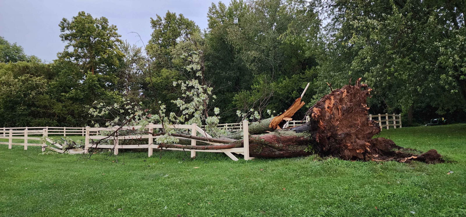
0630 PM Tornado 2 N Melody Hill 38.05N 87.51W
07/30/2024 Vanderburgh IN NWS Storm Survey
EF-1 tornado began just east of Evansville
Regional Airport. Moving east-southeast, the
tornado crossed Interstate 69 into Warrick
County, lifting just northeast of Newburgh
in the Victoria Hills area. Majority of the
damage was caused by downed trees and large
tree limbs. Several trees fell into homes
causing damage. A few homes also suffered
roof and gutter damage. There was very
substantial tree damage along Telephone Road
to Fuquay Road. Damage path was 11.1 miles
with estimated peak winds of 110 mph.
Maximum width was 300 yards.
0630 PM Tstm Wnd Dmg 2 N Melody Hill 38.05N 87.51W
07/30/2024 Vanderburgh IN Public
Tree and power line down on Oak Hill Rd by
Oak Hill Elementary.
0632 PM Tstm Wnd Dmg 1 ENE Melody Hill 38.03N 87.49W
07/30/2024 Vanderburgh IN Emergency Mngr
Several trees down near Heck Rd and N Green
River Rd.
0633 PM Tstm Wnd Gst 1 N Evansville 38.00N 87.55W
07/30/2024 M70 MPH Vanderburgh IN Trained Spotter
0635 PM Tstm Wnd Dmg 3 WNW Newburgh 37.96N 87.46W
07/30/2024 Vanderburgh IN Public
Several large tree limbs down on Fuquay Rd.
0636 PM Tstm Wnd Dmg 4 WNW Newburgh 37.97N 87.46W
07/30/2024 Vanderburgh IN Amateur Radio
Large tree down, smashing a fence.
0639 PM Tstm Wnd Dmg 3 N Newburgh 38.00N 87.40W
07/30/2024 Warrick IN Emergency Mngr
Trees down near Nolia Ln and County Rd 850W.
0645 PM Flash Flood Evansville 37.98N 87.54W
07/30/2024 Vanderburgh IN Trained Spotter
Water over all four lanes of North First Ave
in multiple places.
0656 PM Tstm Wnd Dmg Rockport 37.89N 87.05W
07/30/2024 Spencer IN Trained Spotter
A few trees down in Rockport.
0700 PM Tstm Wnd Dmg 6 WSW Rockport 37.86N 87.15W
07/30/2024 Spencer IN Trained Spotter
A few trees down near the Rockport area,
including along County Road 500.
0748 PM Tstm Wnd Dmg 6 W Dycusburg 37.15N 88.29W
07/30/2024 Livingston KY Public
Barn destroyed, trees down and powerlines
down. Time estimated via radar.
0837 PM Tstm Wnd Gst 2 NNW Hopkinsville 36.88N 87.51W
07/30/2024 E60 MPH Christian KY Public
0838 PM Tstm Wnd Dmg 3 WSW Kuttawa 37.05N 88.16W
07/30/2024 Lyon KY NWS Employee
Retired NWS employee observed lots of twigs
and leaves on U.S. 62 near Suwanee and a
tree limb in a yard.
0840 PM Tstm Wnd Dmg 1 WSW Hopkinsville 36.85N 87.51W
07/30/2024 Christian KY Emergency Mngr
Large healthy tree limb (approximately a
foot in diameter) fell. Scattered power
outages occurred.
0918 PM Tstm Wnd Dmg 2 ENE La Center 37.08N 88.94W
07/30/2024 Ballard KY Law Enforcement
Trees down along Turner Landing Road near
Highway 60.
 |
Media use of NWS Web News Stories is encouraged! Please acknowledge the NWS as the source of any news information accessed from this site. |
|