2024 Annual Climate Review:
Now that 2024 is officially in the books, let's take a look back on the yearly review.
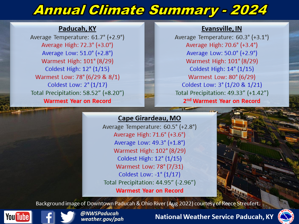
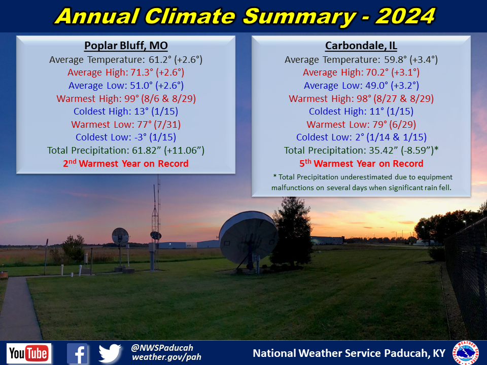
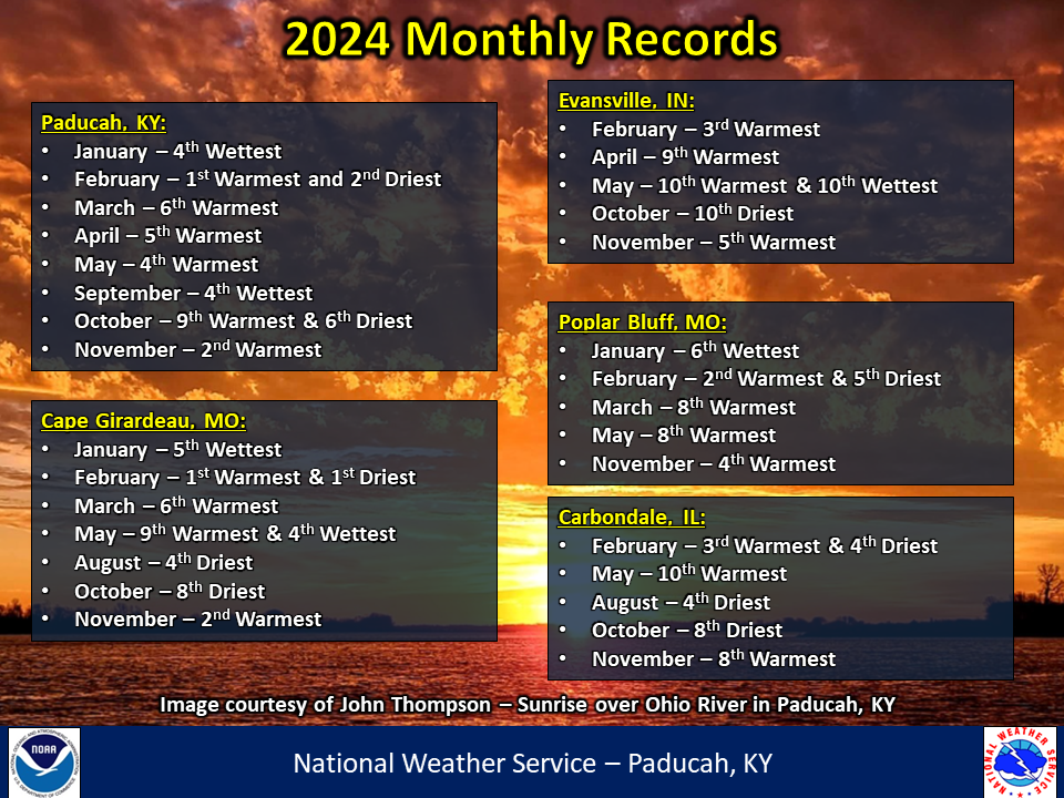
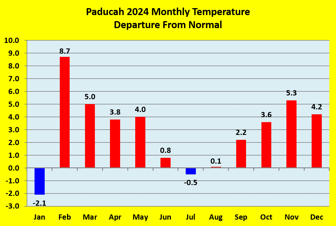
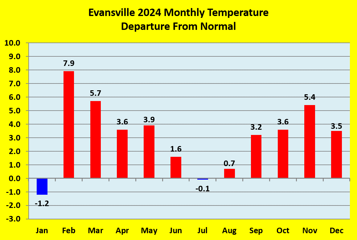
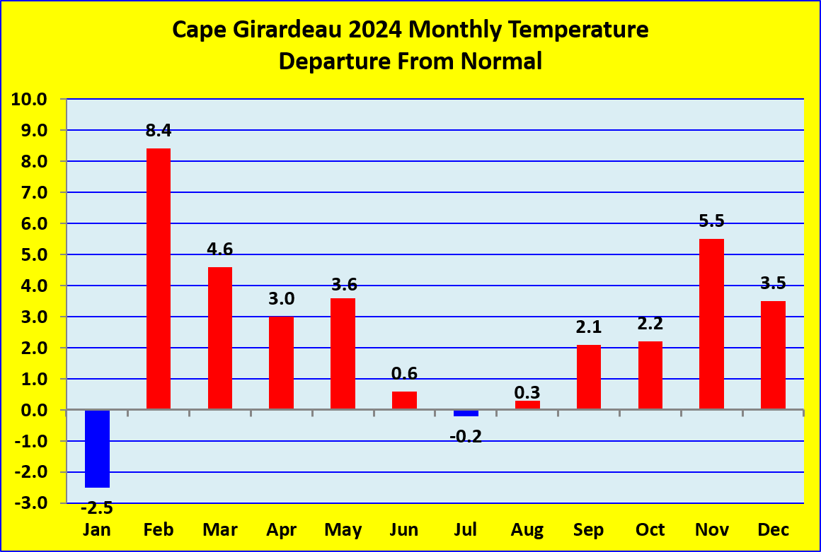
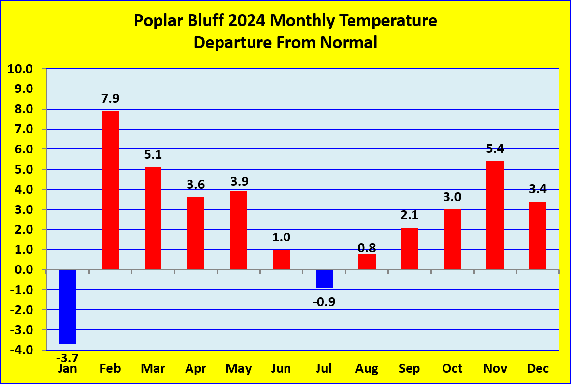
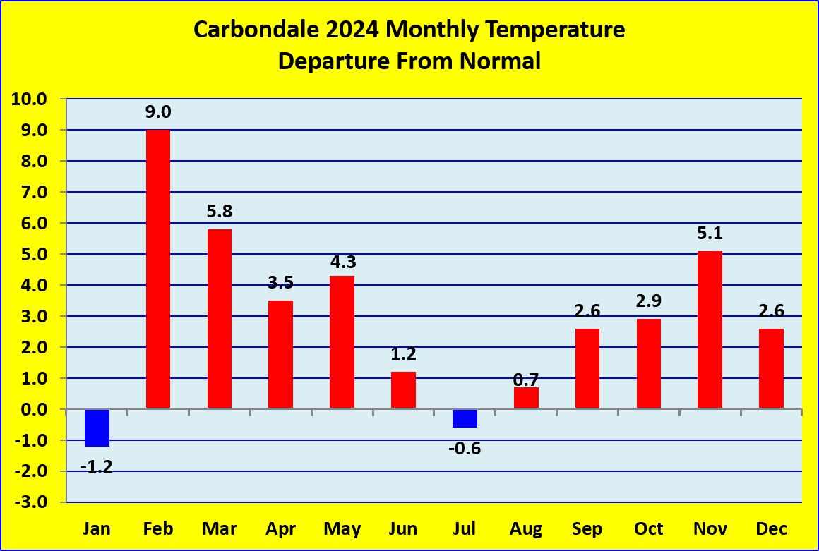
Temperatures finished above normal by 2 to 3.5 degrees. For one month this departure isn’t substantial, but for an entire year it certainly is. All 5 of our long-term climate stations observed one of their top 5 warmest years on record, with both Paducah and Cape Girardeau setting their warmest year. Only 2 of the months finished with below normal temperatures, January and July. The most abnormally warm months compared to normal were February, March, April, May, and November.
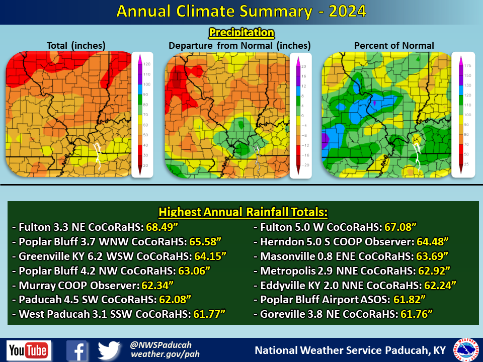
Precipitation finished wetter than normal across much of the region with amounts ranging from 45 to 65 inches. The highest amounts were primarily focused across western Kentucky where localized amounts received over 65”. The wettest months compared to normal were January and May. On the flip side, the driest months compared to normal were February, August, and October. Portions of the region were in moderate drought from the end of February through early May. Moderate to severe drought returned from the end of August through September, with abnormally dry conditions continuing into early November.
The graphic below is an estimated multi-radar, multi-sensor (MRMS) annual rainfall map using a combination of radar estimates and actual observations. Please note that actual rainfall observed at any location may vary slightly due to potential error in radar estimation and observation interpolation.
| 2024 Annual Review: Precipitation and Temperature Maps (Click on image to enlarge) |
 |
| Climate Maps are from the Northeast Regional Climate Center |
 |
 |
 |
 |
 |
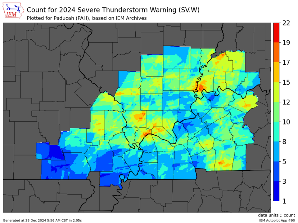
| Severe Thunderstorm Warnings - County Based | Severe Thunderstorm Warnings - Polygon Based |
 |
 |
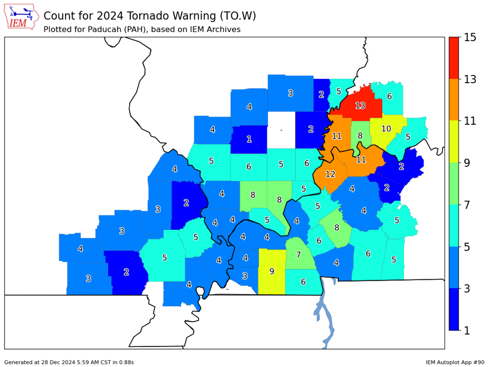
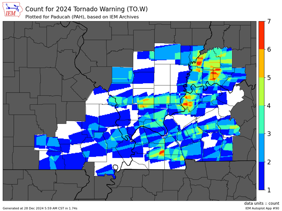
| Tornado Warnings - County Based | Tornado Warnings - Polygon Based |
 |
 |
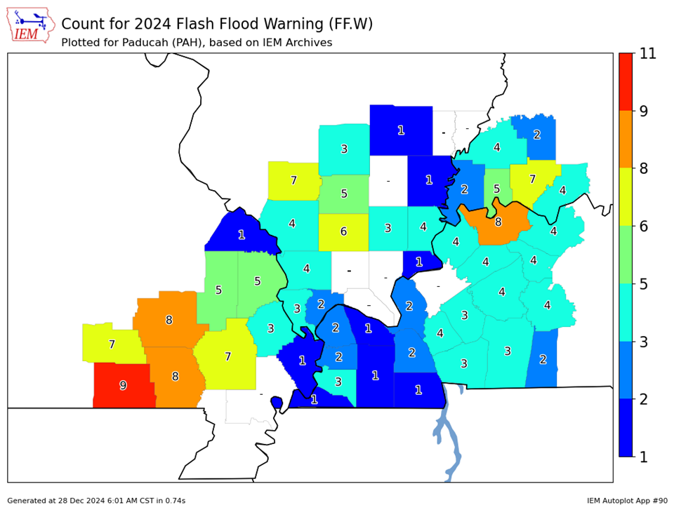
| Flash Flood Warnings - County Based | |
 |