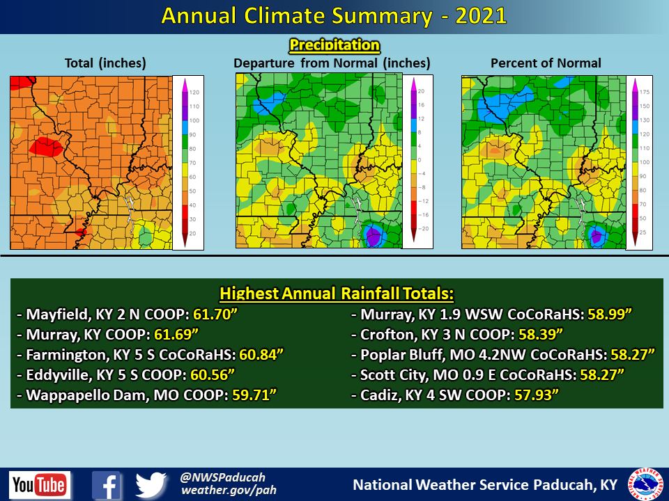
Now that 2021 is officially in the books, let's take a look back on the yearly review. Temperatures finished above normal by around 0.5 to 1 degree across the region. The most abnormally warm months compared to normal were March, October, and December. Many locations recorded their warmest December on record. On the flip side, the coldest months compared to normal were February, April, and November. Most areas observed one of their top 10 coldest February’s on record.
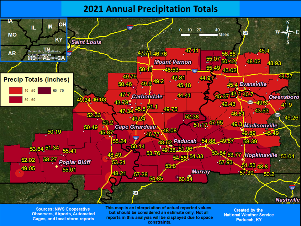
Precipitation was variable, with 4 of the 5 official climate stations finishing drier than normal. However, a decent chunk of the region actually ended up near or wetter than normal. Precipitation amounts ranged from 45 to 58 inches for most the region. Many locations across western Kentucky (particularly the southern Pennyrile region) and into southern Illinois along the I-64 corridor finished 6 to 12 inches wetter than normal. The driest locations tended to be across northwest Kentucky and into extreme southeast Illinois, where deficits were as much as 4 inches below normal. The heaviest rainfall amounts were observed across portions of Calloway and Graves counties in Kentucky. This included a 61.70” total observed at the Mayfield, KY COOP station. The wettest months compared to normal were March and July. The driest months compared to normal were May, June, and November.
Snow was variable and primarily confined to February. The only other notable snow of the year was in mid April when both Paducah and Evansville recorded their latest measurable snow on record. Paducah finished the year with 14” of snow, which was roughly 5 inches above normal. Meanwhile, Evansville finished the year with 7.8”, which was around 3 inches below normal.
The graphic below is an interpolated rainfall map using actual observations. Please note that there are likely discrepancies in between observations, since the values are estimated based on nearest reports.
| 2021 Annual Review: Precipitation and Temperature Maps (Click on image to enlarge) |
 |
| Climate Maps are from the Northeast Regional Climate Center |


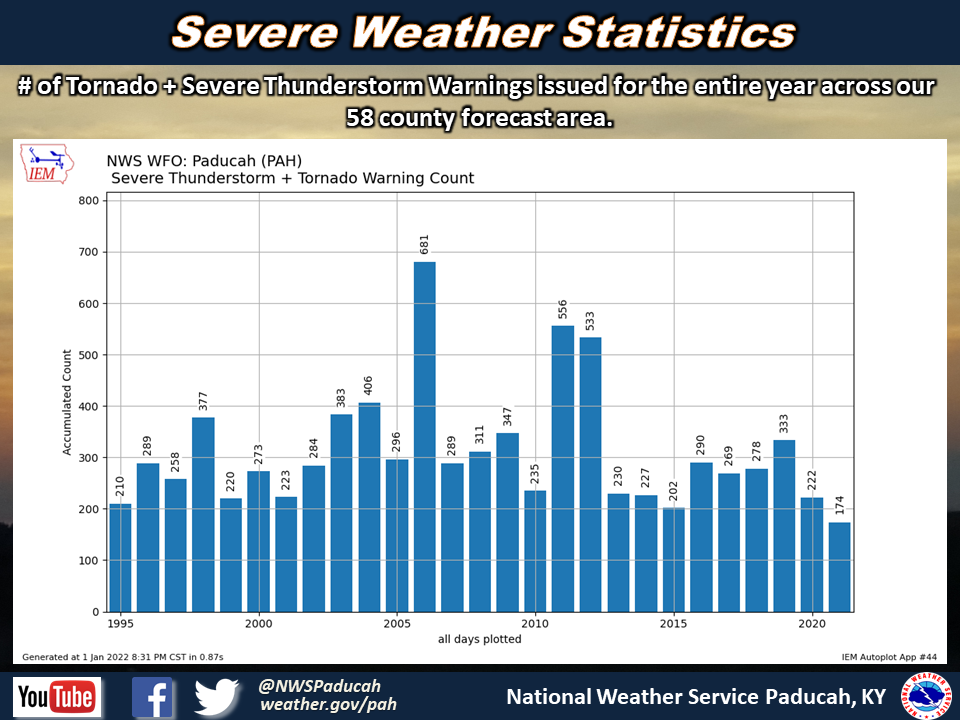
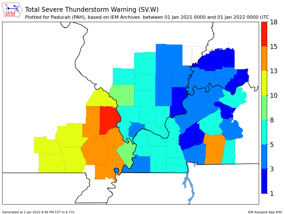
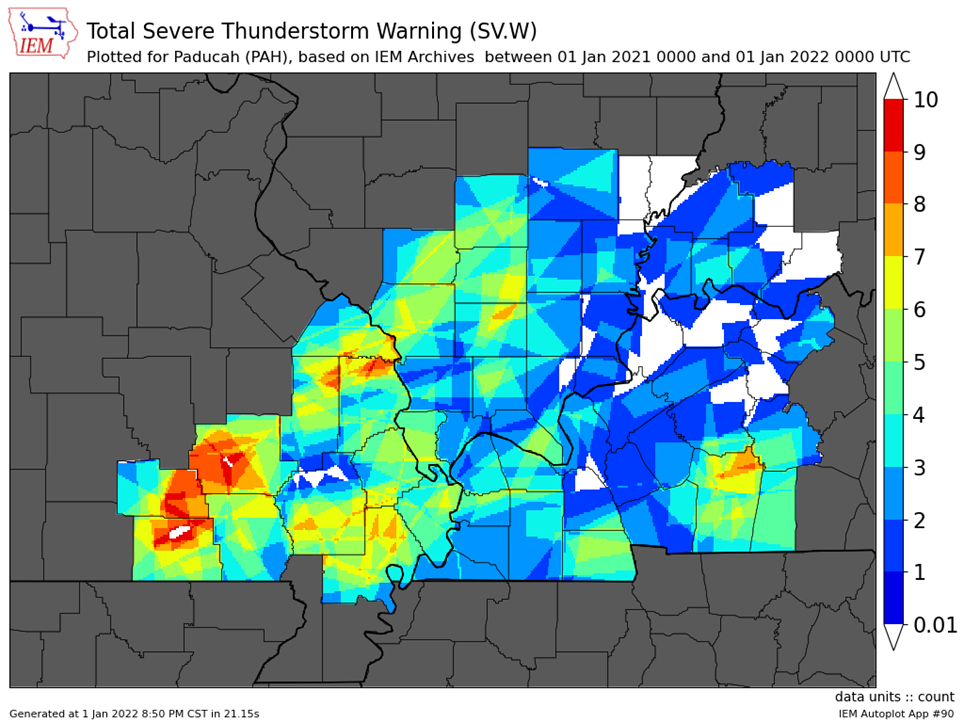
| Severe Thunderstorm Warnings - County Based | Severe Thunderstorm Warnings - Polygon Based |
 |
 |
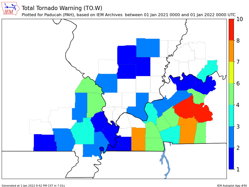
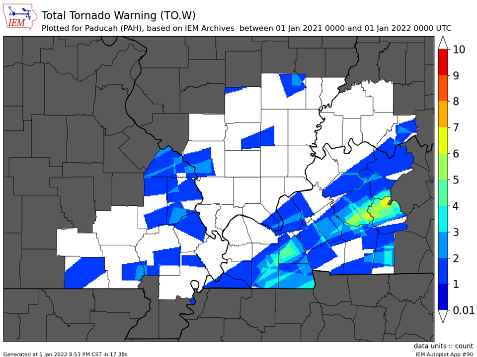
| Tornado Warnings - County Based | Tornado Warnings - Polygon Based |
 |
 |