Houston, TX(HGX) 10/17-19/98: "Best" Z-R; Default Hail Cap simulations
|
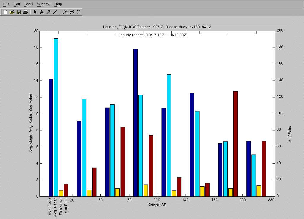
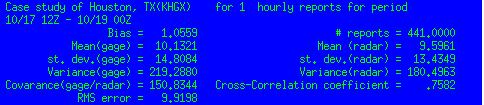
1-Hour Gage-Radar analyses |
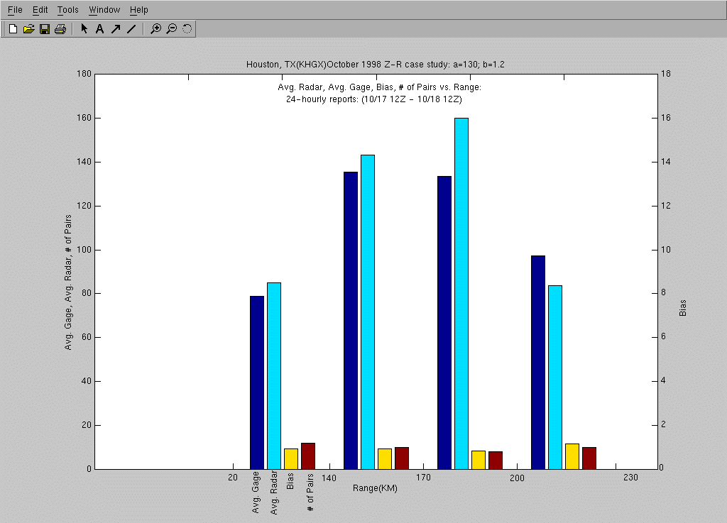
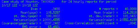
24-Hour Gage-Radar analyses |

|

|

|

|

|

|

|

|
|
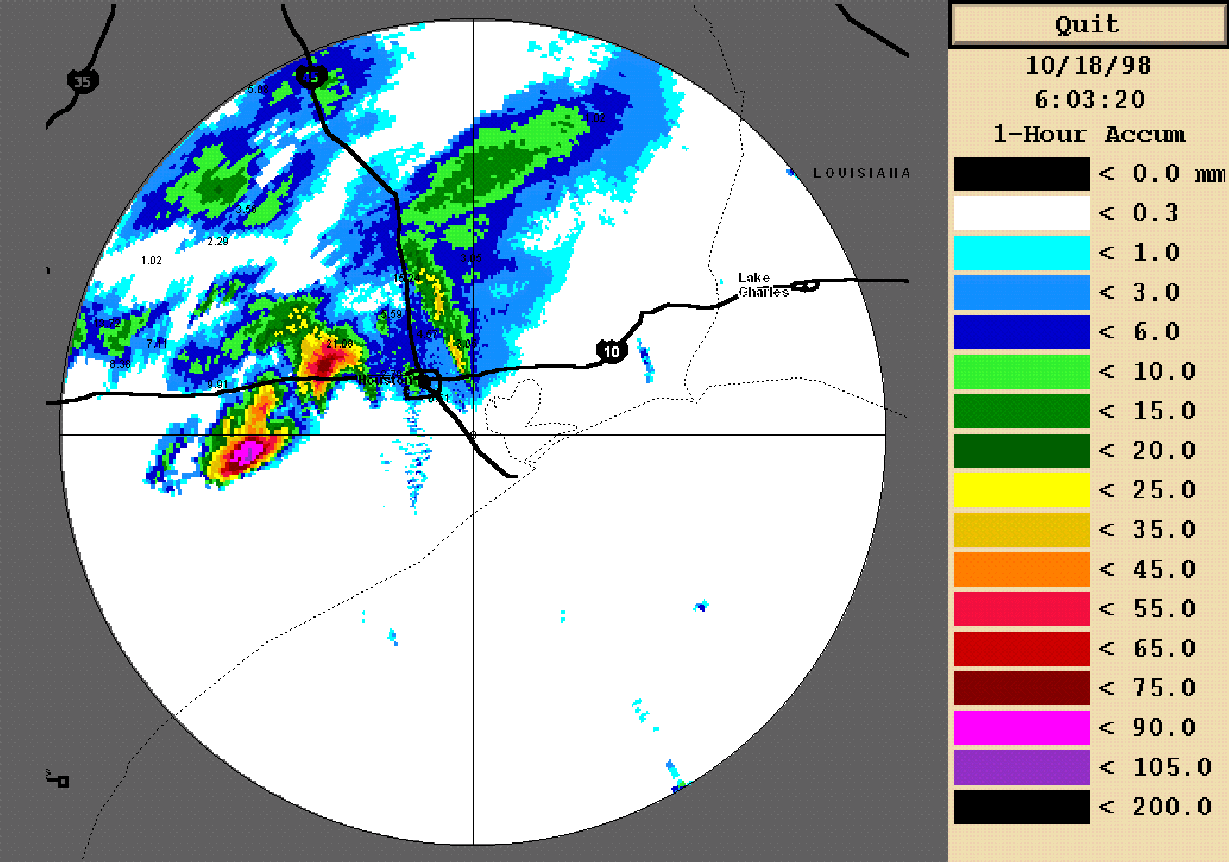
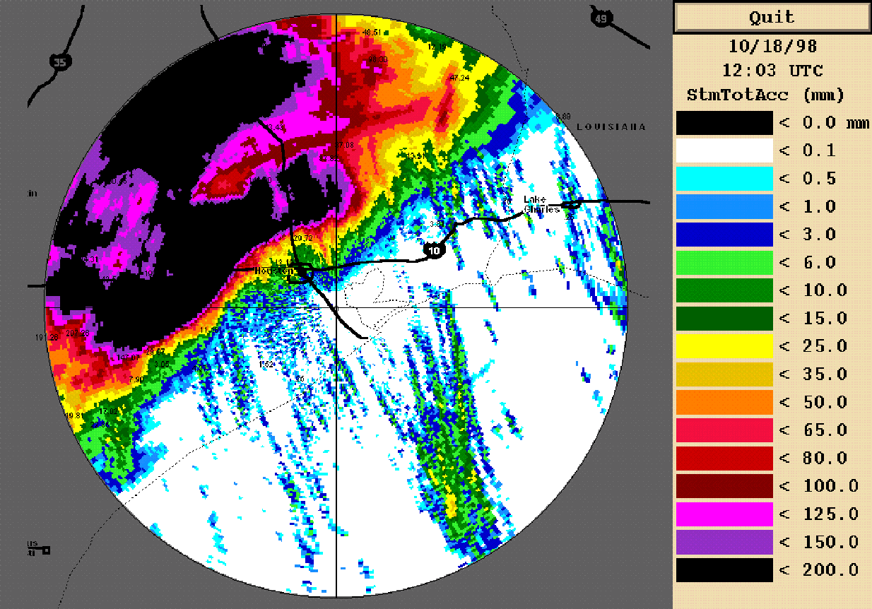
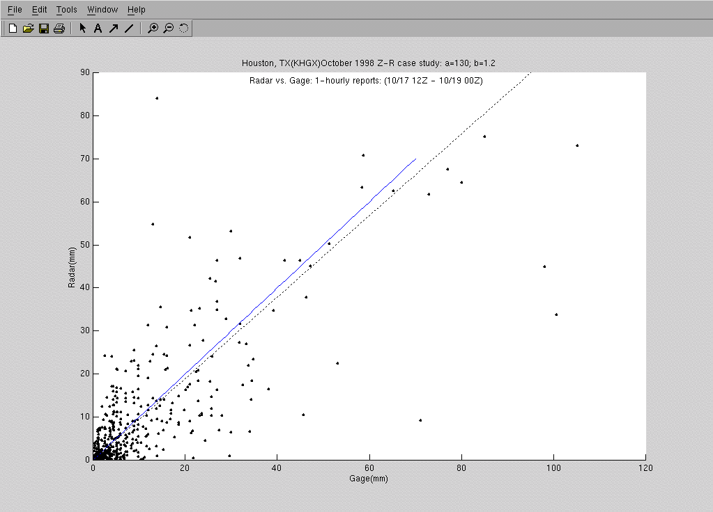
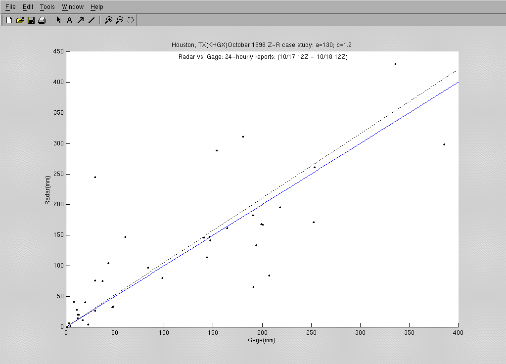
Fig. 2.7O.H: Overview of results from October 17-19 Houston (KHGX) simulation with "Best" Z-R (a=130; b=1.2) and Default Hail Cap threshold(103.8 mm/hr): Left column: analysis of all 1-hr G-R Pairs for duration of run (i.e., 10/17 12 UTC - 10/19 00 UTC); Right column: analysis of 24-hr G-R pairs ending 10/18 12 UTC. Top to bottom (both columns): Accumulation product with rain gage data for matching period superimposed (Left: OHP for indicative hour(i.e., ending 10/18/98 06 UTC); Right: STP for 24-hours); Gage (X) vs. Radar (Y) "Scatter Diagram"; Bias, Avg. Gage, Avg. Radar and # G-R Pairs vs. Range; Summary of Statistics for case. (all accum. units mm)
| |
|