
 |
| Tsunami damage in Banda Aceh. |
December 26, 2014
Today I’m taking a moment to reflect on one of the most destructive tsunamis in recorded history. On December 26, 2004, a large earthquake beneath the Indian Ocean sent a series of waves across the ocean that flooded the coasts of 14 countries in South Asia and East Africa. Around 1.7 million people who lived on these coasts had to move because of the destruction. Nearly 230,000 people lost their lives.
The National Oceanic and Atmospheric Administration and its partners have done a lot in the last ten years to make sure that people who live near the coasts around the world are better prepared for the next big tsunami. My friends at the National Weather Service have taught me that even though tsunamis do not happen very often, they pose a major threat to coastal communities, particularly in the Pacific Ocean. No one can prevent tsunamis or predict where, when, or how destructive the next tsunami will be. But, there are things that can be done to prepare for one. The National Weather Service has a lot of great information online, including a new tsunami safety website and this short video.
After learning about the Indian Ocean Tsunami, I made sure to teach my friends and family about how to stay safe. I don’t live or work at the coast, but I have friends and family who do and I visit them often. It is important that anyone who is ever near the coast understands and is prepared for tsunamis and knows how to respond to a tsunami warning.
Tsunami warnings are broadcast through local radio and television, wireless emergency alerts, NOAA Weather Radio and NOAA websites (like Tsunami.gov). They may also come through outdoor sirens, local officials, text message alerts and telephone notifications. These official warnings give directions for what to do. However, there may not always be enough time for an official warning so it is important to understand the natural warning signs. These signs include a strong or long earthquake, a sudden rise or fall of the ocean, and a loud roar (like a train or an airplane) from the ocean. Even just one of these signs means that a tsunami may be coming. I hope I never experience these things, but you can bet that if I do, I will go quickly to high ground or head inland away from the water!
 |
| Practicing evacuation at the beach: follow directions and head to high ground or inland! |
December 4, 2014
I have always been interested in the weather. In fact, most people who become meteorologists have been fascinated by weather since they were very young. Meteorologists across the world get to predict some of Mother Nature’s wildest weather! From tornadoes to blizzards and heatwaves to hurricanes, a career in meteorology will keep you on your toes! One thing I’ve definitely learned is that while meteorology is a fun and exciting career choice, it takes a lot of dedication and hard work that start with going to school.
The basic requirement for becoming a meteorologist is a 4-year Bachelor of Science degree in Meteorology or Atmospheric Sciences. To become a meteorologist, you need to be good at math and science. Some of the classes that you'll be taking to earn your degree include calculus, physics, atmospheric dynamics, synoptic meteorology, and even computer programming courses. Meteorology is not an easy degree to get, but it one that is very worthwhile! My advice is to take as many math and science classes as you can in high school, including calculus and physics if they’re offered because they'll help you a lot once you get into college.
Whether you already know you want to become a meteorologist or if you're really not sure, the best thing you can do is shadow or intern with local meteorologists. This is extremely important because it allows you to experience the job of a meteorologist and really get to see how we forecast the weather. For more information on careers in weather and how to become a meteorologist, visit NOAA’s National Weather Service at https://www.weather.gov/careers.
 |
| Measuring snow |
November 26, 2014
It looks like there will be some pretty messy weather in the Mid-Atlantic and Northeast leading up to Thanksgiving. Since I’m spending the holiday with friends, I’ll be sending in snowfall reports from New York.
I have my snow measuring equipment ready to go! My snow board (the kind used to measure snow depth, not for sliding down a snowy slope) has been placed on a spot in the yard far away from trees and buildings. That way none of the falling snow is blocked from reaching the board. I have a yardstick handy so that I can take an accurate measurement! Also, I have my cold weather gear ready so that I can bundle up and stay warm while venturing out to take each measurement. I am ready for Mother Nature to bring on the snow!
Want to measure snow depth along with me? Visit my friends at CoCoRaHS to learn more about the equipment I’m using and get tips on how to accurately measure and report snowfall amounts. https://bit.ly/1coFRpO
To report your snowfall amounts to the National Weather Service go to www.weather.gov and click on your location on the map. The page will open to your local office. Scroll down and there will either be a link to submit a “storm report” directly on that page or you can click on the “Contact Us” section and send your report via e-mail.
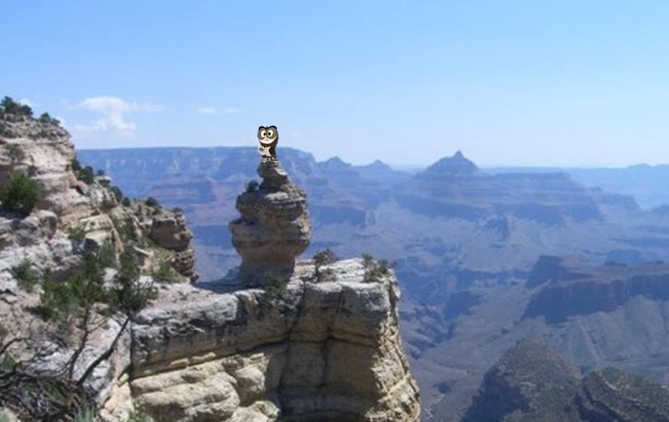 |
| Visit to the Grand Canyon |
November 5, 2014
I recently visited the Grand Canyon and was absolutely wowed by the size of the canyon and the beauty of the rock formations. But one of the most interesting things to me about the Grand Canyon is that it affects the local weather! Whoo knew that the depth of the Grand Canyon and its rocky terrain greatly influence temperature and precipitation?
Chilly at the top? Just head down into the canyon and you’ll notice the temperature gets an average of 5.5 degrees Fahrenheit warmer for every 1,000 feet you climb down. The Grand Canyon is 6000 feet deep at its deepest point so depending on where you are hiking, you may experience a warm-up of 30 degrees or more. That sounds great on a day like today, but during the summer when high temperatures at the Southern Rim average in the 80s, it can get pretty toasty down in the canyon!
The geography of the Grand Canyon makes some areas much wetter than others. The north Rim has much more rainfall during the year than the south. The depth of the canyon also affects precipitation. During the winter it will snow at the rims of the canyon but by the time the flakes reach the bottom of the canyon, they often have melted and will hit the canyon bottom as raindrops. Only about an inch of total snowfall will make it to the bottom of the canyon each winter!
 |
| National day of action. |
September 30, 2014
I had so much fun this past spring building an emergency kit with Laura Furgione, the Deputy Director of the National Weather Service. Today I re-checked the items in the kit to make sure they hadn’t expired. I replaced the water and medications to ensure they would be good if I need to use the kit in the coming months but everything else was still up to date. I also checked my family communications plan to make sure all of the phone numbers were still up to date. My aunt Sue got a new phone number about a month ago so I updated her information on my plan and also gave her a call to touch base. We had a great conversation about where to meet if we are ever in a situation where our phones are not working.
As part of the National PrepareAThon, there is a National Day of Action each Spring (April 30th) and Fall (September 30th). I have the dates marked on my calendar to remind me to check my kit and communications plan to make sure
I am always prepared!
 |
| The Water Cycle |
August 14, 2014
Today I was hanging out in a tree next to the Snake River in Idaho, just watching the river flow below me and puffy white clouds float above me when I realized, both are made up of water, just in different forms. This got me thinking about all the ways I use water every day…to drink, bathe, wash clothes and dishes, and even sometimes for play, like running through the sprinkler! But where does the water come from? To find out, I visited one of my friends who is a meteorologist and here’s what she had to say:
The amount of water on earth does not change, but water itself is always moving and changing. Water can be in any of three forms: solid, liquid, or an invisible gas called water vapor. It changes between the three forms and moves all over the world in an endless cycle called the water cycle, which is powered by the sun. The Sun’s energy causes water to warm or change from a liquid to a gas - a process called evaporation. Once it evaporates, it becomes part of the air around us.
When air rises in the atmosphere, it becomes cooler and the water vapor in the air can turn back into tiny droplets of liquid water – a process called condensation. Condensation is also how clouds form. The tiny droplets can collide to form bigger and bigger droplets until they are too heavy and fall from the cloud. Water that falls from the sky is called precipitation. Rain, snow, hail, and sleet are all forms of precipitation. Should precipitation fall in colder climates, it will take on the solid form of snow or ice. As the ice melts, the water returns to its liquid state and with the Sun’s continued energy, it may even evaporate, turning once again into water vapor. The water cycle is never ending!
 |
| Owlie with the radar dome for NWS Baltimore/Washington located in Sterling, VA. |
August 1, 2014
I think radar is one of the coolest tools used to predict the weather. We can see when rain or snow is expected to arrive, figure out how heavy that rain or snow may be, and even get wind information that helps National Weather Service Forecasters issue tornado warnings! I love flying by a forecast office and seeing the big radar dome outside…but I always wondered how it worked. How does that big white ball sitting way up in the air help create the radar pictures we see on the computer screen and tv?
I finally got a look inside! There is a massive satellite dish that is housed in each one of those domes. This huge dish sends out pulses of energy that travel almost at the speed of light into the atmosphere. When those pulses encounter an object, like a rain drop or snowflake, they bounce back to the radar. The radar can figure out how far away it is and how large the object is based on the amount of energy that comes back. It can also figure out the direction the object is moving. The dish inside the dome rotates 360 degrees to give us a full look at the surrounding area. This is also why radar domes are located so high in the air and are typically built outside of cities with tall buildings. If the beams hit any buildings or trees you wouldn’t get a clear reading of the weather.
 |
| Inside the radar dome. |
 |
| Image from the radar located at the NWS Lake Charles Forecast Office. |
 |
| Earth day activities at Union Station |
The National Weather Service and the NOAA Climate Program Office joined forces and participated in Earth Day activities at Union Station, in Washington D.C., on April 22. NWS promoted the Weather-Ready Nation Ambassadors initiative, NOAA Weather Radio, as well as the JetStream and Young Meteorologist Program educational websites. In the spirit of keeping the event "green," NWS relied on an iPad to showcase the NWS products and services and answer questions from visitors and minimized the number of handouts available.
 |
| Owlie Visits NWS Baltimore/Washington |
Owlie and his handler visited the NWS Baltimore/Washington forecast office, in Sterling, Virginia, to take some promotional photos with the staff there. In addition to photos at the AWIPS terminal and other locations inside the office, Owlie posed for photos outside, while checking the rain gauge and "preparing to launch" a radiosonde .

