Spokane, WA
Weather Forecast Office
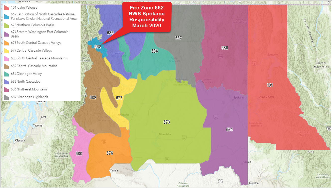
On or about Tuesday, March 3, 2020 at 1000 AM Pacific Standard Time,1800 Coordinated Universal Time (UTC), the NWS Weather Forecast Office in Seattle, WA (WFO SEW) will transfer responsibility of the fire weather zone 662 affecting the East Portion of the North Cascades National Park and the Lake Chelan National Recreational Area to the NWS Weather Forecast Office in Spokane, WA (WFO OTX). After this change, the fire weather forecasts and related products for this area will be issued by WFO OTX.
If you have any questions:
Please call Logan Johnson (206-526-6095 x 222) or Steve Bodnar (509-244-0110)
These changes are intended to simplify the forecast process, reducing redundancy in product creation and eliminate potential inconsistencies. Thereby, improving the quality of the product and service provided.
Zone 662 - East Portion of North Cascades National Park/Lake Chelan National Recreational Area
(Zone Responsibility transferred from NWS Seattle)
If you have any questions:
Please call Logan Johnson (206-526-6095 x 222) or Steve Bodnar (509-244-0110)
US Dept of Commerce
National Oceanic and Atmospheric Administration
National Weather Service
Spokane, WA
2601 N Rambo Rd.
Spokane, WA 99224
509-244-0110
Comments? Questions? Please Contact Us.

