
Unseasonably warm temperatures continue today across the southern U.S., with more than 100 record or near record maximum temperatures forecast through the rest of the week and over the weekend. Dry and gusty winds will produce elevated to critical fire weather in the central and southern Plains and elevated conditions over portions of the Desert Southwest on Friday. Read More >
History of NWS Spokane: 1880 to Now
What is the National Weather Service
The National Weather Service (NWS) is an agency of the United States government which provides weather forecasts, watches, warnings, and many other weather related products to the public and to many organizations across the country. It is a component of the National Oceanic and Atmospheric Administration (NOAA). The mission of the NWS is to "Provide weather, water, and climate data, forecasts and warnings for the protection of life and property and the enhancement of the national economy."
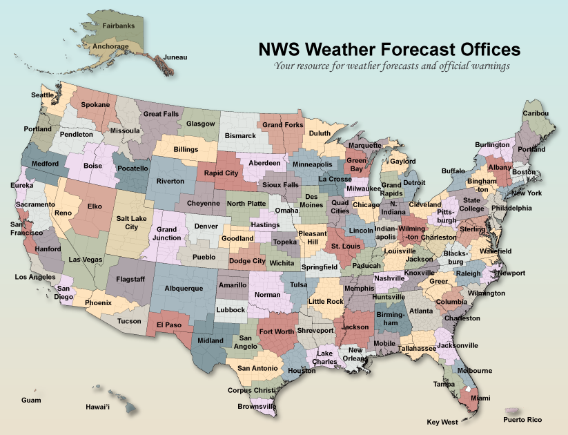
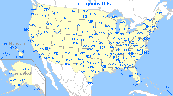
The Weather Forecast Office (WFO) in Spokane is one of 122 Weather Forecast Offices across the country responsible for a collection of counties known as a County Warning Area (CWA). From the map below, these offices cover the entire country as well as Puerto Rico and Guam.
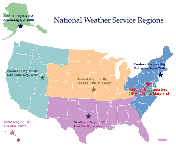
The headquarters of the NWS is located in Silver Springs, Maryland, with regional headquarters located in Kansas City, Missouri; Bohemia, New York; Fort Worth, Texas; Salt Lake City, Utah; Anchorage, Alaska; and Honolulu, Hawaii. The map below shows the locations of the various regions in the National Weather Service.
National Weather Service Spokane - OTX
Operations Area
Pictured below is the operations area of the NWS Office here in Spokane. It is here that all of the forecasts, watches, warnings, and advisories are produced. This area is staffed 24/7/365 with at least 2 people on duty at all times. There are eight different workstations available, of which 3 or 4 will be occupied during normal operations in quiet weather. During a significant or severe weather event all of the workstations can be in use. All of these workstations face the Situational Awareness Display. This is the wall of television screens monitoring local television stations, radar and satellite, regional webcams, and other displays to keep the forecasters up to date on the evolving weather conditions.
.PNG)
Watch/Warning Program
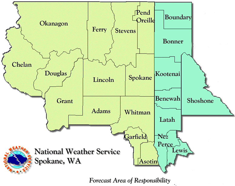
Forecasters on duty monitor the weather for severe and hazardous conditions around the clock. The main mission of the NWS is to issue watches and warnings for severe and hazardous weather that could poise a risk to life and property. This includes winter storms, high winds, dust storms, floods, severe thunderstorms and tornadoes. All watches, warnings, and advisories for the 21 counties in the NWS Spokane Area of Responsibility are issued from the operations area (shown above). The only exceptions are Severe Thunderstorm Watches and Tornado Watches, which are issued by the Storm Prediction Center (SPC).
Forecast Program
At the Spokane Forecast Office, forecasters issue 7-day forecasts for 13 counties in eastern Washington and 8 counties in north Idaho. They use the Advanced Weather Integrated Processing System (AWIPS) to analyze the latest weather data and computer model forecasts. They then create the gridded forecasts using the Graphical Forecast Editor (GFE).
Forecasters also produce aviation and fire weather forecasts. The aviation forecasts are called Terminal Aerodrome Forecasts (TAFs). The NWS in Spokane produces TAFs for 7 airports around the area: Spokane (Geiger), Felts Field, Coeur d'Alene, Lewiston, Pullman, Moses Lake, and Wenatchee. The fire weather forecasts are produced based on the grids in the Graphical Forecast Editor, and are issued as a special product.
Observation Program
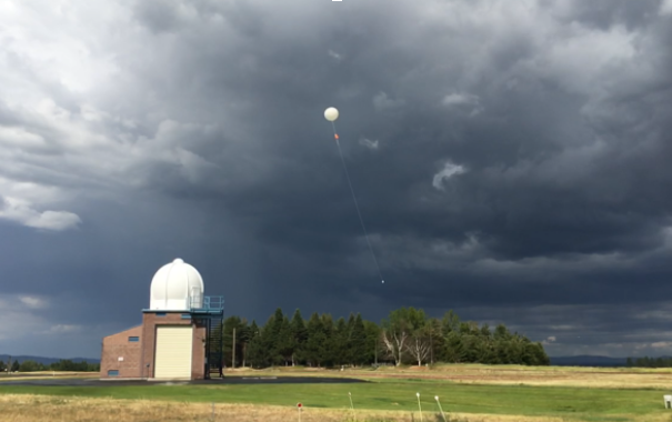
The NWS Spokane is one of the 92 Upper Air Observation sites in the county. Each day, twice a day, weather balloons are launched with a radiosonde to collect valuable weather data in the atmosphere. These weather balloons rise about 19 miles high and take about 1 hour and 45 minutes to complete. Data obtained by the radiosonde to transmitted to a computer in the NWS office and provides the input for computer-based weather prediction models.
In addition, forecasters maintain climate data and records for various observation sites around the area, as well as for cooperative observer sites. This includes records and averages for temperatures and precipitation, along with a few other meteorological variables. Spotter storm reports, snowfall totals, and other weather reports are collected by forecasters and issued in local storm reports or public information statements.
Why OTX and Why on Rambo Road?
With the installation of the radar in the NWS modernization (mid 90s), the GEG airport didn't want a weather radar on their grounds. NWS Spokane Meteorologist In Charge from the 80s and early 90s, found the property on Rambo Road which was owned by Fairchild Air Force Base (FAFB).
What Else We Do
NWS Spokane broadcasts forecasts, watches, warnings, and advisories over NOAA Weather Radio. NOAA Weather Radio is a nationwide network of radio stations broadcasting continuous weather information directly from the nearest National Weather Service Office. The broadcast schedule consists of messages which are repeated every three to five minutes and are routinely revised to provide up-to-date information. In conjunction with Federal, State, and Local Emergency Managers and other public officials, NWR also broadcasts warning and post-event information for all types of hazards - including natural (earthquakes, avalanches, etc), environmental (chemical releases, oil spills, etc), and public safety. If you aren't hearing our broadcast, you can check and see if your station is down temporarily here.
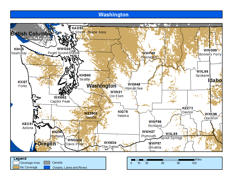
NOAA Weather Radio Coverage in Washington

