Winter Experiment
Test Page
|
|
|
|---|---|
|
|
|
What's this?
ForecastRepresents our official snow and ice forecast, in inches, within the next one to two days.Close |
What's this?
ReportedAs snow and/or ice reports come into the NWS (you can email reports to okx-spotters@noaa.gov or Tweet to @NWSNewYorkNY), we will pass them on here. With the map linked here, and the supporting reports below it, you can keep tabs on how much has fallen.Close |
|
|
||
|
Experimental - Leave feedback |
||
| Minimum | MOST LIKELY | Maximum |
|---|---|---|
| Expect at least this much: | Potential for this much: | |
|
|
|
|
What's this?
Minimum Potential AccumulationExpect at least this much. This is what we see as the least amount of snow the storm can produce.The range between maximum and minimum typically shrinks as the storm nears, and the outcome becomes more certain. "Most Likely" (the forecast) will remain between the two. This information is for advance planning ahead of the storm. It is provided out as far as three days. However, when the snow starts to fall, this will be discontinued to focus on the forecast snow amount. |
What's this?
Most Likely AccumulationRepresents our official snow forecast in inches within the next one to two days. The snowfall amounts are provided in ranges (1-2", 2-4", etc.). Close |
What's this?
Maximum Potential AccumulationWhat you should be prepared for. This is what we see as the storm's maximum potential snowfall accumulation.The range between maximum and minimum typically shrinks as the storm nears, and the outcome becomes more certain. "Most Likely" (the forecast) will remain between the two. This information is for advance planning ahead of the storm. It is provided out as far as three days. However, when the snow starts to fall, this will be discontinued to focus on the forecast snow amount. Close |
|
Experimental - Leave feedback Exceedance ProbabilitiesRepresents the likelihood of exceeding a specific snowfall amount. Thresholds are 0.1", 1", 2", 4", 6", 8", 12", and 18". This product is designed to indicate high or low confidence in the official snowfall forecast.Example: An 80% chance of exceeding 2" means that we have a high confidence that it will snow at least 2". Conversely, a 10% chance of exceeding 18" means that we have high confidence that it will snow less than 18". Close |
| Chance of Snow Accumulation Experimental - Leave feedback Snow AccumulationRangesRepresents the likelihood of various snowfall ranges. Amounts ranges are 0", 1-2", 2-4", 4-6", 6-8", 8-12", 12-18" and 18" +. This product is designed to indicate high or low confidence in the official snowfall forecast.ExceedanceRepresents the likelihood of exceeding a specific snowfall amount. Thresholds are 0.1", 1", 2", 4", 6", 8", 12", and 18". This product is designed to indicate high or low confidence in the official snowfall forecast. Close |
|
|
|
|
|
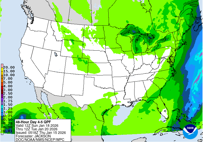
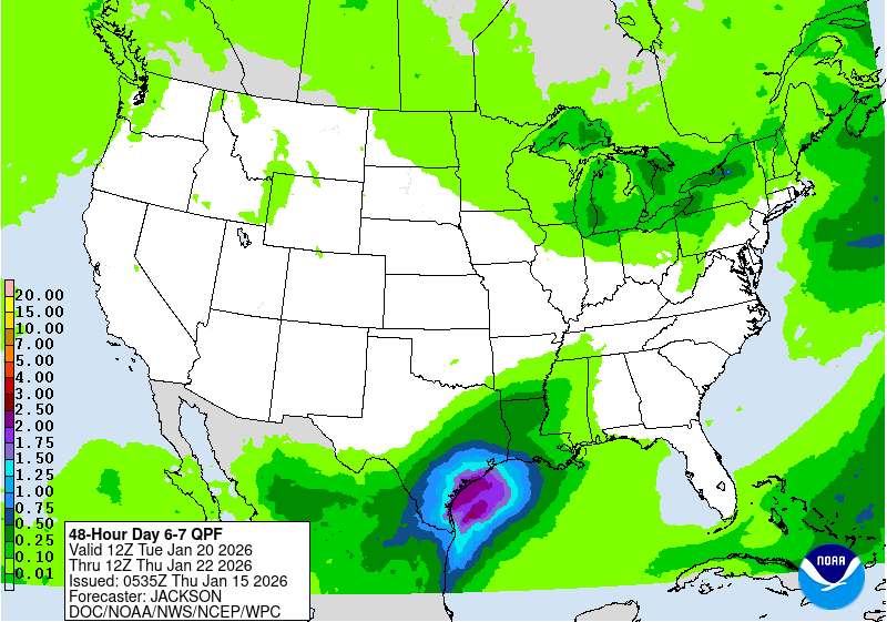
| Days 4-5 Forecast Precipitation | Days 6-7 Forecast Precipitation |
 |
 |
|
|
||||
|
|
|
|
|
|
|
|
|||
|
|
|
|
|
|
||
|
& Advisories |
Statistics |
Measure Snow |
|
|
||
|
|
|
|
|
|
|
Winter Weather Criteria
Past Holiday Weather for Central Park
Snowfall/Snowpack Information
More Winter Weather Information
|