|
|
A low-ampltitude shortwave trough was moving out of the Great Lakes and into New England during the afternoon on October 2, 2018. At the surface, a warm front was draped across southern New York State and southern Connecticut. Off to the west, a cold front approached. With the warm front slow to progress north in the morning, the region was left in the warm sector with dew points rising well into the mid and upper 60s. A general consensus of 1000-1500 J/Kg of CAPE was evident on hi-res models noting the instability. The threat of low level rotation increased during the afternoon and evening as an 850 mb low level jet intensified and helped to increase the tornado potential.
The initial round of convection developed and moved east along the warm front late Tuesday afternoon and evening. Moderate instability, strong deep shear and a low-level SRH environment was supportive of supercell development across the Lower Hudson Valley and Southern Connecticut. The favorable environment aided in tornadogenesis leading to three confirmed tornadoes.
Another line of thunderstorms was organizing over Central NY/PA early Tuesday ahead of the cold front. Although instability was waning into the evening hours, the persistence and intensity of this line was support by the mid and upper level forcing.This line resulted in a weak tornado spinning up on Long Island.


PRELIMINARY LOCAL STORM REPORT
NATIONAL WEATHER SERVICE NEW YORK NY
920 AM EDT WED OCT 03 2018

..TIME...   ...EVENT...      ...CITY LOCATION...     ...LAT.LON...
..DATE...   ....MAG....      ..COUNTY LOCATION..ST.. ...SOURCE....
            ..REMARKS..

1120 PM     TORNADO          RONKONKOMA              40.80N  73.12W
10/02/2018                   SUFFOLK            NY   NWS STORM SURVEY

            STORM SURVEY TEAM CONFIRMED AN EF0 TORNADO IN
            RONKONKOMA WITH ESTIMATED PEAK WINDS OF 85 MPH, A 200
            YARD PATH WIDTH, AND A PATH LENGTH OF 400 YARDS.


&&
PRELIMINARY LOCAL STORM REPORT
NATIONAL WEATHER SERVICE NEW YORK NY
1134 AM EDT WED OCT 03 2018

..TIME...   ...EVENT...      ...CITY LOCATION...     ...LAT.LON...
..DATE...   ....MAG....      ..COUNTY LOCATION..ST.. ...SOURCE....
            ..REMARKS..

0410 PM     TORNADO          STONY POINT             41.23N  74.00W
10/02/2018                   ROCKLAND           NY   NWS STORM SURVEY

            STORM SURVEY TEAM CONFIRMED AN EF1 TORNADO NEAR STONY
            POINT WITH ESTIMATED PEAK WINDS OF 100 MPH, A 100 YARD
            PATH WIDTH, AND A PATH LENGTH OF 1 MILE.


&&
PRELIMINARY LOCAL STORM REPORT
NATIONAL WEATHER SERVICE NEW YORK NY
114 PM EDT WED OCT 03 2018
..TIME... ...EVENT... ...CITY LOCATION... ...LAT.LON...
..DATE... ....MAG.... ..COUNTY LOCATION..ST.. ...SOURCE....
..REMARKS..
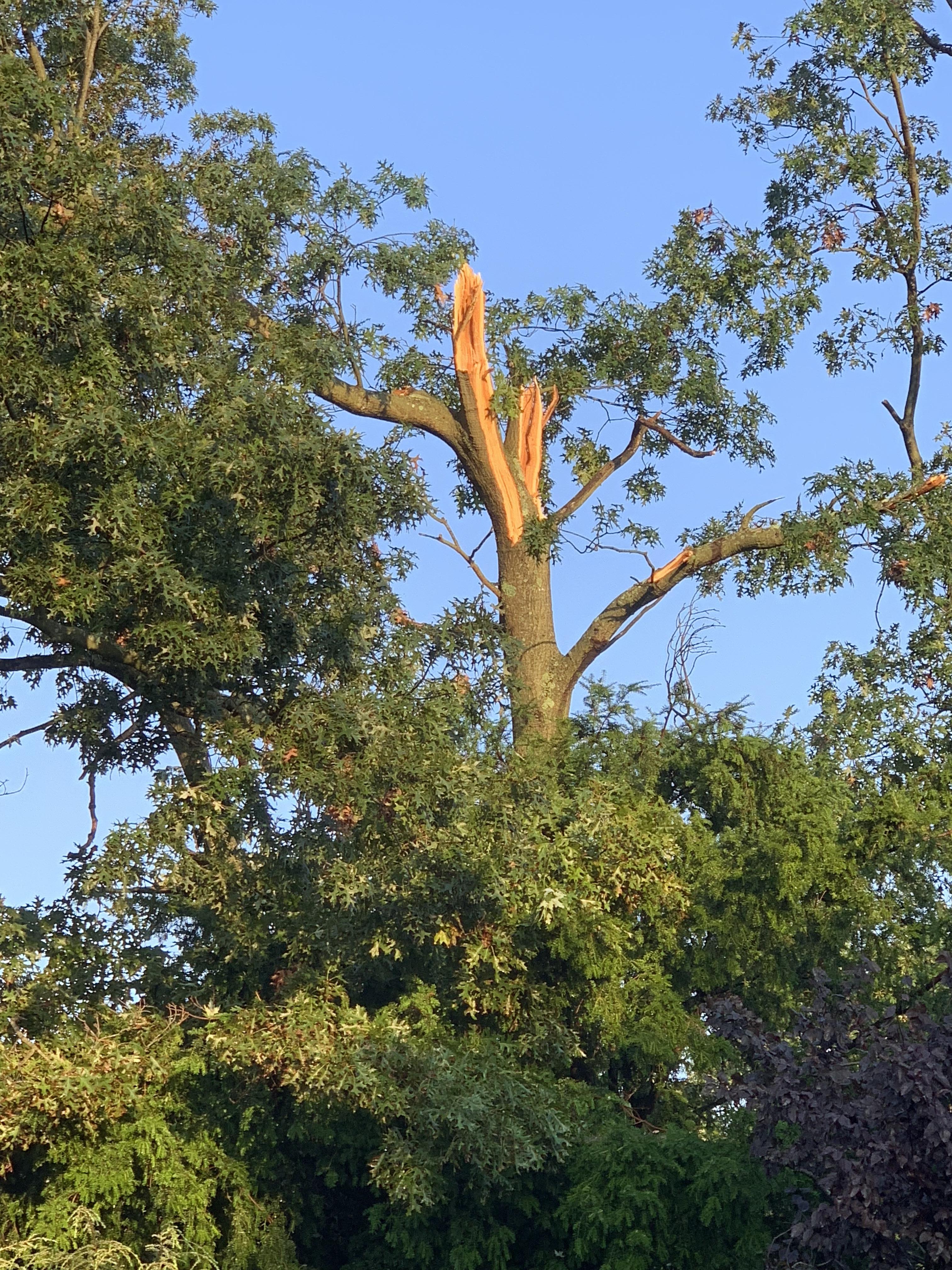
0447 PM TORNADO 1 W MILLWOOD 41.19N 73.81W
10/02/2018 WESTCHESTER NY NWS STORM SURVEY
STORM SURVEY TEAM CONFIRMED AN EF1 TORNADO IN THE NEW
CASTLE AREA OF WESTCHESTER COUNTY WITH ESTIMATED PEAK
WINDS OF 110 MPH, A 300 YARD PATH WIDTH, AND A PATH
LENGTH OF 3.75 MILES.
&&
PRELIMINARY LOCAL STORM REPORT
NATIONAL WEATHER SERVICE NEW YORK NY
730 PM EDT WED OCT 03 2018
..TIME... ...EVENT... ...CITY LOCATION... ...LAT.LON...
..DATE... ....MAG.... ..COUNTY LOCATION..ST.. ...SOURCE....
..REMARKS..
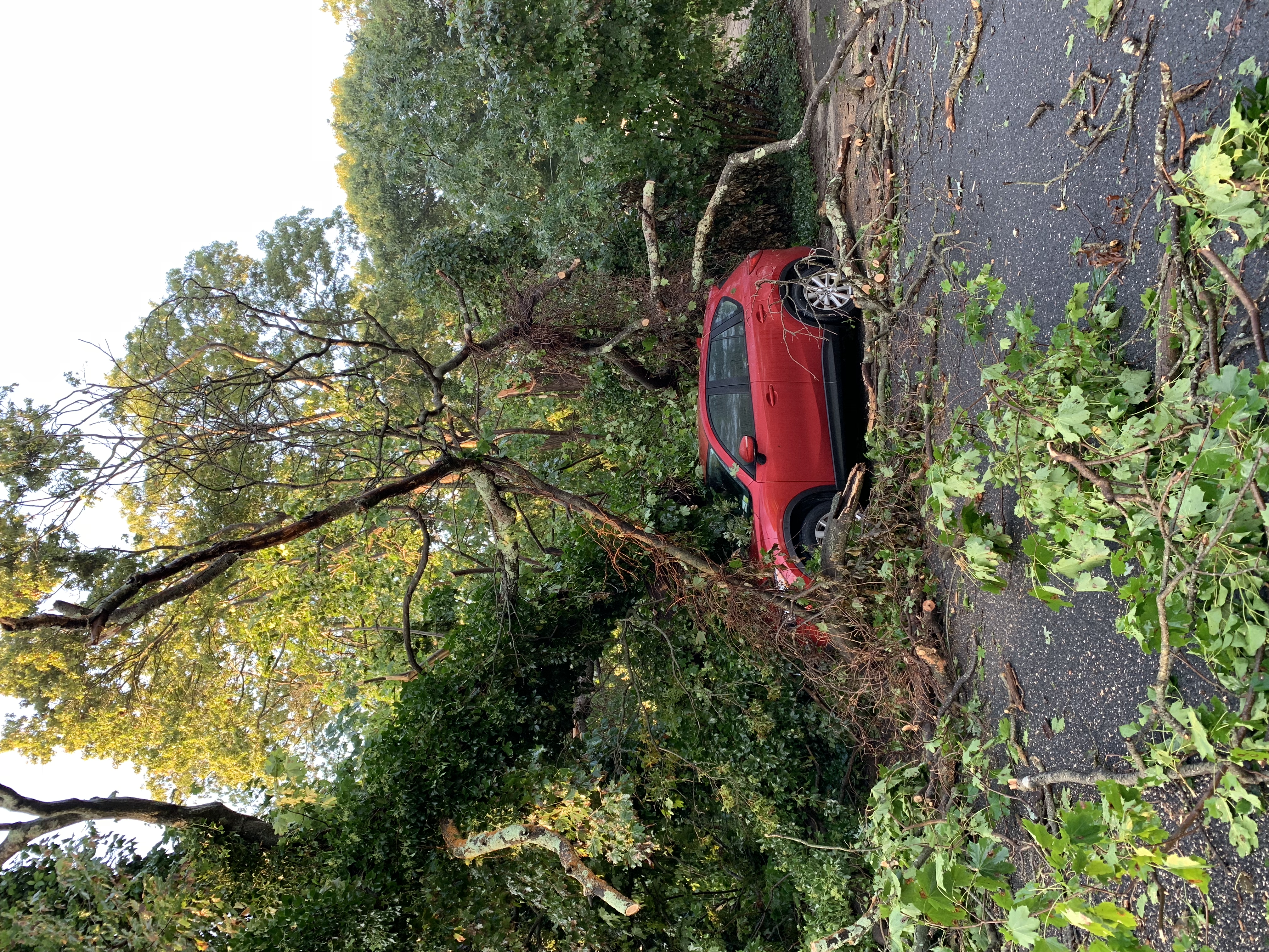
0529 PM TORNADO 1 W NEW CANAAN 41.14N 73.50W
10/02/2018 FAIRFIELD CT NWS STORM SURVEY
STORM SURVEY TEAM CONFIRMED AN EF1 TORNADO THAT BEGAN
NEAR NEW CANAAN AND LIFTED NEAR NORWALK WITH ESTIMATED
PEAK WINDS OF 100 MPH, A 100 YARD PATH WIDTH, AND A PATH
LENGTH OF 3.9 MILES.
&&
|


 |
 |


 Coastal Flooding