National Weather Service United States Department of Commerce
tspotter


The #tSpotter SKYWARN program uses highly trained volunteers to provide localized weather impact and warning information to their community via their own Twitter accounts. The coordinators solicit real time weather reports and geo-tagged photographs from their followers who use the hashtag #tSpotter in their reports. If a report or photograph meets predefined criteria, it is immediately entered into WFO Nashville's NWSChat room where local media and Emergency Managers have instant access to it. As of February 2023, there were 30 Middle Tennessee counties with organized Twitter based SKYWARN groups.

tspotter map

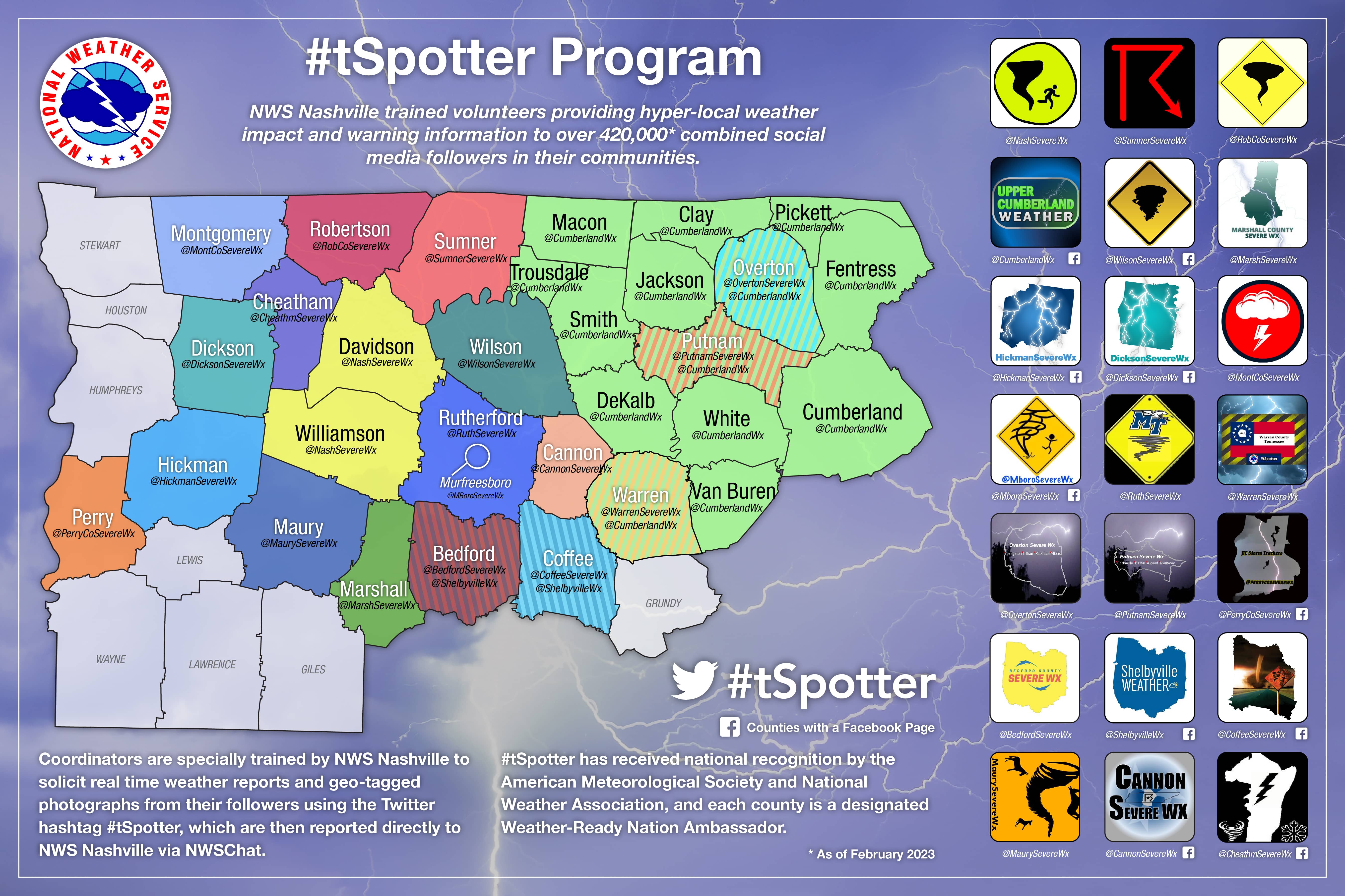
#tSpotter has resulted in hundreds of additional real-time weather reports available via WFO Nashville's NWSChat room. This has greatly aided situational awareness for NWS meteorologists and their partners while reducing storm verification workload. More importantly, highly localized, trusted, and potentially life-saving weather impact information is reaching more people than ever through their smartphones and social media pages. Due to the immense success of #tSpotter across Middle Tennessee, #tSpotter has received national recognition by the American Meteorological Society and National Weather Association, including receiving the National Weather Association's Walter J. Bennett Public Service Award in September 2016, and each county in the #tSpotter network been designated as Weather-Ready Nation Ambassadors. In addition, similar programs are being developed in other areas of the country.

tspotter map

For more information on the #tSpotter program, email Sam Shamburger, NWS Nashville Lead Forecaster.


Twitter logo

@NWSNashville
@NashSevereWx
@BedfordSevereWx
@CannonSevereWx
@CheathmSevereWx
@CoffeeSevereWx
@DicksonSevereWx
@GrundySevereWx
@HickmanSevereWx
@MarshSevereWx
@MaurySevereWx
@MboroSevereWx
@MontCoSevereWx
@OvertonSevereWx
@PerryCoSevereWx
@PutnamSevereWx
@RobCoSevereWx
@RuthSevereWx
@ShelbyvilleWx
@SumnerSevereWx
@WilsonSevereWx
@WarrenSevereWx
@CumberlandWx

Facebook logo

Cannon Severe Weather
Cheatham County Weather
Coffee County Severe Weather
Dickson County Severe Weather
Hickman County Severe Weather
Murfreesboro Severe Weather
Perry County Storm Trackers
Shelbyville Weather
Sumner Severe Weather
Upper Cumberland Weather
Wilson County Severe Weather


Blog logo

Nashville Severe Weather
Cannon County Severe Weather
Coffee County Severe Weather
Dickson County Severe Weather
Hickman County Severe Weather
Murfreesboro Severe Weather
Upper Cumberland Weather

Links & Resources:

NWS SKYWARN page
NWS Nashville Local Storm Reports
NWS Nashville Public Information Statements
Storm Prediction Center (SPC)
SPC Day 1 Outlook for TN
SPC Day 2 Outlook for TN
SPC Day 3 Outlook for TN
SPC Day 4-8 Outlook
SPC HRRR Model
College of Dupage Weather Models