413
FNUS54 KOHX 130511
FWFOHX
Fire Weather Planning Forecast for Tennessee
National Weather Service Nashville TN
1211 AM CDT Sun Apr 13 2025
.DISCUSSION...
Winds will increase tomorrow, and RHs will drop, resulting in the
need to monitor fire weather conditions on Sunday. Next chance of
rain is early in the work week, but the chance for wetting rain
looks low right now.
TNZ075-132115-
Bedford-
Including the city of Shelbyville
1211 AM CDT Sun Apr 13 2025
Today Tonight Mon
Cloud Cover Mclear Mclear Mclear
Temp (24h trend) 72 (+12) 55 (+19) 81
RH % (24h trend) 32 (-6) 77 (-8) 40
RH Recovery Excellent
AM 20FT Wnd (mph) SE 7-11 SW 15-19
PM 20FT Wnd (mph) S 10-14 S 10-14 SW 15-19
Transport Wnd (mph) S 17 S 18 SW 30
Mixing Hgt(ft-agl/msl)3300 500 4800
Vent Rate (mph-ft) 58000 5400 149700
Max Dispersion Early 26 Fair 14 Gen Poor 68 Good
Max Dispersion Late 48 Gen Good 10 Poor 120 Very Good
Category Day 4 1 5
Max LVORI Early 5 2 4
Max LVORI Late 1 3 1
Precip Chance (%) 0 0 0
Chance of Thunder (%) 0 0 0
Precip Type None None None
Precip Duration
Precip Amount 0.00 0.00 0.00
Precip Begin
Precip End
Remarks...None.
.FORECAST FOR DAYS 3 THROUGH 7...
.MONDAY NIGHT...Mostly cloudy with a chance of showers. Lows in
the lower 50s. Chance of showers 30 percent. West winds around
5 mph.
.TUESDAY...Sunny. Highs in the mid 60s. Minimum RH 33 percent.
Northwest winds around 15 mph.
.TUESDAY NIGHT...Clear, colder. Lows around 40. Light winds.
.WEDNESDAY...Sunny. Highs in the upper 60s. Minimum RH
31 percent. Northwest winds around 5 mph.
.WEDNESDAY NIGHT...Partly cloudy. Lows in the mid 40s. Light
winds.
.THURSDAY...Mostly sunny. Highs in the mid 70s. Minimum RH
37 percent. Southeast winds around 5 mph.
.THURSDAY NIGHT...Mostly clear. Warmer. Lows in the upper 50s.
South winds around 10 mph.
.FRIDAY...Mostly sunny. Highs in the lower 80s. Minimum RH
43 percent. Chance of precipitation 20 percent. South winds
around 15 mph.
.FRIDAY NIGHT...Mostly cloudy with a 30 percent chance of
showers. Lows in the lower 60s. South winds around 10 mph.
.SATURDAY...Mostly cloudy. Highs in the lower 80s. Minimum RH
49 percent. Chance of precipitation 20 percent. South winds
around 10 mph.
$$
TNZ063-132115-
Cannon-
Including the city of Woodbury
1211 AM CDT Sun Apr 13 2025
Today Tonight Mon
Cloud Cover Mclear Mclear Mclear
Temp (24h trend) 72 (+14) 54 (+18) 80
RH % (24h trend) 32 (+1) 76 (-5) 41
RH Recovery Excellent
AM 20FT Wnd (mph) SE 6-10 SW 15-19
PM 20FT Wnd (mph) S 8-12 S 10-14 SW 14-18
Transport Wnd (mph) S 16 S 18 W 31
Mixing Hgt(ft-agl/msl)3400 400 5100
Vent Rate (mph-ft) 58300 2500 163200
Max Dispersion Early 23 Fair 15 Gen Poor 70 Good
Max Dispersion Late 46 Gen Good 10 Poor 130 Very Good
Category Day 3 1 5
Max LVORI Early 4 2 3
Max LVORI Late 2 3 1
Precip Chance (%) 0 0 0
Chance of Thunder (%) 0 0 0
Precip Type None None None
Precip Duration
Precip Amount 0.00 0.00 0.00
Precip Begin
Precip End
Remarks...None.
.FORECAST FOR DAYS 3 THROUGH 7...
.MONDAY NIGHT...Mostly cloudy with a chance of showers. Lows in
the lower 50s. Chance of showers 40 percent. West winds around
5 mph.
.TUESDAY...Sunny. Highs in the lower 60s. Minimum RH 36 percent.
Northwest winds around 15 mph.
.TUESDAY NIGHT...Clear, colder. Lows around 40. Light winds.
.WEDNESDAY...Sunny. Highs in the mid 60s. Minimum RH 34 percent.
West winds around 5 mph.
.WEDNESDAY NIGHT...Partly cloudy. Lows in the mid 40s. Light
winds.
.THURSDAY...Mostly sunny. Highs in the lower 70s. Minimum RH
39 percent. Southeast winds around 5 mph.
.THURSDAY NIGHT...Mostly clear. Warmer. Lows in the upper 50s.
South winds around 10 mph.
.FRIDAY...Mostly sunny. Highs around 80. Minimum RH 44 percent.
Chance of precipitation 20 percent. South winds around 15 mph.
.FRIDAY NIGHT...Mostly cloudy with a 30 percent chance of
showers. Lows in the lower 60s. South winds around 10 mph.
.SATURDAY...Partly sunny with a 30 percent chance of showers.
Highs in the upper 70s. Minimum RH 51 percent. Southwest winds
around 10 mph.
$$
TNZ026-132115-
Cheatham-
Including the cities of Ashland City and Kingston Springs
1211 AM CDT Sun Apr 13 2025
Today Tonight Mon
Cloud Cover Mclear Mclear Pcldy
Temp (24h trend) 73 (+13) 60 (+21) 80
RH % (24h trend) 34 (+1) 73 (-6) 43
RH Recovery Excellent
AM 20FT Wnd (mph) SE 7-11 SW 15-19
PM 20FT Wnd (mph) S 11-15 S 10-14 W 15-19
Transport Wnd (mph) S 20 S 18 W 25
Mixing Hgt(ft-agl/msl)3600 500 5000
Vent Rate (mph-ft) 72300 8200 152500
Max Dispersion Early 30 Fair 24 Fair 78 Good
Max Dispersion Late 60 Gen Good 12 Poor 103 Very Good
Category Day 4 1 5
Max LVORI Early 4 2 3
Max LVORI Late 1 3 1
Precip Chance (%) 0 0 0
Chance of Thunder (%) 0 0 0
Precip Type None None None
Precip Duration
Precip Amount 0.00 0.00 0.00
Precip Begin
Precip End
Remarks...None.
.FORECAST FOR DAYS 3 THROUGH 7...
.MONDAY NIGHT...Mostly cloudy. Lows around 50. Chance of
precipitation 20 percent. West winds around 5 mph.
.TUESDAY...Sunny. Highs in the lower 60s. Minimum RH 34 percent.
Northwest winds around 10 mph.
.TUESDAY NIGHT...Clear. Lows in the lower 40s. West winds around
5 mph.
.WEDNESDAY...Sunny. Highs in the upper 60s. Minimum RH
33 percent. West winds around 5 mph.
.WEDNESDAY NIGHT...Partly cloudy. Lows in the upper 40s. Light
winds.
.THURSDAY...Mostly sunny. Highs in the lower 70s. Minimum RH
41 percent. Southeast winds around 5 mph.
.THURSDAY NIGHT...Mostly clear. Warmer. Lows in the upper 50s.
South winds around 10 mph.
.FRIDAY...Mostly sunny. Highs in the lower 80s. Minimum RH
45 percent. Chance of precipitation 20 percent. South winds
around 15 mph.
.FRIDAY NIGHT...Mostly cloudy with a 40 percent chance of
showers. Lows in the lower 60s. South winds around 10 mph.
.SATURDAY...Partly sunny with a chance of showers. Highs in the
upper 70s. Minimum RH 51 percent. Chance of showers 40 percent.
Southwest winds around 10 mph.
$$
TNZ010-132115-
Clay-
Including the city of Celina
1211 AM CDT Sun Apr 13 2025
Today Tonight Mon
Cloud Cover Mclear Mclear Pcldy
Temp (24h trend) 70 (+12) 55 (+20) 78
RH % (24h trend) 29 (-5) 72 (-10) 44
RH Recovery Excellent
AM 20FT Wnd (mph) SE 3-7 SW 10-14
PM 20FT Wnd (mph) S 6-10 S 9-13 SW 9-13
Transport Wnd (mph) S 16 S 16 W 28
Mixing Hgt(ft-agl/msl)3800 500 5000
Vent Rate (mph-ft) 65400 3300 149700
Max Dispersion Early 25 Fair 12 Poor 67 Good
Max Dispersion Late 50 Gen Good 10 Poor 118 Very Good
Category Day 4 1 5
Max LVORI Early 4 2 3
Max LVORI Late 1 3 1
Precip Chance (%) 0 0 0
Chance of Thunder (%) 0 0 0
Precip Type None None None
Precip Duration
Precip Amount 0.00 0.00 0.00
Precip Begin
Precip End
Remarks...None.
.FORECAST FOR DAYS 3 THROUGH 7...
.MONDAY NIGHT...Mostly cloudy with a chance of showers. Lows in
the upper 40s. Chance of showers 50 percent. West winds around
5 mph.
.TUESDAY...Sunny. Highs around 60. Minimum RH 38 percent. West
winds around 10 mph.
.TUESDAY NIGHT...Mostly clear. Colder. Lows in the upper 30s.
Northwest winds around 5 mph.
.WEDNESDAY...Sunny. Highs in the lower 60s. Minimum RH
35 percent. West winds around 5 mph.
.WEDNESDAY NIGHT...Partly cloudy. Lows in the lower 40s. Light
winds.
.THURSDAY...Partly sunny. Highs around 70. Minimum RH 41 percent.
Southeast winds around 5 mph.
.THURSDAY NIGHT...Partly cloudy. Warmer. Lows in the mid 50s.
Southeast winds around 5 mph.
.FRIDAY...Mostly sunny. Highs in the upper 70s. Minimum RH
43 percent. Chance of precipitation 20 percent. South winds
around 10 mph.
.FRIDAY NIGHT...Mostly cloudy with a 40 percent chance of
showers. Lows in the lower 60s. South winds around 5 mph.
.SATURDAY...Mostly cloudy with a chance of showers. Highs in the
upper 70s. Minimum RH 54 percent. Chance of showers 40 percent.
Southwest winds around 5 mph.
$$
TNZ077-132115-
Coffee-
Including the cities of Tullahoma and Manchester
1211 AM CDT Sun Apr 13 2025
Today Tonight Mon
Cloud Cover Mclear Mclear Mclear
Temp (24h trend) 71 (+12) 55 (+19) 79
RH % (24h trend) 31 (-4) 80 (0) 40
RH Recovery Excellent
AM 20FT Wnd (mph) SE 6-10 SW 14-18
PM 20FT Wnd (mph) S 9-13 S 11-15 SW 14-18
Transport Wnd (mph) S 16 S 17 SW 31
Mixing Hgt(ft-agl/msl)3500 400 4600
Vent Rate (mph-ft) 56200 100 148700
Max Dispersion Early 23 Fair 11 Poor 64 Good
Max Dispersion Late 45 Gen Good 10 Poor 119 Very Good
Category Day 3 1 5
Max LVORI Early 4 2 4
Max LVORI Late 2 3 1
Precip Chance (%) 0 0 0
Chance of Thunder (%) 0 0 0
Precip Type None None None
Precip Duration
Precip Amount 0.00 0.00 0.00
Precip Begin
Precip End
Remarks...None.
.FORECAST FOR DAYS 3 THROUGH 7...
.MONDAY NIGHT...Mostly cloudy with a chance of showers. Lows in
the lower 50s. Chance of showers 40 percent. Southwest winds
around 5 mph.
.TUESDAY...Sunny. Highs in the lower 60s. Minimum RH 34 percent.
Northwest winds around 10 mph.
.TUESDAY NIGHT...Clear, colder. Lows around 40. Light winds.
.WEDNESDAY...Sunny. Highs in the mid 60s. Minimum RH 32 percent.
Northwest winds around 5 mph.
.WEDNESDAY NIGHT...Partly cloudy. Lows in the mid 40s. Light
winds.
.THURSDAY...Mostly sunny. Highs in the lower 70s. Minimum RH
37 percent. Southeast winds around 5 mph.
.THURSDAY NIGHT...Mostly clear. Warmer. Lows in the upper 50s.
South winds around 5 mph.
.FRIDAY...Mostly sunny. Highs around 80. Minimum RH 42 percent.
Chance of precipitation 20 percent. South winds around 15 mph.
.FRIDAY NIGHT...Mostly cloudy with a 30 percent chance of
showers. Lows in the lower 60s. South winds around 10 mph.
.SATURDAY...Partly sunny. Highs in the upper 70s. Minimum RH
50 percent. Chance of precipitation 20 percent. South winds
around 10 mph.
$$
TNZ066-132115-
Cumberland-
Including the city of Crossville
1211 AM CDT Sun Apr 13 2025
Today Tonight Mon
Cloud Cover Mclear Mclear Mclear
Temp (24h trend) 68 (+12) 49 (+16) 79
RH % (24h trend) 31 (-3) 77 (-1) 39
RH Recovery Excellent
AM 20FT Wnd (mph) SE 3-7 SW 11-15 G22
PM 20FT Wnd (mph) S 6-10 S 10-14 SW 11-15 G23
Transport Wnd (mph) S 13 S 17 W 35
Mixing Hgt(ft-agl/msl)3500 300 5100
Vent Rate (mph-ft) 48100 0 195100
Max Dispersion Early 16 Gen Poor 20 Gen Poor 74 Good
Max Dispersion Late 41 Gen Good 9 Poor 145 Very Good
Category Day 3 1 5
Max LVORI Early 4 2 4
Max LVORI Late 2 3 1
Precip Chance (%) 0 0 0
Chance of Thunder (%) 0 0 0
Precip Type None None None
Precip Duration
Precip Amount 0.00 0.00 0.00
Precip Begin
Precip End
Remarks...None.
.FORECAST FOR DAYS 3 THROUGH 7...
.MONDAY NIGHT...Mostly cloudy with a chance of showers. Lows in
the upper 40s. Chance of showers 50 percent. Southwest winds
around 5 mph.
.TUESDAY...Sunny. Highs in the upper 50s. Minimum RH 36 percent.
Northwest winds around 10 mph.
.TUESDAY NIGHT...Clear, colder. Lows in the upper 30s. Northwest
winds around 5 mph.
.WEDNESDAY...Sunny. Highs in the lower 60s. Minimum RH
32 percent. Northwest winds around 5 mph.
.WEDNESDAY NIGHT...Partly cloudy. Lows in the lower 40s. Light
winds.
.THURSDAY...Mostly sunny. Highs in the upper 60s. Minimum RH
37 percent. East winds around 5 mph.
.THURSDAY NIGHT...Partly cloudy. Warmer. Lows in the lower 50s.
South winds around 5 mph.
.FRIDAY...Mostly sunny. Highs in the upper 70s. Minimum RH
39 percent. Chance of precipitation 20 percent. South winds
around 10 mph.
.FRIDAY NIGHT...Mostly cloudy with a 30 percent chance of
showers. Lows in the upper 50s. Southwest winds around 5 mph.
.SATURDAY...Partly sunny with a 30 percent chance of showers.
Highs in the upper 70s. Minimum RH 49 percent. Southwest winds
around 5 mph.
$$
TNZ027-132115-
Davidson-
Including the city of Nashville
1211 AM CDT Sun Apr 13 2025
Today Tonight Mon
Cloud Cover Mclear Mclear Pcldy
Temp (24h trend) 73 (+12) 58 (+19) 82
RH % (24h trend) 33 (+2) 74 (-9) 39
RH Recovery Excellent
AM 20FT Wnd (mph) SE 7-11 SW 15-19
PM 20FT Wnd (mph) S 11-15 S 11-15 SW 15-19
Transport Wnd (mph) S 18 S 18 W 28
Mixing Hgt(ft-agl/msl)3500 600 5600
Vent Rate (mph-ft) 70800 7200 169100
Max Dispersion Early 28 Fair 28 Fair 77 Good
Max Dispersion Late 58 Gen Good 11 Poor 129 Very Good
Category Day 4 1 5
Max LVORI Early 5 2 3
Max LVORI Late 1 3 1
Precip Chance (%) 0 0 0
Chance of Thunder (%) 0 0 0
Precip Type None None None
Precip Duration
Precip Amount 0.00 0.00 0.00
Precip Begin
Precip End
Remarks...None.
.FORECAST FOR DAYS 3 THROUGH 7...
.MONDAY NIGHT...Mostly cloudy with a chance of showers. Lows in
the lower 50s. Chance of showers 40 percent. West winds around
5 mph.
.TUESDAY...Sunny. Highs in the mid 60s. Minimum RH 33 percent.
Northwest winds around 15 mph.
.TUESDAY NIGHT...Clear. Lows in the lower 40s. West winds around
5 mph.
.WEDNESDAY...Sunny. Highs in the upper 60s. Minimum RH
31 percent. West winds around 5 mph.
.WEDNESDAY NIGHT...Partly cloudy. Lows in the upper 40s. Light
winds.
.THURSDAY...Mostly sunny. Highs in the lower 70s. Minimum RH
38 percent. Southeast winds around 5 mph.
.THURSDAY NIGHT...Mostly clear. Warmer. Lows in the upper 50s.
South winds around 10 mph.
.FRIDAY...Mostly sunny. Highs in the lower 80s. Minimum RH
43 percent. Chance of precipitation 20 percent. South winds
around 15 mph.
.FRIDAY NIGHT...Mostly cloudy with a 40 percent chance of
showers. Lows in the lower 60s. South winds around 10 mph.
.SATURDAY...Mostly cloudy with a chance of showers. Highs in the
upper 70s. Minimum RH 50 percent. Chance of showers 40 percent.
Southwest winds around 10 mph.
$$
TNZ064-132115-
De Kalb-
Including the city of Smithville
1211 AM CDT Sun Apr 13 2025
Today Tonight Mon
Cloud Cover Mclear Mclear Mclear
Temp (24h trend) 71 (+12) 54 (+19) 80
RH % (24h trend) 31 (0) 76 (-11) 41
RH Recovery Excellent
AM 20FT Wnd (mph) SE 3-7 SW 12-16
PM 20FT Wnd (mph) S 7-11 S 7-11 SW 12-16
Transport Wnd (mph) S 16 S 16 W 30
Mixing Hgt(ft-agl/msl)3500 500 5300
Vent Rate (mph-ft) 59200 6300 165100
Max Dispersion Early 22 Fair 13 Gen Poor 69 Good
Max Dispersion Late 47 Gen Good 10 Poor 128 Very Good
Category Day 3 1 5
Max LVORI Early 5 2 3
Max LVORI Late 2 3 1
Precip Chance (%) 0 0 0
Chance of Thunder (%) 0 0 0
Precip Type None None None
Precip Duration
Precip Amount 0.00 0.00 0.00
Precip Begin
Precip End
Remarks...None.
.FORECAST FOR DAYS 3 THROUGH 7...
.MONDAY NIGHT...Mostly cloudy with a chance of showers. Lows
around 50. Chance of showers 50 percent. West winds around 5 mph.
.TUESDAY...Sunny. Highs in the lower 60s. Minimum RH 36 percent.
Northwest winds around 10 mph.
.TUESDAY NIGHT...Clear, colder. Lows around 40. Light winds.
.WEDNESDAY...Sunny. Highs in the mid 60s. Minimum RH 33 percent.
Northwest winds around 5 mph.
.WEDNESDAY NIGHT...Partly cloudy. Lows in the lower 40s. Light
winds.
.THURSDAY...Mostly sunny. Highs in the lower 70s. Minimum RH
38 percent. Southeast winds around 5 mph.
.THURSDAY NIGHT...Partly cloudy. Warmer. Lows in the mid 50s.
South winds around 5 mph.
.FRIDAY...Mostly sunny. Highs around 80. Minimum RH 42 percent.
Chance of precipitation 20 percent. South winds around 10 mph.
.FRIDAY NIGHT...Mostly cloudy with a 40 percent chance of
showers. Lows in the lower 60s. South winds around 10 mph.
.SATURDAY...Partly sunny with a 30 percent chance of showers.
Highs around 80. Minimum RH 50 percent. Southwest winds around
5 mph.
$$
TNZ025-132115-
Dickson-
Including the city of Dickson
1211 AM CDT Sun Apr 13 2025
Today Tonight Mon
Cloud Cover Mclear Mclear Pcldy
Temp (24h trend) 73 (+12) 59 (+21) 79
RH % (24h trend) 33 (0) 75 (0) 43
RH Recovery Excellent
AM 20FT Wnd (mph) S 7-11 SW 11-15 G21
PM 20FT Wnd (mph) S 10-14 G20 S 9-13 G19 W 11-15 G21
Transport Wnd (mph) S 20 SW 22 W 26
Mixing Hgt(ft-agl/msl)3400 500 4800
Vent Rate (mph-ft) 72300 9200 147200
Max Dispersion Early 30 Fair 21 Fair 73 Good
Max Dispersion Late 61 Good 12 Poor 102 Very Good
Category Day 4 2 5
Max LVORI Early 3 2 3
Max LVORI Late 1 3 1
Precip Chance (%) 0 0 0
Chance of Thunder (%) 0 0 0
Precip Type None None None
Precip Duration
Precip Amount 0.00 0.00 0.00
Precip Begin
Precip End
Remarks...None.
.FORECAST FOR DAYS 3 THROUGH 7...
.MONDAY NIGHT...Mostly cloudy. Lows in the upper 40s. Chance of
precipitation 20 percent. West winds around 5 mph.
.TUESDAY...Sunny. Highs in the lower 60s. Minimum RH 34 percent.
Northwest winds around 10 mph.
.TUESDAY NIGHT...Clear. Lows in the lower 40s. Northwest winds
around 5 mph.
.WEDNESDAY...Sunny. Highs in the upper 60s. Minimum RH
32 percent. West winds around 5 mph.
.WEDNESDAY NIGHT...Partly cloudy. Lows in the upper 40s. Light
winds.
.THURSDAY...Mostly sunny. Highs in the lower 70s. Minimum RH
40 percent. Southeast winds around 5 mph.
.THURSDAY NIGHT...Mostly clear. Warmer. Lows in the upper 50s.
South winds around 10 mph.
.FRIDAY...Mostly sunny. Highs around 80. Minimum RH 46 percent.
Chance of precipitation 20 percent. South winds around 10 mph.
.FRIDAY NIGHT...Mostly cloudy with a 40 percent chance of
showers. Lows in the lower 60s. South winds around 10 mph.
.SATURDAY...Partly sunny with a chance of showers. Highs in the
upper 70s. Minimum RH 51 percent. Chance of showers 40 percent.
Southwest winds around 5 mph.
$$
TNZ034-132115-
Fentress-
Including the cities of Jamestown and Allardt
1211 AM CDT Sun Apr 13 2025
Today Tonight Mon
Cloud Cover Mclear Mclear Mclear
Temp (24h trend) 71 (+14) 52 (+19) 79
RH % (24h trend) 29 (-6) 73 (-7) 40
RH Recovery Excellent
AM 20FT Wnd (mph) SE 3-7 SW 12-16 G22
PM 20FT Wnd (mph) S 6-10 S 8-12 SW 11-15 G23
Transport Wnd (mph) S 14 S 18 W 31
Mixing Hgt(ft-agl/msl)3900 400 5400
Vent Rate (mph-ft) 61900 2100 184200
Max Dispersion Early 19 Gen Poor 17 Gen Poor 70 Good
Max Dispersion Late 45 Gen Good 11 Poor 140 Very Good
Category Day 3 1 5
Max LVORI Early 4 2 3
Max LVORI Late 2 3 1
Precip Chance (%) 0 0 0
Chance of Thunder (%) 0 0 0
Precip Type None None None
Precip Duration
Precip Amount 0.00 0.00 0.00
Precip Begin
Precip End
Remarks...None.
.FORECAST FOR DAYS 3 THROUGH 7...
.MONDAY NIGHT...Mostly cloudy with showers likely. Lows in the
upper 40s. Chance of showers 60 percent. West winds around 5 mph.
.TUESDAY...Sunny. Highs in the upper 50s. Minimum RH 36 percent.
West winds around 10 mph.
.TUESDAY NIGHT...Mostly clear. Colder. Lows in the upper 30s.
Northwest winds around 5 mph.
.WEDNESDAY...Sunny. Highs in the lower 60s. Minimum RH
31 percent. West winds around 5 mph.
.WEDNESDAY NIGHT...Partly cloudy. Lows in the lower 40s. Light
winds.
.THURSDAY...Partly sunny. Highs in the upper 60s. Minimum RH
36 percent. Southeast winds around 5 mph.
.THURSDAY NIGHT...Partly cloudy. Warmer. Lows in the mid 50s.
South winds around 5 mph.
.FRIDAY...Mostly sunny. Highs in the upper 70s. Minimum RH
37 percent. Chance of precipitation 20 percent. South winds
around 10 mph.
.FRIDAY NIGHT...Mostly cloudy with a 40 percent chance of
showers. Lows around 60. Southwest winds around 10 mph.
.SATURDAY...Partly sunny with a chance of showers. Highs in the
upper 70s. Minimum RH 48 percent. Chance of showers 40 percent.
Southwest winds around 5 mph.
$$
TNZ097-132115-
Franklin-
Including the cities of Winchester, Sewanee, Decherd,
Estill Springs, and Cowan
1211 AM CDT Sun Apr 13 2025
Today Tonight Mon
Cloud Cover Clear Mclear Mclear
Temp (24h trend) 71 (+13) 53 (+15) 80
RH % (24h trend) 28 (-6) 79 (+4) 38
RH Recovery Excellent
AM 20FT Wnd (mph) SE 3-7 SW 10-14 G21
PM 20FT Wnd (mph) S 7-11 S 9-13 SW 11-15 G21
Transport Wnd (mph) S 14 S 14 SW 29
Mixing Hgt(ft-agl/msl)3600 200 4300
Vent Rate (mph-ft) 53700 0 138400
Max Dispersion Early 22 Fair 14 Gen Poor 55 Gen Good
Max Dispersion Late 42 Gen Good 8 Poor 102 Very Good
Category Day 3 1 5
Max LVORI Early 4 2 4
Max LVORI Late 2 3 1
Precip Chance (%) 0 0 0
Chance of Thunder (%) 0 0 0
Precip Type None None None
Precip Duration
Precip Amount 0.00 0.00 0.00
Precip Begin
Precip End
Remarks...None.
.FORECAST FOR DAYS 3 THROUGH 7...
.MONDAY NIGHT...Mostly cloudy. Lows in the lower 50s. Southwest
winds around 5 mph.
.TUESDAY...Sunny. Highs in the lower 60s. Minimum RH 32 percent.
Northwest winds around 10 mph.
.TUESDAY NIGHT...Clear, colder. Lows in the lower 40s. Northwest
winds around 5 mph.
.WEDNESDAY...Sunny. Highs in the mid 60s. Minimum RH 31 percent.
Northwest winds around 5 mph.
.WEDNESDAY NIGHT...Partly cloudy. Lows in the mid 40s. Light
winds.
.THURSDAY...Mostly sunny. Highs in the lower 70s. Minimum RH
35 percent. Southeast winds around 5 mph.
.THURSDAY NIGHT...Mostly clear. Warmer. Lows in the mid 50s.
South winds around 5 mph.
.FRIDAY...Mostly sunny. Highs in the upper 70s. Minimum RH
40 percent. South winds around 10 mph.
.FRIDAY NIGHT...Mostly cloudy. Lows in the lower 60s. South winds
around 5 mph.
.SATURDAY...Partly sunny. Highs in the upper 70s. Minimum RH
49 percent. South winds around 5 mph.
$$
TNZ095-132115-
Giles-
Including the city of Pulaski
1211 AM CDT Sun Apr 13 2025
Today Tonight Mon
Cloud Cover Clear Mclear Mclear
Temp (24h trend) 72 (+11) 55 (+18) 80
RH % (24h trend) 33 (+2) 79 (-1) 39
RH Recovery Excellent
AM 20FT Wnd (mph) SE 6-10 SW 10-14 G20
PM 20FT Wnd (mph) S 8-12 S 8-12 G18 SW 11-15
Transport Wnd (mph) S 17 S 18 SW 30
Mixing Hgt(ft-agl/msl)3400 400 4500
Vent Rate (mph-ft) 64100 5800 148900
Max Dispersion Early 28 Fair 15 Gen Poor 64 Good
Max Dispersion Late 52 Gen Good 9 Poor 108 Very Good
Category Day 4 1 5
Max LVORI Early 4 2 4
Max LVORI Late 1 4 1
Precip Chance (%) 0 0 0
Chance of Thunder (%) 0 0 0
Precip Type None None None
Precip Duration
Precip Amount 0.00 0.00 0.00
Precip Begin
Precip End
Remarks...None.
.FORECAST FOR DAYS 3 THROUGH 7...
.MONDAY NIGHT...Mostly cloudy. Lows in the lower 50s. Chance of
precipitation 20 percent. Southwest winds around 5 mph.
.TUESDAY...Sunny. Highs in the mid 60s. Minimum RH 31 percent.
Northwest winds around 10 mph.
.TUESDAY NIGHT...Clear, colder. Lows in the lower 40s. Light
winds.
.WEDNESDAY...Sunny. Highs in the upper 60s. Minimum RH
31 percent. Northwest winds around 5 mph.
.WEDNESDAY NIGHT...Partly cloudy. Lows in the mid 40s. Light
winds.
.THURSDAY...Mostly sunny. Highs in the mid 70s. Minimum RH
36 percent. South winds around 5 mph.
.THURSDAY NIGHT...Mostly clear. Lows in the mid 50s. South winds
around 5 mph.
.FRIDAY...Mostly sunny. Highs in the lower 80s. Minimum RH
43 percent. Chance of precipitation 20 percent. South winds
around 10 mph.
.FRIDAY NIGHT...Mostly cloudy with a 30 percent chance of
showers. Lows in the lower 60s. South winds around 5 mph.
.SATURDAY...Mostly cloudy. Highs around 80. Minimum RH
48 percent. Chance of precipitation 20 percent. South winds
around 5 mph.
$$
TNZ079-132115-
Grundy-
Including the cities of Altamont and Coalmont
1211 AM CDT Sun Apr 13 2025
Today Tonight Mon
Cloud Cover Mclear Mclear Mclear
Temp (24h trend) 70 (+13) 52 (+15) 79
RH % (24h trend) 29 (-5) 75 (+3) 39
RH Recovery Excellent
AM 20FT Wnd (mph) SE 3-7 SW 14-18
PM 20FT Wnd (mph) S 7-11 S 11-15 SW 11-15 G23
Transport Wnd (mph) S 14 S 15 SW 31
Mixing Hgt(ft-agl/msl)3300 200 4400
Vent Rate (mph-ft) 55800 0 161300
Max Dispersion Early 16 Gen Poor 15 Gen Poor 58 Gen Good
Max Dispersion Late 33 Fair 8 Poor 113 Very Good
Category Day 3 1 5
Max LVORI Early 4 2 3
Max LVORI Late 2 3 1
Precip Chance (%) 0 0 0
Chance of Thunder (%) 0 0 0
Precip Type None None None
Precip Duration
Precip Amount 0.00 0.00 0.00
Precip Begin
Precip End
Remarks...None.
.FORECAST FOR DAYS 3 THROUGH 7...
.MONDAY NIGHT...Mostly cloudy with a chance of showers. Lows in
the lower 50s. Chance of showers 40 percent. Southwest winds
around 5 mph.
.TUESDAY...Sunny. Highs in the lower 60s. Minimum RH 34 percent.
Northwest winds around 10 mph.
.TUESDAY NIGHT...Clear, colder. Lows around 40. Northwest winds
around 5 mph.
.WEDNESDAY...Sunny. Highs in the lower 60s. Minimum RH
32 percent. Northwest winds around 5 mph.
.WEDNESDAY NIGHT...Partly cloudy. Lows in the mid 40s. Light
winds.
.THURSDAY...Mostly sunny. Highs around 70. Minimum RH 36 percent.
Southeast winds around 5 mph.
.THURSDAY NIGHT...Mostly clear. Warmer. Lows in the mid 50s.
South winds around 5 mph.
.FRIDAY...Mostly sunny. Highs in the upper 70s. Minimum RH
40 percent. Chance of precipitation 20 percent. South winds
around 10 mph.
.FRIDAY NIGHT...Mostly cloudy with a 30 percent chance of
showers. Lows around 60. South winds around 10 mph.
.SATURDAY...Partly sunny. Highs in the upper 70s. Minimum RH
49 percent. Chance of precipitation 20 percent. South winds
around 5 mph.
$$
TNZ092-132115-
Hardin-
Including the cities of Pickwick Dam, Savannah, and Olive Hill
1211 AM CDT Sun Apr 13 2025
Today Tonight Mon
Cloud Cover Clear Clear Mclear
Temp (24h trend) 76 (+12) 59 (+18) 83
RH % (24h trend) 33 (+1) 77 (-1) 38
RH Recovery Excellent
AM 20FT Wnd (mph) S 8-12 SW 11-15
PM 20FT Wnd (mph) S 10-14 S 10-14 SW 11-15
Transport Wnd (mph) S 20 SW 18 W 25
Mixing Hgt(ft-agl/msl)3500 500 5600
Vent Rate (mph-ft) 72800 6300 157900
Max Dispersion Early 32 Fair 26 Fair 67 Good
Max Dispersion Late 60 Gen Good 10 Poor 128 Very Good
Category Day 4 1 5
Max LVORI Early 4 3 4
Max LVORI Late 1 4 1
Precip Chance (%) 0 0 0
Chance of Thunder (%) 0 0 0
Precip Type None None None
Precip Duration
Precip Amount 0.00 0.00 0.00
Precip Begin
Precip End
Remarks...None.
.FORECAST FOR DAYS 3 THROUGH 7...
.MONDAY NIGHT...Mostly cloudy. Lows in the lower 50s. West winds
around 5 mph.
.TUESDAY...Sunny. Highs in the mid 60s. Minimum RH 31 percent.
Northwest winds around 10 mph.
.TUESDAY NIGHT...Clear. Lows in the lower 40s. Light winds.
.WEDNESDAY...Sunny. Highs in the lower 70s. Minimum RH
29 percent. Light winds.
.WEDNESDAY NIGHT...Partly cloudy. Lows in the upper 40s. Light
winds.
.THURSDAY...Mostly sunny. Highs in the upper 70s. Minimum RH
35 percent. South winds around 10 mph.
.THURSDAY NIGHT...Mostly clear. Warmer. Lows around 60. South
winds around 5 mph.
.FRIDAY...Partly sunny. Highs in the lower 80s. Minimum RH
43 percent. South winds around 10 mph.
.FRIDAY NIGHT...Mostly cloudy with a 30 percent chance of
showers. Lows in the lower 60s. South winds around 5 mph.
.SATURDAY...Partly sunny. Highs in the lower 80s. Minimum RH
47 percent. South winds around 5 mph.
$$
TNZ057-132115-
Hickman-
Including the city of Centerville
1211 AM CDT Sun Apr 13 2025
Today Tonight Mon
Cloud Cover Clear Mclear Mclear
Temp (24h trend) 75 (+13) 59 (+21) 81
RH % (24h trend) 32 (+1) 75 (-2) 39
RH Recovery Excellent
AM 20FT Wnd (mph) S 7-11 SW 11-15
PM 20FT Wnd (mph) S 10-14 S 9-13 G19 SW 11-15
Transport Wnd (mph) S 20 SW 18 W 28
Mixing Hgt(ft-agl/msl)3500 500 5400
Vent Rate (mph-ft) 71300 7700 159000
Max Dispersion Early 28 Fair 24 Fair 72 Good
Max Dispersion Late 61 Good 11 Poor 127 Very Good
Category Day 4 1 5
Max LVORI Early 4 2 3
Max LVORI Late 1 3 1
Precip Chance (%) 0 0 0
Chance of Thunder (%) 0 0 0
Precip Type None None None
Precip Duration
Precip Amount 0.00 0.00 0.00
Precip Begin
Precip End
Remarks...None.
.FORECAST FOR DAYS 3 THROUGH 7...
.MONDAY NIGHT...Mostly cloudy. Lows around 50. Chance of
precipitation 20 percent. West winds around 5 mph.
.TUESDAY...Sunny. Highs in the mid 60s. Minimum RH 31 percent.
Northwest winds around 10 mph.
.TUESDAY NIGHT...Clear. Lows in the lower 40s. Light winds.
.WEDNESDAY...Sunny. Highs in the upper 60s. Minimum RH
30 percent. Light winds.
.WEDNESDAY NIGHT...Partly cloudy. Lows in the upper 40s. Light
winds.
.THURSDAY...Mostly sunny. Highs in the mid 70s. Minimum RH
37 percent. Southeast winds around 5 mph.
.THURSDAY NIGHT...Mostly clear. Warmer. Lows in the upper 50s.
Southeast winds around 5 mph.
.FRIDAY...Mostly sunny. Highs in the lower 80s. Minimum RH
43 percent. Chance of precipitation 20 percent. South winds
around 10 mph.
.FRIDAY NIGHT...Mostly cloudy with a 30 percent chance of
showers. Lows in the lower 60s. South winds around 5 mph.
.SATURDAY...Partly sunny with a 30 percent chance of showers.
Highs in the upper 70s. Minimum RH 48 percent. Southwest winds
around 5 mph.
$$
TNZ023-132115-
Houston-
Including the cities of Erin and Tennessee Ridge
1211 AM CDT Sun Apr 13 2025
Today Tonight Mon
Cloud Cover Mclear Mclear Pcldy
Temp (24h trend) 75 (+13) 60 (+20) 79
RH % (24h trend) 31 (0) 70 (+2) 42
RH Recovery Excellent
AM 20FT Wnd (mph) S 7-11 SW 11-15 G21
PM 20FT Wnd (mph) S 10-14 G22 S 11-15 G21 W 11-15 G21
Transport Wnd (mph) S 21 SW 18 W 24
Mixing Hgt(ft-agl/msl)3200 600 4600
Vent Rate (mph-ft) 69000 9200 124800
Max Dispersion Early 33 Fair 27 Fair 76 Good
Max Dispersion Late 62 Good 13 Gen Poor 88 Good
Category Day 4 1 4
Max LVORI Early 3 2 3
Max LVORI Late 1 3 1
Precip Chance (%) 0 0 0
Chance of Thunder (%) 0 0 0
Precip Type None None None
Precip Duration
Precip Amount 0.00 0.00 0.00
Precip Begin
Precip End
Remarks...None.
.FORECAST FOR DAYS 3 THROUGH 7...
.MONDAY NIGHT...Mostly cloudy. Lows in the upper 40s. Chance of
precipitation 20 percent. West winds around 5 mph.
.TUESDAY...Sunny. Highs in the lower 60s. Minimum RH 31 percent.
Northwest winds around 10 mph.
.TUESDAY NIGHT...Clear. Lows in the lower 40s. Light winds.
.WEDNESDAY...Sunny. Highs in the upper 60s. Minimum RH
30 percent. Northwest winds around 5 mph.
.WEDNESDAY NIGHT...Partly cloudy. Lows in the upper 40s. Light
winds.
.THURSDAY...Mostly sunny. Highs in the lower 70s. Minimum RH
38 percent. Southeast winds around 10 mph.
.THURSDAY NIGHT...Mostly clear. Warmer. Lows around 60. Southeast
winds around 10 mph.
.FRIDAY...Partly sunny. Highs in the lower 80s. Minimum RH
43 percent. Chance of precipitation 20 percent. South winds
around 10 mph.
.FRIDAY NIGHT...Mostly cloudy with a 40 percent chance of
showers. Lows in the lower 60s. Southwest winds around 10 mph.
.SATURDAY...Partly sunny with a chance of showers. Highs in the
upper 70s. Minimum RH 47 percent. Chance of showers 40 percent.
Southwest winds around 5 mph.
$$
TNZ024-132115-
Humphreys-
Including the cities of Waverly, New Johnsonville, and McEwen
1211 AM CDT Sun Apr 13 2025
Today Tonight Mon
Cloud Cover Clear Mclear Mclear
Temp (24h trend) 75 (+13) 59 (+20) 81
RH % (24h trend) 32 (0) 74 (0) 40
RH Recovery Excellent
AM 20FT Wnd (mph) S 7-11 SW 10-14 G21
PM 20FT Wnd (mph) S 10-14 G21 S 10-14 G21 W 10-14 G21
Transport Wnd (mph) S 20 SW 21 W 25
Mixing Hgt(ft-agl/msl)3300 500 4900
Vent Rate (mph-ft) 70300 9200 138400
Max Dispersion Early 30 Fair 25 Fair 79 Good
Max Dispersion Late 59 Gen Good 11 Poor 104 Very Good
Category Day 4 1 5
Max LVORI Early 3 2 3
Max LVORI Late 1 3 1
Precip Chance (%) 0 0 0
Chance of Thunder (%) 0 0 0
Precip Type None None None
Precip Duration
Precip Amount 0.00 0.00 0.00
Precip Begin
Precip End
Remarks...None.
.FORECAST FOR DAYS 3 THROUGH 7...
.MONDAY NIGHT...Mostly cloudy. Lows in the upper 40s. Chance of
precipitation 20 percent. West winds around 5 mph.
.TUESDAY...Sunny. Highs in the mid 60s. Minimum RH 31 percent.
Northwest winds around 10 mph.
.TUESDAY NIGHT...Clear. Lows in the lower 40s. Light winds.
.WEDNESDAY...Sunny. Highs in the upper 60s. Minimum RH
30 percent. Light winds.
.WEDNESDAY NIGHT...Partly cloudy. Lows in the upper 40s. Light
winds.
.THURSDAY...Mostly sunny. Highs in the mid 70s. Minimum RH
37 percent. Southeast winds around 5 mph.
.THURSDAY NIGHT...Mostly clear. Warmer. Lows in the upper 50s.
Southeast winds around 5 mph.
.FRIDAY...Partly sunny. Highs in the lower 80s. Minimum RH
43 percent. Chance of precipitation 20 percent. South winds
around 10 mph.
.FRIDAY NIGHT...Mostly cloudy with a 30 percent chance of
showers. Lows in the lower 60s. South winds around 5 mph.
.SATURDAY...Partly sunny with a chance of showers. Highs in the
upper 70s. Minimum RH 47 percent. Chance of showers 30 percent.
Southwest winds around 5 mph.
$$
TNZ031-132115-
Jackson-
Including the city of Gainesboro
1211 AM CDT Sun Apr 13 2025
Today Tonight Mon
Cloud Cover Mclear Mclear Pcldy
Temp (24h trend) 71 (+13) 55 (+20) 79
RH % (24h trend) 30 (-2) 73 (-9) 42
RH Recovery Excellent
AM 20FT Wnd (mph) SE 3-7 SW 12-16
PM 20FT Wnd (mph) S 6-10 S 7-11 SW 12-16
Transport Wnd (mph) S 16 S 16 W 29
Mixing Hgt(ft-agl/msl)3800 500 5300
Vent Rate (mph-ft) 64600 6700 164100
Max Dispersion Early 24 Fair 14 Gen Poor 73 Good
Max Dispersion Late 50 Gen Good 9 Poor 127 Very Good
Category Day 3 1 5
Max LVORI Early 4 2 3
Max LVORI Late 1 3 1
Precip Chance (%) 0 0 0
Chance of Thunder (%) 0 0 0
Precip Type None None None
Precip Duration
Precip Amount 0.00 0.00 0.00
Precip Begin
Precip End
Remarks...None.
.FORECAST FOR DAYS 3 THROUGH 7...
.MONDAY NIGHT...Mostly cloudy with a chance of showers. Lows in
the upper 40s. Chance of showers 50 percent. West winds around
5 mph.
.TUESDAY...Sunny. Highs in the lower 60s. Minimum RH 37 percent.
West winds around 10 mph.
.TUESDAY NIGHT...Mostly clear. Colder. Lows in the upper 30s.
Light winds.
.WEDNESDAY...Sunny. Highs in the lower 60s. Minimum RH
34 percent. West winds around 5 mph.
.WEDNESDAY NIGHT...Partly cloudy. Lows in the lower 40s. Light
winds.
.THURSDAY...Partly sunny. Highs in the lower 70s. Minimum RH
40 percent. Southeast winds around 5 mph.
.THURSDAY NIGHT...Partly cloudy. Warmer. Lows in the mid 50s.
South winds around 5 mph.
.FRIDAY...Mostly sunny. Highs in the upper 70s. Minimum RH
43 percent. Chance of precipitation 20 percent. South winds
around 10 mph.
.FRIDAY NIGHT...Mostly cloudy with a 40 percent chance of
showers. Lows in the lower 60s. South winds around 5 mph.
.SATURDAY...Mostly cloudy with a chance of showers. Highs in the
upper 70s. Minimum RH 52 percent. Chance of showers 40 percent.
Southwest winds around 5 mph.
$$
TNZ094-132115-
Lawrence-
Including the city of Lawrenceburg
1211 AM CDT Sun Apr 13 2025
Today Tonight Mon
Cloud Cover Clear Mclear Mclear
Temp (24h trend) 73 (+11) 57 (+19) 81
RH % (24h trend) 33 (+2) 79 (0) 39
RH Recovery Excellent
AM 20FT Wnd (mph) S 7-11 SW 12-16
PM 20FT Wnd (mph) S 10-14 S 9-13 G19 SW 12-16
Transport Wnd (mph) S 18 S 20 SW 28
Mixing Hgt(ft-agl/msl)3400 500 5100
Vent Rate (mph-ft) 68200 7200 161700
Max Dispersion Early 30 Fair 17 Gen Poor 61 Good
Max Dispersion Late 56 Gen Good 9 Poor 121 Very Good
Category Day 4 1 5
Max LVORI Early 4 3 4
Max LVORI Late 1 3 1
Precip Chance (%) 0 0 0
Chance of Thunder (%) 0 0 0
Precip Type None None None
Precip Duration
Precip Amount 0.00 0.00 0.00
Precip Begin
Precip End
Remarks...None.
.FORECAST FOR DAYS 3 THROUGH 7...
.MONDAY NIGHT...Mostly cloudy. Lows in the lower 50s. Chance of
precipitation 20 percent. West winds around 5 mph.
.TUESDAY...Sunny. Highs in the mid 60s. Minimum RH 31 percent.
Northwest winds around 10 mph.
.TUESDAY NIGHT...Clear, colder. Lows in the lower 40s. Light
winds.
.WEDNESDAY...Sunny. Highs in the upper 60s. Minimum RH
31 percent. Northwest winds around 5 mph.
.WEDNESDAY NIGHT...Partly cloudy. Lows in the mid 40s. Light
winds.
.THURSDAY...Mostly sunny. Highs in the mid 70s. Minimum RH
37 percent. South winds around 10 mph.
.THURSDAY NIGHT...Mostly clear. Warmer. Lows in the upper 50s.
South winds around 10 mph.
.FRIDAY...Partly sunny. Highs in the lower 80s. Minimum RH
44 percent. Chance of precipitation 20 percent. South winds
around 10 mph.
.FRIDAY NIGHT...Mostly cloudy with a 30 percent chance of
showers. Lows in the lower 60s. South winds around 5 mph.
.SATURDAY...Partly sunny. Highs in the upper 70s. Minimum RH
49 percent. Chance of precipitation 20 percent. South winds
around 5 mph.
$$
TNZ058-132115-
Lewis-
Including the city of Hohenwald
1211 AM CDT Sun Apr 13 2025
Today Tonight Mon
Cloud Cover Mclear Mclear Mclear
Temp (24h trend) 74 (+12) 58 (+20) 81
RH % (24h trend) 32 (+1) 76 (+1) 38
RH Recovery Excellent
AM 20FT Wnd (mph) S 7-11 SW 10-14 G21
PM 20FT Wnd (mph) S 9-13 S 9-13 G19 SW 10-14 G21
Transport Wnd (mph) S 20 SW 20 W 28
Mixing Hgt(ft-agl/msl)3500 500 5500
Vent Rate (mph-ft) 70300 8200 160100
Max Dispersion Early 28 Fair 28 Fair 71 Good
Max Dispersion Late 58 Gen Good 11 Poor 133 Very Good
Category Day 4 1 5
Max LVORI Early 3 2 3
Max LVORI Late 1 3 1
Precip Chance (%) 0 0 0
Chance of Thunder (%) 0 0 0
Precip Type None None None
Precip Duration
Precip Amount 0.00 0.00 0.00
Precip Begin
Precip End
Remarks...None.
.FORECAST FOR DAYS 3 THROUGH 7...
.MONDAY NIGHT...Mostly cloudy. Lows in the lower 50s. Chance of
precipitation 20 percent. West winds around 5 mph.
.TUESDAY...Sunny. Highs in the mid 60s. Minimum RH 30 percent.
Northwest winds around 10 mph.
.TUESDAY NIGHT...Clear. Lows in the lower 40s. Light winds.
.WEDNESDAY...Sunny. Highs in the upper 60s. Minimum RH
29 percent. Light winds.
.WEDNESDAY NIGHT...Partly cloudy. Lows in the upper 40s. Light
winds.
.THURSDAY...Mostly sunny. Highs in the mid 70s. Minimum RH
36 percent. Southeast winds around 5 mph.
.THURSDAY NIGHT...Mostly clear. Warmer. Lows in the upper 50s.
South winds around 5 mph.
.FRIDAY...Partly sunny. Highs in the lower 80s. Minimum RH
43 percent. Chance of precipitation 20 percent. South winds
around 10 mph.
.FRIDAY NIGHT...Mostly cloudy with a 30 percent chance of
showers. Lows in the lower 60s. South winds around 5 mph.
.SATURDAY...Partly sunny with a 30 percent chance of showers.
Highs in the upper 70s. Minimum RH 47 percent. South winds around
5 mph.
$$
TNZ096-132115-
Lincoln-
Including the city of Fayetteville
1211 AM CDT Sun Apr 13 2025
Today Tonight Mon
Cloud Cover Clear Mclear Mclear
Temp (24h trend) 72 (+12) 54 (+17) 80
RH % (24h trend) 33 (0) 81 (-2) 40
RH Recovery Excellent
AM 20FT Wnd (mph) SE 4-8 SW 10-14 G20
PM 20FT Wnd (mph) S 7-11 S 7-11 G17 SW 11-15 G21
Transport Wnd (mph) S 16 S 16 SW 29
Mixing Hgt(ft-agl/msl)3400 400 4300
Vent Rate (mph-ft) 58900 2600 140600
Max Dispersion Early 26 Fair 13 Gen Poor 60 Gen Good
Max Dispersion Late 47 Gen Good 9 Poor 101 Very Good
Category Day 3 1 5
Max LVORI Early 5 2 4
Max LVORI Late 1 4 1
Precip Chance (%) 0 0 0
Chance of Thunder (%) 0 0 0
Precip Type None None None
Precip Duration
Precip Amount 0.00 0.00 0.00
Precip Begin
Precip End
Remarks...None.
.FORECAST FOR DAYS 3 THROUGH 7...
.MONDAY NIGHT...Mostly cloudy. Lows in the lower 50s. Chance of
precipitation 20 percent. Southwest winds around 5 mph.
.TUESDAY...Sunny. Highs in the mid 60s. Minimum RH 31 percent.
Northwest winds around 10 mph.
.TUESDAY NIGHT...Clear, colder. Lows around 40. Light winds.
.WEDNESDAY...Sunny. Highs in the upper 60s. Minimum RH
31 percent. Northwest winds around 5 mph.
.WEDNESDAY NIGHT...Partly cloudy. Lows in the mid 40s. Light
winds.
.THURSDAY...Mostly sunny. Highs in the mid 70s. Minimum RH
36 percent. Southeast winds around 5 mph.
.THURSDAY NIGHT...Mostly clear. Warmer. Lows in the mid 50s.
South winds around 5 mph.
.FRIDAY...Mostly sunny. Highs in the lower 80s. Minimum RH
42 percent. South winds around 10 mph.
.FRIDAY NIGHT...Mostly cloudy with a 30 percent chance of
showers. Lows in the lower 60s. South winds around 5 mph.
.SATURDAY...Mostly cloudy. Highs around 80. Minimum RH
49 percent. South winds around 5 mph.
$$
TNZ009-132115-
Macon-
Including the city of Lafayette
1211 AM CDT Sun Apr 13 2025
Today Tonight Mon
Cloud Cover Mclear Mclear Pcldy
Temp (24h trend) 69 (+12) 55 (+20) 77
RH % (24h trend) 32 (-3) 76 (-7) 46
RH Recovery Excellent
AM 20FT Wnd (mph) S 4-8 SW 10-14
PM 20FT Wnd (mph) S 8-12 S 8-12 SW 10-14
Transport Wnd (mph) S 17 SW 20 W 28
Mixing Hgt(ft-agl/msl)3300 500 4800
Vent Rate (mph-ft) 58800 7200 140300
Max Dispersion Early 29 Fair 13 Gen Poor 70 Good
Max Dispersion Late 49 Gen Good 10 Poor 111 Very Good
Category Day 4 1 5
Max LVORI Early 4 2 3
Max LVORI Late 1 3 1
Precip Chance (%) 0 0 0
Chance of Thunder (%) 0 0 0
Precip Type None None None
Precip Duration
Precip Amount 0.00 0.00 0.00
Precip Begin
Precip End
Remarks...None.
.FORECAST FOR DAYS 3 THROUGH 7...
.MONDAY NIGHT...Mostly cloudy with a chance of showers. Lows in
the upper 40s. Chance of showers 50 percent. West winds around
5 mph.
.TUESDAY...Sunny. Highs around 60. Minimum RH 39 percent.
Northwest winds around 10 mph.
.TUESDAY NIGHT...Clear. Lows in the upper 30s. Northwest winds
around 5 mph.
.WEDNESDAY...Sunny. Highs in the lower 60s. Minimum RH
36 percent. Northwest winds around 5 mph.
.WEDNESDAY NIGHT...Partly cloudy. Lows in the lower 40s. Light
winds.
.THURSDAY...Partly sunny. Highs in the upper 60s. Minimum RH
43 percent. Southeast winds around 5 mph.
.THURSDAY NIGHT...Partly cloudy. Warmer. Lows in the mid 50s.
Southeast winds around 5 mph.
.FRIDAY...Mostly sunny. Highs in the upper 70s. Minimum RH
47 percent. Chance of precipitation 20 percent. South winds
around 10 mph.
.FRIDAY NIGHT...Mostly cloudy with a 40 percent chance of
showers. Lows in the lower 60s. South winds around 10 mph.
.SATURDAY...Mostly cloudy with a chance of showers. Highs in the
mid 70s. Minimum RH 56 percent. Chance of showers 40 percent.
Southwest winds around 5 mph.
$$
TNZ061-132115-
Marshall-
Including the city of Lewisburg
1211 AM CDT Sun Apr 13 2025
Today Tonight Mon
Cloud Cover Mclear Mclear Mclear
Temp (24h trend) 72 (+11) 55 (+19) 81
RH % (24h trend) 34 (0) 78 (-4) 40
RH Recovery Excellent
AM 20FT Wnd (mph) SE 7-11 SW 14-18
PM 20FT Wnd (mph) S 10-14 S 9-13 SW 14-18
Transport Wnd (mph) S 17 S 18 SW 28
Mixing Hgt(ft-agl/msl)3300 400 5100
Vent Rate (mph-ft) 61800 4900 149400
Max Dispersion Early 28 Fair 15 Gen Poor 68 Good
Max Dispersion Late 52 Gen Good 9 Poor 121 Very Good
Category Day 4 1 5
Max LVORI Early 4 2 4
Max LVORI Late 1 3 1
Precip Chance (%) 0 0 0
Chance of Thunder (%) 0 0 0
Precip Type None None None
Precip Duration
Precip Amount 0.00 0.00 0.00
Precip Begin
Precip End
Remarks...None.
.FORECAST FOR DAYS 3 THROUGH 7...
.MONDAY NIGHT...Mostly cloudy. Lows in the lower 50s. Chance of
precipitation 20 percent. Southwest winds around 5 mph.
.TUESDAY...Sunny. Highs in the mid 60s. Minimum RH 32 percent.
Northwest winds around 10 mph.
.TUESDAY NIGHT...Clear, colder. Lows around 40. Light winds.
.WEDNESDAY...Sunny. Highs in the upper 60s. Minimum RH
31 percent. Northwest winds around 5 mph.
.WEDNESDAY NIGHT...Partly cloudy. Lows in the mid 40s. Light
winds.
.THURSDAY...Mostly sunny. Highs in the mid 70s. Minimum RH
36 percent. South winds around 5 mph.
.THURSDAY NIGHT...Mostly clear. Warmer. Lows in the upper 50s.
South winds around 10 mph.
.FRIDAY...Mostly sunny. Highs in the lower 80s. Minimum RH
43 percent. Chance of precipitation 20 percent. South winds
around 15 mph.
.FRIDAY NIGHT...Mostly cloudy with a 30 percent chance of
showers. Lows in the lower 60s. South winds around 10 mph.
.SATURDAY...Mostly cloudy. Highs around 80. Minimum RH
48 percent. Chance of precipitation 20 percent. South winds
around 10 mph.
$$
TNZ060-132115-
Maury-
Including the city of Columbia
1211 AM CDT Sun Apr 13 2025
Today Tonight Mon
Cloud Cover Mclear Mclear Mclear
Temp (24h trend) 73 (+11) 57 (+20) 82
RH % (24h trend) 33 (+2) 77 (-4) 38
RH Recovery Excellent
AM 20FT Wnd (mph) S 6-10 SW 14-18
PM 20FT Wnd (mph) S 10-14 S 10-14 SW 12-16
Transport Wnd (mph) S 18 SW 17 W 28
Mixing Hgt(ft-agl/msl)3500 500 5300
Vent Rate (mph-ft) 69800 6300 161700
Max Dispersion Early 29 Fair 17 Gen Poor 72 Good
Max Dispersion Late 55 Gen Good 10 Poor 129 Very Good
Category Day 4 1 5
Max LVORI Early 4 2 4
Max LVORI Late 1 3 1
Precip Chance (%) 0 0 0
Chance of Thunder (%) 0 0 0
Precip Type None None None
Precip Duration
Precip Amount 0.00 0.00 0.00
Precip Begin
Precip End
Remarks...None.
.FORECAST FOR DAYS 3 THROUGH 7...
.MONDAY NIGHT...Mostly cloudy. Lows in the lower 50s. Chance of
precipitation 20 percent. West winds around 5 mph.
.TUESDAY...Sunny. Highs in the mid 60s. Minimum RH 31 percent.
Northwest winds around 10 mph.
.TUESDAY NIGHT...Clear, colder. Lows in the lower 40s. Light
winds.
.WEDNESDAY...Sunny. Highs in the upper 60s. Minimum RH
30 percent. Northwest winds around 5 mph.
.WEDNESDAY NIGHT...Partly cloudy. Lows in the mid 40s. Light
winds.
.THURSDAY...Mostly sunny. Highs in the mid 70s. Minimum RH
36 percent. South winds around 5 mph.
.THURSDAY NIGHT...Mostly clear. Warmer. Lows in the upper 50s.
South winds around 10 mph.
.FRIDAY...Mostly sunny. Highs in the lower 80s. Minimum RH
43 percent. Chance of precipitation 20 percent. South winds
around 15 mph.
.FRIDAY NIGHT...Mostly cloudy with a 30 percent chance of
showers. Lows in the lower 60s. South winds around 5 mph.
.SATURDAY...Partly sunny with a 30 percent chance of showers.
Highs in the lower 80s. Minimum RH 47 percent. South winds around
5 mph.
$$
TNZ006-132115-
Montgomery-
Including the city of Clarksville
1211 AM CDT Sun Apr 13 2025
Today Tonight Mon
Cloud Cover Mclear Mclear Pcldy
Temp (24h trend) 74 (+14) 60 (+21) 79
RH % (24h trend) 34 (-3) 75 (-2) 46
RH Recovery Excellent
AM 20FT Wnd (mph) S 9-13 SW 14-18
PM 20FT Wnd (mph) S 12-16 S 10-14 W 14-18
Transport Wnd (mph) S 21 S 20 W 24
Mixing Hgt(ft-agl/msl)3400 500 4400
Vent Rate (mph-ft) 73300 8700 118800
Max Dispersion Early 34 Fair 20 Gen Poor 76 Good
Max Dispersion Late 61 Good 13 Gen Poor 89 Good
Category Day 4 1 4
Max LVORI Early 4 2 3
Max LVORI Late 1 3 1
Precip Chance (%) 0 0 0
Chance of Thunder (%) 0 0 0
Precip Type None None None
Precip Duration
Precip Amount 0.00 0.00 0.00
Precip Begin
Precip End
Remarks...None.
.FORECAST FOR DAYS 3 THROUGH 7...
.MONDAY NIGHT...Mostly cloudy. Lows in the upper 40s. Chance of
precipitation 20 percent. West winds around 5 mph.
.TUESDAY...Sunny. Highs in the lower 60s. Minimum RH 35 percent.
Northwest winds around 15 mph.
.TUESDAY NIGHT...Clear. Lows in the lower 40s. Northwest winds
around 5 mph.
.WEDNESDAY...Sunny. Highs in the mid 60s. Minimum RH 33 percent.
West winds around 5 mph.
.WEDNESDAY NIGHT...Partly cloudy. Lows in the upper 40s. Light
winds.
.THURSDAY...Mostly sunny. Highs in the lower 70s. Minimum RH
42 percent. Southeast winds around 10 mph.
.THURSDAY NIGHT...Mostly clear. Warmer. Lows in the upper 50s.
Southeast winds around 10 mph.
.FRIDAY...Mostly sunny. Highs around 80. Minimum RH 47 percent.
Chance of precipitation 20 percent. South winds around 15 mph.
.FRIDAY NIGHT...Mostly cloudy with a 40 percent chance of
showers. Lows in the lower 60s. Southwest winds around 10 mph.
.SATURDAY...Partly sunny with a chance of showers. Highs in the
upper 70s. Minimum RH 52 percent. Chance of showers 40 percent.
Southwest winds around 10 mph.
$$
TNZ076-132115-
Moore-
Including the city of Lynchburg
1211 AM CDT Sun Apr 13 2025
Today Tonight Mon
Cloud Cover Clear Mclear Mclear
Temp (24h trend) 71 (+11) 54 (+17) 80
RH % (24h trend) 31 (-4) 80 (-4) 40
RH Recovery Excellent
AM 20FT Wnd (mph) SE 4-8 SW 11-15
PM 20FT Wnd (mph) S 8-12 S 7-11 G17 SW 11-15
Transport Wnd (mph) S 16 S 16 SW 30
Mixing Hgt(ft-agl/msl)3300 400 4200
Vent Rate (mph-ft) 54500 5500 137200
Max Dispersion Early 23 Fair 14 Gen Poor 58 Gen Good
Max Dispersion Late 44 Gen Good 8 Poor 107 Very Good
Category Day 3 1 5
Max LVORI Early 5 2 4
Max LVORI Late 2 3 1
Precip Chance (%) 0 0 0
Chance of Thunder (%) 0 0 0
Precip Type None None None
Precip Duration
Precip Amount 0.00 0.00 0.00
Precip Begin
Precip End
Remarks...None.
.FORECAST FOR DAYS 3 THROUGH 7...
.MONDAY NIGHT...Mostly cloudy. Lows in the lower 50s. Chance of
precipitation 20 percent. Southwest winds around 5 mph.
.TUESDAY...Sunny. Highs in the mid 60s. Minimum RH 32 percent.
Northwest winds around 10 mph.
.TUESDAY NIGHT...Clear, colder. Lows around 40. Light winds.
.WEDNESDAY...Sunny. Highs in the upper 60s. Minimum RH
31 percent. Northwest winds around 5 mph.
.WEDNESDAY NIGHT...Partly cloudy. Lows in the mid 40s. Light
winds.
.THURSDAY...Mostly sunny. Highs in the mid 70s. Minimum RH
36 percent. Southeast winds around 5 mph.
.THURSDAY NIGHT...Mostly clear. Warmer. Lows in the mid 50s.
South winds around 5 mph.
.FRIDAY...Mostly sunny. Highs around 80. Minimum RH 42 percent.
Chance of precipitation 20 percent. South winds around 10 mph.
.FRIDAY NIGHT...Mostly cloudy with a 30 percent chance of
showers. Lows in the lower 60s. South winds around 5 mph.
.SATURDAY...Partly sunny. Highs around 80. Minimum RH 48 percent.
Chance of precipitation 20 percent. South winds around 5 mph.
$$
TNZ033-132115-
Overton-
Including the city of Livingston
1211 AM CDT Sun Apr 13 2025
Today Tonight Mon
Cloud Cover Mclear Mclear Mclear
Temp (24h trend) 70 (+14) 54 (+18) 79
RH % (24h trend) 29 (-6) 69 (-5) 42
RH Recovery Excellent
AM 20FT Wnd (mph) SE 3-7 SW 15-19
PM 20FT Wnd (mph) S 7-11 S 10-14 SW 12-16 G22
Transport Wnd (mph) S 13 S 17 W 30
Mixing Hgt(ft-agl/msl)3700 400 5200
Vent Rate (mph-ft) 53700 900 172200
Max Dispersion Early 22 Fair 12 Poor 70 Good
Max Dispersion Late 46 Gen Good 11 Poor 133 Very Good
Category Day 3 1 5
Max LVORI Early 3 2 3
Max LVORI Late 2 3 1
Precip Chance (%) 0 0 0
Chance of Thunder (%) 0 0 0
Precip Type None None None
Precip Duration
Precip Amount 0.00 0.00 0.00
Precip Begin
Precip End
Remarks...None.
.FORECAST FOR DAYS 3 THROUGH 7...
.MONDAY NIGHT...Mostly cloudy with a chance of showers. Lows in
the upper 40s. Chance of showers 50 percent. West winds around
5 mph.
.TUESDAY...Sunny. Highs in the upper 50s. Minimum RH 37 percent.
West winds around 10 mph.
.TUESDAY NIGHT...Mostly clear. Colder. Lows in the upper 30s.
Northwest winds around 5 mph.
.WEDNESDAY...Sunny. Highs in the lower 60s. Minimum RH
33 percent. West winds around 5 mph.
.WEDNESDAY NIGHT...Partly cloudy. Lows in the lower 40s. Light
winds.
.THURSDAY...Partly sunny. Highs in the upper 60s. Minimum RH
38 percent. Southeast winds around 5 mph.
.THURSDAY NIGHT...Partly cloudy. Warmer. Lows in the mid 50s.
South winds around 5 mph.
.FRIDAY...Mostly sunny. Highs in the upper 70s. Minimum RH
40 percent. Chance of precipitation 20 percent. South winds
around 10 mph.
.FRIDAY NIGHT...Mostly cloudy with a 40 percent chance of
showers. Lows in the lower 60s. South winds around 10 mph.
.SATURDAY...Partly sunny with a chance of showers. Highs in the
mid 70s. Minimum RH 51 percent. Chance of showers 40 percent.
Southwest winds around 10 mph.
$$
TNZ056-132115-
Perry-
Including the cities of Linden and Lobelville
1211 AM CDT Sun Apr 13 2025
Today Tonight Mon
Cloud Cover Clear Mclear Mclear
Temp (24h trend) 76 (+13) 59 (+20) 81
RH % (24h trend) 31 (-1) 74 (+1) 37
RH Recovery Excellent
AM 20FT Wnd (mph) S 6-10 SW 10-14 G20
PM 20FT Wnd (mph) S 9-13 G20 S 9-13 G20 SW 10-14 G20
Transport Wnd (mph) S 20 SW 18 W 28
Mixing Hgt(ft-agl/msl)3500 500 5500
Vent Rate (mph-ft) 71800 6300 159600
Max Dispersion Early 30 Fair 28 Fair 70 Good
Max Dispersion Late 61 Good 11 Poor 126 Very Good
Category Day 4 1 5
Max LVORI Early 3 2 3
Max LVORI Late 1 3 1
Precip Chance (%) 0 0 0
Chance of Thunder (%) 0 0 0
Precip Type None None None
Precip Duration
Precip Amount 0.00 0.00 0.00
Precip Begin
Precip End
Remarks...None.
.FORECAST FOR DAYS 3 THROUGH 7...
.MONDAY NIGHT...Mostly cloudy. Lows in the lower 50s. Chance of
precipitation 20 percent. West winds around 5 mph.
.TUESDAY...Sunny. Highs in the mid 60s. Minimum RH 29 percent.
Northwest winds around 10 mph.
.TUESDAY NIGHT...Clear. Lows in the lower 40s. Light winds.
.WEDNESDAY...Sunny. Highs around 70. Minimum RH 28 percent. Light
winds.
.WEDNESDAY NIGHT...Partly cloudy. Lows in the upper 40s. Light
winds.
.THURSDAY...Mostly sunny. Highs in the mid 70s. Minimum RH
35 percent. South winds around 5 mph.
.THURSDAY NIGHT...Mostly clear. Warmer. Lows in the upper 50s.
South winds around 5 mph.
.FRIDAY...Partly sunny. Highs in the lower 80s. Minimum RH
42 percent. Chance of precipitation 20 percent. South winds
around 10 mph.
.FRIDAY NIGHT...Mostly cloudy with a 30 percent chance of
showers. Lows in the lower 60s. South winds around 5 mph.
.SATURDAY...Partly sunny with a 30 percent chance of showers.
Highs around 80. Minimum RH 46 percent. South winds around 5 mph.
$$
TNZ011-132115-
Pickett-
Including the city of Byrdstown
1211 AM CDT Sun Apr 13 2025
Today Tonight Mon
Cloud Cover Mclear Mclear Pcldy
Temp (24h trend) 71 (+13) 54 (+19) 78
RH % (24h trend) 29 (-7) 71 (-8) 42
RH Recovery Excellent
AM 20FT Wnd (mph) SE 3-7 SW 12-16
PM 20FT Wnd (mph) S 6-10 S 9-13 SW 11-15
Transport Wnd (mph) S 14 S 15 W 29
Mixing Hgt(ft-agl/msl)4000 400 5200
Vent Rate (mph-ft) 60400 1300 164300
Max Dispersion Early 22 Fair 9 Poor 64 Good
Max Dispersion Late 48 Gen Good 11 Poor 126 Very Good
Category Day 3 1 5
Max LVORI Early 4 2 3
Max LVORI Late 2 3 1
Precip Chance (%) 0 0 0
Chance of Thunder (%) 0 0 0
Precip Type None None None
Precip Duration
Precip Amount 0.00 0.00 0.00
Precip Begin
Precip End
Remarks...None.
.FORECAST FOR DAYS 3 THROUGH 7...
.MONDAY NIGHT...Mostly cloudy with a chance of showers. Lows in
the upper 40s. Chance of showers 50 percent. West winds around
5 mph.
.TUESDAY...Sunny. Highs around 60. Minimum RH 37 percent. West
winds around 10 mph.
.TUESDAY NIGHT...Mostly clear. Colder. Lows in the upper 30s.
West winds around 5 mph.
.WEDNESDAY...Sunny. Highs in the lower 60s. Minimum RH
33 percent. West winds around 5 mph.
.WEDNESDAY NIGHT...Partly cloudy. Lows in the lower 40s. Light
winds.
.THURSDAY...Partly sunny. Highs around 70. Minimum RH 38 percent.
Southeast winds around 5 mph.
.THURSDAY NIGHT...Partly cloudy. Warmer. Lows in the mid 50s.
South winds around 5 mph.
.FRIDAY...Mostly sunny. Highs in the upper 70s. Minimum RH
40 percent. Chance of precipitation 20 percent. South winds
around 10 mph.
.FRIDAY NIGHT...Mostly cloudy with a 40 percent chance of
showers. Lows in the lower 60s. Southwest winds around 10 mph.
.SATURDAY...Partly sunny with a chance of showers. Highs in the
upper 70s. Minimum RH 52 percent. Chance of showers 40 percent.
Southwest winds around 5 mph.
$$
TNZ032-132115-
Putnam-
Including the city of Cookeville
1211 AM CDT Sun Apr 13 2025
Today Tonight Mon
Cloud Cover Mclear Mclear Mclear
Temp (24h trend) 71 (+14) 54 (+19) 79
RH % (24h trend) 30 (-2) 73 (-6) 43
RH Recovery Excellent
AM 20FT Wnd (mph) SE 3-7 SW 12-16 G22
PM 20FT Wnd (mph) S 7-11 S 8-12 G17 SW 12-16 G23
Transport Wnd (mph) S 14 S 18 W 30
Mixing Hgt(ft-agl/msl)3500 400 5300
Vent Rate (mph-ft) 56100 100 173400
Max Dispersion Early 22 Fair 12 Poor 69 Good
Max Dispersion Late 46 Gen Good 9 Poor 132 Very Good
Category Day 3 1 5
Max LVORI Early 4 2 3
Max LVORI Late 2 3 1
Precip Chance (%) 0 0 0
Chance of Thunder (%) 0 0 0
Precip Type None None None
Precip Duration
Precip Amount 0.00 0.00 0.00
Precip Begin
Precip End
Remarks...None.
.FORECAST FOR DAYS 3 THROUGH 7...
.MONDAY NIGHT...Mostly cloudy with a chance of showers. Lows in
the upper 40s. Chance of showers 50 percent. West winds around
5 mph.
.TUESDAY...Sunny. Highs around 60. Minimum RH 37 percent.
Northwest winds around 10 mph.
.TUESDAY NIGHT...Clear, colder. Lows in the upper 30s. Northwest
winds around 5 mph.
.WEDNESDAY...Sunny. Highs in the lower 60s. Minimum RH
34 percent. West winds around 5 mph.
.WEDNESDAY NIGHT...Partly cloudy. Lows in the lower 40s. Light
winds.
.THURSDAY...Mostly sunny. Highs around 70. Minimum RH 38 percent.
Southeast winds around 5 mph.
.THURSDAY NIGHT...Partly cloudy. Warmer. Lows in the mid 50s.
South winds around 5 mph.
.FRIDAY...Mostly sunny. Highs in the upper 70s. Minimum RH
41 percent. Chance of precipitation 20 percent. South winds
around 10 mph.
.FRIDAY NIGHT...Mostly cloudy with a 40 percent chance of
showers. Lows in the lower 60s. South winds around 10 mph.
.SATURDAY...Partly sunny with a 40 percent chance of showers.
Highs in the upper 70s. Minimum RH 51 percent. Southwest winds
around 10 mph.
$$
TNZ007-132115-
Robertson-
Including the city of Springfield
1211 AM CDT Sun Apr 13 2025
Today Tonight Mon
Cloud Cover Mclear Mclear Pcldy
Temp (24h trend) 72 (+13) 58 (+20) 78
RH % (24h trend) 37 (0) 77 (-3) 49
RH Recovery Excellent
AM 20FT Wnd (mph) SE 8-12 SW 15-19
PM 20FT Wnd (mph) S 11-15 S 11-15 W 15-19
Transport Wnd (mph) S 20 S 22 W 25
Mixing Hgt(ft-agl/msl)3100 500 4300
Vent Rate (mph-ft) 66200 8200 116200
Max Dispersion Early 32 Fair 17 Gen Poor 78 Good
Max Dispersion Late 55 Gen Good 12 Poor 91 Good
Category Day 4 2 4
Max LVORI Early 4 2 4
Max LVORI Late 1 4 1
Precip Chance (%) 0 0 0
Chance of Thunder (%) 0 0 0
Precip Type None None None
Precip Duration
Precip Amount 0.00 0.00 0.00
Precip Begin
Precip End
Remarks...None.
.FORECAST FOR DAYS 3 THROUGH 7...
.MONDAY NIGHT...Mostly cloudy. Lows in the upper 40s. Chance of
precipitation 20 percent. West winds around 10 mph.
.TUESDAY...Sunny. Highs in the lower 60s. Minimum RH 39 percent.
Northwest winds around 15 mph.
.TUESDAY NIGHT...Clear. Lows around 40. Northwest winds around
5 mph.
.WEDNESDAY...Sunny. Highs in the mid 60s. Minimum RH 36 percent.
West winds around 5 mph.
.WEDNESDAY NIGHT...Partly cloudy. Lows in the mid 40s. Northwest
winds around 5 mph.
.THURSDAY...Partly sunny. Highs in the lower 70s. Minimum RH
44 percent. Southeast winds around 10 mph.
.THURSDAY NIGHT...Partly cloudy. Warmer. Lows in the upper 50s.
South winds around 10 mph.
.FRIDAY...Partly sunny. Highs in the upper 70s. Minimum RH
49 percent. Chance of precipitation 20 percent. South winds
around 15 mph.
.FRIDAY NIGHT...Mostly cloudy with a chance of showers. Lows in
the lower 60s. Chance of showers 40 percent. South winds around
10 mph.
.SATURDAY...Partly sunny with a chance of showers. Highs in the
mid 70s. Minimum RH 57 percent. Chance of showers 40 percent.
Southwest winds around 10 mph.
$$
TNZ062-132115-
Rutherford-
Including the cities of Murfreesboro, Smyrna, and La Vergne
1211 AM CDT Sun Apr 13 2025
Today Tonight Mon
Cloud Cover Mclear Mclear Mclear
Temp (24h trend) 73 (+12) 56 (+19) 82
RH % (24h trend) 32 (0) 73 (-9) 39
RH Recovery Excellent
AM 20FT Wnd (mph) S 7-11 SW 15-19
PM 20FT Wnd (mph) S 11-15 S 12-16 SW 15-19
Transport Wnd (mph) S 17 SW 18 W 29
Mixing Hgt(ft-agl/msl)3400 500 5500
Vent Rate (mph-ft) 64700 3700 169400
Max Dispersion Early 27 Fair 18 Gen Poor 71 Good
Max Dispersion Late 51 Gen Good 10 Poor 133 Very Good
Category Day 4 1 5
Max LVORI Early 4 2 3
Max LVORI Late 1 3 1
Precip Chance (%) 0 0 0
Chance of Thunder (%) 0 0 0
Precip Type None None None
Precip Duration
Precip Amount 0.00 0.00 0.00
Precip Begin
Precip End
Remarks...None.
.FORECAST FOR DAYS 3 THROUGH 7...
.MONDAY NIGHT...Mostly cloudy with a chance of showers. Lows in
the lower 50s. Chance of showers 40 percent. West winds around
5 mph.
.TUESDAY...Sunny. Highs in the mid 60s. Minimum RH 33 percent.
Northwest winds around 15 mph.
.TUESDAY NIGHT...Clear, colder. Lows around 40. Northwest winds
around 5 mph.
.WEDNESDAY...Sunny. Highs in the upper 60s. Minimum RH
31 percent. West winds around 5 mph.
.WEDNESDAY NIGHT...Partly cloudy. Lows in the mid 40s. Light
winds.
.THURSDAY...Mostly sunny. Highs in the mid 70s. Minimum RH
37 percent. South winds around 10 mph.
.THURSDAY NIGHT...Mostly clear. Warmer. Lows in the upper 50s.
South winds around 10 mph.
.FRIDAY...Mostly sunny. Highs in the lower 80s. Minimum RH
43 percent. Chance of precipitation 20 percent. South winds
around 15 mph.
.FRIDAY NIGHT...Mostly cloudy with a 40 percent chance of
showers. Lows in the lower 60s. South winds around 10 mph.
.SATURDAY...Mostly cloudy with a 30 percent chance of showers.
Highs in the lower 80s. Minimum RH 48 percent. South winds around
10 mph.
$$
TNZ030-132115-
Smith-
Including the cities of Carthage, South Carthage,
and Gordonsville
1211 AM CDT Sun Apr 13 2025
Today Tonight Mon
Cloud Cover Mclear Mclear Pcldy
Temp (24h trend) 72 (+13) 54 (+19) 80
RH % (24h trend) 32 (0) 76 (-13) 44
RH Recovery Excellent
AM 20FT Wnd (mph) SE 3-7 SW 12-16
PM 20FT Wnd (mph) S 7-11 S 8-12 SW 12-16
Transport Wnd (mph) S 16 S 16 W 28
Mixing Hgt(ft-agl/msl)3600 500 5300
Vent Rate (mph-ft) 62500 5900 174400
Max Dispersion Early 24 Fair 13 Gen Poor 73 Good
Max Dispersion Late 49 Gen Good 10 Poor 122 Very Good
Category Day 3 1 5
Max LVORI Early 6 2 4
Max LVORI Late 1 3 1
Precip Chance (%) 0 0 0
Chance of Thunder (%) 0 0 0
Precip Type None None None
Precip Duration
Precip Amount 0.00 0.00 0.00
Precip Begin
Precip End
Remarks...None.
.FORECAST FOR DAYS 3 THROUGH 7...
.MONDAY NIGHT...Mostly cloudy with a chance of showers. Lows in
the upper 40s. Chance of showers 50 percent. West winds around
5 mph.
.TUESDAY...Sunny. Highs in the lower 60s. Minimum RH 38 percent.
Northwest winds around 10 mph.
.TUESDAY NIGHT...Clear, colder. Lows in the upper 30s. Light
winds.
.WEDNESDAY...Sunny. Highs in the mid 60s. Minimum RH 35 percent.
West winds around 5 mph.
.WEDNESDAY NIGHT...Partly cloudy. Lows in the lower 40s. Light
winds.
.THURSDAY...Partly sunny. Highs in the lower 70s. Minimum RH
41 percent. Southeast winds around 5 mph.
.THURSDAY NIGHT...Partly cloudy. Warmer. Lows in the mid 50s.
South winds around 5 mph.
.FRIDAY...Mostly sunny. Highs around 80. Minimum RH 45 percent.
Chance of precipitation 20 percent. South winds around 10 mph.
.FRIDAY NIGHT...Mostly cloudy with a 40 percent chance of
showers. Lows in the lower 60s. South winds around 5 mph.
.SATURDAY...Mostly cloudy with a 40 percent chance of showers.
Highs in the upper 70s. Minimum RH 53 percent. Southwest winds
around 5 mph.
$$
TNZ005-132115-
Stewart-
Including the city of Dover
1211 AM CDT Sun Apr 13 2025
Today Tonight Mon
Cloud Cover Mclear Mclear Pcldy
Temp (24h trend) 75 (+13) 61 (+20) 78
RH % (24h trend) 31 (0) 70 (+2) 43
RH Recovery Excellent
AM 20FT Wnd (mph) S 8-12 SW 11-15 G21
PM 20FT Wnd (mph) S 10-14 G21 S 10-14 G21 W 11-15 G21
Transport Wnd (mph) S 22 SW 22 W 23
Mixing Hgt(ft-agl/msl)3200 500 4100
Vent Rate (mph-ft) 76600 9700 110900
Max Dispersion Early 35 Fair 29 Fair 74 Good
Max Dispersion Late 63 Good 13 Gen Poor 81 Good
Category Day 4 2 4
Max LVORI Early 3 2 3
Max LVORI Late 1 3 2
Precip Chance (%) 0 0 20
Chance of Thunder (%) 0 0 20
Precip Type None None Tstms
Precip Duration 0
Precip Amount 0.00 0.00 0.00
Precip Begin 4 PM
Precip End Continuing
Remarks...None.
.FORECAST FOR DAYS 3 THROUGH 7...
.MONDAY NIGHT...Mostly cloudy. Lows in the upper 40s. Chance of
precipitation 20 percent. West winds around 5 mph.
.TUESDAY...Sunny. Highs in the lower 60s. Minimum RH 30 percent.
Northwest winds around 10 mph.
.TUESDAY NIGHT...Clear. Lows in the lower 40s. Northwest winds
around 5 mph.
.WEDNESDAY...Sunny. Highs in the upper 60s. Minimum RH
30 percent. Northwest winds around 5 mph.
.WEDNESDAY NIGHT...Mostly cloudy. Lows in the upper 40s. Light
winds.
.THURSDAY...Mostly sunny. Highs in the lower 70s. Minimum RH
38 percent. Southeast winds around 5 mph.
.THURSDAY NIGHT...Mostly clear. Warmer. Lows around 60. Southeast
winds around 10 mph.
.FRIDAY...Mostly sunny. Highs in the lower 80s. Minimum RH
43 percent. Chance of precipitation 20 percent. South winds
around 10 mph.
.FRIDAY NIGHT...Mostly cloudy with a 40 percent chance of
showers. Lows in the lower 60s. Southwest winds around 5 mph.
.SATURDAY...Partly sunny with a chance of showers. Highs in the
upper 70s. Minimum RH 48 percent. Chance of showers 40 percent.
Southwest winds around 5 mph.
$$
TNZ008-132115-
Sumner-
Including the cities of Hendersonville, Gallatin,
and Goodlettsville
1211 AM CDT Sun Apr 13 2025
Today Tonight Mon
Cloud Cover Mclear Mclear Pcldy
Temp (24h trend) 72 (+13) 56 (+19) 80
RH % (24h trend) 34 (+1) 77 (-6) 44
RH Recovery Excellent
AM 20FT Wnd (mph) SE 7-11 SW 14-18
PM 20FT Wnd (mph) S 11-15 S 11-15 SW 14-18
Transport Wnd (mph) S 20 SW 20 W 25
Mixing Hgt(ft-agl/msl)3300 500 4800
Vent Rate (mph-ft) 67700 7700 156800
Max Dispersion Early 30 Fair 17 Gen Poor 75 Good
Max Dispersion Late 52 Gen Good 9 Poor 96 Good
Category Day 4 1 5
Max LVORI Early 5 2 4
Max LVORI Late 1 3 1
Precip Chance (%) 0 0 0
Chance of Thunder (%) 0 0 0
Precip Type None None None
Precip Duration
Precip Amount 0.00 0.00 0.00
Precip Begin
Precip End
Remarks...None.
.FORECAST FOR DAYS 3 THROUGH 7...
.MONDAY NIGHT...Mostly cloudy with a chance of showers. Lows in
the upper 40s. Chance of showers 40 percent. West winds around
5 mph.
.TUESDAY...Sunny. Highs in the lower 60s. Minimum RH 37 percent.
Northwest winds around 15 mph.
.TUESDAY NIGHT...Clear. Lows around 40. West winds around 5 mph.
.WEDNESDAY...Sunny. Highs in the mid 60s. Minimum RH 35 percent.
Northwest winds around 5 mph.
.WEDNESDAY NIGHT...Partly cloudy. Lows in the mid 40s. Light
winds.
.THURSDAY...Partly sunny. Highs in the lower 70s. Minimum RH
42 percent. Southeast winds around 5 mph.
.THURSDAY NIGHT...Partly cloudy. Warmer. Lows in the upper 50s.
South winds around 10 mph.
.FRIDAY...Partly sunny. Highs in the upper 70s. Minimum RH
46 percent. Chance of precipitation 20 percent. South winds
around 15 mph.
.FRIDAY NIGHT...Mostly cloudy with a 40 percent chance of
showers. Lows in the lower 60s. South winds around 10 mph.
.SATURDAY...Mostly cloudy with a chance of showers. Highs in the
upper 70s. Minimum RH 54 percent. Chance of showers 40 percent.
Southwest winds around 10 mph.
$$
TNZ029-132115-
Trousdale-
Including the city of Hartsville
1211 AM CDT Sun Apr 13 2025
Today Tonight Mon
Cloud Cover Mclear Mclear Pcldy
Temp (24h trend) 71 (+12) 55 (+19) 79
RH % (24h trend) 33 (0) 78 (-9) 44
RH Recovery Excellent
AM 20FT Wnd (mph) SE 3-7 SW 10-14
PM 20FT Wnd (mph) S 8-12 S 8-12 SW 10-14
Transport Wnd (mph) S 17 S 17 W 26
Mixing Hgt(ft-agl/msl)3500 500 5000
Vent Rate (mph-ft) 61300 6800 145300
Max Dispersion Early 29 Fair 14 Gen Poor 74 Good
Max Dispersion Late 50 Gen Good 9 Poor 112 Very Good
Category Day 4 1 5
Max LVORI Early 6 3 4
Max LVORI Late 1 4 1
Precip Chance (%) 0 0 0
Chance of Thunder (%) 0 0 0
Precip Type None None None
Precip Duration
Precip Amount 0.00 0.00 0.00
Precip Begin
Precip End
Remarks...None.
.FORECAST FOR DAYS 3 THROUGH 7...
.MONDAY NIGHT...Mostly cloudy with a chance of showers. Lows in
the upper 40s. Chance of showers 40 percent. West winds around
5 mph.
.TUESDAY...Sunny. Highs in the lower 60s. Minimum RH 38 percent.
Northwest winds around 10 mph.
.TUESDAY NIGHT...Clear. Lows in the upper 30s. Light winds.
.WEDNESDAY...Sunny. Highs in the mid 60s. Minimum RH 35 percent.
Northwest winds around 5 mph.
.WEDNESDAY NIGHT...Partly cloudy. Lows in the lower 40s. Light
winds.
.THURSDAY...Partly sunny. Highs in the lower 70s. Minimum RH
42 percent. Southeast winds around 5 mph.
.THURSDAY NIGHT...Partly cloudy. Warmer. Lows in the mid 50s.
South winds around 5 mph.
.FRIDAY...Partly sunny. Highs in the upper 70s. Minimum RH
46 percent. Chance of precipitation 20 percent. South winds
around 10 mph.
.FRIDAY NIGHT...Mostly cloudy with a 40 percent chance of
showers. Lows in the lower 60s. South winds around 5 mph.
.SATURDAY...Mostly cloudy with a 40 percent chance of showers.
Highs in the upper 70s. Minimum RH 54 percent. Southwest winds
around 5 mph.
$$
TNZ080-132115-
Van Buren-
Including the city of Spencer
1211 AM CDT Sun Apr 13 2025
Today Tonight Mon
Cloud Cover Mclear Mclear Mclear
Temp (24h trend) 71 (+14) 52 (+18) 80
RH % (24h trend) 27 (-5) 73 (-4) 35
RH Recovery Excellent
AM 20FT Wnd (mph) SE 3-7 SW 9-13 G22
PM 20FT Wnd (mph) S 3-7 S 7-11 SW 9-13 G22
Transport Wnd (mph) S 13 S 16 SW 32
Mixing Hgt(ft-agl/msl)3600 300 4900
Vent Rate (mph-ft) 51400 2200 169200
Max Dispersion Early 19 Gen Poor 17 Gen Poor 72 Good
Max Dispersion Late 38 Fair 9 Poor 130 Very Good
Category Day 3 1 5
Max LVORI Early 4 2 3
Max LVORI Late 2 3 1
Precip Chance (%) 0 0 0
Chance of Thunder (%) 0 0 0
Precip Type None None None
Precip Duration
Precip Amount 0.00 0.00 0.00
Precip Begin
Precip End
Remarks...None.
.FORECAST FOR DAYS 3 THROUGH 7...
.MONDAY NIGHT...Mostly cloudy with a chance of showers. Lows
around 50. Chance of showers 50 percent. Southwest winds around
5 mph.
.TUESDAY...Sunny. Highs in the lower 60s. Minimum RH 33 percent.
Northwest winds around 10 mph.
.TUESDAY NIGHT...Clear, colder. Lows around 40. Northwest winds
around 5 mph.
.WEDNESDAY...Sunny. Highs in the mid 60s. Minimum RH 30 percent.
Northwest winds around 5 mph.
.WEDNESDAY NIGHT...Partly cloudy. Lows in the lower 40s. Light
winds.
.THURSDAY...Mostly sunny. Highs in the lower 70s. Minimum RH
34 percent. Southeast winds around 5 mph.
.THURSDAY NIGHT...Partly cloudy. Warmer. Lows in the mid 50s.
Southeast winds around 5 mph.
.FRIDAY...Mostly sunny. Highs in the upper 70s. Minimum RH
36 percent. Chance of precipitation 20 percent. South winds
around 10 mph.
.FRIDAY NIGHT...Mostly cloudy with a 30 percent chance of
showers. Lows around 60. South winds around 5 mph.
.SATURDAY...Partly sunny with a 30 percent chance of showers.
Highs in the upper 70s. Minimum RH 45 percent. Southwest winds
around 5 mph.
$$
TNZ078-132115-
Warren-
Including the city of McMinnville
1211 AM CDT Sun Apr 13 2025
Today Tonight Mon
Cloud Cover Mclear Mclear Mclear
Temp (24h trend) 71 (+13) 54 (+18) 79
RH % (24h trend) 28 (-4) 78 (-3) 39
RH Recovery Excellent
AM 20FT Wnd (mph) SE 3-7 SW 15-19
PM 20FT Wnd (mph) S 7-11 S 9-13 SW 14-18
Transport Wnd (mph) S 15 S 15 SW 32
Mixing Hgt(ft-agl/msl)3600 400 4700
Vent Rate (mph-ft) 58800 0 156000
Max Dispersion Early 22 Fair 11 Poor 73 Good
Max Dispersion Late 45 Gen Good 11 Poor 127 Very Good
Category Day 3 1 5
Max LVORI Early 4 2 4
Max LVORI Late 2 3 1
Precip Chance (%) 0 0 0
Chance of Thunder (%) 0 0 0
Precip Type None None None
Precip Duration
Precip Amount 0.00 0.00 0.00
Precip Begin
Precip End
Remarks...None.
.FORECAST FOR DAYS 3 THROUGH 7...
.MONDAY NIGHT...Mostly cloudy with a chance of showers. Lows in
the lower 50s. Chance of showers 40 percent. Southwest winds
around 5 mph.
.TUESDAY...Sunny. Highs in the lower 60s. Minimum RH 35 percent.
Northwest winds around 10 mph.
.TUESDAY NIGHT...Clear, colder. Lows around 40. Light winds.
.WEDNESDAY...Sunny. Highs in the mid 60s. Minimum RH 33 percent.
Northwest winds around 5 mph.
.WEDNESDAY NIGHT...Partly cloudy. Lows in the mid 40s. Light
winds.
.THURSDAY...Mostly sunny. Highs in the lower 70s. Minimum RH
37 percent. Southeast winds around 5 mph.
.THURSDAY NIGHT...Partly cloudy. Warmer. Lows in the mid 50s.
South winds around 5 mph.
.FRIDAY...Mostly sunny. Highs in the upper 70s. Minimum RH
41 percent. Chance of precipitation 20 percent. South winds
around 10 mph.
.FRIDAY NIGHT...Mostly cloudy with a 30 percent chance of
showers. Lows in the lower 60s. South winds around 10 mph.
.SATURDAY...Partly sunny. Highs in the upper 70s. Minimum RH
49 percent. Chance of precipitation 20 percent. Southwest winds
around 10 mph.
$$
TNZ093-132115-
Wayne-
Including the cities of Clifton and Waynesboro
1211 AM CDT Sun Apr 13 2025
Today Tonight Mon
Cloud Cover Clear Clear Mclear
Temp (24h trend) 76 (+13) 57 (+18) 82
RH % (24h trend) 33 (+1) 78 (+3) 38
RH Recovery Excellent
AM 20FT Wnd (mph) S 7-11 SW 10-14 G20
PM 20FT Wnd (mph) S 9-13 S 8-12 G19 SW 11-15
Transport Wnd (mph) S 18 S 18 W 28
Mixing Hgt(ft-agl/msl)3500 500 5500
Vent Rate (mph-ft) 71300 6300 159200
Max Dispersion Early 29 Fair 27 Fair 63 Good
Max Dispersion Late 58 Gen Good 10 Poor 130 Very Good
Category Day 4 1 5
Max LVORI Early 4 2 3
Max LVORI Late 1 3 1
Precip Chance (%) 0 0 0
Chance of Thunder (%) 0 0 0
Precip Type None None None
Precip Duration
Precip Amount 0.00 0.00 0.00
Precip Begin
Precip End
Remarks...None.
.FORECAST FOR DAYS 3 THROUGH 7...
.MONDAY NIGHT...Mostly cloudy. Lows in the lower 50s. Chance of
precipitation 20 percent. West winds around 5 mph.
.TUESDAY...Sunny. Highs in the mid 60s. Minimum RH 31 percent.
Northwest winds around 10 mph.
.TUESDAY NIGHT...Clear, colder. Lows in the lower 40s. Light
winds.
.WEDNESDAY...Sunny. Highs in the upper 60s. Minimum RH
31 percent. Light winds.
.WEDNESDAY NIGHT...Partly cloudy. Lows in the upper 40s. Light
winds.
.THURSDAY...Mostly sunny. Highs in the mid 70s. Minimum RH
37 percent. Southeast winds around 5 mph.
.THURSDAY NIGHT...Mostly clear. Lows in the upper 50s. South
winds around 5 mph.
.FRIDAY...Partly sunny. Highs in the lower 80s. Minimum RH
45 percent. Chance of precipitation 20 percent. South winds
around 10 mph.
.FRIDAY NIGHT...Mostly cloudy with a 40 percent chance of
showers. Lows in the lower 60s. South winds around 5 mph.
.SATURDAY...Partly sunny with a 40 percent chance of showers.
Highs around 80. Minimum RH 49 percent. South winds around 5 mph.
$$
TNZ065-132115-
White-
Including the city of Sparta
1211 AM CDT Sun Apr 13 2025
Today Tonight Mon
Cloud Cover Mclear Mclear Mclear
Temp (24h trend) 72 (+14) 52 (+17) 80
RH % (24h trend) 29 (-3) 76 (-4) 39
RH Recovery Excellent
AM 20FT Wnd (mph) SE 3-7 SW 11-15 G22
PM 20FT Wnd (mph) S 6-10 S 7-11 SW 11-15 G22
Transport Wnd (mph) S 14 S 15 SW 30
Mixing Hgt(ft-agl/msl)3800 400 5100
Vent Rate (mph-ft) 57400 100 174800
Max Dispersion Early 21 Fair 9 Poor 69 Good
Max Dispersion Late 44 Gen Good 9 Poor 126 Very Good
Category Day 3 1 5
Max LVORI Early 4 2 3
Max LVORI Late 2 3 1
Precip Chance (%) 0 0 0
Chance of Thunder (%) 0 0 0
Precip Type None None None
Precip Duration
Precip Amount 0.00 0.00 0.00
Precip Begin
Precip End
Remarks...None.
.FORECAST FOR DAYS 3 THROUGH 7...
.MONDAY NIGHT...Mostly cloudy with a chance of showers. Lows
around 50. Chance of showers 50 percent. Southwest winds around
5 mph.
.TUESDAY...Sunny. Highs in the lower 60s. Minimum RH 36 percent.
Northwest winds around 10 mph.
.TUESDAY NIGHT...Clear, colder. Lows around 40. Northwest winds
around 5 mph.
.WEDNESDAY...Sunny. Highs in the mid 60s. Minimum RH 33 percent.
Northwest winds around 5 mph.
.WEDNESDAY NIGHT...Partly cloudy. Lows in the lower 40s. Light
winds.
.THURSDAY...Mostly sunny. Highs in the lower 70s. Minimum RH
37 percent. Southeast winds around 5 mph.
.THURSDAY NIGHT...Partly cloudy. Warmer. Lows in the mid 50s.
South winds around 5 mph.
.FRIDAY...Mostly sunny. Highs around 80. Minimum RH 39 percent.
Chance of precipitation 20 percent. South winds around 10 mph.
.FRIDAY NIGHT...Mostly cloudy with a 30 percent chance of
showers. Lows in the lower 60s. South winds around 5 mph.
.SATURDAY...Partly sunny with a 30 percent chance of showers.
Highs in the upper 70s. Minimum RH 49 percent. Southwest winds
around 5 mph.
$$
TNZ059-132115-
Williamson-
Including the cities of Franklin and Brentwood
1211 AM CDT Sun Apr 13 2025
Today Tonight Mon
Cloud Cover Mclear Mclear Mclear
Temp (24h trend) 73 (+12) 56 (+18) 81
RH % (24h trend) 35 (+2) 76 (-3) 41
RH Recovery Excellent
AM 20FT Wnd (mph) S 7-11 SW 15-19
PM 20FT Wnd (mph) S 11-15 S 12-16 SW 15-19
Transport Wnd (mph) S 20 SW 18 W 29
Mixing Hgt(ft-agl/msl)3300 500 5100
Vent Rate (mph-ft) 68700 4900 158100
Max Dispersion Early 27 Fair 18 Gen Poor 70 Good
Max Dispersion Late 54 Gen Good 10 Poor 124 Very Good
Category Day 4 1 5
Max LVORI Early 4 2 3
Max LVORI Late 1 3 1
Precip Chance (%) 0 0 0
Chance of Thunder (%) 0 0 0
Precip Type None None None
Precip Duration
Precip Amount 0.00 0.00 0.00
Precip Begin
Precip End
Remarks...None.
.FORECAST FOR DAYS 3 THROUGH 7...
.MONDAY NIGHT...Mostly cloudy with a chance of showers. Lows
around 50. Chance of showers 30 percent. West winds around 5 mph.
.TUESDAY...Sunny. Highs in the mid 60s. Minimum RH 33 percent.
Northwest winds around 15 mph.
.TUESDAY NIGHT...Clear. Lows in the lower 40s. Northwest winds
around 5 mph.
.WEDNESDAY...Sunny. Highs in the upper 60s. Minimum RH
32 percent. West winds around 5 mph.
.WEDNESDAY NIGHT...Partly cloudy. Lows in the mid 40s. Light
winds.
.THURSDAY...Mostly sunny. Highs in the mid 70s. Minimum RH
38 percent. South winds around 10 mph.
.THURSDAY NIGHT...Mostly clear. Warmer. Lows in the upper 50s.
South winds around 10 mph.
.FRIDAY...Mostly sunny. Highs in the lower 80s. Minimum RH
44 percent. Chance of precipitation 20 percent. South winds
around 15 mph.
.FRIDAY NIGHT...Mostly cloudy with a 40 percent chance of
showers. Lows in the lower 60s. South winds around 10 mph.
.SATURDAY...Partly sunny with a 30 percent chance of showers.
Highs around 80. Minimum RH 50 percent. Southwest winds around
10 mph.
$$
TNZ028-132115-
Wilson-
Including the cities of Lebanon and Mount Juliet
1211 AM CDT Sun Apr 13 2025
Today Tonight Mon
Cloud Cover Mclear Mclear Mclear
Temp (24h trend) 72 (+12) 55 (+19) 81
RH % (24h trend) 33 (0) 76 (-10) 42
RH Recovery Excellent
AM 20FT Wnd (mph) SE 7-11 SW 14-18
PM 20FT Wnd (mph) S 10-14 S 10-14 SW 14-18
Transport Wnd (mph) S 17 S 20 W 29
Mixing Hgt(ft-agl/msl)3400 500 5200
Vent Rate (mph-ft) 63300 5000 160800
Max Dispersion Early 27 Fair 17 Gen Poor 75 Good
Max Dispersion Late 51 Gen Good 9 Poor 121 Very Good
Category Day 4 1 5
Max LVORI Early 5 2 3
Max LVORI Late 1 3 1
Precip Chance (%) 0 0 0
Chance of Thunder (%) 0 0 0
Precip Type None None None
Precip Duration
Precip Amount 0.00 0.00 0.00
Precip Begin
Precip End
Remarks...None.
.FORECAST FOR DAYS 3 THROUGH 7...
.MONDAY NIGHT...Mostly cloudy with a chance of showers. Lows in
the upper 40s. Chance of showers 40 percent. West winds around
5 mph.
.TUESDAY...Sunny. Highs in the lower 60s. Minimum RH 36 percent.
Northwest winds around 15 mph.
.TUESDAY NIGHT...Clear. Lows around 40. West winds around 5 mph.
.WEDNESDAY...Sunny. Highs in the mid 60s. Minimum RH 34 percent.
Northwest winds around 5 mph.
.WEDNESDAY NIGHT...Partly cloudy. Lows in the mid 40s. Light
winds.
.THURSDAY...Mostly sunny. Highs in the lower 70s. Minimum RH
39 percent. Southeast winds around 5 mph.
.THURSDAY NIGHT...Partly cloudy. Warmer. Lows in the mid 50s.
South winds around 10 mph.
.FRIDAY...Mostly sunny. Highs in the lower 80s. Minimum RH
44 percent. Chance of precipitation 20 percent. South winds
around 15 mph.
.FRIDAY NIGHT...Mostly cloudy with a 40 percent chance of
showers. Lows in the lower 60s. South winds around 10 mph.
.SATURDAY...Mostly cloudy with a 40 percent chance of showers.
Highs in the upper 70s. Minimum RH 51 percent. Southwest winds
around 10 mph.
$$


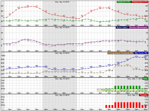
