HOME
FORECAST
Local
Graphical
Aviation
Marine
Rivers and Lakes
Hurricanes
Severe Weather
Fire Weather
Sunrise/Sunset
Long Range Forecasts
Climate Prediction
Space Weather
PAST WEATHER
Past Weather
Astronomical Data
Certified Weather Data
SAFETY
INFORMATION
Wireless Emergency Alerts
Weather-Ready Nation
Brochures
Cooperative Observers
Daily Briefing
Damage/Fatality/Injury Statistics
Forecast Models
GIS Data Portal
NOAA Weather Radio
Publications
SKYWARN Storm Spotters
StormReady
TsunamiReady
Service Change Notices
EDUCATION
NEWS
SEARCH
Search For
NWS
All NOAA
ABOUT
About NWS
Organization
For NWS Employees
National Centers
Careers
Contact Us
Glossary
Social Media
NWS Transformation
Local forecast by
"City, St" or ZIP code
Sorry, the location you searched for was not found. Please try another search.
Multiple locations were found. Please select one of the following:
Location Help
News Headlines
2025 Significant Weather Events
Weather101 Continues
6 To 10 Day Outlook
Customize Your
Weather.gov
Enter Your City, ST or ZIP Code
Remember Me
LOADING...
Nashville, TN
Weather Forecast Office
NWS Nashville Cooperative Observer Locations
Weather.gov
>
Nashville, TN
> NWS Nashville Cooperative Observer Locations
Current Hazards
Submit a Storm Report
Decision Support
Outlooks
Detailed Hazards
Graphical Hazardous Weather Outlook
Local Storm Reports (Text)
Local Storm Reports (Graphical)
Severe Weather Mode
Current Conditions
Observed Precipitation
Satellite
Surface Observations
BNA - 5 Min Obs
CKV - 5 Min Obs
CSV - 5 Min Obs
Graphical Observations
GOES Imagery (Nashville Sector)
MADIS Display
Radar
Nashville (KOHX) - Enhanced Radar
Nashville (KOHX) Local Standard Radar (low bandwidth)
Hopkinsville, KY (KHPX) Local Standard Radar (low bandwidth)
Hytop, AL (KHTX) Local Standard Radar (low bandwidth)
Columbus, MS (KGWX) Local Standard Radar (low bandwidth)
National Radar Enhanced Radar
National Radar Standard Radar (low bandwidth)
Southern Mississippi Valley Local Standard Radar (low bandwidth)
Central Great Lakes Local Standard Radar (low bandwidth)
Southeast Local Standard Radar (low bandwidth)
Forecasts
Probabilistic Precipitation
Hourly View
Forecaster's Discussion
Fire
Aviation Weather
Graphical
Air Quality
Models
Tropical Weather
Winter Weather (Experimental)
Rivers and Lakes
*New* National Water Prediction Service (NWPS)
*New* NWPS - Local View
Precipitation Viewer
River Monitor
Rivers and Lakes Levels
Drought
LMRFC
OHRFC
Climate and Past Weather
Climate Prediction
Drought
State of Tennessee and Middle TN Climate Maps
Additional Middle TN Climate Information
Sunrise & Sunset
Past Weather Events
Local Programs
About Our Office
Outreach
CoCoRaHS
COOP Program
Fire Weather
GIS
Research
SKYWARN
StormReady
Text Products
Tornado Database
tSpotter
Upper Air
Weather Radio
Weather 101
HOME
COOP Locations
Uses and Users of Data
Sources of Data
Get Involved
Training & Resources
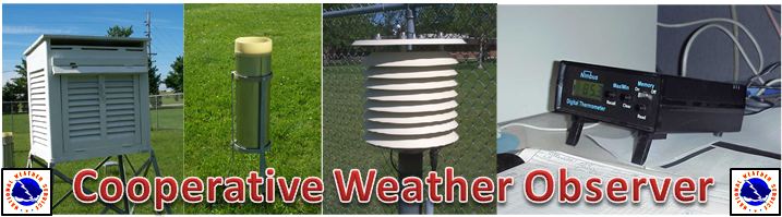
Cooperative Weather Observer Stations in Middle Tennessee
Station
County
Year
Established
Elevation
(ft MSL)
Allardt
Fentress
1949
1675
Ardmore
Giles
2008
885
Bells Bend Nature Center
Davidson
2008
460
Bethpage
Sumner
1953
560
Brentwood
Williamson
1995
707
Byrdstown
Pickett
1998
880
Carthage
Smith
1883
515
Celina
Clay
1903
540
Centerville Water Plant
Hickman
1939
660
Centerville 4NE
Hickman
2000
740
Charlotte WWTP
Dickson
2006
694
Cheatham Lock & Dam
Cheatham
1936
392
Christiana 5W
Rutherford
2004
750
Clarksville Sewage Plant
Montgomery
1854
382
Clarksville Water Plant
Montgomery
1967
496
Coalmont
Grundy
1999
1856
Columbia
Maury
1948
650
Cookeville
Putnam
1884
1090
Crossville Experiment Station
Cumberland
1912
1810
Crossville Airport
Cumberland
1953
1867
Dickson
Dickson
1884
780
Dover/Fort Donelson
Stewart
1892
475
Dover Cross Creeks NWR
Stewart
1965
400
Edgar Evins Marina
De Kalb
1974
642
Fairview Bowie Nature Center
Williamson
2001
820
Fall Creek Falls State Park
Van Buren
1999
1790
Franklin Sewage Plant
Williamson
1879
655
Gainesboro
Jackson
1975
487
Gladeville
Wilson
2001
600
Hartsville
Trousdale
1998
511
Hohenwald
Lewis
1998
980
Jamestown
Fentress
1951
1690
Joelton
Davidson
1999
820
Kingston Springs
Cheatham
1941
517
Lafayette
Macon
1954
975
Lawrenceburg Filtration Plant
Lawrence
1954
870
Lawrenceburg WWTP
Lawrence
2007
790
Lebanon WWTP
Wilson
1985
525
Lebanon 7N
Wilson
1956
510
Lewisburg
Marshall
1888
787
Linden
Perry
1962
498
Livingston
Overton
1961
975
Lobelville
Perry
1997
445
McMinnville
Warren
1883
940
Manchester
Coffee
2000
1070
Monterey
Putnam
1904
1860
Montgomery Bell SP
Dickson
2004
600
Mount Pleasant
Maury
1953
778
Mousetail Landing SP
Perry
2005
450
Murfreesboro Water Plant
Rutherford
1882
550
Murfreesboro Stones River NB
Rutherford
2007
570
Nashville Berry Field
Davidson
1937
580
Neapolis (Spring Hill)
Maury
1975
700
Old Hickory Lock & Dam
Davidson
1954
460
Old Hickory NWS
Wilson
1974
590
Pickett SP
Pickett
1999
1625
Portland
Sumner
1952
794
Port Royal
Montgomery
1961
447
Pulaski
Giles
1957
634
Rock Island SP
Warren
2005
880
Rock Island 2NW
Warren
1939
870
Shelby Bottoms Nature Center
Davidson
2008
405
Shelbyville Airport
Bedford
2008
803
Shelbyville WP
Bedford
1951
760
Smithville
De Kalb
1971
890
Smyrna
Rutherford
1941
550
Sparta
White
1940
1020
Spencer 5NE
Van Buren
2010
885
Springfield
Robertson
1938
745
Tennessee NWR Duck River
Humphreys
2009
430
Tennessee Ridge
Houston
1999
722
Thompson Station
Williamson
2001
760
Tullahoma WTP
Coffee
1883
1022
Tullahoma Duck River UC
Coffee
2009
1020
Warner Park Nature Center
Davidson
2000
625
Wartrace
Coffee
2001
1014
Watertown
Wilson
2001
630
Waverly Airport
Humphreys
2000
749
Waynesboro
Wayne
1884
750
White House
Sumner
2001
820
Woodbury
Cannon
1954
750
Follow us on X
Follow us on Facebook
Follow us on YouTube
OHX RSS Feed