Overview
An impressive cold front and post-frontal moisture brought a batch of light snow to portions of Middle Tennessee on January 20, 2019. The previous day, January 19, started with rain and overcast conditions, which halted for a period of time in the early afternoon hours. Sunshine and blue skies returned for a short period of time in the middle of the afternoon, before quickly returning to an overcast sky. A sharp and well-organized line of moderate to heavy showers pushed through the Mid State directly ahead of the approaching cold front.
While temperatures were falling rapidly behind the front, additional moisture on the back side of a low pressure system was swinging southeast toward Middle TN. By late evening into early Sunday (1/20), temperatures west of I-65 were already in the 30s and continuing to plummet. Eventually, the aforementioned moisture caught up with the intrusion of cold air and produced measurable snowfall, mainly along and north of the Interstate 40 corridor. Amounts ranging from a few tenths of an inch to around 2 inches of snow fell, with the greatest amounts in northwestern Middle Tennessee (Clarksville area). This activity exited east and left behind a frigid air mass, where temperatures dipped well into the 20s and wind chills reached into the teens.
Schaper
Photos & Video
Snow on January 20, 2019
 |
 |
 |
 |
| Snow in Coopertown (Source: Facebook) |
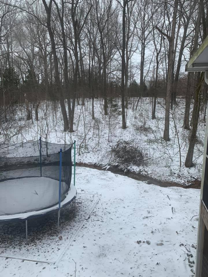
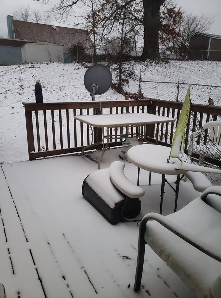
Snow on deck in Clarksville (Source: Facebook) |
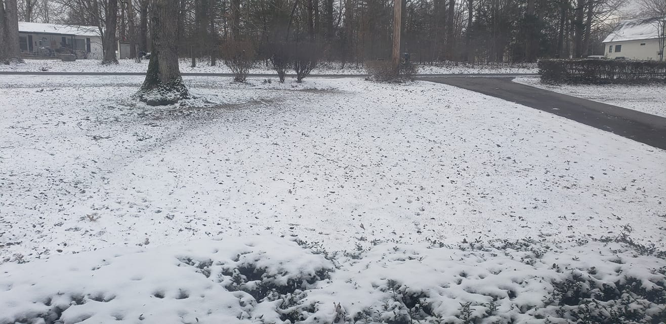
Snow in Kingston Springs (Source: Facebook) |
Snow falling in North Nashville (Source: Twitter) |
 |
 |
 |
 |
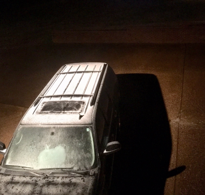
| Snow on vehicle roof in Leiper's Fork (Source: Twitter) |
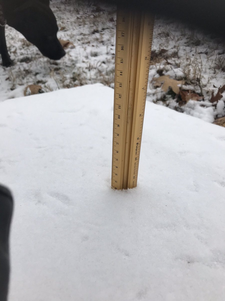
Snow measurement in White Bluff (Source: Twitter) |
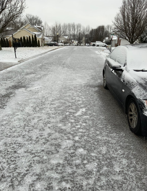
Snow and ice on streets in White House (Source: Twitter) |
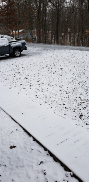
Snow between White House and Millersville (Source: Twitter) |
Storm Reports
PRELIMINARY LOCAL STORM REPORT...SUMMARY
NATIONAL WEATHER SERVICE NASHVILLE TN
636 PM CST MON JAN 21 2019

..TIME...   ...EVENT...      ...CITY LOCATION...     ...LAT.LON...
..DATE...   ....MAG....      ..COUNTY LOCATION..ST.. ...SOURCE....
            ..REMARKS..

1158 PM     SNOW             ASHLAND CITY            36.28N  87.06W
01/19/2019  M1.0 INCH        CHEATHAM           TN   SOCIAL MEDIA

            AN INCH OF SNOWFALL ACCUMULATION PRESENTLY AND MORE
            SNOW FALLING.

0240 AM     SNOW             JOELTON                 36.31N  86.87W
01/20/2019  M1.0 INCH        DAVIDSON           TN   SOCIAL MEDIA

0700 AM     SNOW             WHITE HOUSE             36.47N  86.65W
01/20/2019  M1.0 INCH        SUMNER             TN   NWS EMPLOYEE

            COOP OBSERVER REPORT OF TOTAL SNOWFALL ACCUMULATION.

0700 AM     SNOW             1 NNE PORTLAND          36.60N  86.51W
01/20/2019  M1.0 INCH        SUMNER             TN   COCORAHS

0700 AM     SNOW             1 N GREENBRIER          36.44N  86.80W
01/20/2019  M1.0 INCH        ROBERTSON          TN   COCORAHS

0700 AM     SNOW             10 WSW CLARKSVILLE      36.51N  87.51W
01/20/2019  M2.0 INCH        MONTGOMERY         TN   COCORAHS

0700 AM     SNOW             KINGSTON SPRINGS        36.10N  87.10W
01/20/2019  M1.0 INCH        CHEATHAM           TN   COCORAHS

0700 AM     SNOW             7 SSW DICKSON           35.98N  87.43W
01/20/2019  M1.0 INCH        DICKSON            TN   TRAINED SPOTTER

0700 AM     SNOW             COOPERTOWN              36.44N  86.97W
01/20/2019  E1.0 INCH        ROBERTSON          TN   SOCIAL MEDIA

0700 AM     SNOW             5 NNW CHARLOTTE         36.25N  87.38W
01/20/2019  E1.0 INCH        DICKSON            TN   SOCIAL MEDIA

0700 AM     SNOW             WHITE BLUFF             36.11N  87.21W
01/20/2019  E1.0 INCH        DICKSON            TN   SOCIAL MEDIA

0700 AM     SNOW             3 ESE BON AQUA          35.94N  87.28W
01/20/2019  M0.5 INCH        HICKMAN            TN   COCORAHS

0700 AM     SNOW             10 N CENTERVILLE        35.93N  87.45W
01/20/2019  M0.6 INCH        HICKMAN            TN   COCORAHS

0700 AM     SNOW             5 NW BETHPAGE           36.53N  86.37W
01/20/2019  M0.8 INCH        SUMNER             TN   COCORAHS

0756 AM     SNOW             DOVER                   36.48N  87.84W
01/20/2019  M2.0 INCH        STEWART            TN   EMERGENCY MNGR

            TOTAL SNOWFALL ACCUMULATION REPORT.

0815 AM     SNOW             SPRINGFIELD             36.50N  86.88W
01/20/2019  E0.5 INCH        ROBERTSON          TN   EMERGENCY MNGR

            AROUND ONE HALF OF AN INCH OF SNOWFALL ACCUMULATION.
            SECONDARY ROADS AND BRIDGES STILL HAZARDOUS.

0830 AM     SNOW             CLARKSVILLE             36.56N  87.35W
01/20/2019  E1.2 INCH        MONTGOMERY         TN   EMERGENCY MNGR

            BETWEEN ONE AND ONE AND A QUARTER INCHES OF SNOWFALL
            ACCUMULATION REPORTED ACROSS THE COUNTY.


&&
 |
Media use of NWS Web News Stories is encouraged! Please acknowledge the NWS as the source of any news information accessed from this site. |
|

