Overview
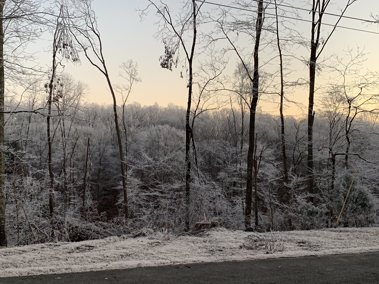
A slow moving upper level storm system brought several rounds of winter weather to much of Middle Tennessee from December 8, 2018 through December 10, 2018. A mix of rain and snow fell early in the day on December 8, with light snow accumulations in some areas. Additional rain spread across Middle Tennessee late in the day on December 8 and continued into the morning hours on December 9. With temperatures near or below freezing across northwest and northern Middle Tennessee, this rain fell as freezing rain generally along and north of a line from Waverly to Joelton to Lafayette, with ice accumulating as much as 1/4" on elevated surfaces like trees, power lines, and cars, as well as a few bridges and overpasses. The weight of the ice brought down several trees, tree limbs, and power lines across Stewart, Montgomery, Dickson, Cheatham, Robertson, and northern Sumner Counties, resulting in scattered power outages for up to 20,000 customers. Lesser amounts of ice also accumulated further south across Houston, Humphreys, Macon, and extreme northern Davidson Counties. The ice also led to several traffic accidents in the Clarksville area.
After a break in precipitation later in the day on December 9, another mix of rain and snow developed across the southeastern half of Middle Tennessee during the night from late on December 9 into the morning hours on December 10. Areas on the Cumberland Plateau received anywhere from 1/2" to 2" of snow, while locations west of the Plateau only received a light dusting (Lawrence County), a trace of snow (Cannon County), or just rain (Rutherford County).
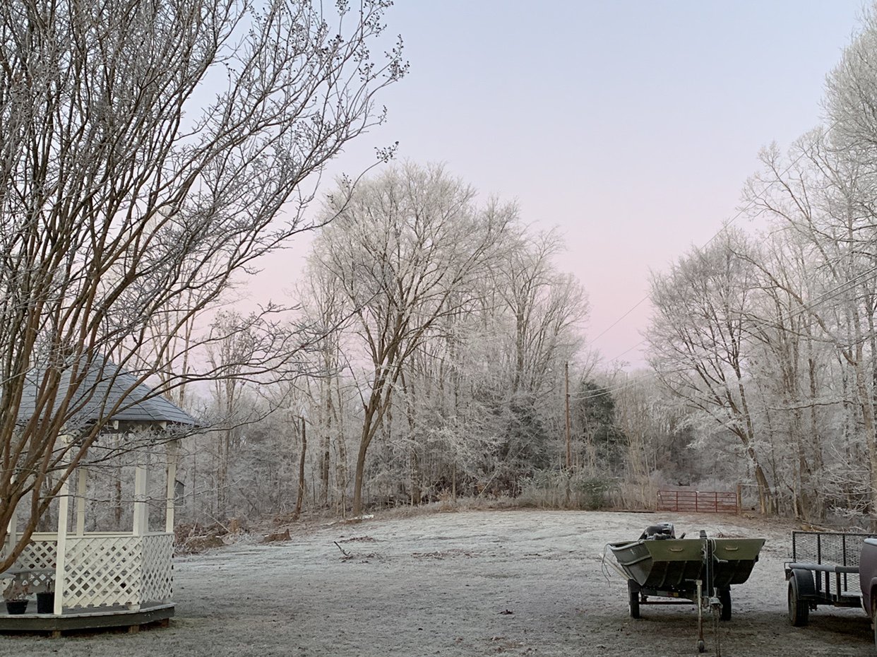
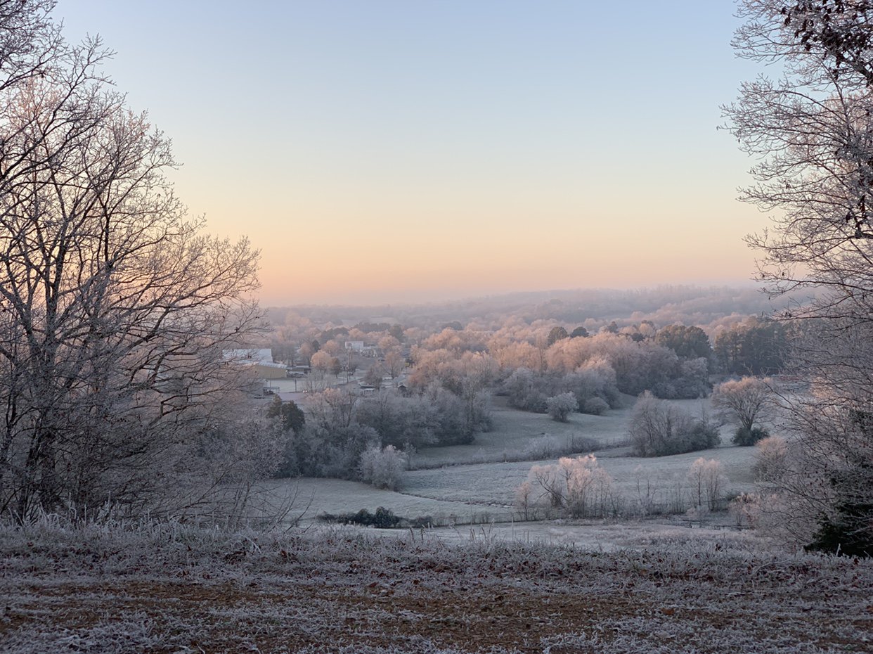
Finally, as the system exited the area on December 10, very cold air moved into Middle Tennessee, with low temperatures dropping into the upper 10s and lower 20s by the morning of December 11. With some ice and snow still present and plenty of low level moisture available, dense freezing fog developed across many areas especially along rivers and lakes such as the Tennessee River, Cumberland River, Duck River, Caney Fork River, and the Obey River. Where freezing fog occurred, ice crystals within the fog attached to nearly all surfaces, resulting in amazing and beautiful winter scenes despite their no precipitation falling.
Photos & Video
Ice/Snow on December 8-9, 2018
 |
 |
 |
 |
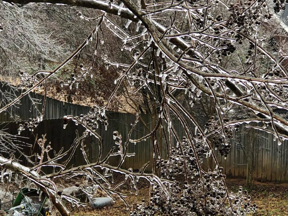
| Ice on trees in White House (Source: Facebook) |
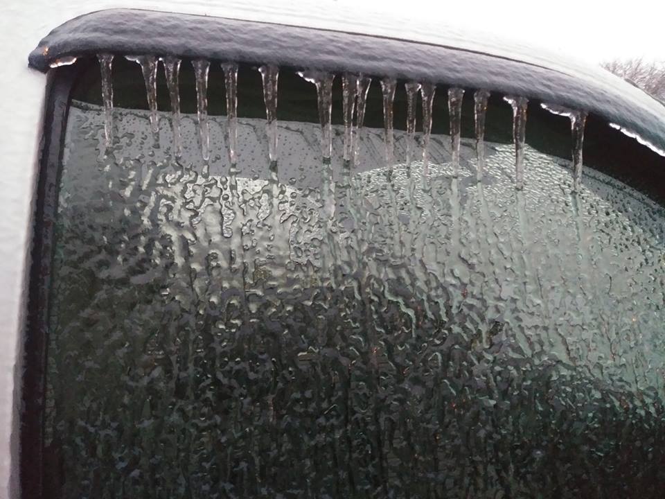
Ice on vehicle windows in Clarksville (Source: Facebook) |
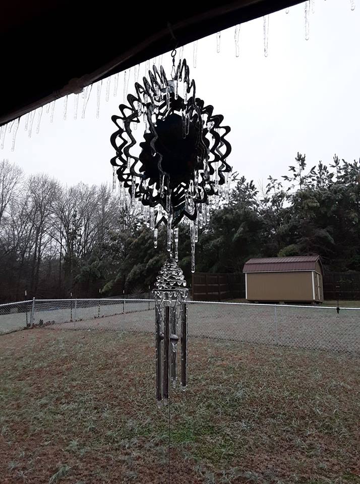
Icicles on wind chimes in Dotsonville (Source: Facebook) |
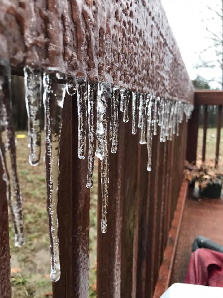
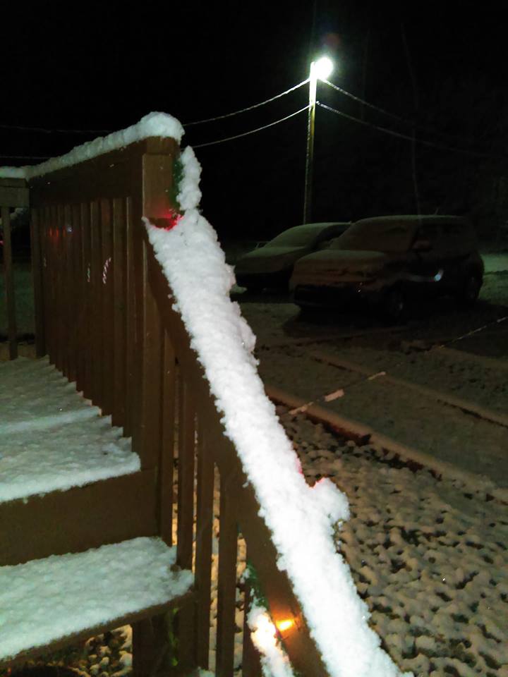
Ice forming on railing in Clarksville (Source: Facebook) |
 |
 |
 |
FB.jpg) |
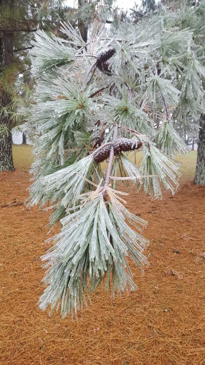
| Ice on pine tree branches in Greenbrier (Source: N/A) |
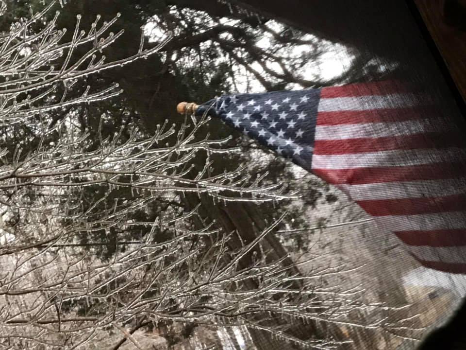
American flag frozen to eaves in Springfield (Source: Facebook) |
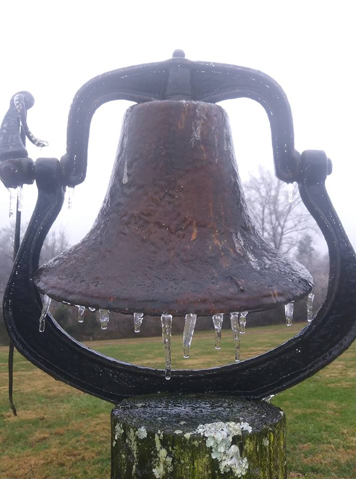
Ice on bell in Lafayette (Source: Facebook) |
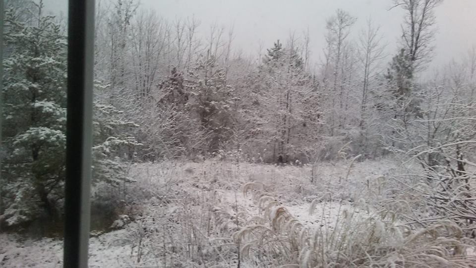
Snow in Grundy County (Source: Facebook) |
Snow on December 10, 2018
 |
 |
 |
 |
| Snow in Tracy City (Source: Facebook) |
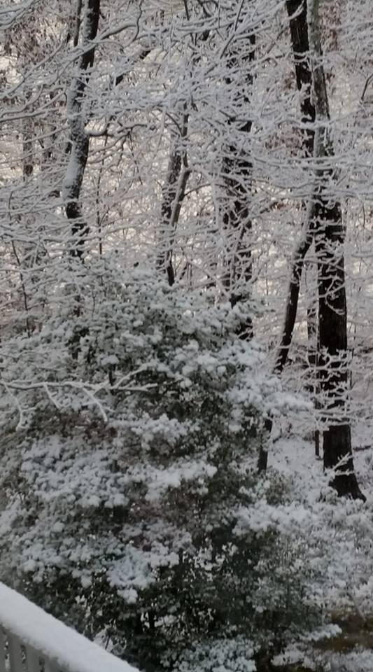
Snow on deck in Cumberland County (Source: Facebook) |
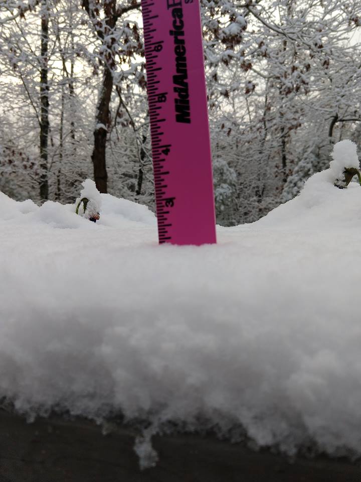
Snow measurement from Fairfield Glade (Source: Facebook) |
Snow on trees in Crossville (Source: Facebook) |
Freezing Fog on December 11, 2018
 |
 |
 |
.jpg) |
| Ice from freezing fog in Perry County (Source: TennesseeWx.com) |
Ice from freezing fog in Perry County (Source: TennesseeWx.com) |
Ice from freezing fog in Perry County (Source: TennesseeWx.com) |
Freezing fog in Maury County (Source: Maury County EMA) |
Storm Reports
PRELIMINARY LOCAL STORM REPORT...SUMMARY
NATIONAL WEATHER SERVICE NASHVILLE TN
1240 AM CST MON DEC 10 2018
..TIME... ...EVENT... ...CITY LOCATION... ...LAT.LON...
..DATE... ....MAG.... ..COUNTY LOCATION..ST.. ...SOURCE....
..REMARKS..
0723 PM FREEZING RAIN GALLATIN 36.38N 86.45W
12/08/2018 E0.01 INCH SUMNER TN SOCIAL MEDIA
TSPOTTER REPORT OF GLAZE OF ICE ON ELEVATED SURFACES.
0728 PM FREEZING RAIN WESTMORELAND 36.56N 86.25W
12/08/2018 E0.01 INCH SUMNER TN SOCIAL MEDIA
TSPOTTER REPORT OF A LIGHT GLAZING OF ICE, ESPECIALLY
ON ELEVATED SURFACES.
0753 PM FREEZING RAIN WHITE HOUSE 36.47N 86.65W
12/08/2018 E0.01 INCH SUMNER TN NWS EMPLOYEE
LIGHT FREEZING RAIN
0825 PM FREEZING RAIN SPRINGFIELD 36.50N 86.88W
12/08/2018 E0.01 INCH ROBERTSON TN SOCIAL MEDIA
TSPOTTER REPORT OF FREEZING RAIN.
0834 PM FREEZING RAIN LAFAYETTE 36.52N 86.03W
12/08/2018 E0.01 INCH MACON TN SOCIAL MEDIA
FACEBOOK REPORT OF GLAZING OF ICE IN NORTHERN MACON
COUNTY.
0840 PM FREEZING RAIN CLARKSVILLE 36.56N 87.35W
12/08/2018 E0.01 INCH MONTGOMERY TN SOCIAL MEDIA
TSPOTTER REPORT OF A GLAZE OF ICE ON ELEVATED SURFACES.
0843 PM FREEZING RAIN GREENBRIER 36.42N 86.80W
12/08/2018 E0.01 INCH ROBERTSON TN SOCIAL MEDIA
TSPOTTER REPORT OF FREEZING RAIN.
0930 PM FREEZING RAIN 5 NNE CLARKSVILLE 36.63N 87.32W
12/08/2018 E0.01 INCH MONTGOMERY TN SOCIAL MEDIA
TSPOTTER REPORT OF ICING ON EXIT RAMP 1 NEAR TRENTON
AND TINY TOWN RD.
0945 PM FREEZING RAIN CLARKRANGE 36.18N 85.02W
12/08/2018 E0.01 INCH FENTRESS TN SOCIAL MEDIA
TSPOTTER REPORT OF FREEZING RAIN ACCUMULATING ON
VEHICLES AND ELEVATED SURFACES.
1045 PM FREEZING RAIN 2 SSE RED RIVER ESTATES 36.51N 87.22W
12/08/2018 E0.01 INCH MONTGOMERY TN SOCIAL MEDIA
TSPOTTER REPORT OF A THIN GLAZE OF ICE.
0103 AM FREEZING RAIN SPRINGFIELD 36.50N 86.88W
12/09/2018 U0.00 INCH ROBERTSON TN SOCIAL MEDIA
FACEBOOK REPORT OF ROADS BECOMING ICY ACROSS ROBERTSON
COUNTY
0106 AM FREEZING RAIN WESTMORELAND 36.56N 86.25W
12/09/2018 E0.10 INCH SUMNER TN SOCIAL MEDIA
TSPOTTER REPORT OF ONE TENTH OF AN INCH OF ICE WITH
CARS COATED IN ICE NEAR WESTMORELAND
0252 AM FREEZING RAIN 4 NNW PARK LANE 36.62N 87.42W
12/09/2018 M0.07 INCH MONTGOMERY TN ASOS
TOTAL ICE ACCUMULATION MEASURED BY THE CKV ASOS THROUGH
3AM CST
0535 AM FREEZING RAIN 4 NW CHAPMANSBORO 36.35N 87.20W
12/09/2018 U0.00 INCH CHEATHAM TN SOCIAL MEDIA
TSPOTTER REPORT AND PHOTO SHOWED SIGNIFICANT ICING ON
TREES IN THE NEPTUNE COMMUNITY
0552 AM FREEZING RAIN 4 NNW PARK LANE 36.62N 87.42W
12/09/2018 M0.17 INCH MONTGOMERY TN ASOS
TOTAL ICE ACCUMULATION MEASURED AT CKV ASOS AS OF 6AM
0604 AM FREEZING RAIN WHITE BLUFF 36.11N 87.21W
12/09/2018 E0.10 INCH DICKSON TN SOCIAL MEDIA
TWITTER REPORT OF UP TO 1/8 INCH OF ICE ON
TREES...CARS...AND GRASS. ROADS JUST WET.
0608 AM FREEZING RAIN WHITE HOUSE 36.46N 86.67W
12/09/2018 U0.00 INCH ROBERTSON TN SOCIAL MEDIA
FACEBOOK REPORT OF ICE WEIGHING DOWN TREES IN WHITE
HOUSE
0615 AM FREEZING RAIN ERIN 36.32N 87.70W
12/09/2018 U0.00 INCH HOUSTON TN SOCIAL MEDIA
FACEBOOK REPORT OF THICK ICE COATING CARS IN HOUSTON
COUNTY
0615 AM FREEZING RAIN SPRINGFIELD 36.50N 86.88W
12/09/2018 U0.00 INCH ROBERTSON TN SOCIAL MEDIA
FACEBOOK REPORT OF SIGNIFICANT ICE ON ELEVATED SURFACES
WITH POWER OUTAGES ACROSS ROBERTSON COUNTY
0642 AM FREEZING RAIN WESTMORELAND 36.56N 86.25W
12/09/2018 E0.20 INCH SUMNER TN SOCIAL MEDIA
TSPOTTER REPORT OF SIGNIFICANT ICING ON ELEVATED
SURFACES WITH A FEW TREE BRANCHES SNAPPED. PHOTO SHOWED
APPX 2/10 OF AN INCH OF ICE ON TREES
0735 AM FREEZING RAIN 2 S OAK HILL 36.04N 86.79W
12/09/2018 U0.00 INCH DAVIDSON TN SOCIAL MEDIA
TSPOTTER REPORT AND PHOTO SHOWED SIGNIFICANT ICING OF
TREES AND POWER LINES ON HILLVIEW DRIVE ABOVE 900 FEET
ELEVATION
0751 AM FREEZING RAIN 2 SE WHITE HOUSE 36.43N 86.64W
12/09/2018 E0.25 INCH SUMNER TN SOCIAL MEDIA
TSPOTTER REPORT AND PHOTO SHOWED APPX 1/4 INCH OF ICE
ON TREES AND ELEVATED SURFACES ON BEN ALBERT ROAD
0824 AM FREEZING RAIN 9 N SPRINGFIELD 36.63N 86.86W
12/09/2018 E0.25 INCH ROBERTSON TN FIRE DEPT/RESCUE
ESTIMATED 1/4 INCH OF ICE ON TREES AND ELEVATED
SURFACES AT ASHBURN ROAD AND HIGHWAY 431 NORTH. NUMEROUS
TREES AND LIMBS DOWN IN ROADS AND POWER LINES DOWN
ACROSS ROBERTSON COUNTY. ROADS JUST WET.
0900 AM FREEZING RAIN LAFAYETTE 36.52N 86.03W
12/09/2018 U0.00 INCH MACON TN BROADCAST MEDIA
FACEBOOK PHOTOS FROM NEWSCHANNEL5 SHOWED SIGNIFICANT
ICING OF TREES ACROSS MACON COUNTY
0955 AM FREEZING RAIN MILLERSVILLE 36.38N 86.69W
12/09/2018 U0.00 INCH SUMNER TN SOCIAL MEDIA
TSPOTTER REPORT AND PHOTO OF A TREE AND POWER LINE DOWN
BLOCKING POLE HILL ROAD
1016 AM FREEZING RAIN 2 ENE DICKSON 36.08N 87.35W
12/09/2018 U0.00 INCH DICKSON TN SOCIAL MEDIA
TSPOTTER REPORT AND PHOTO SHOWED SIGNIFICANT ICING ON
TREES AND ELEVATED SURFACES AT OLD COLUMBIA ROAD AND
HIGHWAY 70
1100 AM FREEZING RAIN 4 NNW PARK LANE 36.62N 87.42W
12/09/2018 M0.25 INCH MONTGOMERY TN ASOS
TOTAL ICE ACCUMULATION MEASURED AT CKV ASOS FOR
FREEZING RAIN EVENT
1107 AM FREEZING RAIN WESTMORELAND 36.56N 86.25W
12/09/2018 E0.25 INCH SUMNER TN SOCIAL MEDIA
TSPOTTER REPORT OF TOTAL ICE ACCUM OF 1/4 INCH ON TREES
AND ELEVATED SURFACE
$$
SHAMBURGER
PRELIMINARY LOCAL STORM REPORT...SUMMARY
NATIONAL WEATHER SERVICE NASHVILLE TN
642 AM CST MON DEC 10 2018
..TIME... ...EVENT... ...CITY LOCATION... ...LAT.LON...
..DATE... ....MAG.... ..COUNTY LOCATION..ST.. ...SOURCE....
..REMARKS..
0330 AM SNOW 6 WSW TRACY CITY 35.24N 85.85W
12/10/2018 E2.0 INCH GRUNDY TN BROADCAST MEDIA
1.5 TO 2 INCHES OF SNOW REPORTED ON THE GROUND AT THE
SUPER 8 IN MONTEAGLE
0407 AM SNOW 3 N FAIRFIELD GLADE 36.04N 84.90W
12/10/2018 E1.8 INCH CUMBERLAND TN SOCIAL MEDIA
FACEBOOK REPORT AND PHOTO SHOWED 1.75 INCHES OF SNOW
ACCUMULATION AT 1600 FT ELEVATION. ROADS WET.
0426 AM SNOW 6 WSW PLEASANT HILL 35.95N 85.31W
12/10/2018 E1.8 INCH WHITE TN SOCIAL MEDIA
FACEBOOK REPORT OF CLOSE TO 2 INCHES OF SNOW ON BON AIR
MOUNTAIN
0451 AM SNOW 9 WSW BIG LICK 35.77N 85.17W
12/10/2018 E1.0 INCH CUMBERLAND TN SOCIAL MEDIA
FACEBOOK REPORT AND PHOTO SHOWED AROUND 1 INCH OF SNOW
ON THE CUMBERLAND/BLEDSOE COUNTY LINE
0526 AM SNOW SPENCER 35.74N 85.46W
12/10/2018 E1.5 INCH VAN BUREN TN SOCIAL MEDIA
TWITTER REPORT OF 1.5 INCHES OF SNOW IN VAN BUREN
COUNTY
0622 AM SNOW CROSSVILLE 35.95N 85.04W
12/10/2018 E1.0 INCH CUMBERLAND TN BROADCAST MEDIA
MEDIA ESTIMATED AROUND 1 INCH OF SNOW FELL IN
CROSSVILLE
0634 AM SNOW 9 ESE MCMINNVILLE 35.63N 85.64W
12/10/2018 M2.0 INCH WARREN TN COCORAHS
COCORAHS STATION MCMINNVILLE 8.5 ESE MEASURED 2.0
INCHES OF SNOW
$$
SHAMBURGER
 |
Media use of NWS Web News Stories is encouraged! Please acknowledge the NWS as the source of any news information accessed from this site. |
|

