Overview
|
After making landfall in the Florida Panhandle, former Tropical Storm Alberto continued northwestward across Alabama and weakened to a tropical depression on May 29. Alberto then moved northward across western Middle Tennessee from the afternoon hours on May 29 into the morning hours on May 30, bringing widespread wind damage and power outages to many counties west of I-65. Additional thunderstorms rotating around the circulation affected Middle Tennessee into the afternoon hours on May 30. |
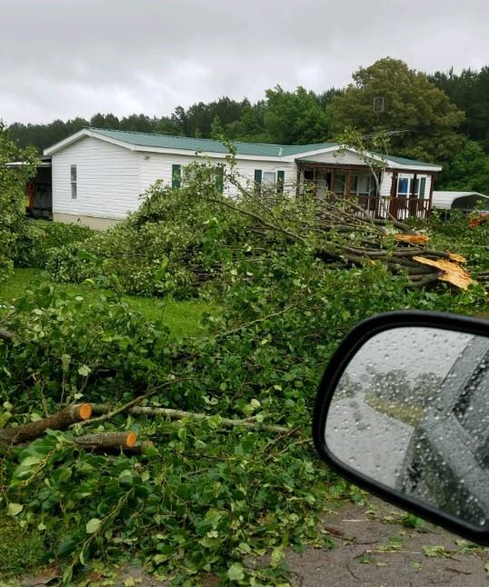
 Tree damage resulting from Tropical Depression Alberto |
Photos & Video
.jpg) |
.jpg) |
.JPG) |
.jpg) |
| Tree damage in Lewis County | Tree damage in Lewis County | Tree snapped in Lawrence County | Trees down in Lawrence County |
.jpg) |
 |
 |
 |
| Minor structural damage in Lawrence County | Tree damage from Tropical Depression Alberto | Tree damage from Tropical Depression Alberto | Tree damage from Tropical Depression Alberto |
Storm Reports
| 05/29/2018 21:00 | LAWRENCE,TN | 2 W JONESTOWN | Tstm Wnd Dmg | NUMEROUS TREES DOWN AND MINOR DAMAGE TO SEVERAL HOMES IN THE NEIGHBORHOOD OF DUGOUT ROAD AND GULLEY DRIVE. WITNESSES REPORTED A TRAMPOLINE BEING LIFTED AND MOVING SOUTH, THEN WEST, THEN NORTH. TIME IS ESTIMATED VIA RADAR. | ||||
| 05/29/2018 21:50 | LEWIS,TN | HOHENWALD | Tstm Wnd Dmg | REPORT OF TREES DOWN AND MINOR DAMAGE TO HOMES IN THE 600 BLOCK OF METAL FORD ROAD. | ||||
| 05/30/2018 22:12 | LAWRENCE,TN | 1 WNW MEADOWVIEW | Tstm Wnd Dmg | RECEIVED REPORTS OF SEVERAL TREES DOWN ON POWER LINES IN DAVID CROCKETT STATE PARK, AND TREES DOWN IN THE CITY. TIME ESTIMATED FROM RADAR. | ||||
| 05/31/2018 20:06 | PUTNAM,TN | ALGOOD | Tstm Wnd Dmg | RECEIVED A REPORT OF A TREE ON A HOUSE IN THE ALGOOD AREA. THE TREE TOOK SOME POWERLINES DOWN TOO. RECEIVED REPORTS OF ADDITIONAL TREES DOWN IN THE SAME AREA. | ||||
| 05/31/2018 20:54 | MACON,TN | 2 WSW KIRBY | Tstm Wnd Dmg | TREE DOWN AT UNION CAMP AND ROYD ROAD. | ||||
 |
Media use of NWS Web News Stories is encouraged! Please acknowledge the NWS as the source of any news information accessed from this site. |
 |