Nashville, TN
Weather Forecast Office
| Overview | |
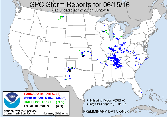
| The largest severe weather event of the Spring of 2016 affected Middle Tennessee on Wednesday, June 15, 2016. A line of strong to severe thunderstorms developed across western Kentucky during the early afternoon hours, then moved southeast across Middle Tennessee through the rest of the afternoon into the evening. These storms produced widespread wind damage to trees, power lines, and several buildings, with nearly 100 reports of wind damage received along with measured wind gusts over 50 mph. |
| Measured Wind Gusts 6/15/16 | |||
| LOCATION | COUNTY | WIND GUST | SOURCE |
| Nashville Int'l Airport | Davidson | 53 mph | ASOS |
| Smyrna Airport | Rutherford | 52 mph | AWOS |
| Clarksville Outlaw Field | Montgomery | 46 mph | ASOS |
| Tullahoma Airport | Coffee | 45 mph | AWOS |
| Dickson Airport | Dickson | 39 mph | AWOS |
| Lewisburg Airport | Marshall | 39 mph | AWOS |
| Columbia Airport | Maury | 31 mph | AWOS |
| Crossville Memorial Airport | Cumberland | 30 mph | ASOS |
| Reports & Radar | |||
| SPC Storm Reports | SPC Event Archive | SPC Main Webpage | |
| Local Storm Reports | Public Information Statement | OHX BR/BV Radar Loop (20 Mb file) | |
| Photos | |
 |
|
| Severe thunderstorms approaching NWS Nashville office in Old Hickory, TN on June 15, 2016 Photo by Sam Shamburger, NWS Nashville Lead Forecaster |
|
 |
 |
| Silo blown over on Kennys Bend Road in Riddleton, TN (Smith County) Photo via Anthony Taylor, @SmithCountyWX |
Large tree blown down on a car in Defeated, TN (Smith County) Photo via Anthony Taylor, @SmithCountyWX |
US Dept of Commerce
National Oceanic and Atmospheric Administration
National Weather Service
Nashville, TN
500 Weather Station Road
Old Hickory, TN 37138
615-754-8500
Comments? Questions? Please Contact Us.
Thank you for visiting a National Oceanic and Atmospheric Administration (NOAA) website. The link you have selected will take you to a non-U.S. Government website for additional information.
NOAA is not responsible for the content of any linked website not operated by NOAA. This link is provided solely for your information and convenience, and does not imply any endorsement by NOAA or the U.S. Department of Commerce of the linked website or any information, products, or services contained therein.
You will be redirected to:

