| Overview | |
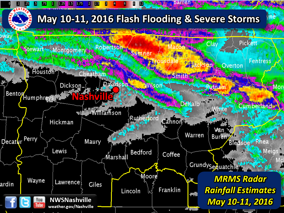
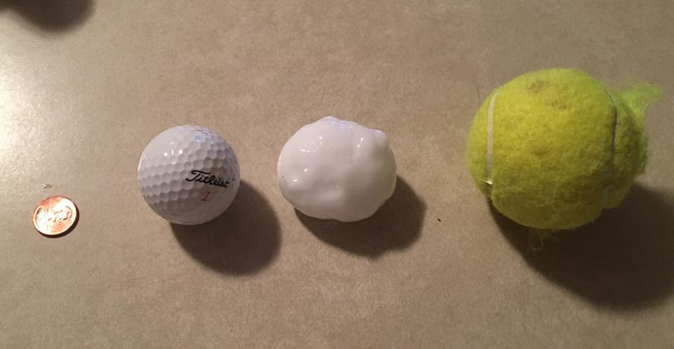
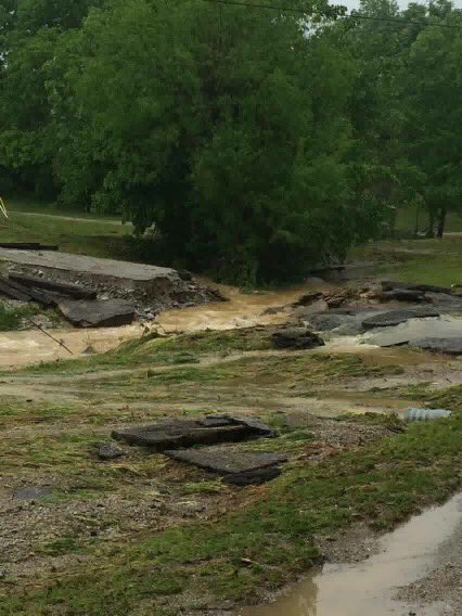
| Numerous severe thunderstorms, including supercells with a few tornadoes, developed across western and central Kentucky during the afternoon hours on May 10. These supercell thunderstorms eventually spread southeast into northern Middle Tennessee late in the evening on May 10 and continued through the morning on May 11. Dozens of reports of large hail as big as the size of tennis balls was reported, along with scattered areas of wind damage. These thunderstorms began training along a northwest-to-southeast oriented boundary early Wednesday morning, and with ample moisture available in the atmosphere, these storms were able to produce significant rainfall amounts and flash flooding. The highest rainfall amounts fell across Sumner, Macon, Trousdale, Smith, and Wilson Counties, which received radar estimated totals and measured amounts ranging from 3" up to 7" of rain (see MRMS radar estimated rainfall map above). The heaviest rainfall amounts fell across northern Sumner County, where 6.21 inches was measured at a CoCoRaHS site 4.5 miles northwest of Bethpage, TN. Numerous homes and businesses were flooded by the heavy rainfall, mainly from northern Sumner county into Macon, Trousdale, and northern Smith Counties, and a large number of roads were closed or washed out due to the flooding. Dozens of water rescues were also conducted across these same areas to rescue people from flooded vehicles and homes. |
| Rainfall Totals 5/10/16 - 5/11/16 | |||
| LOCATION | COUNTY | AMOUNT | SOURCE |
| Bethpage 4.5 NW | Sumner | 6.21" | CoCoRaHS |
| Westmoreland 3.8 WSW | Sumner | 5.12" | CoCoRaHS |
| Hartsville 6.5 SE | Smith | 4.27" | CoCoRaHS |
| Mount Juliet 4.0 SE | Wilson | 3.69" | CoCoRaHS |
| Carthage 8.7 NNE | Smith | 3.20" | CoCoRaHS |
| Hermitage 2.6 E | Davidson | 3.16" | CoCoRaHS |
| Mount Juliet 2.9 WSW | Wilson | 3.09" | CoCoRaHS |
| NWS Nashville | Wilson | 3.00" | Official Obs |
| Nashville Int'l Airport | Davidson | 0.02" | ASOS |
| Reports & Outlooks | |||
| SPC Storm Reports | SPC Event Archive | Local Storm Reports | CoCoRaHS Rainfall Reports |
| Large Hail | |
 |
 |
| Tennis ball-size hail in Hermitage, TN (Davidson County) Photo by Adam Morlan |
Golfball-size hail in Hermitage, TN (Davidson County) Photo by Cindy Shimanski |
| Flash Flooding | |
 |
 |
| Flood Damage on Red Tuttle Road in Bethpage, TN (Sumner County) Photo by Pamela Barnes |
Flooding in Bowmans Branch, TN (Smith County) Photo from @SmithCountyWx |