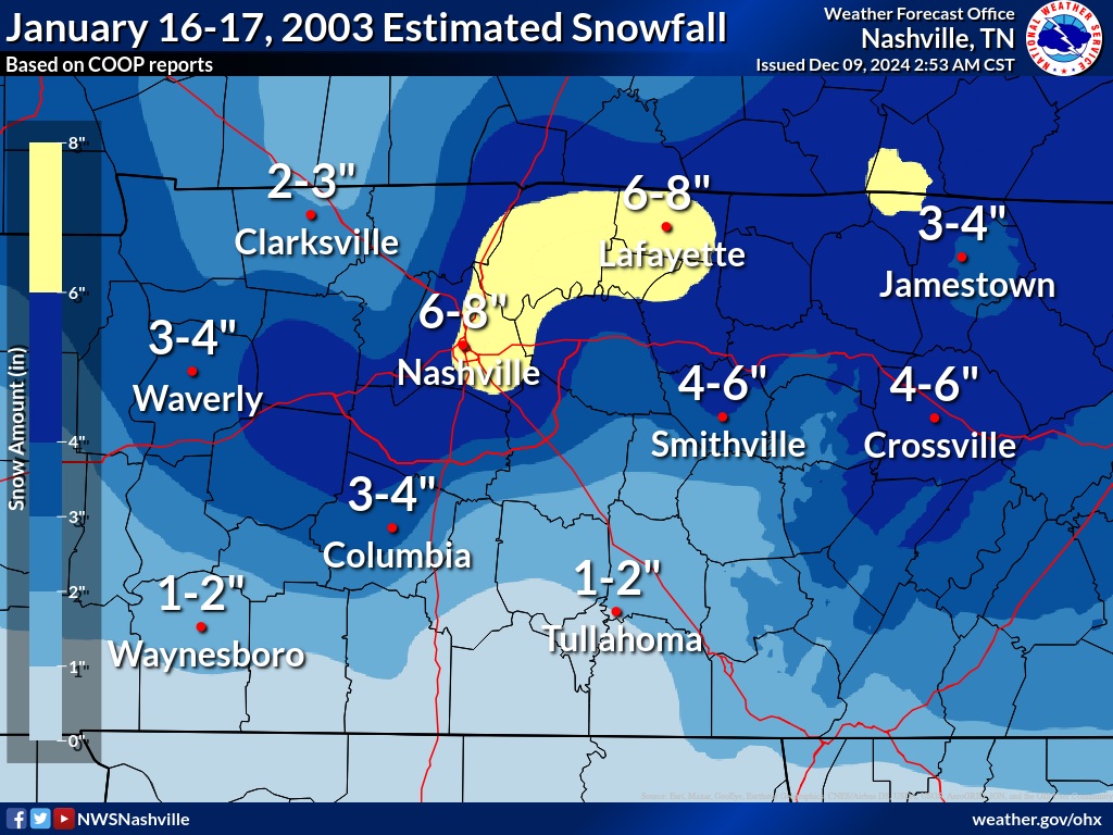
Heavy snow moved into Middle Tennessee faster and heavier than forecasters thought (on the morning of January 16, 2003). There was as much as 8 inches of snow in Gallatin and 7 inches at the NWS Office at Old Hickory. Specific amounts as of 4 PM were:
GALLATIN 8 INCHES (SPOTTER)
GAINESBORO 5 INCHES (SPOTTER)
CLARKSVILLE 4 INCHES (SPOTTER)
CROSSVILLE 3-5 INCHES WITH A FEW 5-6 INCHES. (LAW ENFORCEMENT)
ALLARDT 2.8 INCHES (CO-OP OBSERVER)
DICKSON 5.0 INCHES (CO-OP OBSERVER)
SPARTA 2.8 INCHES (CO-OP OBSERVER)
NWS OLD HICKORY 7.0 INCHES. This amount at NWS OLD HICKORY ties the record snowfall for January 16.
Downtown Nashville had 7 inches of snow by 145 PM CST. 7 inches of snowfall was recorded in Nashville on January 16, 1948.
The snow began to fall in the Metro Nashville area around 8 AM. The snow shut down the city with schools, businesses and government agencies shutting down early. Motorists were stranded in slow-moving or non-moving traffic. It took hours to get cross town. Tractor trailer trucks could not move on the interstates or jack-knifed, which resulted in grid lock. Since schools let out early, parents rushed to pick them up. Schools closed at 9 AM, right in the middle of the storm. Many school buses were stranded in the snow and some students didn't get home until 10 PM. At one point, 60 buses were stranded throughout the city. Also, some students were kept in schools with food, heat and water. Other students were sent home with teachers or school officials with 4 wheel drive vehicles. Parents were angry because students were either kept at school or because their child had to ride in 4 wheel drive vehicles with strangers. I-65 was backed up for 5 hours from Nashville to the Kentucky border. A newspaper story stated that many motorists had to relieve themselves in their vehicles because of the grid lock. |
|
|

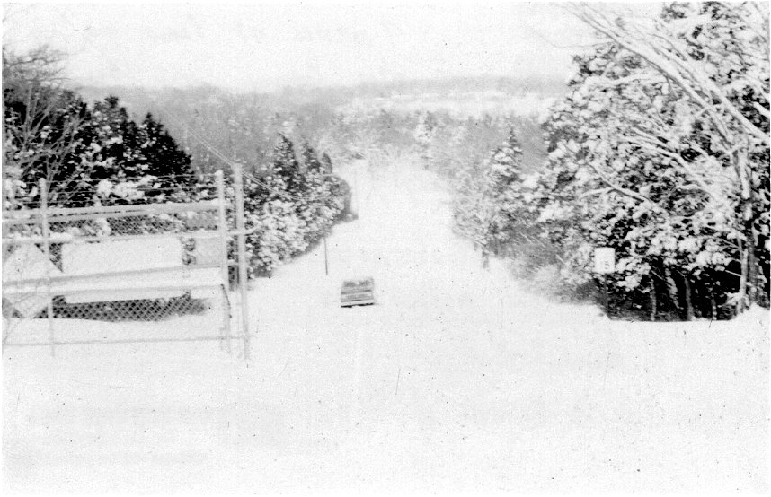
Car stranded in 7 inches of snow at NWS Nashville on January 16, 2003. Photo by Bobby Boyd.
|
|
