Nashville, TN
Weather Forecast Office
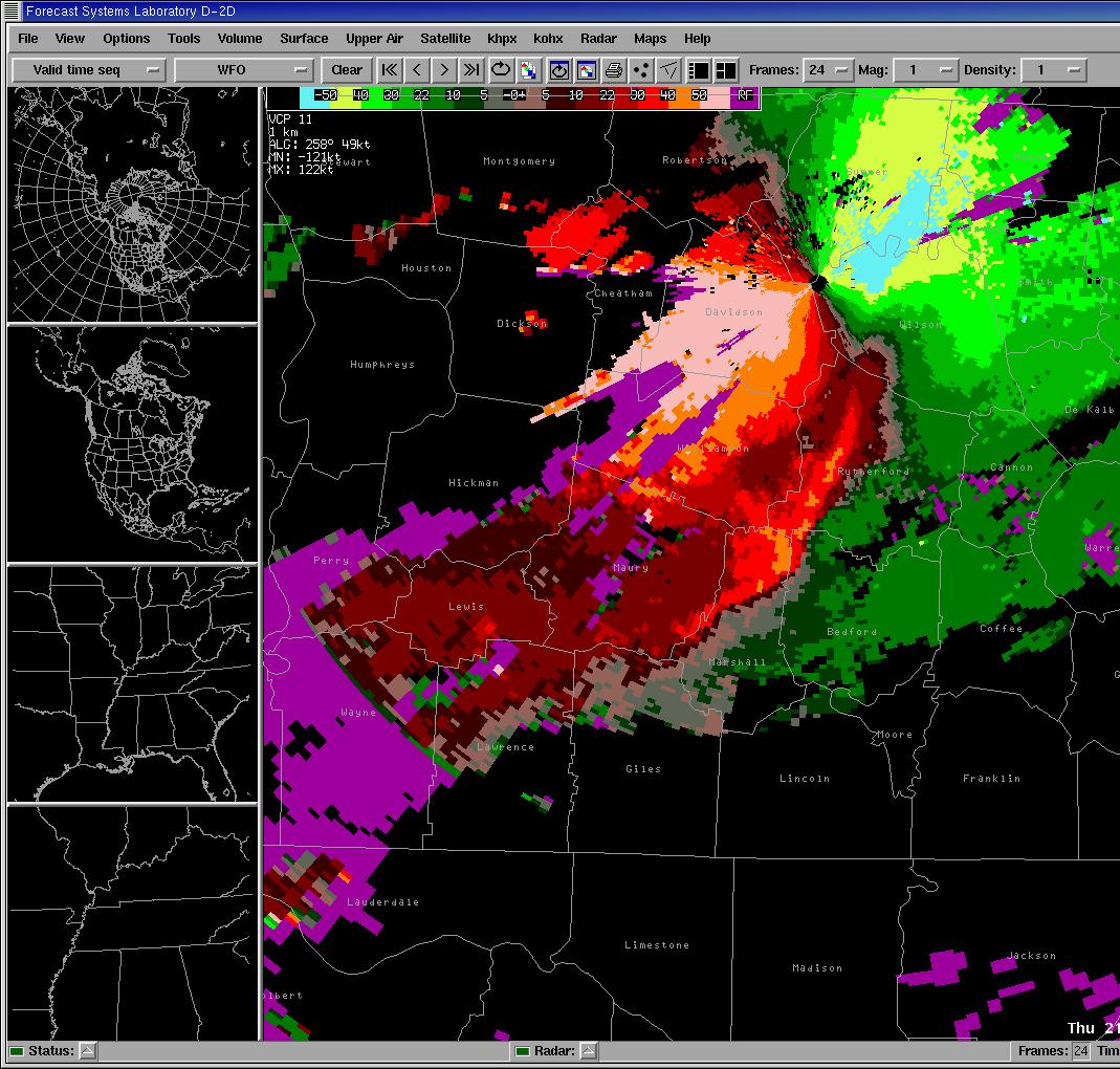
A line of strong thunderstorms moved through the southern half of middle Tennessee Thursday evening, ahead of a fast moving cold front. As the line of storms moved through Williamson and Maury Counties and crossed I-65, one storm in the line advanced ahead of the rest of the line. This phenomenon is called a "bow echo" due to the bow look (see Figure 1) to the line. A bow echo can produce very strong winds as the advancing thunderstorm taps into the available energy ahead of the other storms in the line.
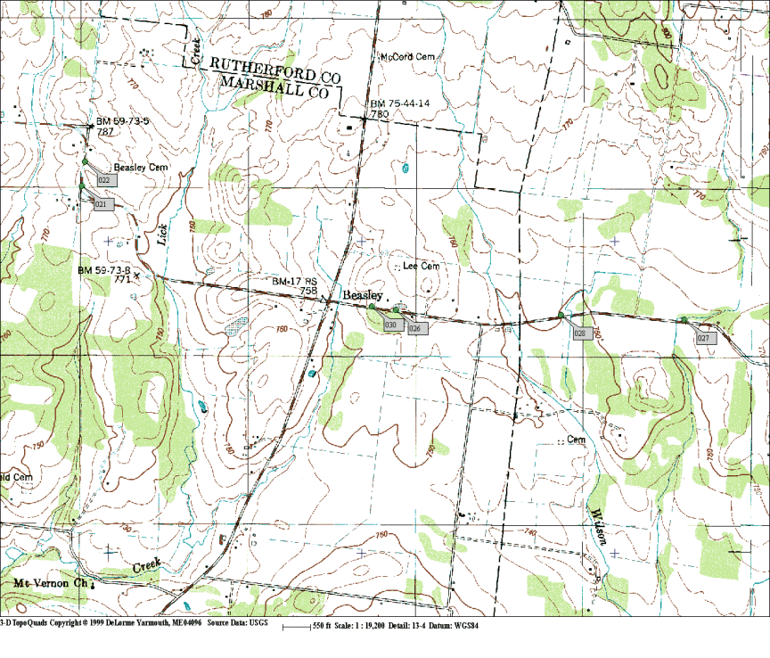
National Weather Service Doppler radar indicated wind speeds of 80 to 90 knots (90 to 100 mph) at 3,000 feet above the ground (see Figure 2) as the storms moved into Marshall County. A thunderstorm downburst, a violent flow of air from a thunderstorm, usually as the storm decays, occurred over the Holts Corner area of Marshall County (see Figure 3), near the intersection of Highway 31A and Beasley Road.
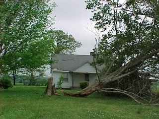
A roof built over a mobile home was blown off and carried over 30 feet in Holts Corner. Several homeowners experienced tree damage with most trees uprooted, however a few trees were snapped off in the high winds. The line of storms advanced to the east at 50 mph causing isolated damage along a path 7 miles long. A tin roof was blown off a large barn and some minor roof damage to a few homes. After the bow echo crossed Highway 99, near the end of its life-cycle, several large trees were broken off and/or uprooted in an open area near a farm. Some of the last damage associated with this storm was located at the Bedford County line, including a flag pole bent over and nearly touching the ground.
No tornadic indications were observed with this storm, either on radar or during the storm survey. Wind speeds on the ground were estimated at 70 to 80 mph. Several reports of dime-sized hail were associated with this storm as well.
Thanks to the public and SKYWARN spotters for the numerous and prompt reports, and to the Marshall County EMA for their help.

Figure 1: Bow Echo signature on radar reflectivity

Figure 2: Bow Echo signature on radar velocity

Figure 3: Map of damage in Holts Corner area


Ralph Troutman
Data Acquisition Program Manager
Michael Davis
Information Technology Officer
US Dept of Commerce
National Oceanic and Atmospheric Administration
National Weather Service
Nashville, TN
500 Weather Station Road
Old Hickory, TN 37138
615-754-8500
Comments? Questions? Please Contact Us.

