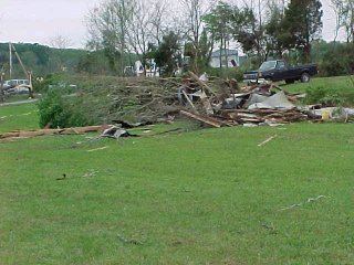
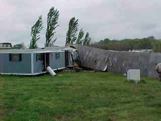
This afternoon officials of the National Weather Service Office in Nashville conducted a ground survey of the storm that occurred yesterday evening in the Wartrace area in Bedford County.
It was determined from the damage characteristics that it was caused by a tornado having an intensity of F1 (73 to 112 miles an hour) on the Fujita tornado intensity scale. The scale ranges from F0 to F5 with a 5 being the strongest.
The tornado first touched down about two and one half miles west of Wartrace at the intersection of Railroad Avenue and Horse Mountain Road, having an intensity of F1 (73 to 112 miles an hour) and a width of about 200 feet.
After the initial touchdown, the tornado moved east about one tenth mile and then diminished rapidly to F0 intensity (40 to 72 miles an hour), and continued east for another one and nine tenths miles before lifting back into the clouds. The total path length is estimated to be two miles.
The greatest amount of damage and the fatality occurred near the beginning of its track where the tornado had its greatest intensity. The damage included some large trees that were uprooted and snapped, roof damage to one house, moving both a house and mobile home off their foundations, and overturning a nearby mobile home.
Regarding the fatality, local law enforcement mentioned that as the storm approached, a man got back in a small pickup truck to escape the impending rain and hail. The tornado then struck and moved or rolled the truck across a field and through a barn, causing or aiding the barn being destroyed. The truck ended up in a creekbed over 350 feet away. The man was thrown from the truck and was found underneath the vehicle in the creekbed.
Only sporadic damage occurred after the tornado weakened, with roof damage to several barns and out buildings, some twisting, snapping, and uprooting of some trees, and a few power poles snapped.
Using the advanced technology of Doppler radar, the National Weather Service was able to identify rotation within the storm and issue a tornado warning more than 30 minutes in advance of the touch down. A tornado warning was issued for Bedford County at 641 PM and was valid until 730 PM. The Bedford County Emergency Management Agengy estimated the fatality occurred at 714 PM, and tornado touchdown occurring perhaps a minute or two earlier.


Henry Steigerwaldt
Science and Operations Officer
Ralph Troutman
Data Acquisition Program Manager