Nashville, TN
Weather Forecast Office
| Overview |
|
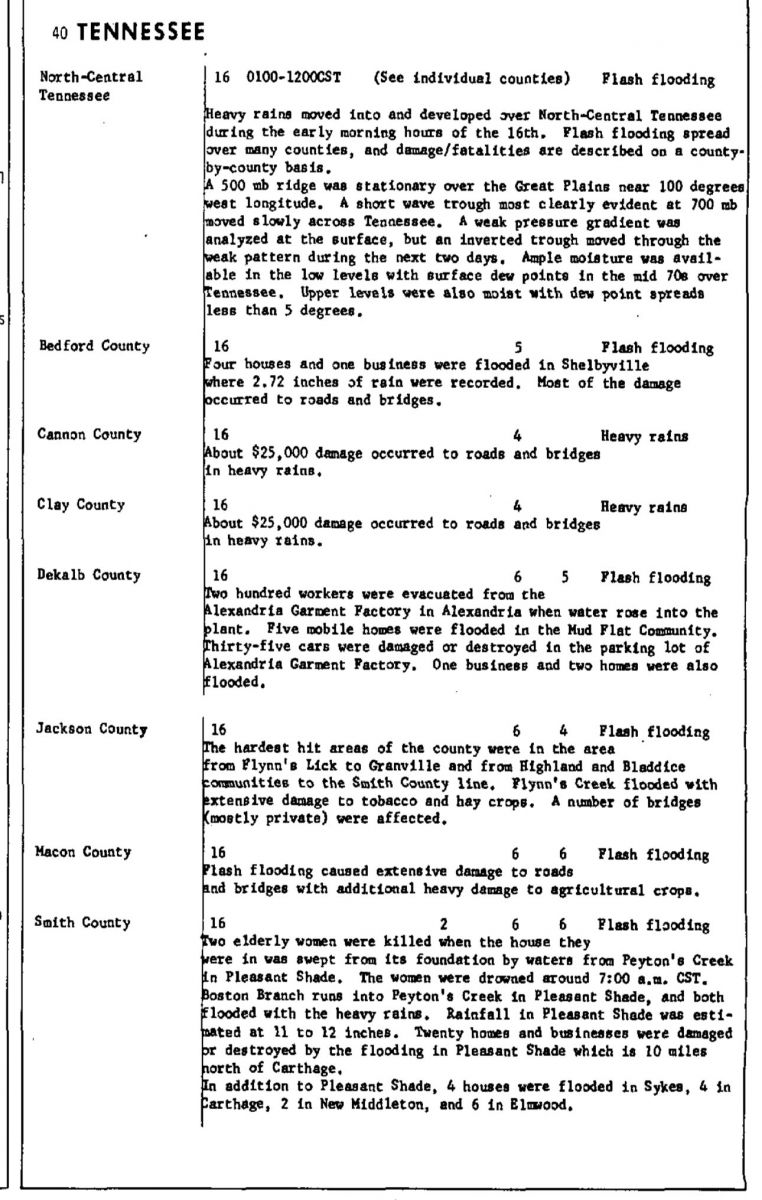
FROM AUGUST 1982 STORM DATA PUBLICATION: Heavy rains moved into and developed over North-Central Tennessee during the early morning hours of the 16th. Flash flooding spread over many counties, and damage/fatalities are described on a county-by-county basis. A 500 mb ridge was stationary over the Great Plains near 100 degrees west longitude. A shortwave trough most clearly evident at 700 mb moved slowly across Tennessee. A weak pressure gradient was analyzed at the surface, but an inverted trough moved through the weak pattern during the next two days. Ample moisture was available in the low levels with surface dewpoints in the mid 70s over Tennessee. Upper levels were also moist with dewpoint spreads less than 5 degrees. |
| Storm Data | |
 |
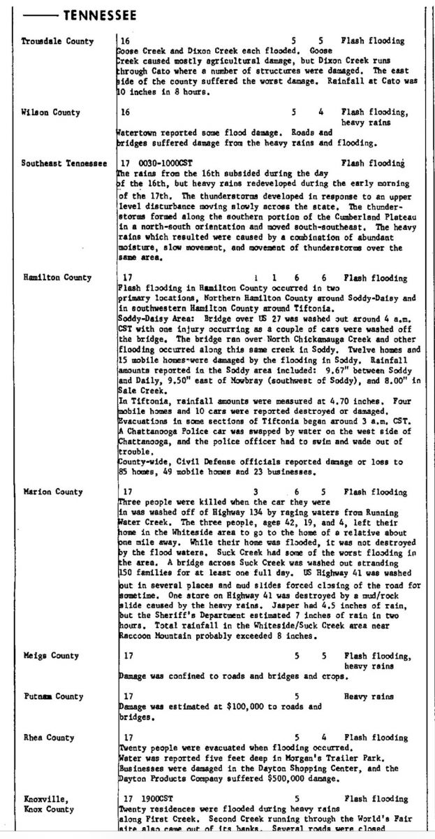 |
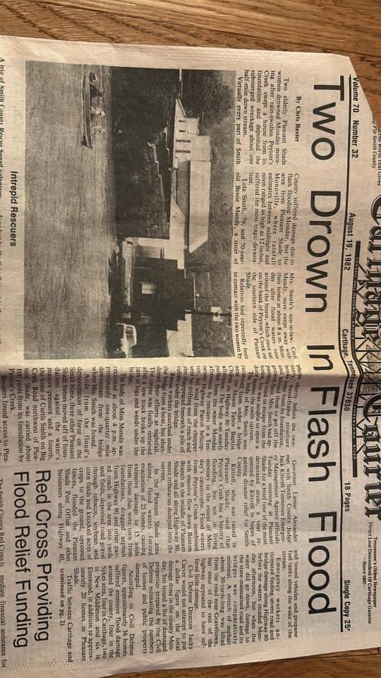
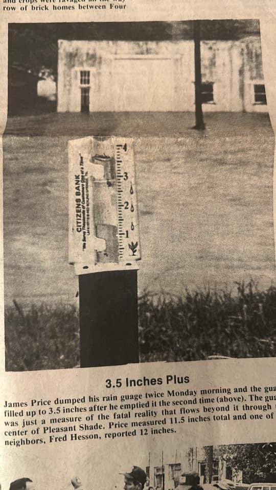
| Smith County Flash Flood | |
|
|
|
|
|
|
 |
 |
 |
 |
|
|
|
 |
|
 |
 |
 |
 |
US Dept of Commerce
National Oceanic and Atmospheric Administration
National Weather Service
Nashville, TN
500 Weather Station Road
Old Hickory, TN 37138
615-754-8500
Comments? Questions? Please Contact Us.

