 One of the strongest El Niño events on record is starting to weaken as the winter of 2023-2024 enters its final days.
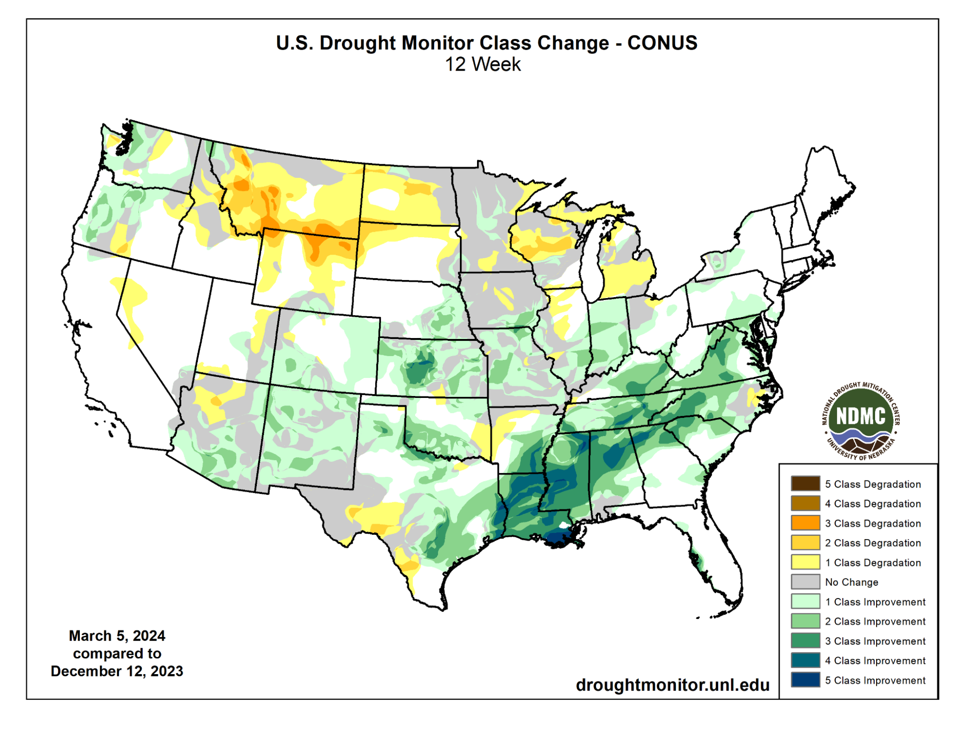
This warm phase of the pattern in the Pacific Ocean known as the El Niño Southern Oscillation, or ENSO, helped steer atmospheric rivers into the western United States. El Niño brought welcome drought relief across much of the southern tier of the country. In fact, areal coverage of drought conditions across the US and Puerto Rico has dropped dramatically from the peak in October of last year, when more than a third of the country was at least in moderate drought.
Now, that number is down to less than 20%, and the areas in extreme or exceptional drought have been nearly eliminated from the map. This is in part because the El Niño-influenced storm track has brought rain and some snow to places that needed it most, like the southern Plains and Gulf Coast states.
According to experts at NOAA’s Climate Prediction Center, winter is a favorable time of year for drought relief, as the lower sun angle means less precipitation is lost to evaporation. Winter precipitation also tends to be less intense, with fewer instances of heavy downpours more typically seen in thunderstorms. This means more precipitation absorbs into the soil with less runoff – especially in the South, as the ground is not frozen even in the coldest winter months.
On the flip side, El Niño conditions led to a less-active storm track and above-average temperatures in the northern tier of the US over the winter. As a result, snowfall in the Upper Midwest and Northern Great Plains was well below average. While below-average snowfall lowers the region’s flood risk, it also means that there’s not as much water available to start the growing season. Exacerbating the situation is that parts of these areas are already in Moderate to Severe drought.
The Climate Prediction Center expects the drought to continue or even worsen this spring, as El Niño’s influence is likely to extend at least through the month of April. And even with a return to ENSO Neutral (the absence of El Niño or La Niña), likely to happen later this spring, the CPC outlook still favors above-normal precipitation for the Southeast during the April-May-June time frame, and equal chances of below, near, and above average precipitation in the northern and central Great Plains.
NOAA’s Climate Prediction Center will issue its full Spring Outlook, including flood and drought outlooks, on Thursday, March 21. Find temperature and precipitation outlooks with lead times up to 13 months on the Climate Prediction Center’s website.