 |
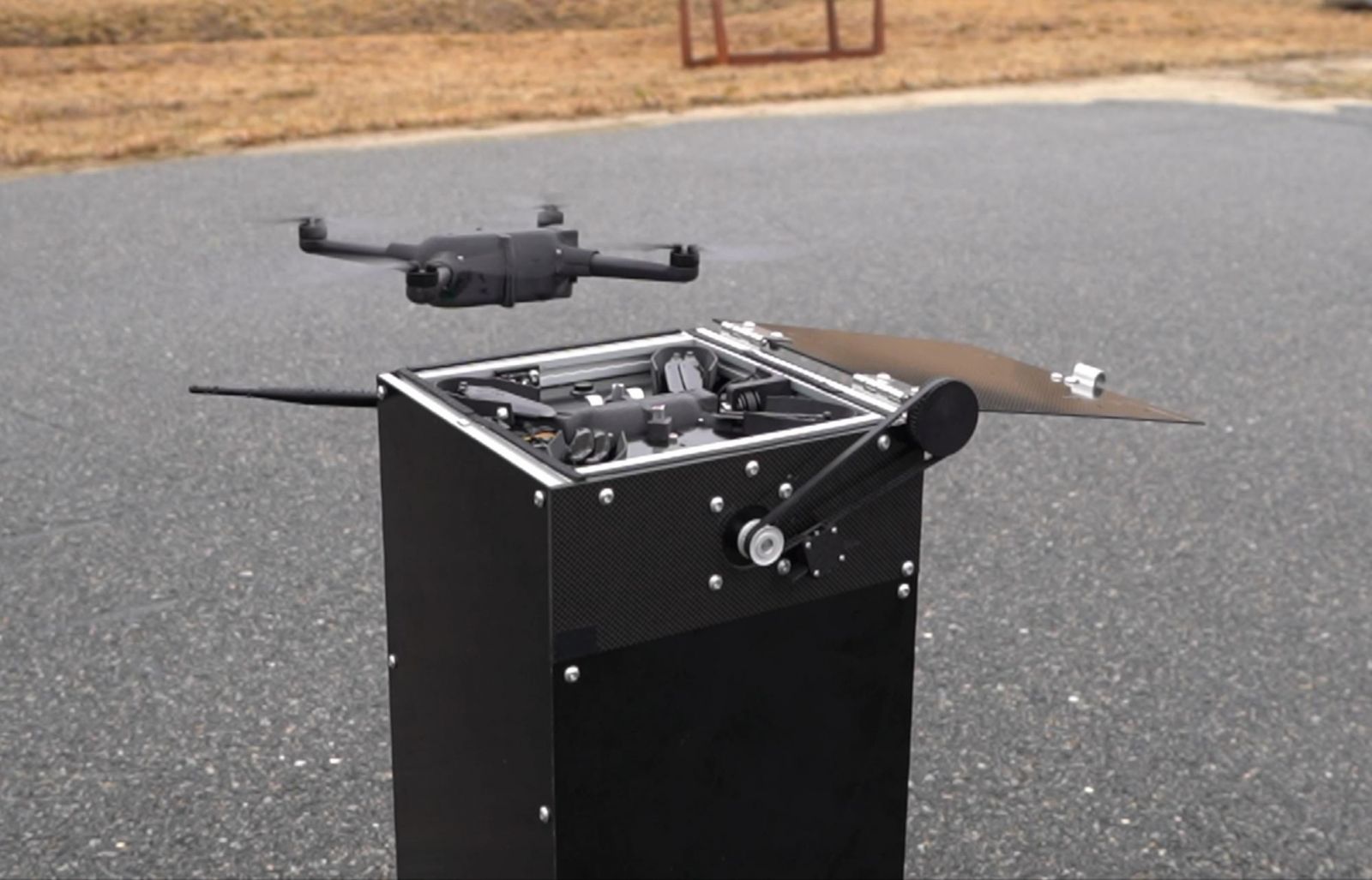
| GreenSight’s WeatherHive collects atmospheric measurements to help forecast the weather. A “hive” has 10 nano drones, each can fly up to 5 kilometers in altitude and 10 kilometers laterally in a single flight and automatically launch and land in their “hive” for recharging and reuse. (Credit: GreenSight) |
June 10, 2024 - NOAA’s National Weather Service (NWS) and GreenSight signed a one-year Cooperative Research and Development Agreement to deploy an uncrewed aircraft system, called WeatherHive, to measure atmospheric conditions and evaluate if the data could aid in weather forecasting. The demonstration project will take place in and around Tulsa, OK. The NWS plans to expand testing to other sites later this year.
WeatherHive’s uncrewed nano drones, called WISPs, gather real-time atmospheric measurements – pressure, temperature, humidity, and wind speed and direction – that can be used to forecast the weather. Each “hive" contains 10 WISPs spanning a 300-square-kilometer area reaching altitudes up to five kilometers, generating a 3D cube of measurements. Operating in rain or shine and winds up to 39 mph, WeatherHive provides critical observations within the planetary boundary layer that can be used for weather forecasting.
Dozens or hundreds of WeatherHive’s drones can be used at once to gather large quantities of data. Remotely deployable, the palm-sized drones automatically launch and land in their “hive” for recharging and reuse. The fully autonomous system provides approximately 50 minutes of sampling per flight that can be repeated continuously.
“We are excited to test and evaluate WeatherHive’s observations to determine if the data could be useful to our forecasters,” said Steven Piltz, Meteorologist in Charge of the National Weather Service office in Tulsa. ”We are also looking at what height they can fly safely during severe weather.”
“WeatherHive has enormous potential to benefit the weather forecasting community and the nation as a whole, enhancing forecast accuracy to enable better planning and save lives,” said James Peverill, CEO and Co-founder of GreenSight. ”We are looking forward to collaborating with NOAA and working closely with the NWS in Tulsa.”
Under the CRADA, NOAA and GreenSight will:
The project will be conducted in parallel with traditional special sounding deployments.
NOAA regularly partners with private sector companies through CRADAs to conduct research and development work that is mutually beneficial and helps to accomplish NOAA’s mission.
WeatherHive technology was developed in partnership with the National Science Foundation's America’s Seed Fund.
Media contact: Maureen O’Leary, nws.pa@noaa.gov, 202-578-5257

