|
|
“Daniel Bennett was officiating Sunday services before 600 to 700 people when he heard an electronic warning tone. Then another. And another.
‘I'd say probably two dozen phones started going off in the service, and everybody started looking down,’ he said.
What they saw was a text message from the National Weather Service cautioning that a twister was in the area. Bennett stopped the service and ushered everyone to a safe place until the threat passed.”
- Forecasts, warnings spared lives from tornadoes, Associated Press, November 18, 2013
NOAA’s Weather-Ready Nation initiative is about building community resilience in the face of increasing vulnerability to extreme weather and water events.
The devastating impacts of extreme events (such as the November 2013 tornadoes in Illinois) can be reduced through improved readiness. NOAA and many government, media, private sector and academic partners are working together to make the nation more weather ready.
The Weather-Ready Nation (WRN) initiative began in 2011, in response to deadly tornadoes that struck Joplin, MO and Birmingham, AL. Following those storms, NOAA’s National Weather Service (NWS) realized the need to do more than just issue warnings – NWS needed to better understand how to get people to respond to the warnings. The NWS support chain, from NOAA’s research arm to NOAA’s satellite service and other associated science and technology elements, is focused on efforts to help improve NWS operations and ultimately better serve the nation. The end goal is to save lives and livelihoods by providing better information for better decisions. A Weather-Ready Nation requires the collective effort of the whole community that include other government agencies and emergency managers, researchers, the media, insurance industry, non-profits and the private sector united in the shared goal of weather preparedness.
Since the launch of the initiative in 2011, NOAA and the NWS have made some great progress.
Through operational initiatives, NWS is transforming its operations to help America respond. In 2013 NWS released the Weather-Ready Nation Roadmap 2.0. The Roadmap blends an understanding of social and physical sciences and lends itself to building community resilience in the face of increasing vulnerability to extreme weather and water events. The Roadmap reiterates a commitment to working with the Weather Enterprise and the plan provides the agency an ability to meet new challenges over the coming years through a flexible and agile business structure.
Along with the Roadmap, the initiative has had some great success.
|
|
NOAA is directing research through external grants and through its network of laboratories and cooperative academic institutes, to focus not only on improving scientific understanding of severe weather, develop new technologies and improve models, but also on sociological challenges which may help improve the likelihood that people will take prompt action to save lives when they receive a warning.
From massive supercomputers to innovative pilot projects, NOAA pursued a comprehensive strategy to build a Weather-Ready Nation through 2011 and into 2013:
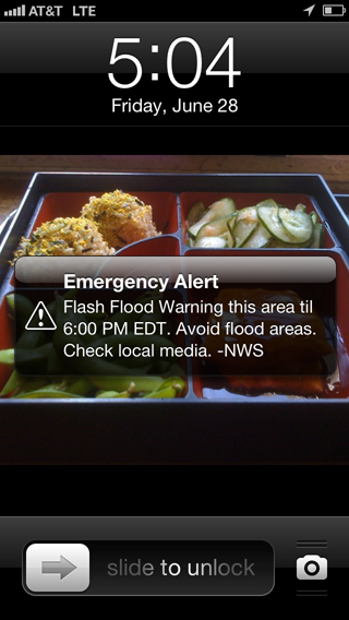
Wireless Emergency Alerts
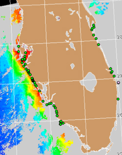
Wireless Emergency Alerts are weather warnings that are provided directly to cellphones and began being implemented in April of 2012. With no sign-up required, the alerts are sent directly to WEA-capable phones. By providing advanced weather warnings, this groundbreaking technological development saved lives during the November, 2013, tornado outbreak in Illinois.
Dual-pol Radar Upgrades Completed
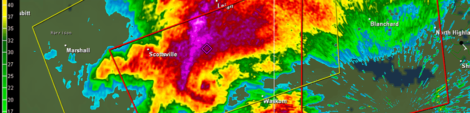
NWS completed dual-polarization upgrades in April of 2013– concluding the 122 NWS radar site upgrades throughout the country. This new advanced technology, the result of decades of investment in research and development, is helping federal weather forecasters more accurately track, assess and warn the public of approaching high-impact weather.
NWS Doubles Computing Capacity
Whizzing through 213 trillion calculations per second, newly upgraded supercomputers of NOAA’s National Weather Service are now nearly three times as fast in processing sophisticated computer models to provide more accurate forecasts further out in time.
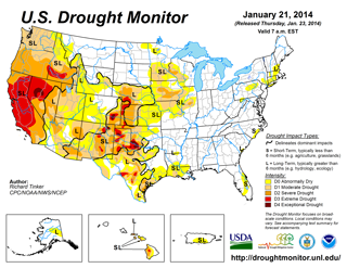
NOAA Joins National Drought Resilience Partnership
As part of the President’s Climate Action Plan, the Administration launched a National Drought Resilience Partnership (the Partnership). The Partnership makes it easier for communities to access the drought assistance they need by promoting strong partnership and information sharing at all levels of government. In addition, NOAA’s Climate Prediction Center began a new monthly drought outlook product.
|
|
With the addition of this product, the NOAA drought outlook suite now contains a Seasonal Drought Outlook (3-month) released on the 3rd Thursday of the month and the Monthly Drought Outlook released on the last day of month. NWS developed this short-term product to more accurately reflect evolving drought conditions across the U.S. The new monthly outlooks are now possible due to improvements in model forecasts and associated post-processing as reflected in extended range forecasts (e.g. 6-10 day, 8-14 day, monthly, etc.).
Louis W. Uccellini Selected as NWS Director
In 2013, Louis W. Uccellini, Ph.D was named Director of the National Weather Service. He has become a powerful advocate for the vision of a Weather-Ready Nation, travelling around the country to speak and present on the importance of weather preparedness.
Pilot Projects Help Build Weather-Ready Nation
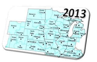
NWS, in partnership with the National Weather Service Employees Organization, is working on six pilot projects designed to build a Weather-Ready Nation and are being developed in the following locations:
The Weather-Ready Nation pilot projects enhance the protection of lives and livelihoods through three key elements of the projects:
Researchers Develop Method to Better Predict Severity of Tornado Outbreaks
Using new experimental high-resolution forecast models, researchers have developed a method to help forecasters better predict the severity of tornado outbreaks. Researchers found that the amount of rotation in the rapidly rising air within simulated storms – a measure known as updraft helicity -- was strongly related to the track-length of observed tornadoes in previous severe weather events. These results show the potential for forecasters to use this measure to make very reliable predictions of the magnitude of spring season tornado outbreaks. A report on this work by scientists at NOAA’s National Severe Storms Laboratory and the NOAA Cooperative Institute for Mesoscale Meteorological Studies at the University of Oklahoma is available online.
NOAA Funds University and Federal Researchers to Advance Hurricane Forecasting
NOAA’s Office of Weather and Air Quality has funded several multi-year proposals totaling $1.3 million for university partners and federal scientists to more rapidly and smoothly transfer new technology, research results, and observational advances through NOAA’s Joint Hurricane Testbed (JHT) to operational hurricane forecasting. The research will focus on: improving important hurricane models; testing new algorithms to better identify a storm's center; developing a visualization tool for assessing storm surge and inundation threats; improving confidence in hurricane intensity forecasts; prediction rapid intensification of tropical cyclones; and estimating wind speed and duration inside a hurricane.
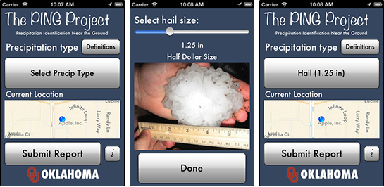
New Smart Phone App Lets Public Report Rain, Hail, Sleet and Snow to NOAA: Public Reports Will Aid Weather Research
The NOAA National Severe Storms Laboratory, in partnership with the University of Oklahoma, launched a free app for users to anonymously report precipitation from their Apple or Android mobile device. With the mPING app, anyone can send a weather observation on the go. The user simply opens the app, selects the type of precipitation that is falling at his or her location, and presses submit. The user’s location and the time of the observation are automatically included in the report. All submissions become part of a research project called PING – Precipitation Identification Near the Ground. NSSL and OU researchers are using the mPING submissions to build a valuable database of tens of thousands of observations from across the United States.
|
|
Experimental High-Resolution Atmospheric Model Improved, Prepared for Operational Use
The 2013 High-Resolution Rapid Refresh experimental atmospheric model (HRRR) was recognized as a significant improvement by community users in the aviation, renewable energy, and severe storm forecasting communities. In 2013, NOAA Research completed development of improved version of three-kilometer storm-scale hourly updated High-Resolution Rapid Refresh (HRRR) model, raising forecaster confidence in HRRR. The 2013 HRRR also generated improved wind forecasts at all levels, especially near the surface. NWS and NOAA researchers are working to implement HRR for operational forecasting in 2014.
Research Yields Significant Improvement in Technologies for High Resolution Global Weather Forecasts
The Global Systems Division of NOAA’s Earth System Research Laboratory demonstrated that high resolution global models could be run three times faster using fine grain computing technologies instead of Central Processing Unit (CPU) technology. This research is needed to run advanced, non-hydrostatic global models operationally at processing speeds required for weather-scale real-time forecasting, while significantly reducing the size and cost of the computers.
New Tool Developed to Relate Weather Forecasts to Potential Impacts on Air Traffic Management
NOAA Research created the INSITE (INtegrated Support for Impacted air-Traffic Environments) Tool, to relate weather forecasts to their potential impacts on air traffic management and flow. INSITE is a web-based tool that incorporates information from several different convective weather forecasts, as well as observations, and combines them with traffic information to produce a constraint field representing potential impacts to the airspace. INSITE also provides a weighted average of individual forecast constraints, considered a ‘synthesis’ of the products. Measures of forecast constraint confidence and consistency are also provided. INSITE is designed to provide guidance to NWS forecaster by highlighting areas of potential impact and providing detailed information on the effects of weather on operations. It is aligned with several of the service concepts that are part of the NWS vision for a Weather-Ready Nation, including: Supporting a shift from product focus to product interpretation and consultation; Communicating on-demand forecast confidence information; and delivering information in a way that conveys potential impacts and supports good decision-making and planning.
Portable Numerical Weather Prediction Tool Deployed
NOAA Research deployed the Local Analysis and Prediction System (LAPS), a highly portable, computationally efficient Numerical Weather Prediction (NWP) data assimilation and short range forecast system. LAPS offers frequently updated (15-30 minutes) fine scale (1-3 km) analyses using local and global observations. LAPS is primarily used in situational awareness and short range forecasting (Warn-On-Forecasting, WOF). In 2013, LAPS was deployed and used operationally on AWIPS-II (Advanced Weather Interactive Processing System) platforms at the National Weather Service (NWS) Weather Forecast Offices (WFOs) supporting enhanced situational awareness. NWS applications of LAPS include severe weather, winter weather, fire weather, hydrometeorological, tropical, and aviation forecasting. LAPS was also tested in the Hazardous Weather Testbed (HWT) to produce reflectivity forecasts, supporting severe weather warnings.
|
|
Impact Based Warnings Demonstration
In 2013, NWS Central Region conducted its second year of the Impact Based Warning (IBW) demonstration. IBW was conceived in the aftermath of the 2011 tornado season to address key findings within an internal service assessment, and also an assessment done by the National Institutes for Science and Technology (NIST). These studies revealed that societal needs indicate a demand for warnings that emphasize high impact events – those most likely to do serious harm. They also indicated that clear and credible risk communication is necessary for people to take immediate protective action. IBW is a simple, but important change to the existing warning system and is part of a gradual evolutionary process to improve usefulness and effectiveness of NWS warnings. The use of short word phrases called “tags”, along with descriptive phrases that communicate potential impacts, help to clarify the message within NWS tornado warnings. The 2013 demonstration brought these changes to the warning services provided by 38 offices in the north central part of the United States. Comprehensive feedback gathered from external customers indicates that the refinements to these warning products improved risk communication and community response. IBW warnings made up just 6% of all tornado warnings issued in the demonstration area in 2013.
Improved, Consistent Messaging for Storm Surge Information
In 2013, the National Ocean Service Center for Operational Oceanographic Products and Services (CO-OPS) made several enhancements to its existing products to be consistent with messages from the National Hurricane Center (NHC) on storm surge risks and impacts. The result is more consistent and effective communication regarding storm surge and inundation. NOAA’s Storm QuickLook product, which highlights real-time storm tide information at locations where a tropical cyclone is impacting the U.S. coast, has been upgraded to provide more datum options within the product, allowing users to further customize their storm tide and tidal predictions.
Storm Surge Marketing Plan
As part of the ongoing NOAA Storm Surge Roadmap work, the NOAA Coastal Services Center is leading an effort to conduct social science research and develop a storm surge marketing plan for the NWS. Through focus group research, social scientists identified communication needs for storm surge information among NWS core customers (e.g. emergency managers, broadcast meteorologists) and Weather Forecast Office staff. The use of NWS surge products was also explored and modifications to the new Potential Storm Surge Flooding map were made based on user feedback. Key storm surge messages were developed and new outreach materials are being created. This work will also result in a marketing plan that will be used to guide National Hurricane Center and other NWS outreach efforts for the 2014 hurricane season and beyond.
|
|
Harmful Algal Bloom Alerts Added to Beach Hazard Statements
In 2013, NOS and the National Weather Service (NWS) partnered to issue alerts of potential respiratory impacts from harmful algal blooms (HAB). These HAB alerts are part of a broader experimental initiative that NWS is testing to expand use of their Beach Hazards Statement, which alerts the public about coastal hazards such as rip currents. NOS issues HAB forecasts for the public and coastal managers to protect public safety through the HAB Operational Forecast System. The addition of HAB alerts to Beach Hazards Statements will help this same public safety information reach a greater audience.
Great Lakes "Story Maps" on Flood Resilience Earn Esri GIS Award
The NOAA Coastal Services Center received Esri's 2013 Special Achievement in GIS Award for three story maps that illustrate flood resilience opportunities in the Great Lakes using spatial data, graphics, and concise messages. These maps will help coastal planners communicate the benefits of protecting and restoring coastal habitats. Developed in collaboration with Esri and the Association of State Floodplain Managers (ASFPM) from Esri templates, the story maps were customized for three Wisconsin counties: Ozaukee, Sheboygan, and Brown. The maps are part of an online Great Lakes Coastal Resilience Planning Guide by ASFPM and the Digital Coast partnership, funded by the U.S. Environmental Protection Agency’s Great Lakes Restoration Initiative.
Hurricane Local Statement and Hazard Simplification
The NOAA Coastal Services Center is leading the current social science component of two projects geared towards improving National Weather Service forecast communications. Social science methods are being used on the Hurricane Local Statement (HLS) product and the Hazard Simplification project to clear up miscommunication and increase understanding of expected impacts in dangerous weather situations with the hope that the forecast information will be perceived as intended and lead to desirable actions by the reader.
NOAA “SEED” Project Exploring Next-Generation Watch/Warning Concepts (FACETs)
“Forecasting a Continuum of Environmental Threats” (FACETs) is a revolutionary, next-generation watch/warning concept being explored by the National Severe Storms Laboratory, thanks to a two-year Special Early-Stage Experimental or Development (SEED) Project grant from NOAA’s Office of Oceanic and Atmospheric Research (OAR). FACETs was borne out of the findings, recommendations and action items identified in the Weather Ready Nation meetings held in Norman, OK and Birmingham, AL. At the heart of FACETs is a move from the current “binary” approach to watches and warnings (you’re either in or out of them) to an approach that delivers rapidly-updated, highly-detailed hazardous weather information starting days before a severe weather event right up to when it occurs. This information will be customizable for user-specific decision making. Every step of this approach will be incorporating the best of social and behavioral sciences, as well. FACETs concepts are currently in early stages of development at NSSL, with testing and evaluation by NWS forecasters scheduled in the Hazardous Weather Testbed in the springs of 2014 and 2015.
Weather-Ready Nation Ambassador Initiative Debuts
The Weather-Ready Nation Ambassador™ initiative is an effort to formally recognize NOAA partners who are improving the nation’s readiness against extreme weather, water, and climate events.
Four New Research Awards to Study Social Science
These projects apply innovative social science research methods to the immense challenge of communicating crucial weather information in an increasingly complex world.
|
|
These Weather-Ready Nation accomplishments offer a snapshot of advances made by one agency and its partners. In the coming year, NOAA expects to establish many new Weather-Ready Nation partnerships and through these new and existing partners build a focused, multi-faceted effort to prepare communities and individuals to become more weather ready.