North Central River Forecast Center
River Forecast Center
| Wisconsin River Guidance based on Forecast Precipitation Scenarios |
|
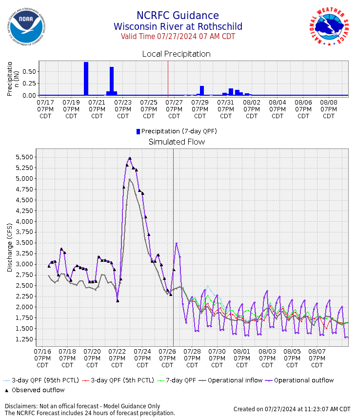
Images below show model inflows/outflows produced by the NCRFC river model for select Wisconsin River and tributary locations. Charts include both the forecaster-in-the-loop NCRFC forecasts and select automated probabilistic forecast precipitation (PQPF) ensemble members. NCRFC forecasts are updated with forecaster approved model runs - typically 2+ times per day in the morning and evening. PQPF automated runs are issued 1-2 times each morning. This data is not an official forecast, but represents preliminary model data, and should be used with judgement. Official forecasts for specific locations are available on the NWS AHPS web page. Text product (MSR_ncrfc_wis.120norm.q) that includes guidance for future flow time series at selected sites. |

|

|

|

|
|

|

|

|

|

|

|

|

|

|

|

|

|
|

|
US Dept of Commerce
National Oceanic and Atmospheric Administration
National Weather Service
North Central River Forecast Center
1733 Lake Drive West
Chanhassen, MN 55317-8581
952-361-6650
Comments? Questions? Please Contact Us.

