National Weather Service United States Department of Commerce

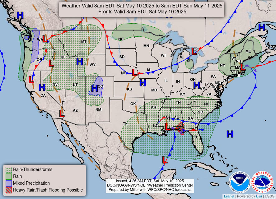
Heavy to Excessive Rainfall in South Texas; Lake Effect Snow in Michigan; Tropical Storm Warning for American Samoa

Heavy to excessive rainfall may produce a localized flash flooding threat across South Texas today. Slight Risk for Excessive Rainfall issued. Lake effect snow will impact the Upper Peninsula of Michigan today, and the Lower Peninsula on Monday. A Tropical Storm Warning has been issued for Manu`a Islands and Rose Atoll in American Samoa. Read More >

Coastal flooding with up to 2.0 ft of inundation above ground level is possible in low-lying areas near shorelines and tidal waterways. High tides will result in flooding of low-lying infrastructure, numerous road closures, and coastal erosion. Rising tides will bring water and waves farther up the beach than normal, restricting escape from beaches and coastal areas. Take the necessary actions to protect flood-prone property. If travel is required, do not drive around barricades or through water of unknown depth. At the San Francisco tidal gauge, high tide is expected to be 2.0 ft above normal (7.8 ft MLLW) at 8:48 AM Sunday, 2.2 ft above normal (8.0 ft MLLW) at 9:25 AM Monday, 2.6 ft above normal (8.4 ft MLLW) at 10:05 AM Tuesday, 2.8 ft above normal (8.6 ft MLLW) at 10:49 AM Wednesday, and 2.4 ft above normal (8.2 ft MLLW) at 11:38 AM Thursday. These predictions include up to 1.6 ft of surge that will enhance the astronomical tide and flooding threat. High tide varies up to 90 minutes earlier or later along the Pacific Coast and through the San Francisco Bay, respectively.
Coastal flooding with up to 2.8 ft of inundation above ground level is possible in low-lying areas near shorelines and tidal waterways. High tides will result in flooding of low-lying infrastructure, numerous road closures, and coastal erosion. Rising tides will bring water and waves farther up the beach than normal, restricting escape from beaches and coastal areas. Take the necessary actions to protect flood-prone property. If travel is required, do not drive around barricades or through water of unknown depth. At the San Francisco tidal gauge, high tide is expected to be 2.2 ft above normal (8.0 ft MLLW) at 9:25 AM Monday, 2.6 ft above normal (8.4 ft MLLW) at 10:05 AM Tuesday, 2.8 ft above normal (8.6 ft MLLW) at 10:49 AM Wednesday, and 2.4 ft above normal (8.2 ft MLLW) at 11:38 AM Thursday. These predictions include up to 1.6 ft of surge that will enhance the astronomical tide and flooding threat. High tide varies up to 90 minutes earlier or later along the Pacific Coast and through the San Francisco Bay, respectively.
There is an extreme risk for coastal flooding around the San Francisco and San Pablo Bay shorelines Tuesday and Wednesday. A strong storm system will coincide with King Tides potentially exacerbating the coastal flooding impacts during Thanksgiving travel. Tuesday and Wednesday are expected to have the greatest impacts; however, a major risk of coastal flooding is expected Sunday, Monday, and again Thanksgiving and into the weekend.


Text Product Selector (Selected product opens in current window)