Severe thunderstorms are forecast through this weekend along a slow moving cold front and secondary storm system that will impact areas from the southern Plains to the Great Lakes. Large hail and isolated damaging wind gusts are the main threats with these storms along with a risk for heavy to excessive rainfall which could bring flooding. Read More >
| Winter Weather Event March 11-18 |
|
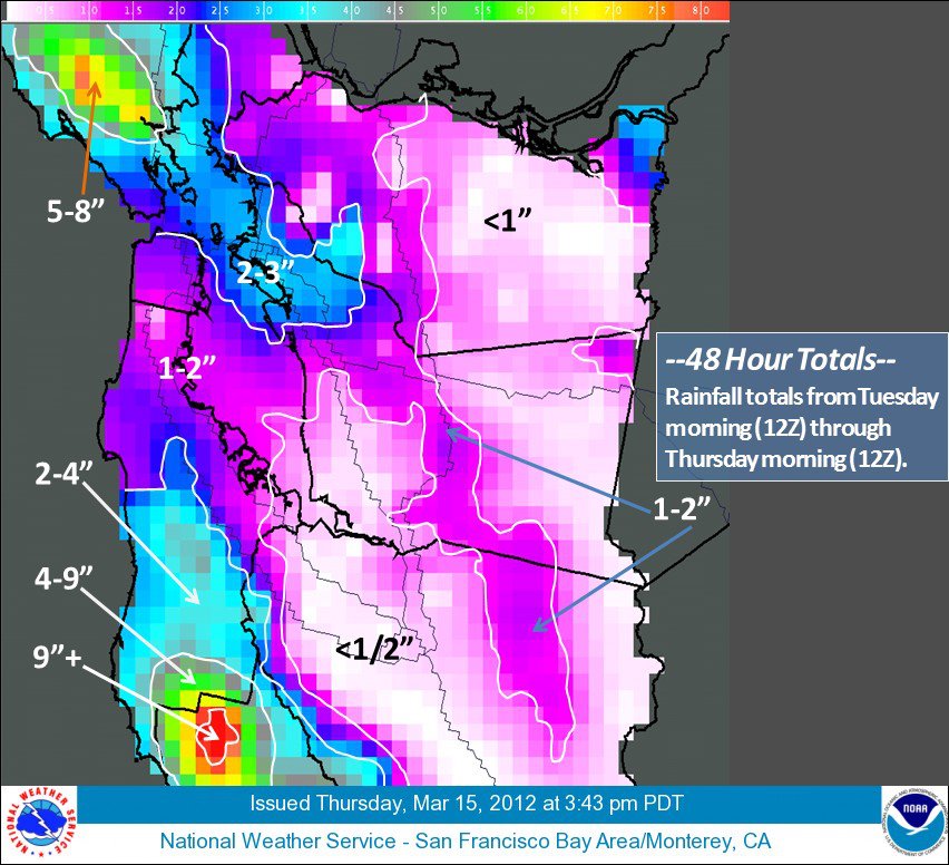
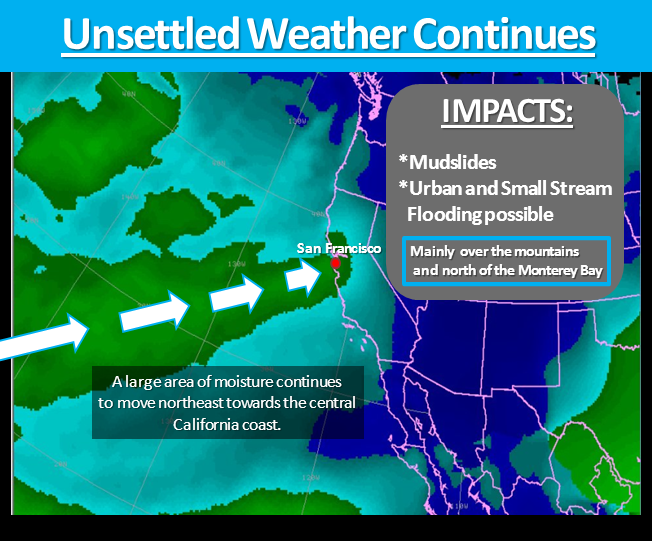
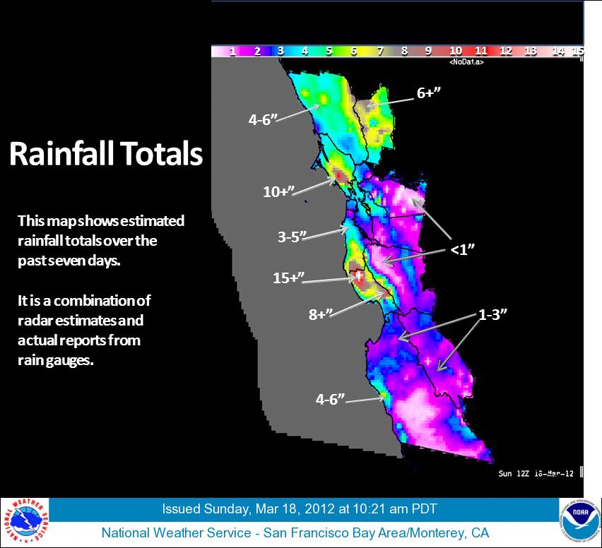
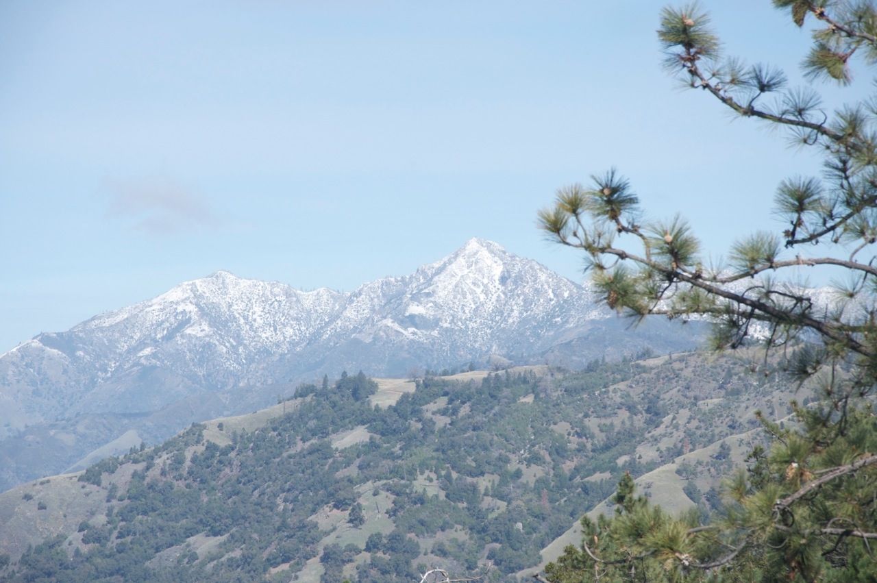
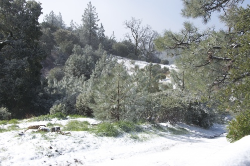
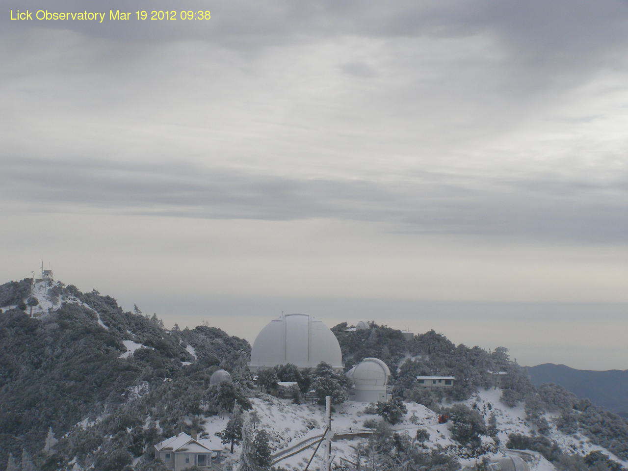
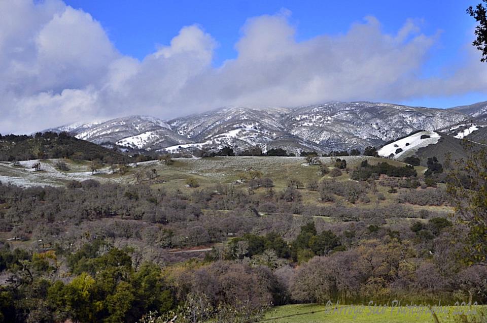
After several months of rather quiet and dry weather, much needed rainfall fell across the region as the storm door opened. The large persistent area of high pressure anchored over the eastern Pacific weakened, allowing the storm track to shift much farther south. A wide range of weather was observed from March 11-18, across the Bay Area from heavy rain to snow. The first in a series of systems swept through the North Bay bringing light rain March 11th and 12th, but the main event was still another day way. By Tuesday March 13th, a much stronger cold front took aim at the Central Coast of California. All the necessary ingredients were in place to produce persistent steady, and occasionally heavy, rainfall. Meteorologists in the forecast office used computer models to look for signs of: strong isentropic lift, favorable winds allowing for enhanced orographic lifting, concentrated areas of higher precipitable water and a frontal boundary that was forecast to stall. The official National Weather Service forecast called for periods of rain, possibly heavy at times, to fall across the North and San Francisco Bay as well as the coastal mountains March 13th and 14th. The forecast verified rather well as unprecedented rain fall across parts of the Bay Area, especially the Santa Cruz Mountains, with over 9 inches in a 48 hour period (see image below). One item of note, the 48 hour total depicts a very impressive gradient from heavy rainfall to almost no rainfall in such a short distance. There was a brief respite from heavy rainfall on Thursday March 15th , but scattered showers remained. The last and final storm system began to move into the Bay Area Friday March 16th, keeping unsettled weather in place through March 18th. One main difference with the last storm system was the air mass associated with it. Unlike the previous storm systems, this low pressure and associated cold front ushered in much colder air. The colder air helped produce a more unstable atmosphere, favorable for thunderstorm development and lowered snow levels down to around 1,700 feet. There were only a few reports of lightning and thunder, but several SKYWARN Spotters reported hail to the size of rice/pea. Mountain ranges around the Bay Area also received measurable snowfall over the weekend, but mainly above 2,000 feet. The Lick Observatory reported seven inches of snow by Sunday as well. In addition, other spotters in the Santa Cruz and Santa Lucia Mountains reported a winter wonderland with enough snow to cover the ground. Lastly, there was one unconfirmed reported of a foot of snow in the Santa Lucia mountains.
|
|
Pictures
|
| Public Information Statement (PNS) - Rainfall totals |
...RAINFALL TOTALS FOR THE PAST WEEK...

 LISTED BELOW ARE RAINFALL TOTALS ACROSS THE SAN FRANCISCO BAY AREA
 AND MONTEREY BAY AREA FOR THE PAST WEEK...FROM MONDAY NIGHT MARCH
 12 THROUGH SUNDAY AFTERNOON MARCH 18.

 LOCATION                     AMOUNT (INCHES)

 NORTH BAY...
  KENTFIELD ..................11.19
  NAPA ....................... 5.73
  NAPA AIRPORT ............... 3.62
  SAN RAFAEL ................. 6.01
  SANTA ROSA ................. 4.92
  SONOMA COUNTY AIRPORT ...... 4.14

 SAN FRANCISCO PENINSULA...
  SAN FRANCISCO DOWNTOWN ..... 2.95
  SAN FRANCISCO AIRPORT ...... 2.08
  REDWOOD CITY ............... 2.75

 EAST BAY...
  CONCORD .................... 1.97
  CONCORD AIRPORT ............ 1.63
  HAYWARD AIRPORT ............ 1.74
  LIVERMORE AIRPORT .......... 0.88
  OAKLAND MUSEUM ............. 4.21
  OAKLAND AIRPORT ............ 3.13

 SANTA CLARA COUNTY...
  SAN JOSE ................... 0.69
  MOFFETT FEDERAL AIRFIELD ... 0.56
  GILROY ..................... 1.74
  MORGAN HILL ................ 0.11

 MONTEREY BAY...BIG SUR...AND SANTA CRUZ MOUNTAINS...
  MONTEREY NWS ............... 1.52
  MONTEREY AIRPORT ........... 1.48
  SANTA CRUZ ................. 4.65
  WATSONVILLE AIRPORT ........ 2.87

 INTERIOR MONTEREY COUNTY AND SAN BENITO COUNTY...
  CARMEL VALLEY............... 1.90
  HOLLISTER .................. 1.76
  KING CITY .................. 1.11
  SALINAS .................... 1.86
  SALINAS AIRPORT ............ 1.69
|
MMEHLE